
Karumba to Cape York
(Click on images to enlarge)
By the time we hit Karumba, we had travelled around 6000 kilometres in two months and Karumba was our final familiar place before we started heading up Cape York Peninsula into territory we had previously not visited. Before leaving Karumba, we called in at the caravan park and bought some fresh cooked prawns to take with us for that night’s dinner.
Taking the Burke Development Road (the Alternate Route of the Savannah Way) we expected our next couple of days to be relatively quiet with less traffic, as this road is roughly 600 km unsealed, unserviced and un-touristy terrain, following for the large part, the Mitchell River and travelling through several large cattle stations but no towns or settlements and therefore no fuel stops until you arrive at Chillagoe almost 600 km down the track. Indeed, the first road sign we came to after turning onto this road indicated “No Fuel for 540km!” Checking our vehicle’s fuel range indicator, we could have been concerned that it said we only had 431km till empty, but we knew that our long-range tanks were almost full giving us a range of almost 1000 km, so we forged ahead.


Travelling this road, we were also aware that there were no specific camp areas along the whole distance till Chillagoe and we had been told that the first station we passed through had a strictly “No Camping” policy, so we intended to just drive on through and camp somewhere along the road once we had passed through the station boundary. Hadn’t really thought that through had we, as this station stretches for about a hundred kilometres from boundary to boundary along the road, with very little in the way of nice bushy areas you could sneak into for the night. So, once we passed the homestead area, we drove about 80 kilometres and by 5ish and having not passed anything suitable we just pulled off the road and parked, thinking this would do for the night – surely we won’t disturb anyone on this quiet stretch of outback road? How wrong we were!! We certainly hadn’t counted on the amount of traffic that decided to pass by us once we had parked – cars, station utes, campers and quite a number of trucks kicked up dust well into the night. Added to that, Gary’s plan for a nice meal of garlic prawns almost came unstuck too; with no running water (trying to conserve what we had in the tanks) and thousands of little bugs that somehow found their way through the flywire, his task of peeling the prawns became a misery! Got the job done in the end with a bit of help from me and we still managed a delicious dinner on the roadside.
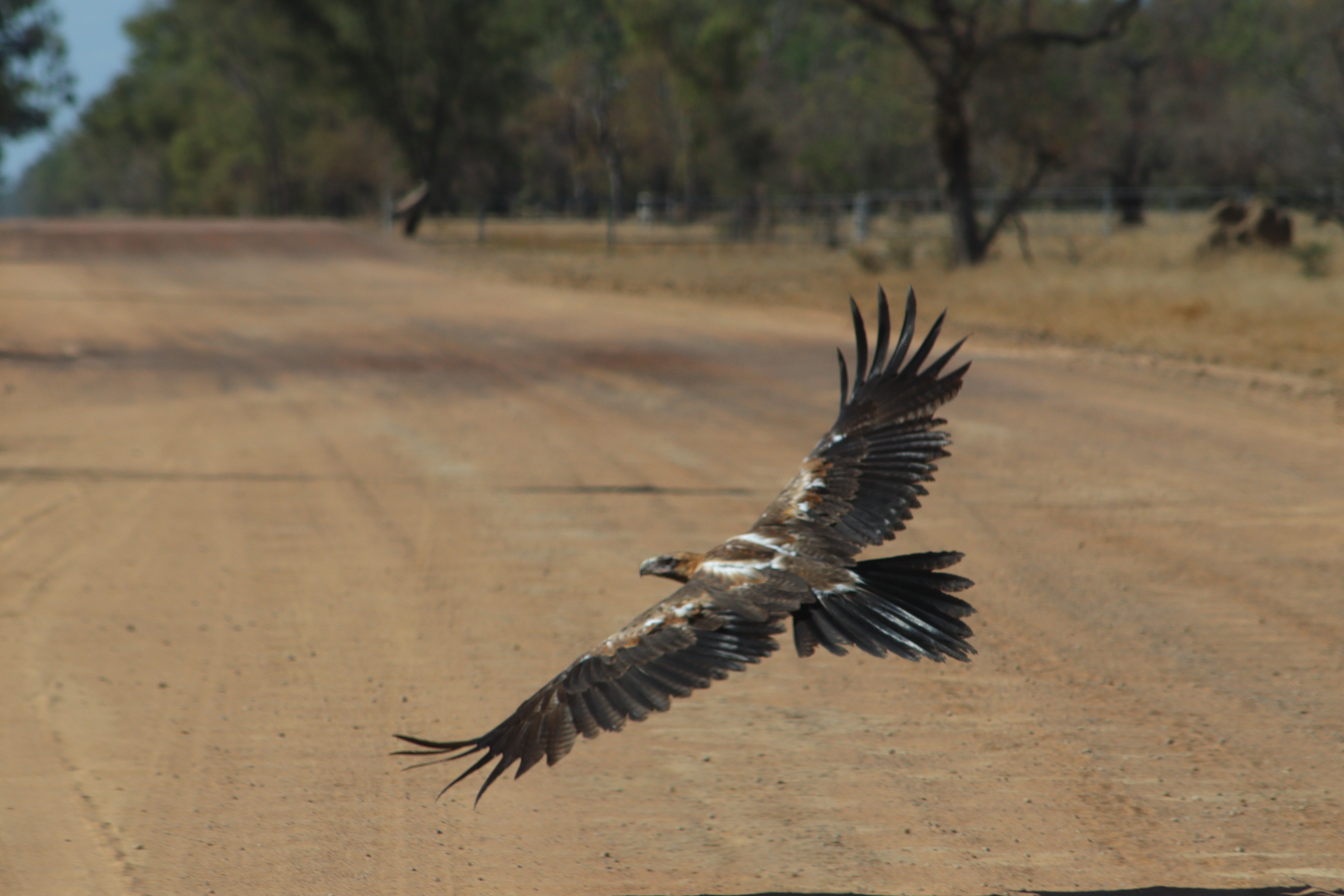
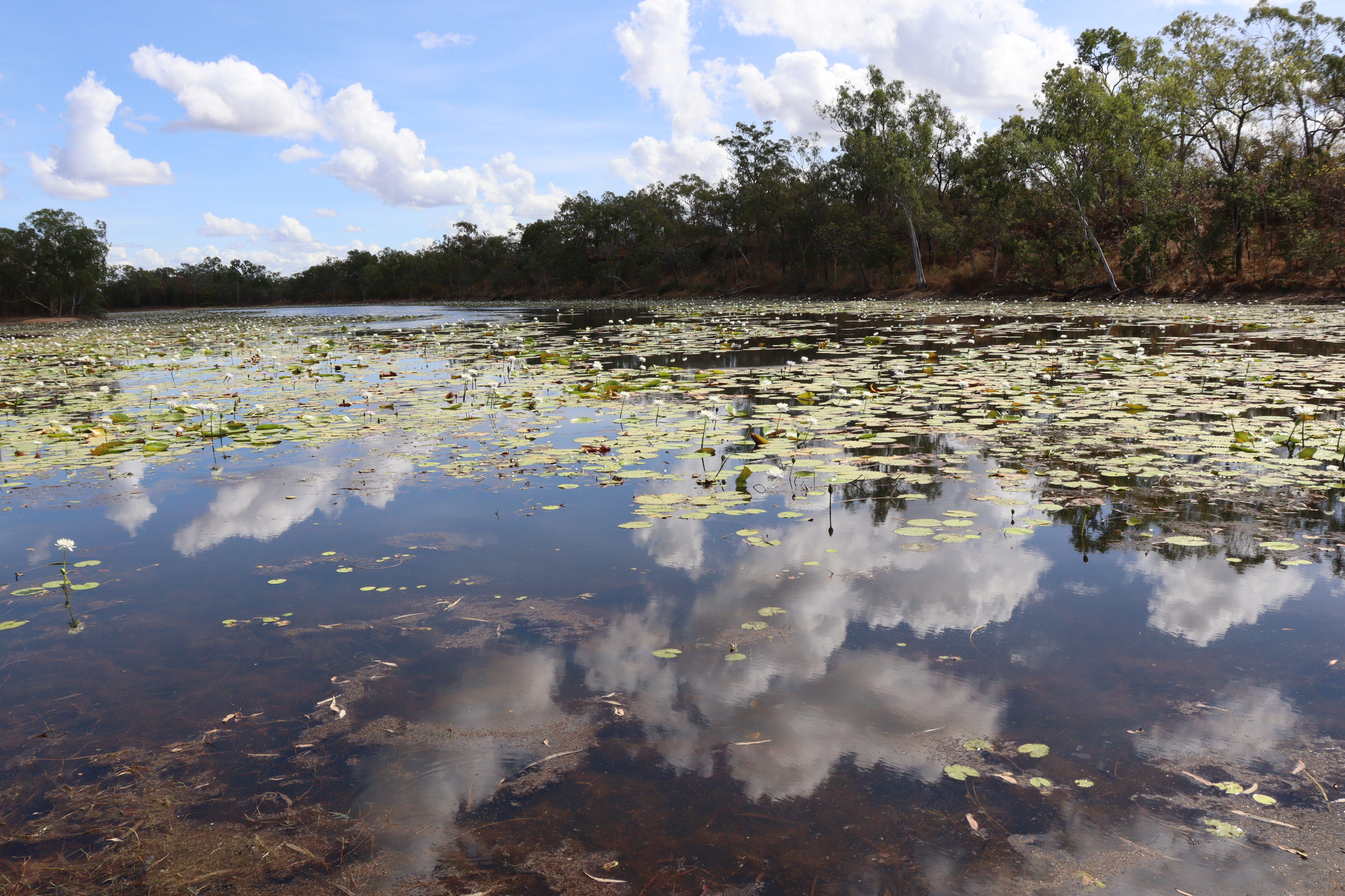
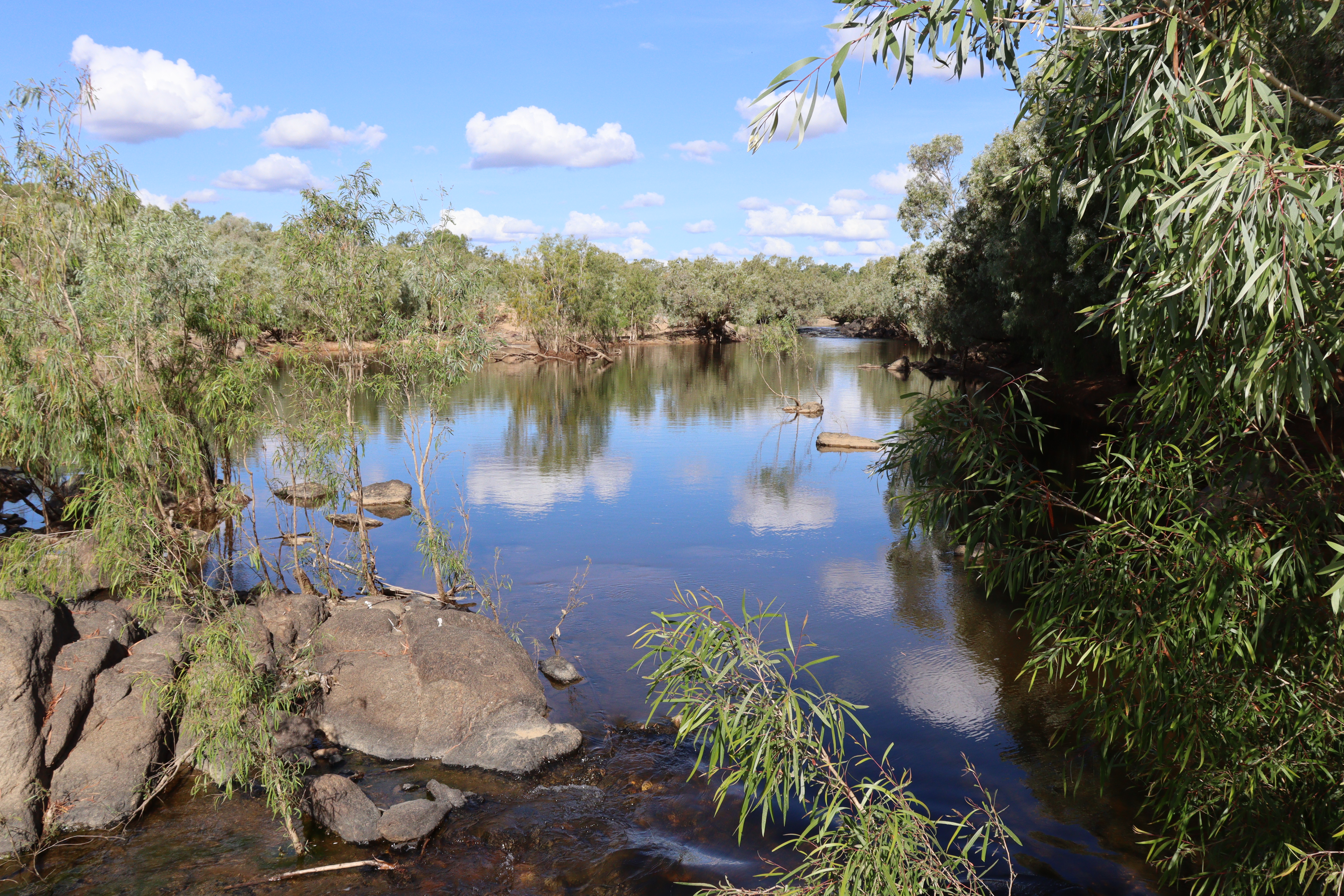
Next morning, we had only driven about 10 kilometres before we came across “Dinnertime Lagoon,” a large and stunning waterhole covered with waterlilies in full flower – would have been a perfect campsite if only we’d known!! For the rest of this day and the next, we continued on the dirt road, encountering a variety of things which made it a memorable drive: cattle on this unfenced road by the hundreds -yeah we’re pretty used to that but always a good sight; a majestic wedge tailed eagle feasting on road kill and not in a hurry to leave it, giving me a chance for some pretty good shots of him through the windscreen; a white bellied sea eagle also soaring past; signs indicating the 68000 square kilometre shire that has a MASSIVE population of just 2500; 250 kilometres of bulldust holes – and yep I reckon we hit every one of them creating a nice dust cloud in our wake; several waterlily covered waterholes – so pretty and unexpected in this dry savannah country; and several crossings of the Mitchell River where we stopped for a break to admire its sparkling beauty.
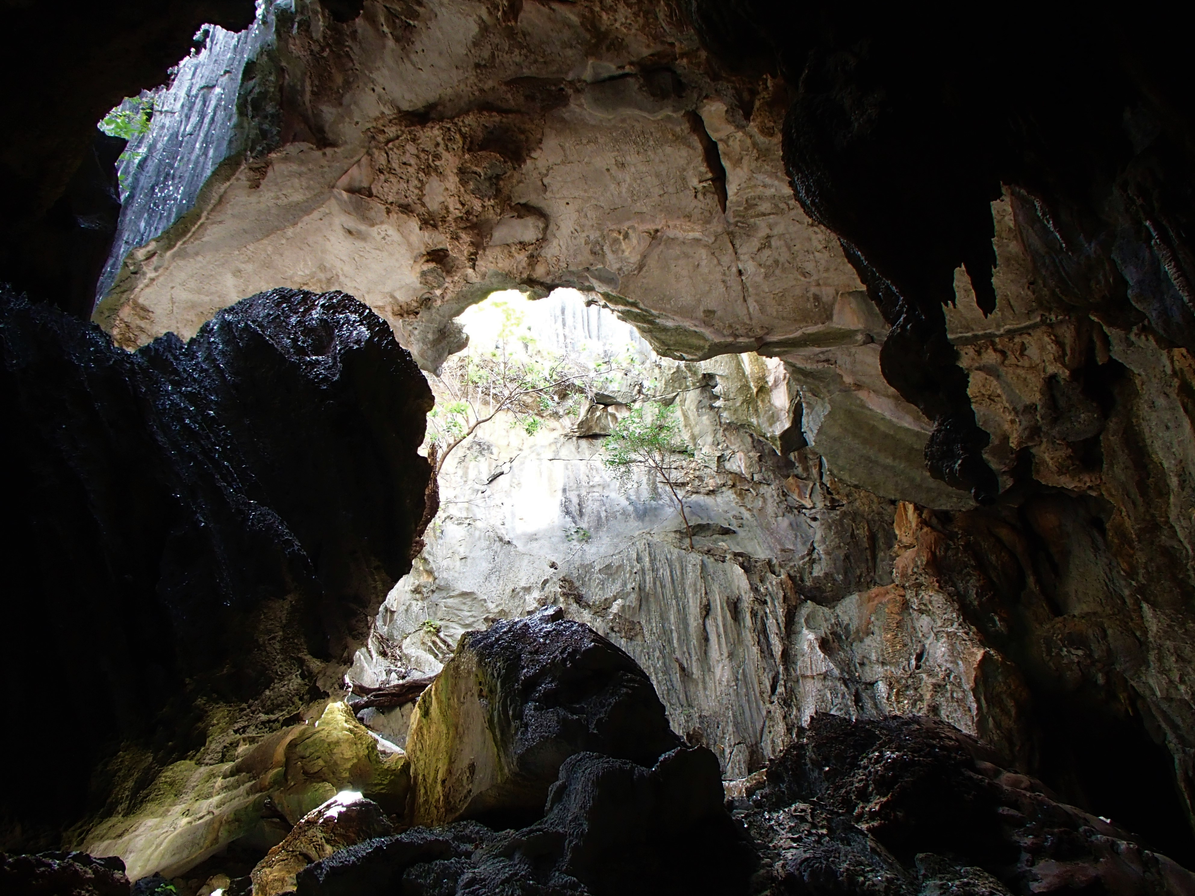
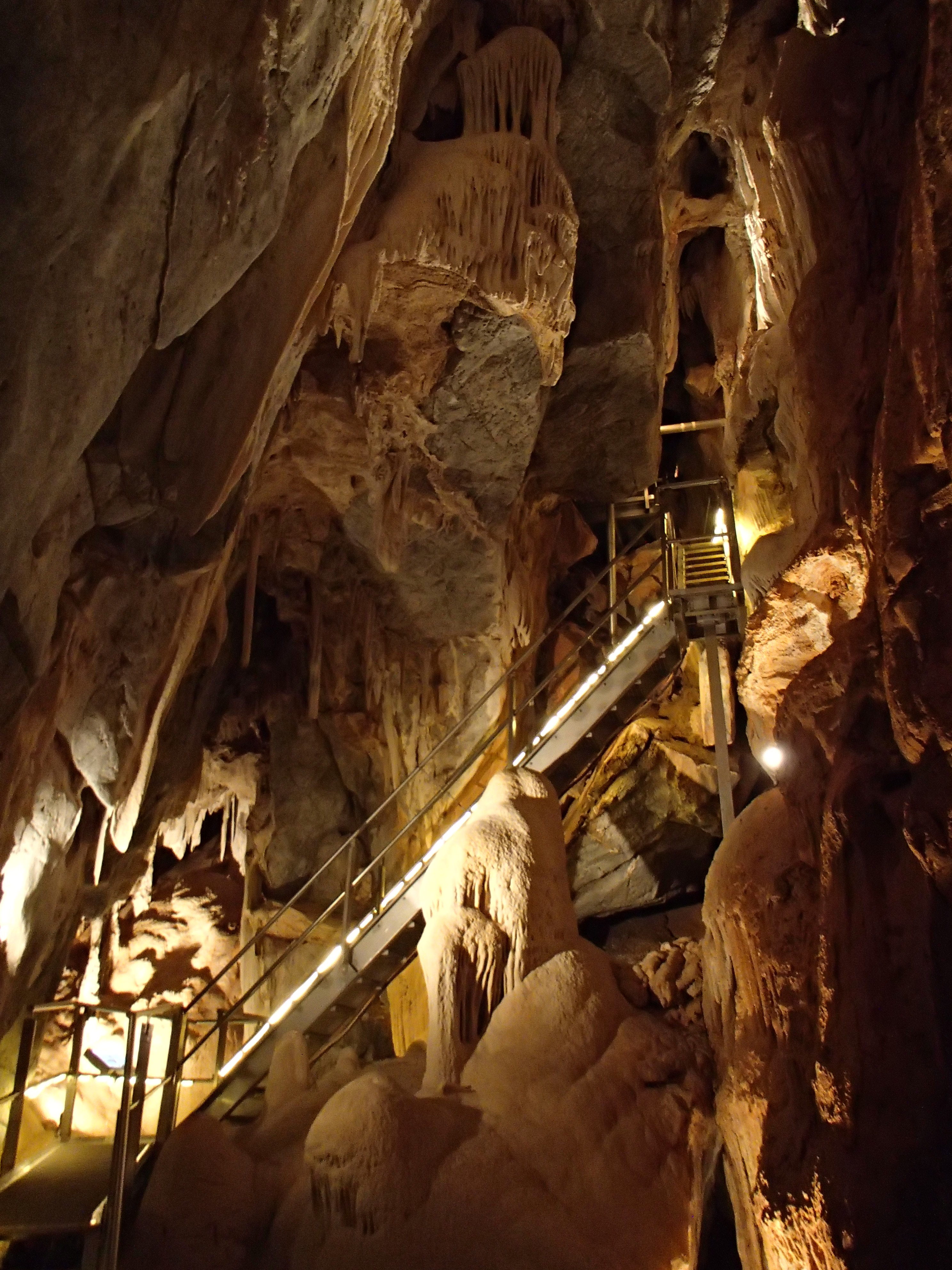
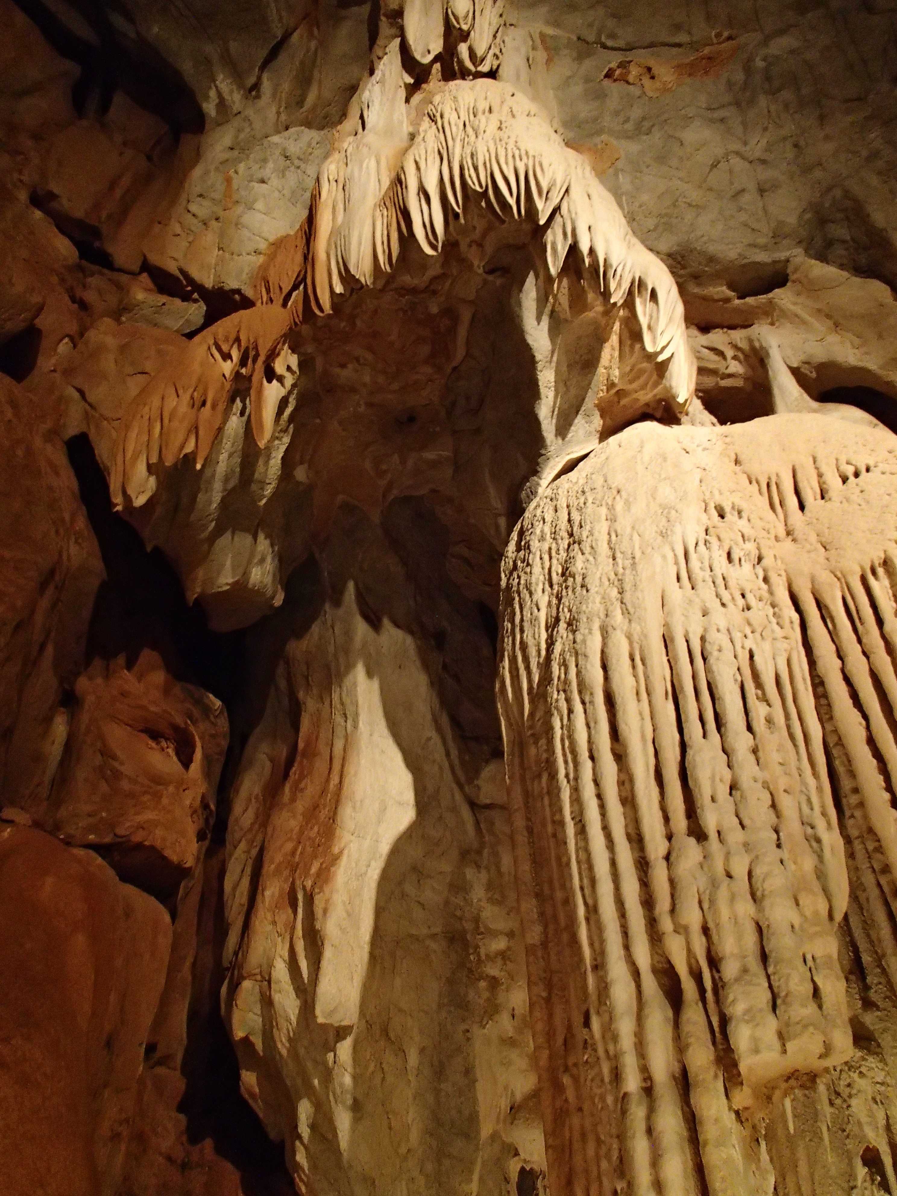


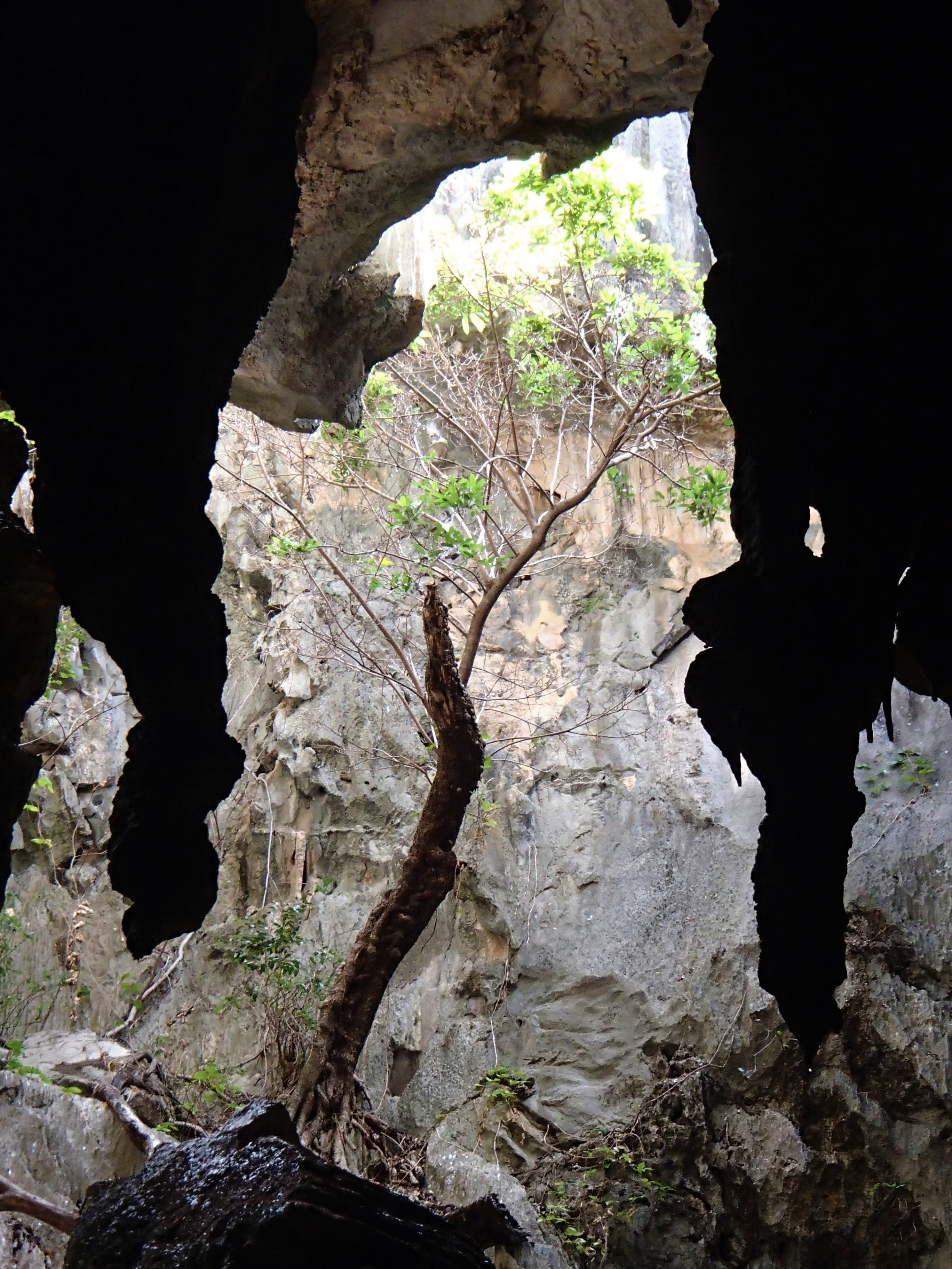
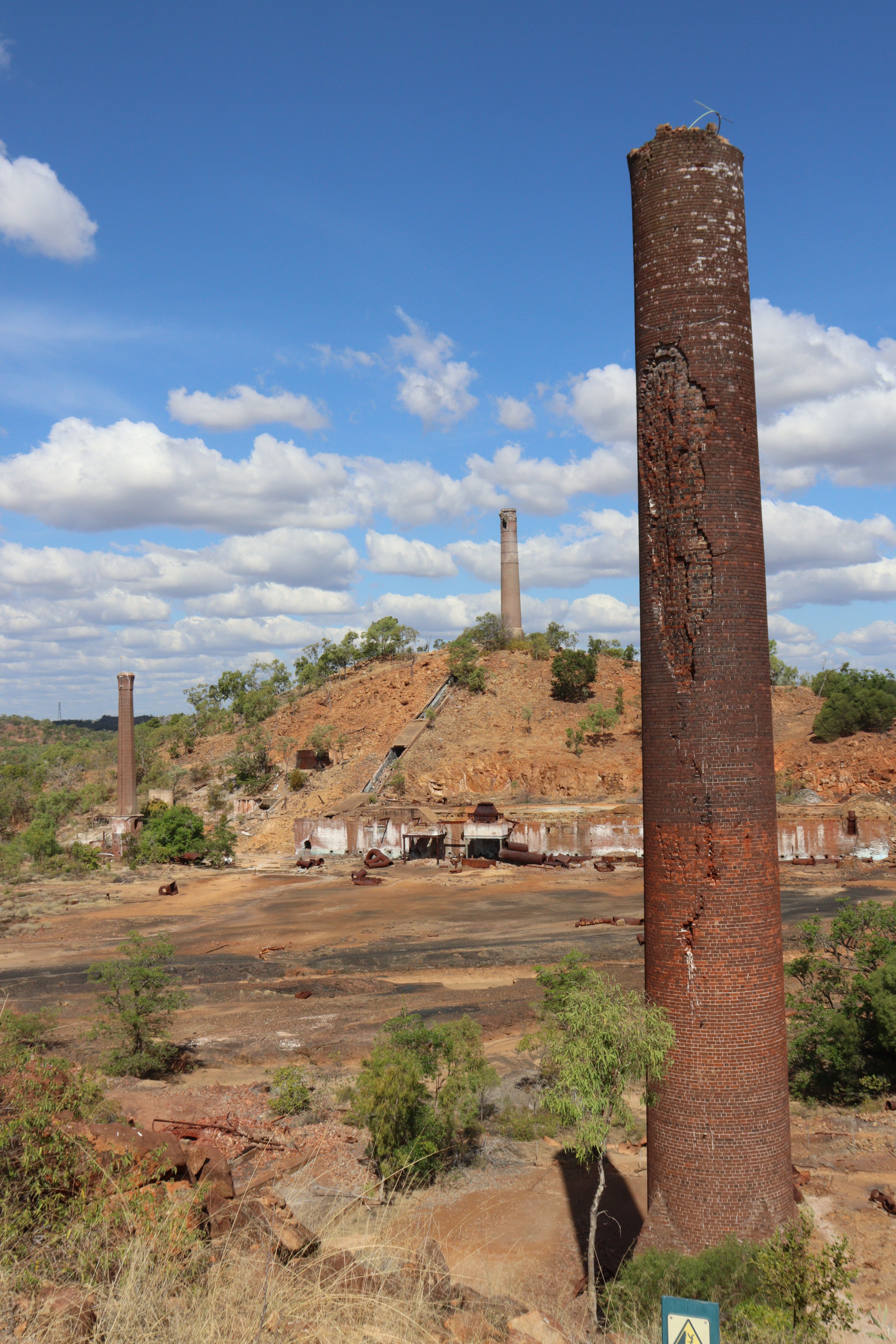
After almost 600 kilometres of dirt and dust driving, we hit the bitumen just as we entered Chillagoe, a town that once thrived on mining of gold, silver, copper, and fluorite, but now has just a small zinc mine and marble quarries. However, Chillagoe also boasts a spectacular karst landscape, and the Chillagoe-Mungana Caves National Park is its main tourist drawcard – and rightly so. Of the 600 to 1000 limestone caves in the area, several are open for ranger guided tours while a few offer the self-guided option. The guided tours are well worth doing as they take you deep into the cave systems to learn about their history of formation and discovery, to witness the wonderful formations of stalagmites, stalactites, columns and shawls in a range of colors, as well as a variety of chambers, some small and others huge, and to catch a glimpse of the caves’ wildlife including large hand-sized huntsmen spiders and leaf-nosed- and sheath-tailed- bats. The jewel in the crown is the Royal Arch Cave which boasts two massive chambers, The Cathedral and The Royal Arch – absolutely stunning! -and where Gary got to squeeze through “The Chute,” a tiny claustrophobic tunnel from one chamber to another. As well as the caves there are numerous limestone rock formations surrounding the town including the much-photographed Balancing Rock, and just out of town are the Heritage Listed Chillagoe Smelters, which have their own interesting history.


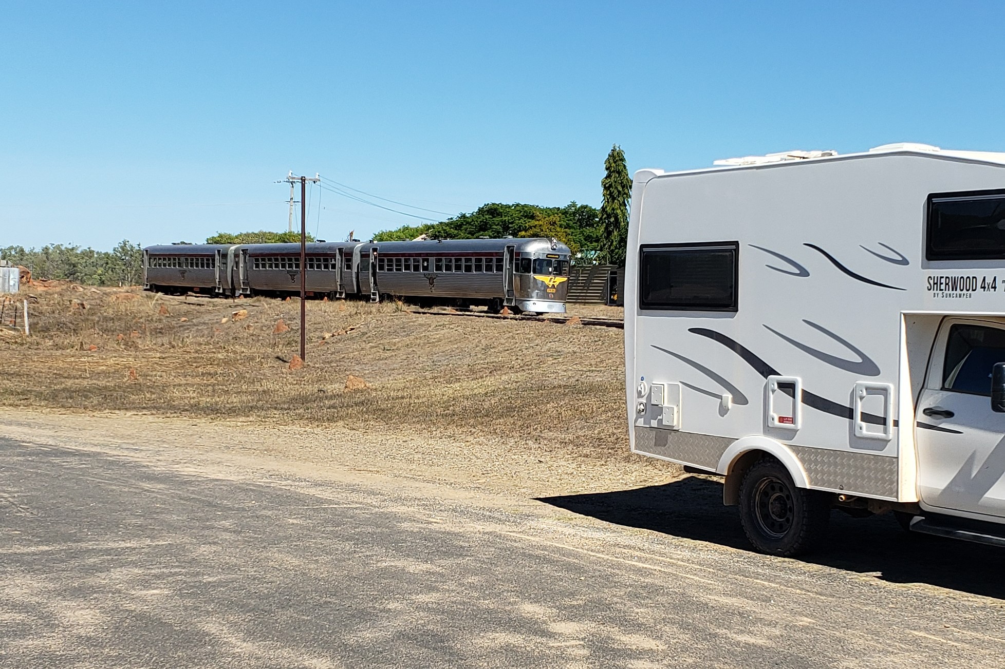
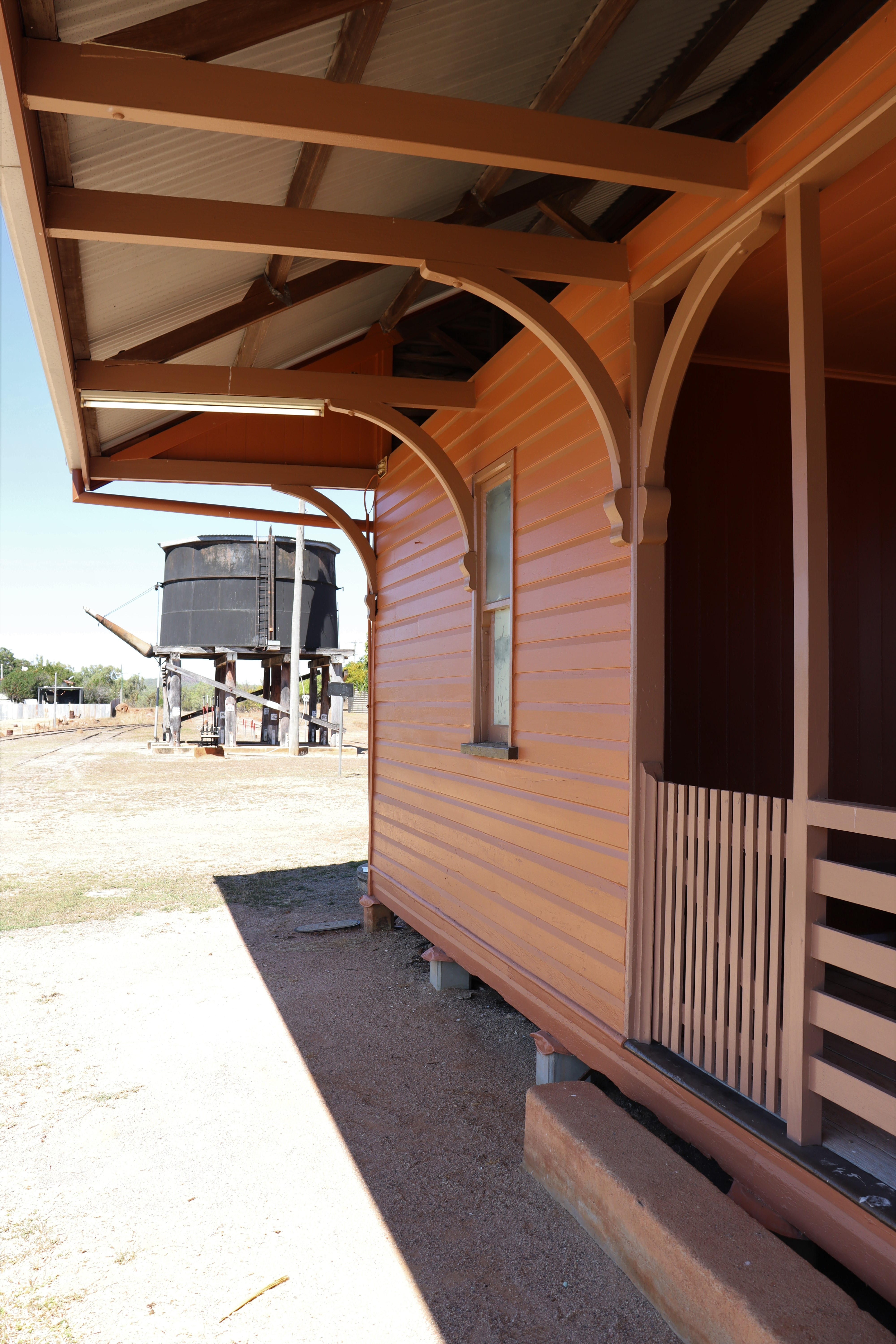
Thirty kilometres from Chillagoe is the township of Almaden, a thriving metropolis of less than a hundred people. There’s a quaint historic railway station there as it’s on the Mareeba-Chillagoe line and the town also serves as an overnight stopover for passengers on the tourist train, “Savannah Lander,” which runs twice weekly between Cairns and Forsayth. We had joked about the man sitting at the station saying he was waiting for a train, but as it happened, he turned out to be the station master and he actually WAS waiting for the Savannah Lander which was due within half an hour after a four-day trip from Cairns.

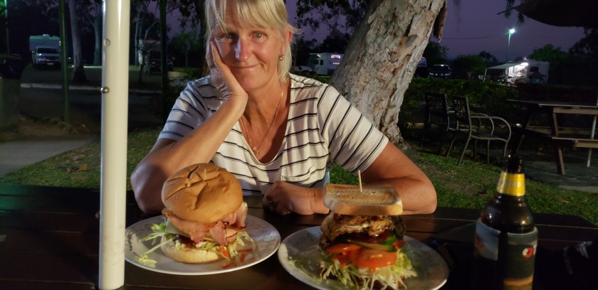
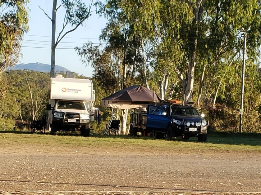
Coming to Mareeba, the last big town we would see for the next few weeks, we stopped to stock up on some supplies. Luckily, we hadn’t planned to stay there because the place was packed!! Passing the showgrounds on our way in, there would have been 200 caravans/RVs and then at another reserve, there appeared to be a CMCA gathering of around 300 RVs! No Thanks!! Our stopover at Palmer River Roadhouse 150 kilometres further on proved to be a much better choice, as there was plenty of space and we were able to have a relaxed, quiet evening and enjoyed a great roadhouse dinner – the biggest burgers you’ve ever seen!!
And so, we reached the PDR – Peninsula Development Road, and for the next 800 kilometres to the Tip of Cape York, the road lived up to its reputation. About 300km or so of the 800km is sealed, sometimes in good long stretches and with more sealing happening each year, but the rest varies between average gravel/dirt road to awful corrugated or rocky, rough or possibly the worst-you’ve-ever-been-on road that “rattles the fillings out of your teeth” according to Gary. Along the way though, there was plenty of interest: scenery changing from dry cattle country to forest to tropical rainforest and waterways ranging from trickles to wide rivers.


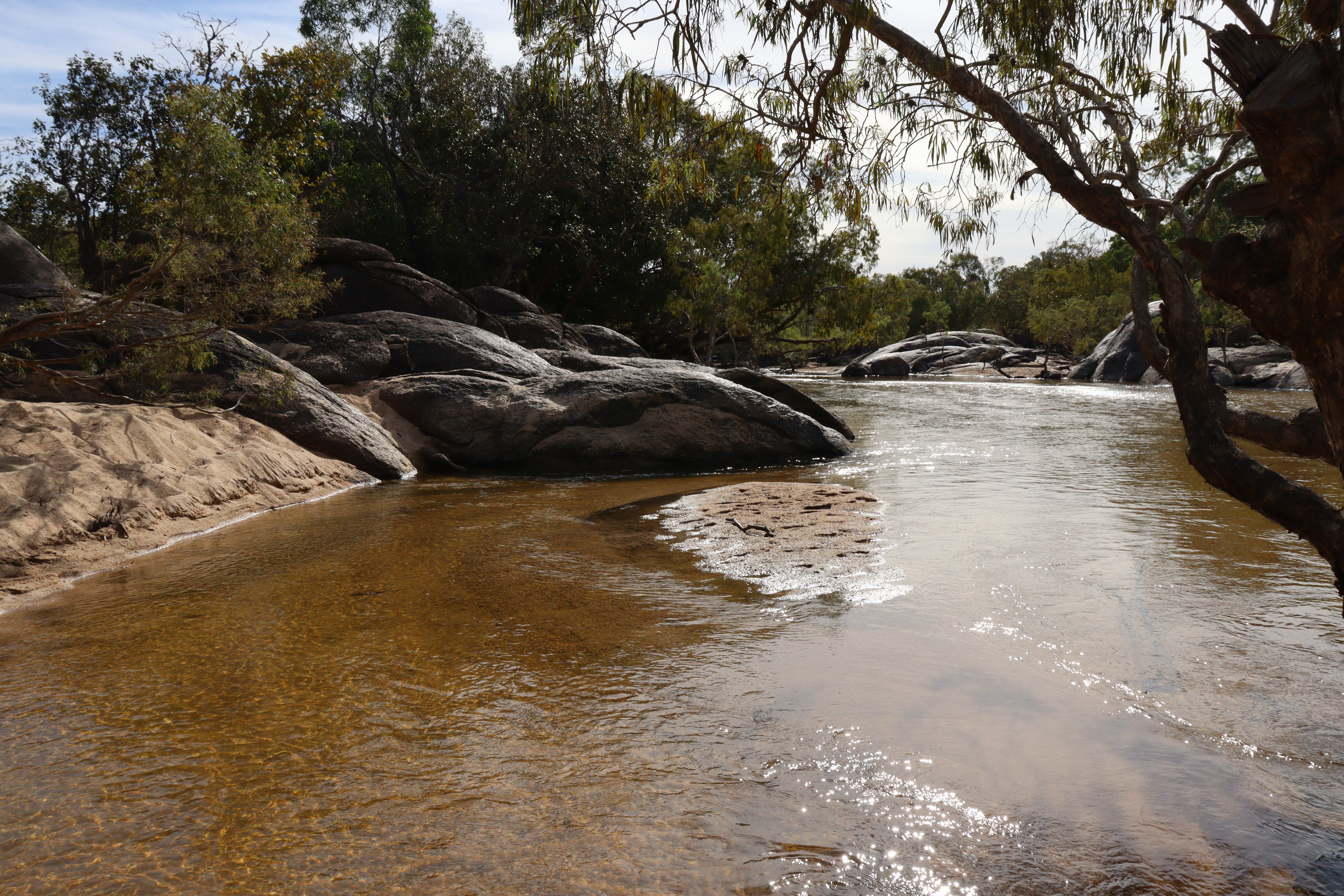
Archer River Roadhouse about halfway up the Cape, sits above the Archer River, a lovely clear, wide but shallow waterway that is obviously a popular spot for the locals from Lockhart River Aboriginal Community to come for a crocodile-free swim. Once again, the roadhouse offers camping, accommodation, meals, and a welcome beer or two.
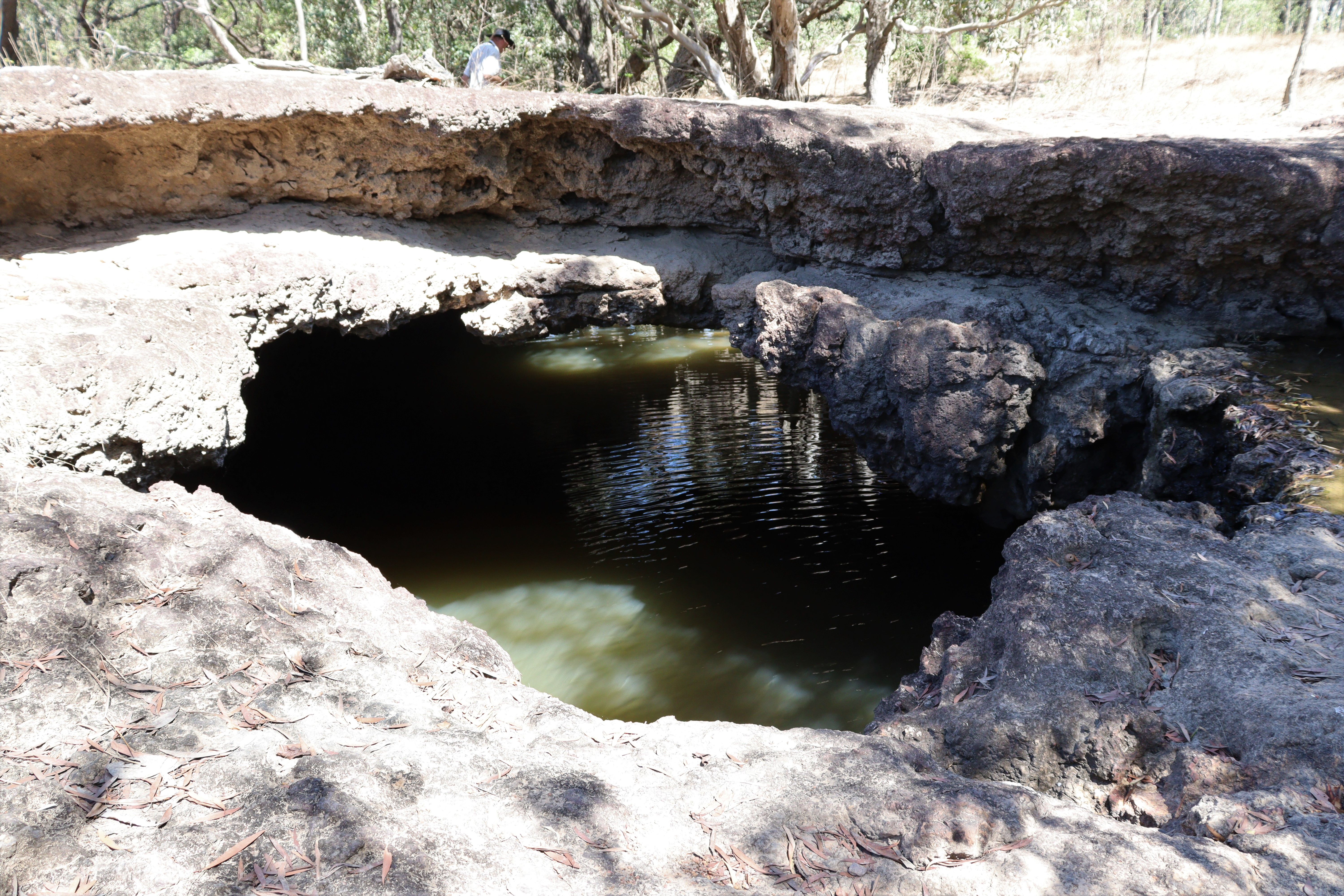
About 50 kilometres north of Archer River the route to the Tip turns onto the Telegraph or Bamaga Road and the awful road conditions continue! A pleasant stop – and a chance to take a break from the corrugations rattling everything – is Moreton Telegraph Station, originally built in 1887 as part of the Overland Electric Telegraph line connecting Australia to the rest of the world. Although it no longer serves as a Telegraph station, its position on the Wenlock River makes it an ideal spot for a break or an overnighter if you so desire. We didn’t stay but called in to the kiosk and the lady there told us about their 3-kilometre walking track along the river to the “barra hole” and down to Cave Creek where the rock has been eroded to form a Natural Bridge and the creek flows under the “bridge” in a small waterfall – well worth the look.

From Bramwell Junction, the road splits; you can continue on the OTT or Old Telegraph Track, a very rough, challenging, strictly 4WD track, which follows the original telegraph line, passing through several deep river crossings, slippery riverbanks and stretches of deep sand. NO thanks – I’ve seen the pictures and videos!! OR you can follow the Telegraph Road/Northern Bypass Road which gets you there in roughly similar distance but with far less challenging – albeit corrugated – conditions, which suited us just fine! Either route will get you to the Jardine River.
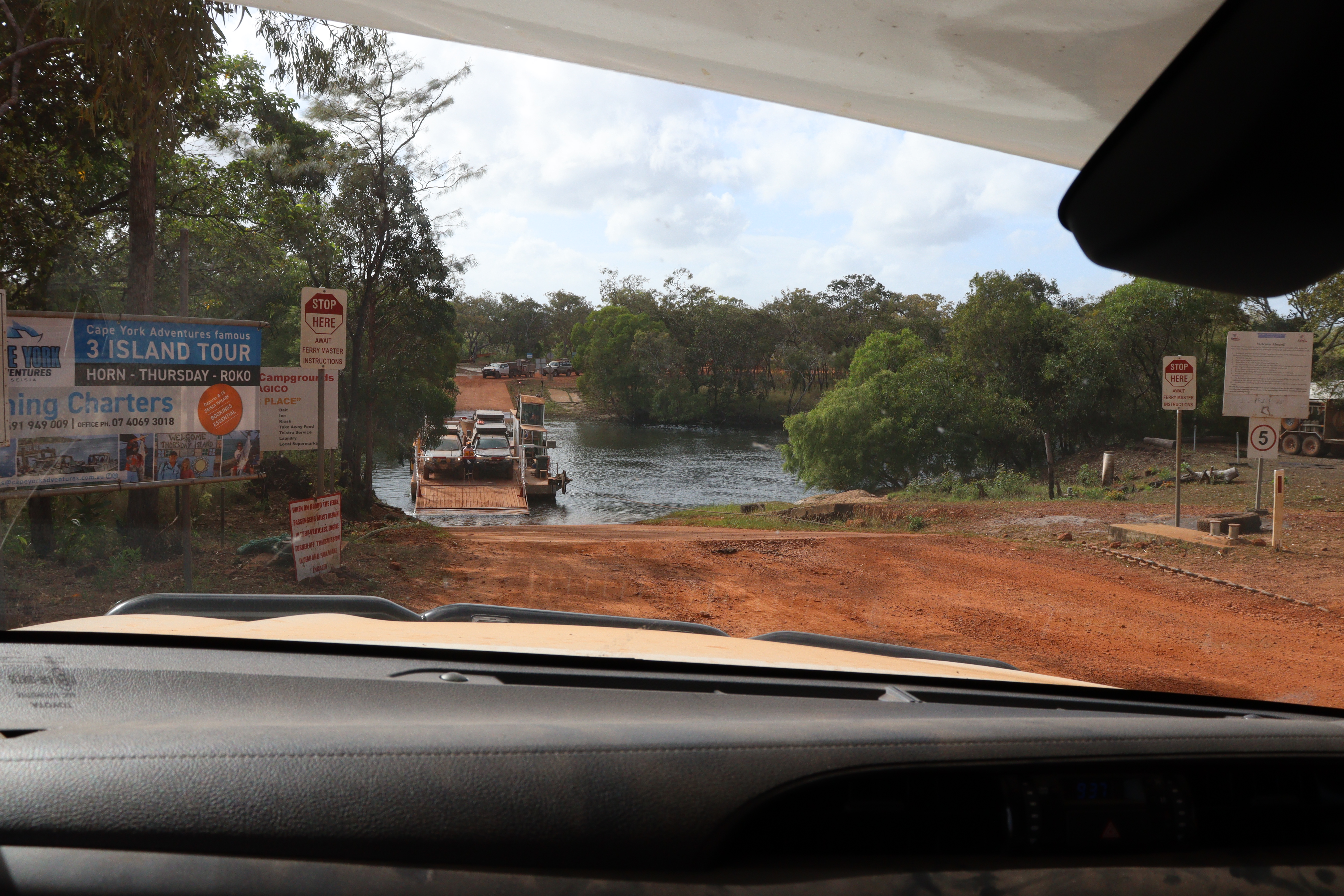
The Jardine River Ferry is operated by the locals and the $100 return fare entitles you to the 30-second crossing each way and to camp in some of the CYPAL (Cape York Peninsula Aboriginal Lands) that are not National Parks or private campgrounds, but we chose to head out to Loyalty Beach campground as we’d heard that the Seisia campground was always packed. Checked in, set up then checked all the cupboards and were pleasantly surprised to find that despite all those corrugations (that rattled our fillings out!), we had not broken so much as an egg or a china cup! Pretty good going!!


So here we were – we’d made it to the Tip of Cape York, well ALMOST!
WTF or Ha Ha!!
- Chillagoe must have a pre-requisite of guinea-fowl ownership for potential residents. Never before have I seen so many guinea fowl – it seemed like every house had at least a dozen of the noisy critters!!
- Looking at the Almaden station (dirt) platform, it appeared to have been very neatly raked and I commented that someone had done so. “That would be me -it’s part of the contract” says the man who turned out to be the station master. I guess it’s the outback version of rolling out the red carpet for the visitors.
- How close is too close? Palmer River campsite, there’s more than 30 metres of clear space between us and the next caravan, but Old Mate backed in SO close to us that when he opened his camper towards us, his bed was about 30 centimetres from our window!!
- Parked up for the night in a roadside pull out, two more vehicles together, both towing, pull in, one (A) parking virtually nose to nose with us and second one (B) across the track from us. A little later a third vehicle (C) comes into the pull out and parks near (but not right on top of) vehicle B, so B moves his vehicle up next to his mate (A), almost blocking us in, but still had the cheek to comment that the newest guy was “not very socially acceptable, parking so close!”
