Destination Cape York – Final

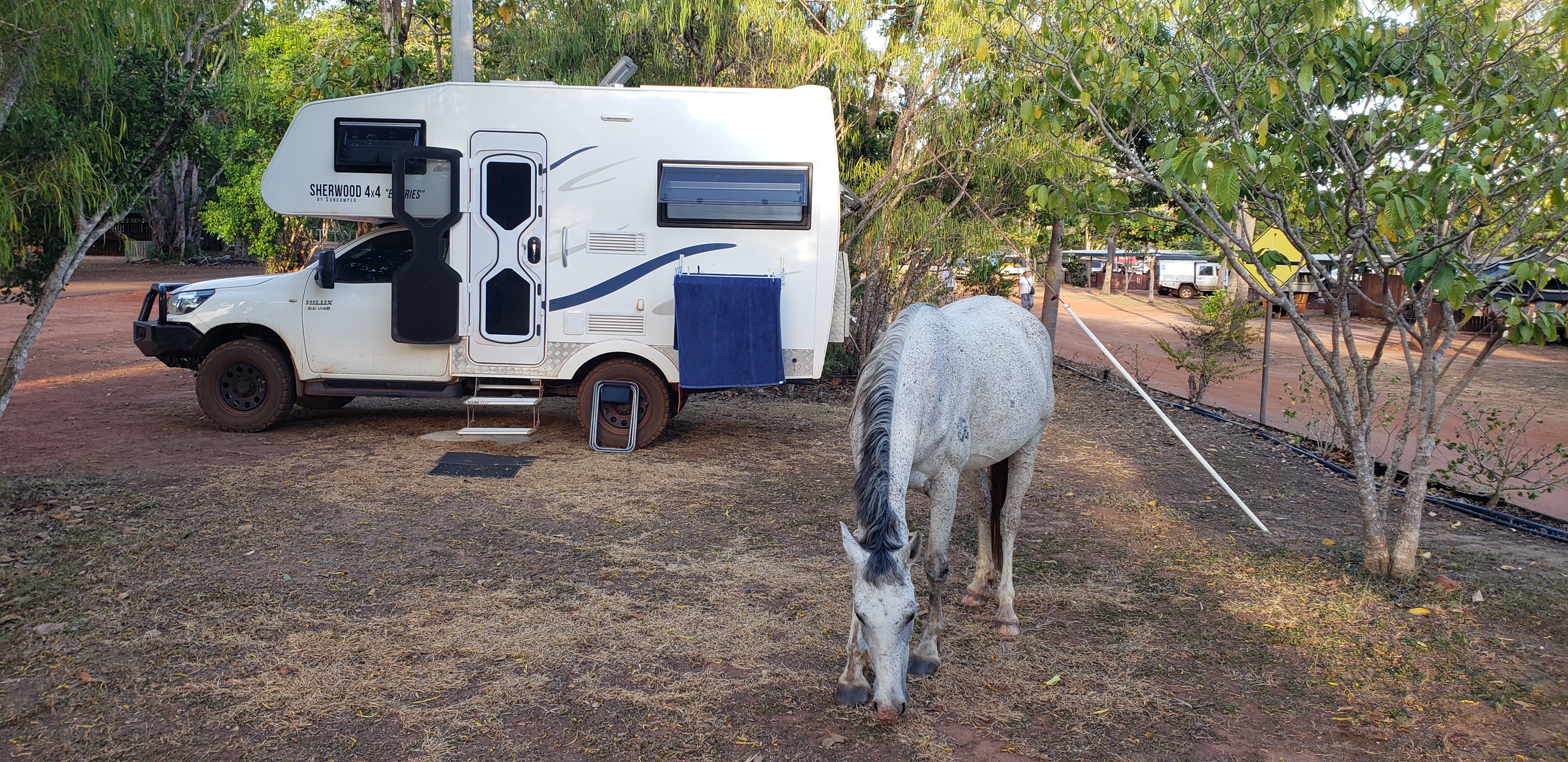
Rinyirru-Lakefield NP – Cooktown – Home

(Click on images to enlarge)

Coming back down the Cape, we took a detour. Turning eastward from Musgrave Roadhouse onto Lilyvale Road, we headed towards Rinyirru-Lakefield National Park, another of the CYPAL (Cape York Peninsula Aboriginal Land) National Parks.

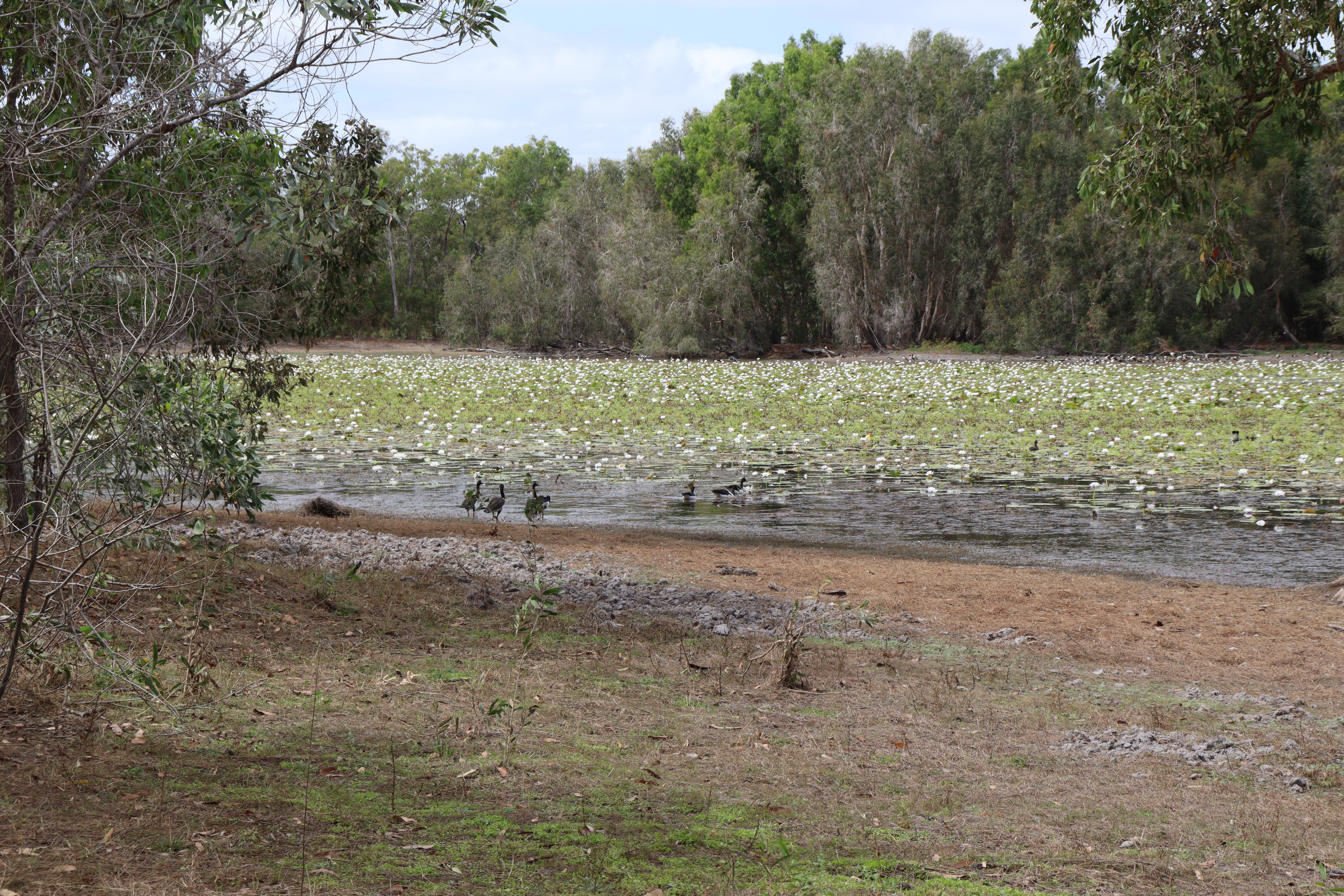
Not far from the turnoff, we pulled into a side track to check out the waterhole at Lotusbird Lodge – the place certainly lives up to its name as the waterhole was covered in lotus lilies and numerous birds including magpie geese and ducks. Further on, we entered Rinyirru Lakefield NP, and we drove through Nifold Plain, where we were suddenly struck by the sight of these weird tall triangular shaped trees in the distance. They turned out to be a variety of Corypha utan palm which originate in India through Malaysia, Philippines Indonesia and into Cape York  and can grow to 20 metres tall, flowering in a massive cluster of up to a million flowers, only once at the end of its life. (thanks Mr Google/Wikipedia.)

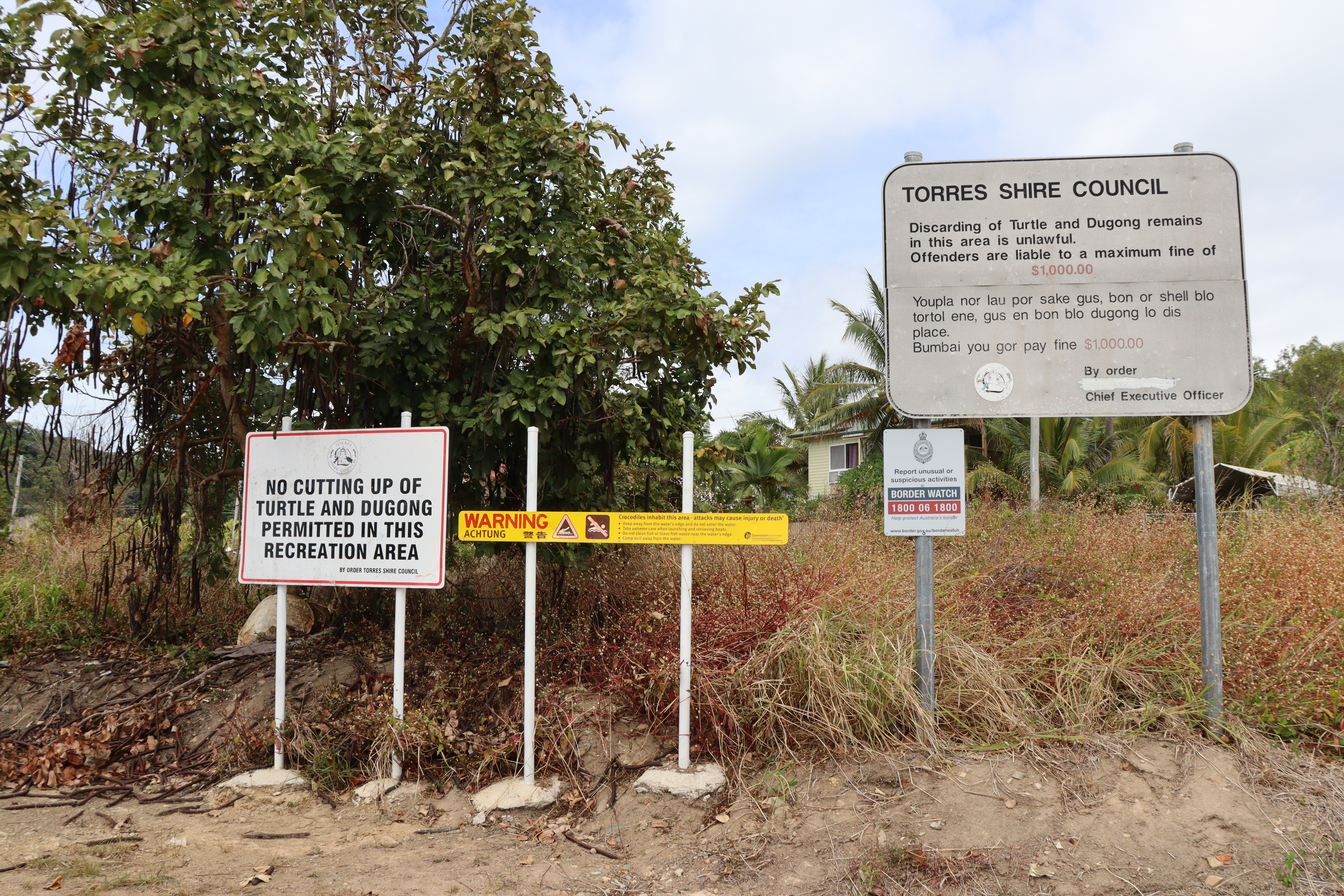
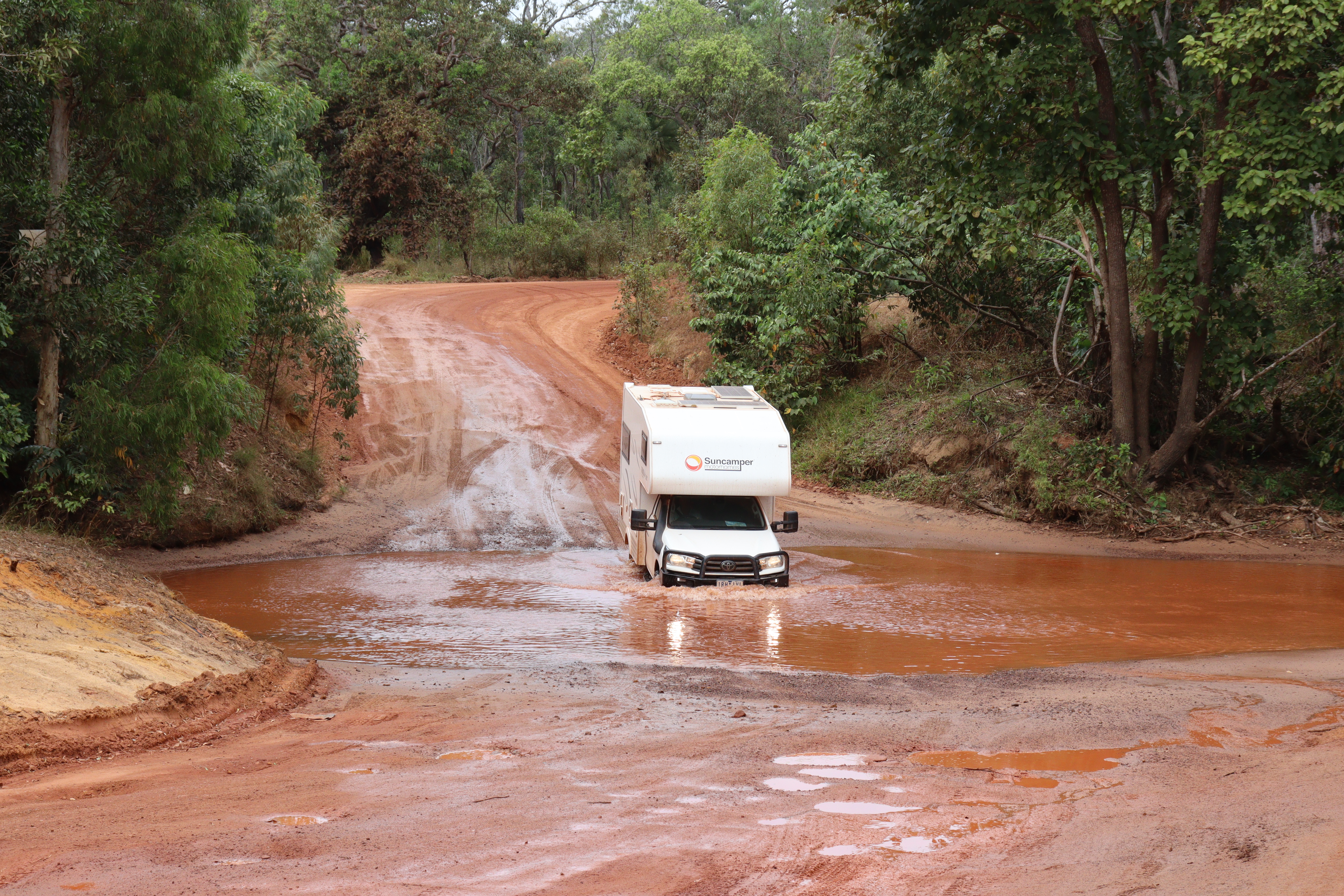
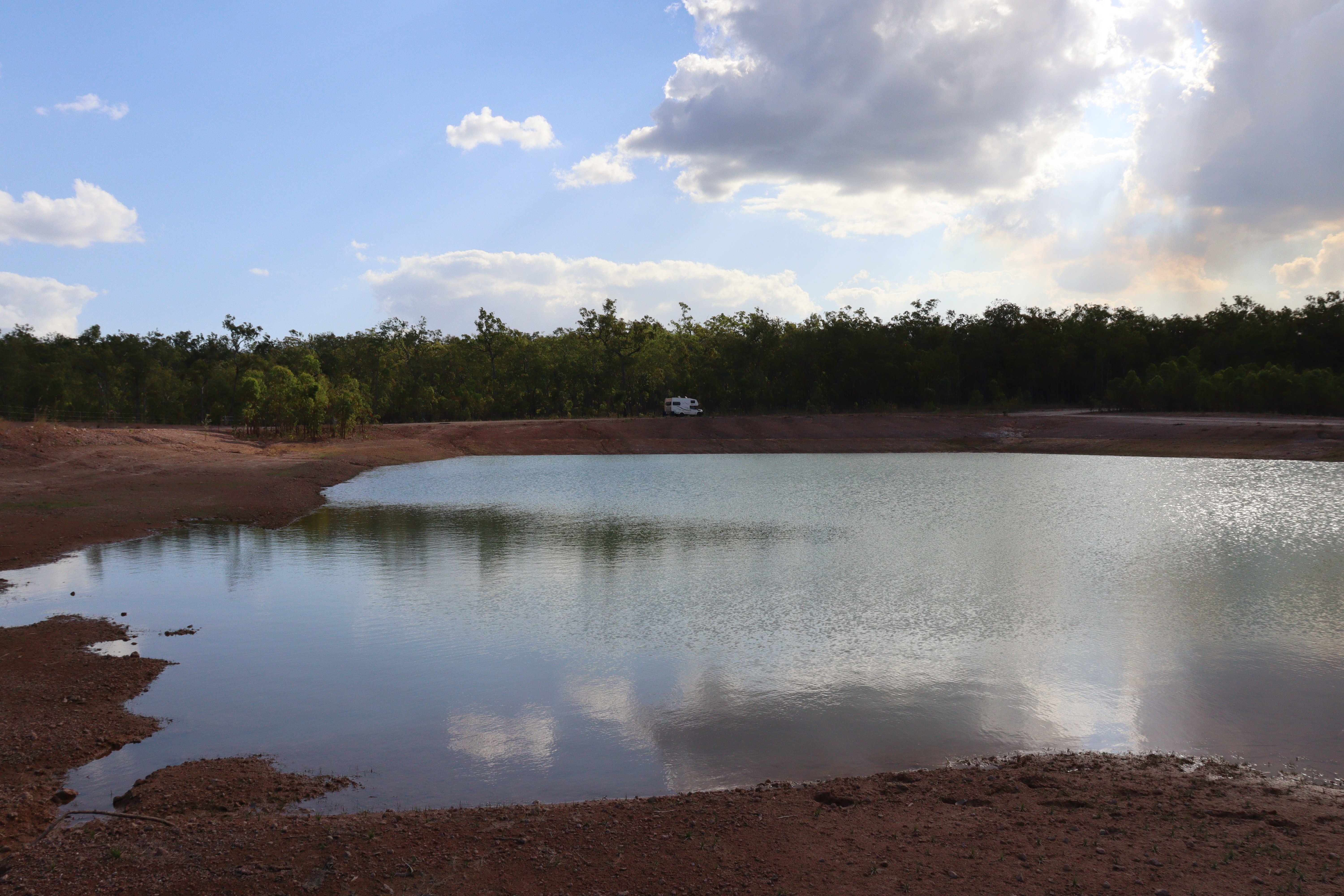
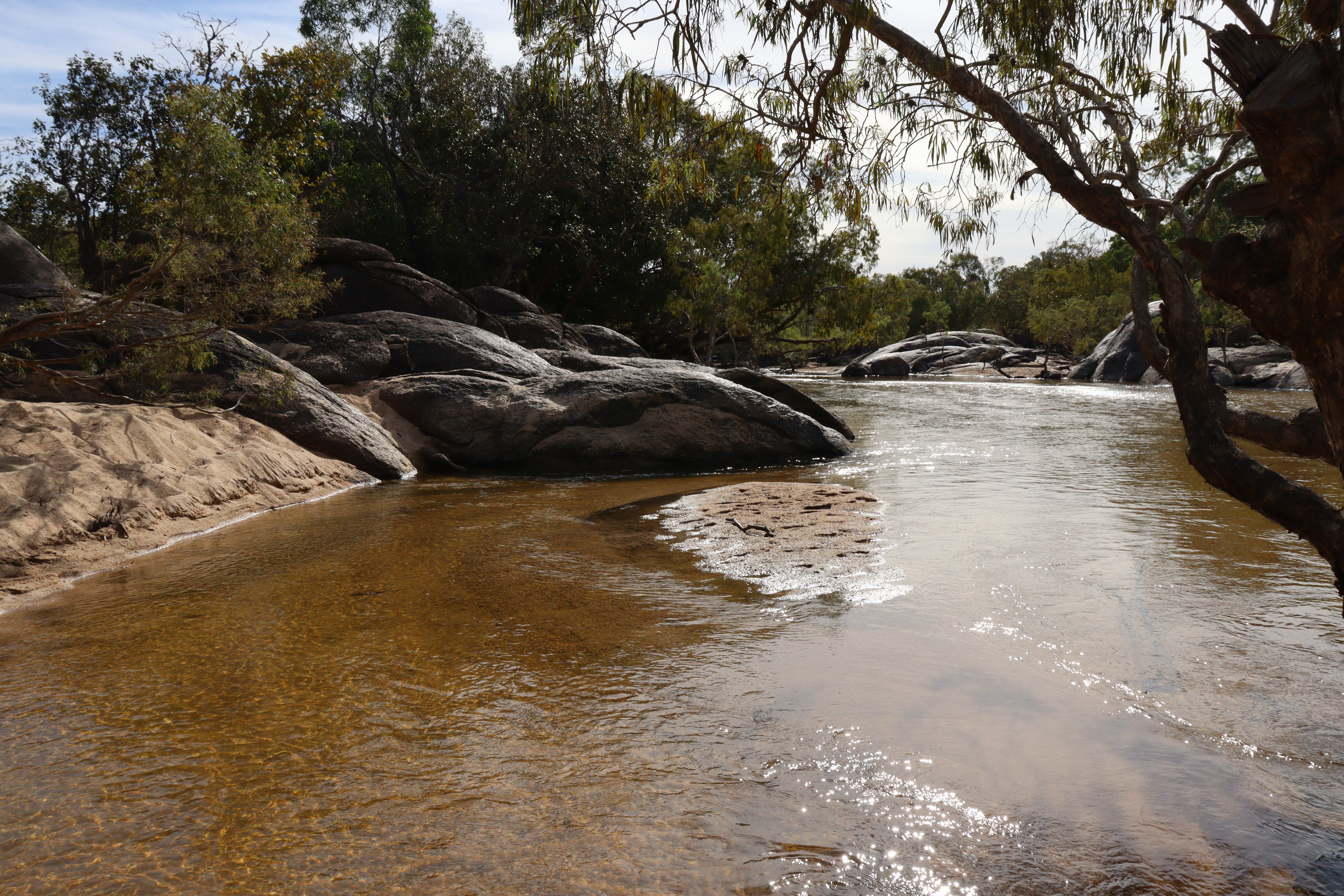
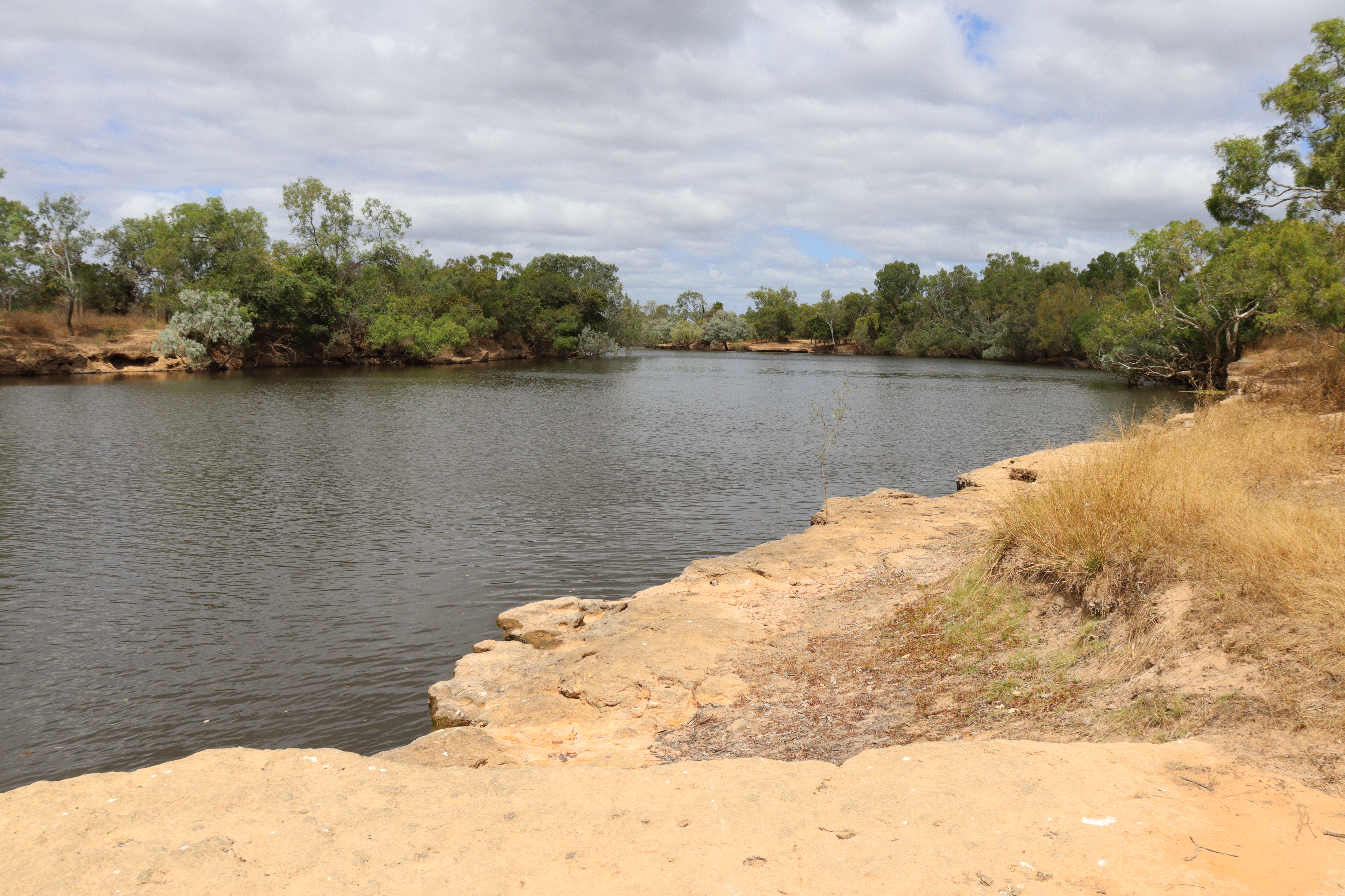
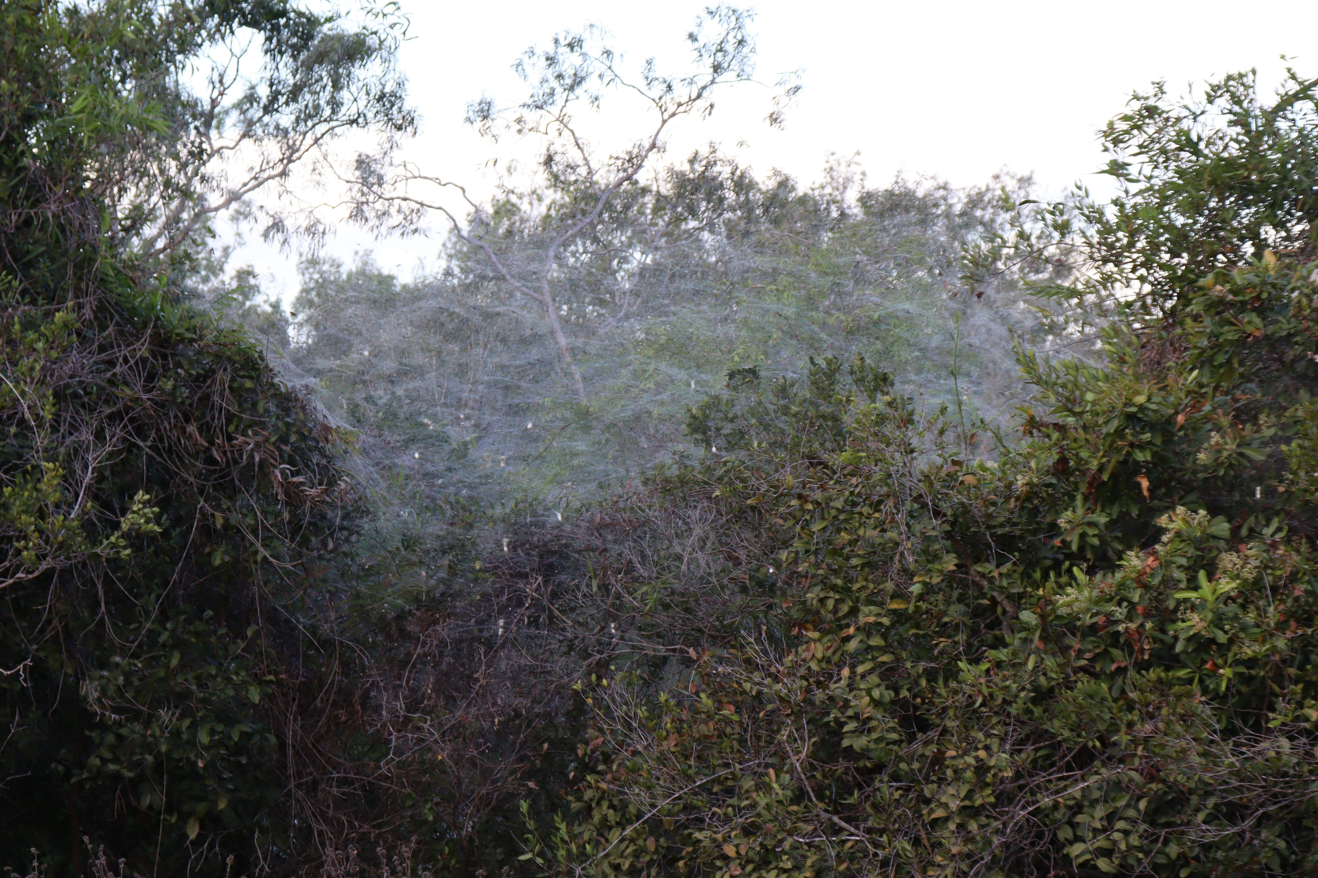
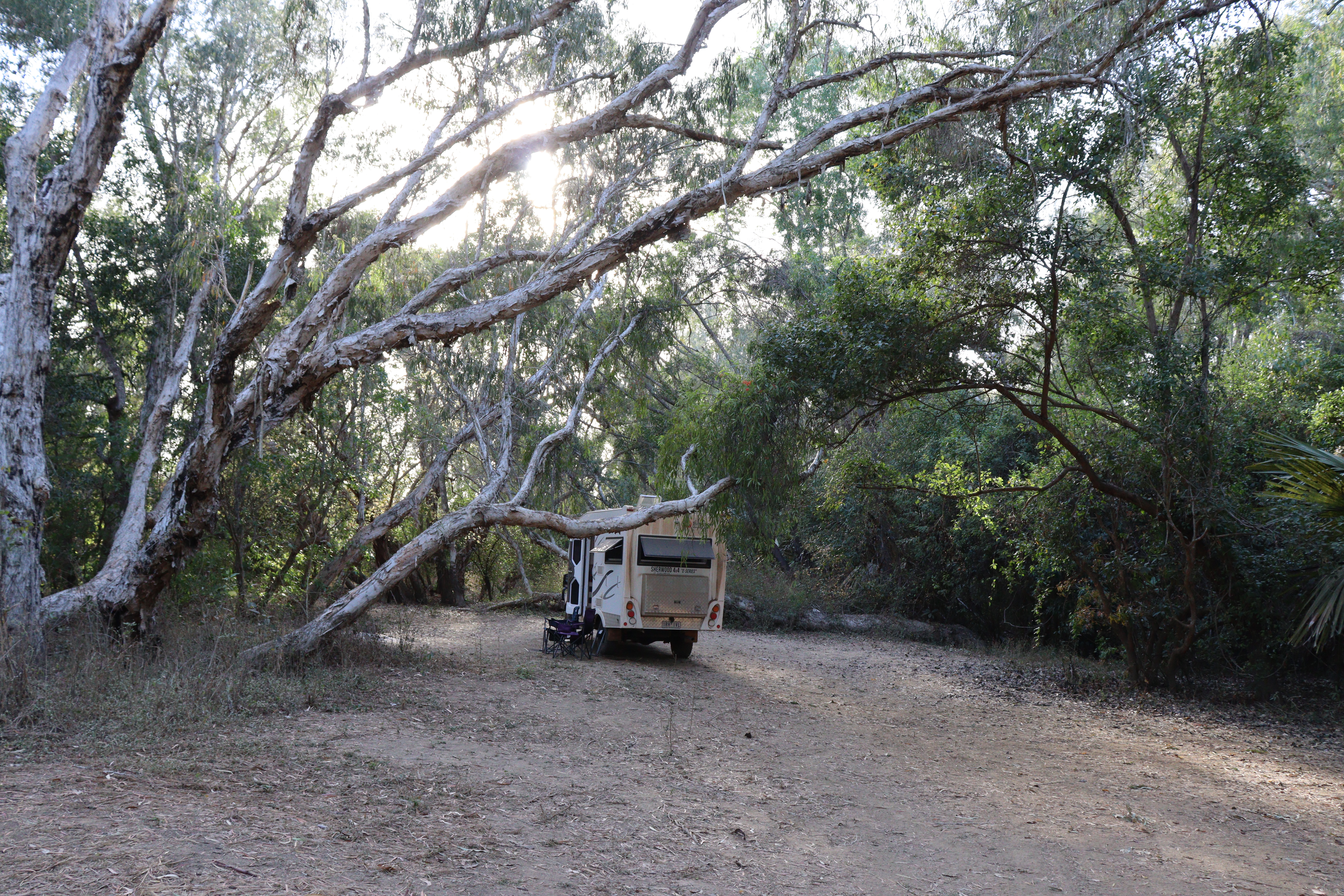
This Park has many campsites at different waterholes and along several different rivers, all of which are tidal and therefore have the “Achtung” croc warnings.  Staying the first night at Hann Crossing on the North Kennedy River, our campsite was a lovely, secluded spot, very quiet on a ledge well above the water.  Walking back to the crossing, it seemed that only a couple of the campsites were occupied. At one point, I saw what appeared to be a smoky haze amongst the bushes, but on closer inspection, it turned out to be a huge mass of spider webs slung thickly between the trees, with hundreds of spiders of different shapes and sizes hanging in them. I’ve never seen anything like it! At the actual Crossing, the river reduces to a narrow chute before cascading into a wide pool that expands to a large waterhole. That night, sitting outside in the dark, we heard a large splash and shining a torch on the water, we spied several pairs of red eyes – CROCS! Luckily our ledge, although close to the water’s edge, was high enough to not be a concern.

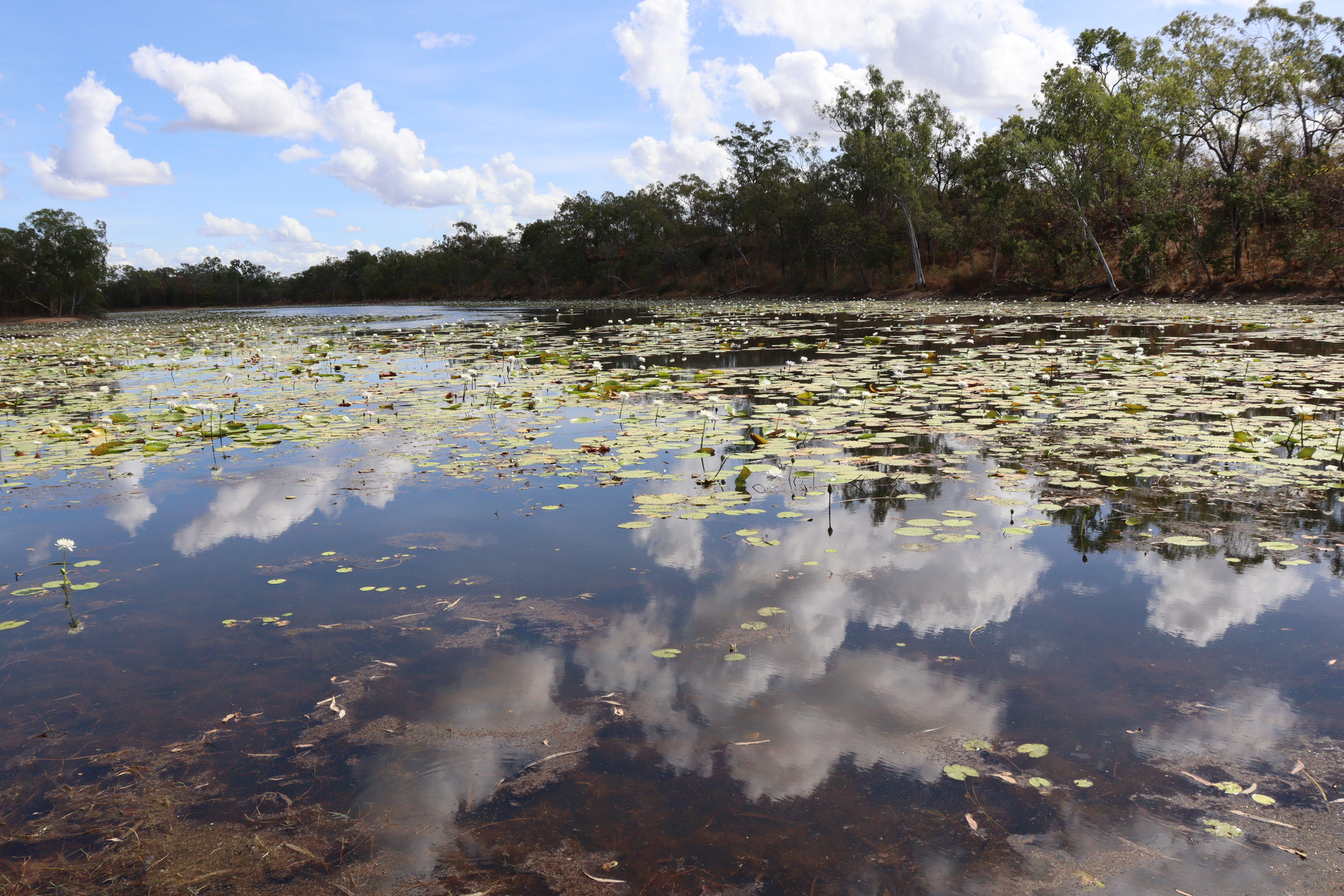
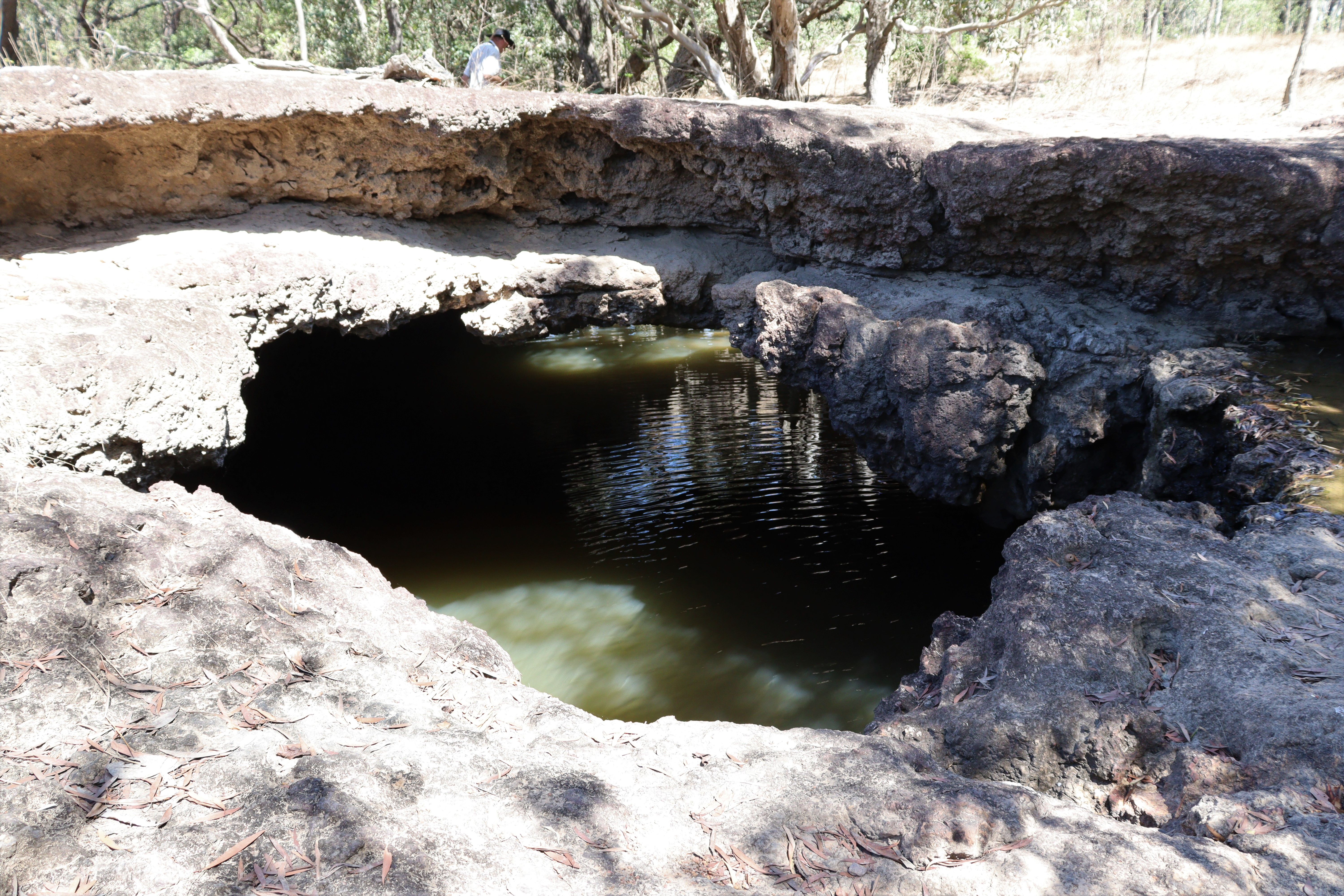
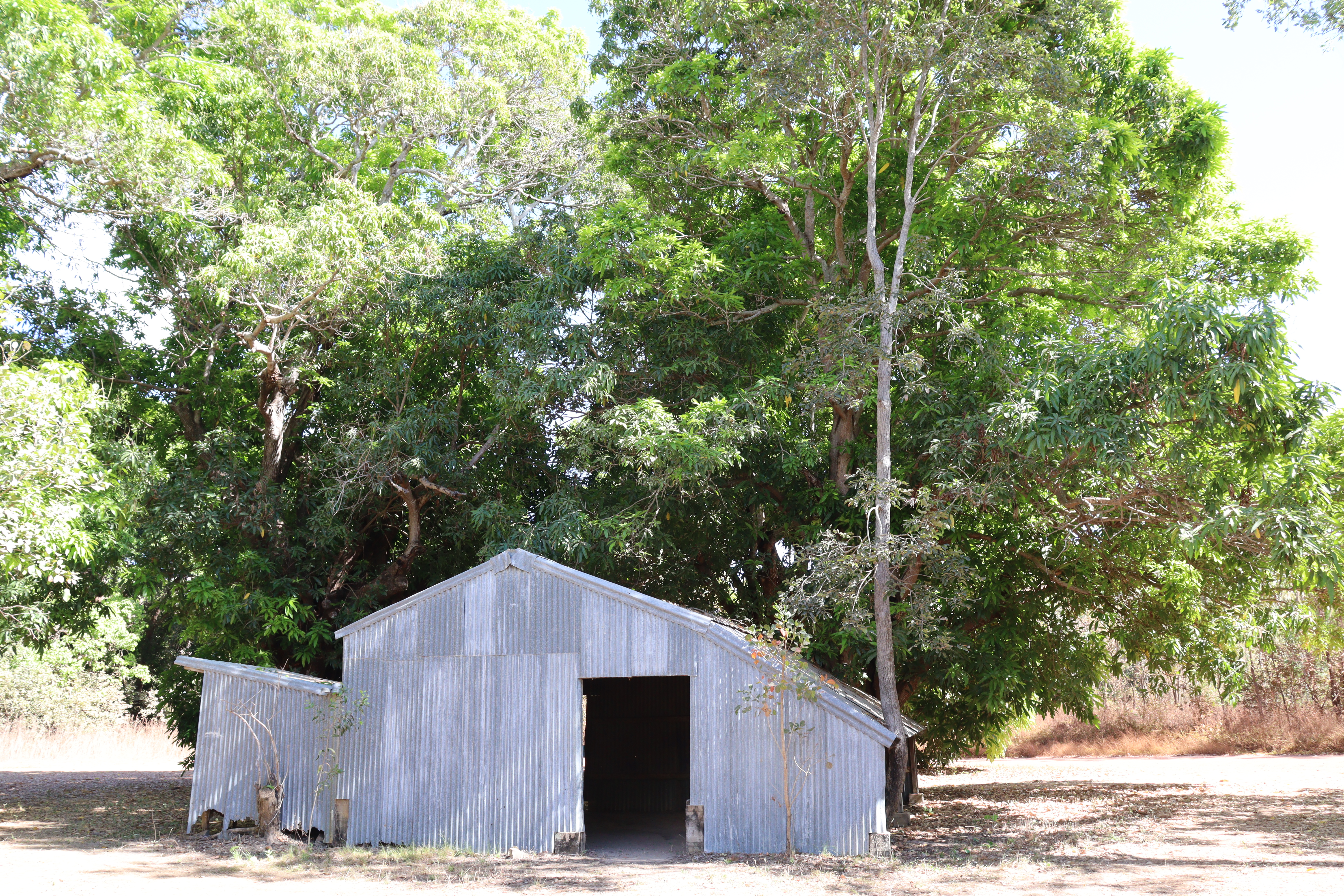
Continuing through the Rinyirru Lakefield NP, we stopped in at Breeza Homestead  historic site where the relics of the original corrugated iron homestead remain nestled under a pair of  huge mango trees a short distance from a large lagoon covered in waterlilies. Further along the road, Red Lily Lagoon boasts a year-round water retention which is ideal for the survival of the many plants, particularly the lotus lilies, that grow there.

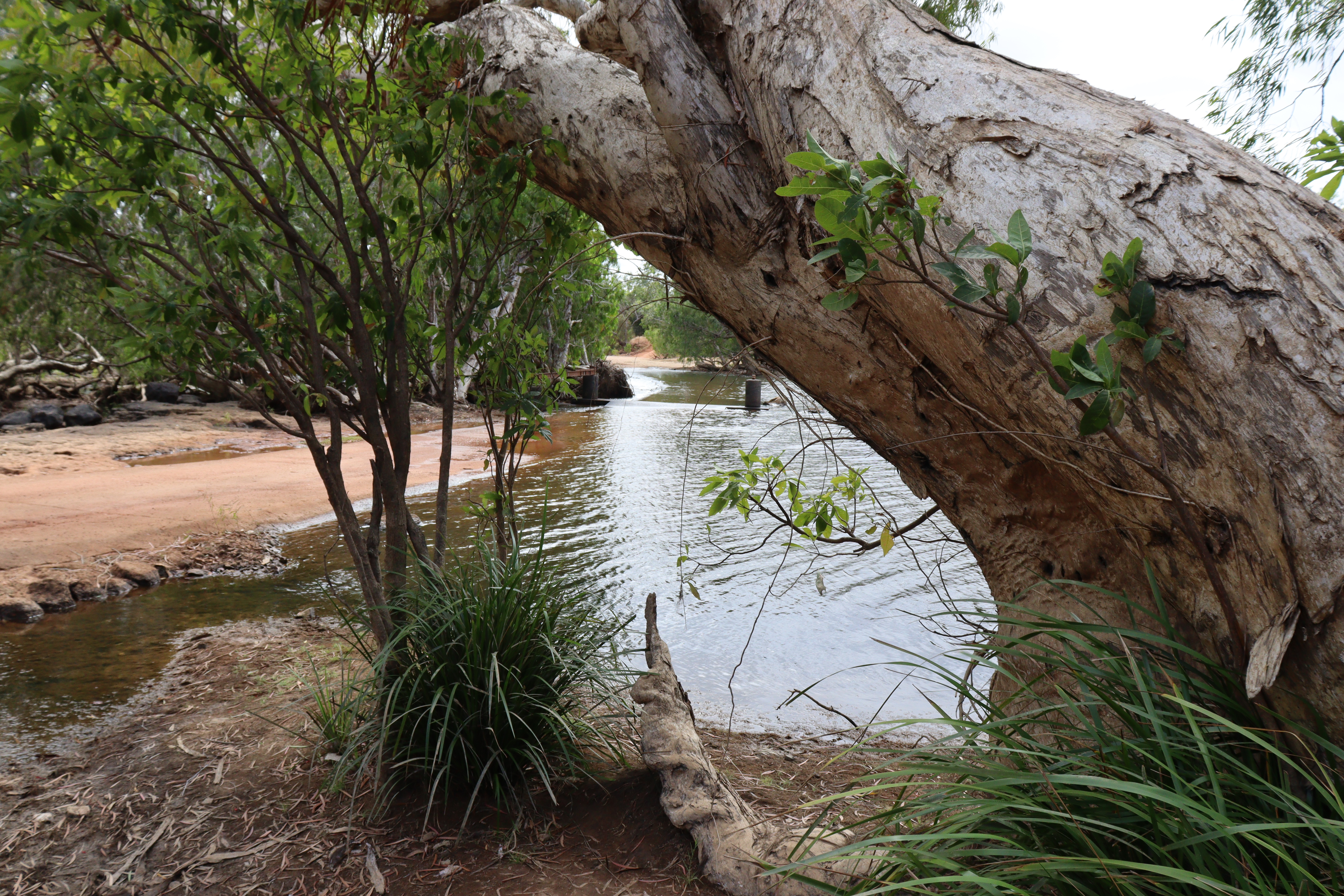
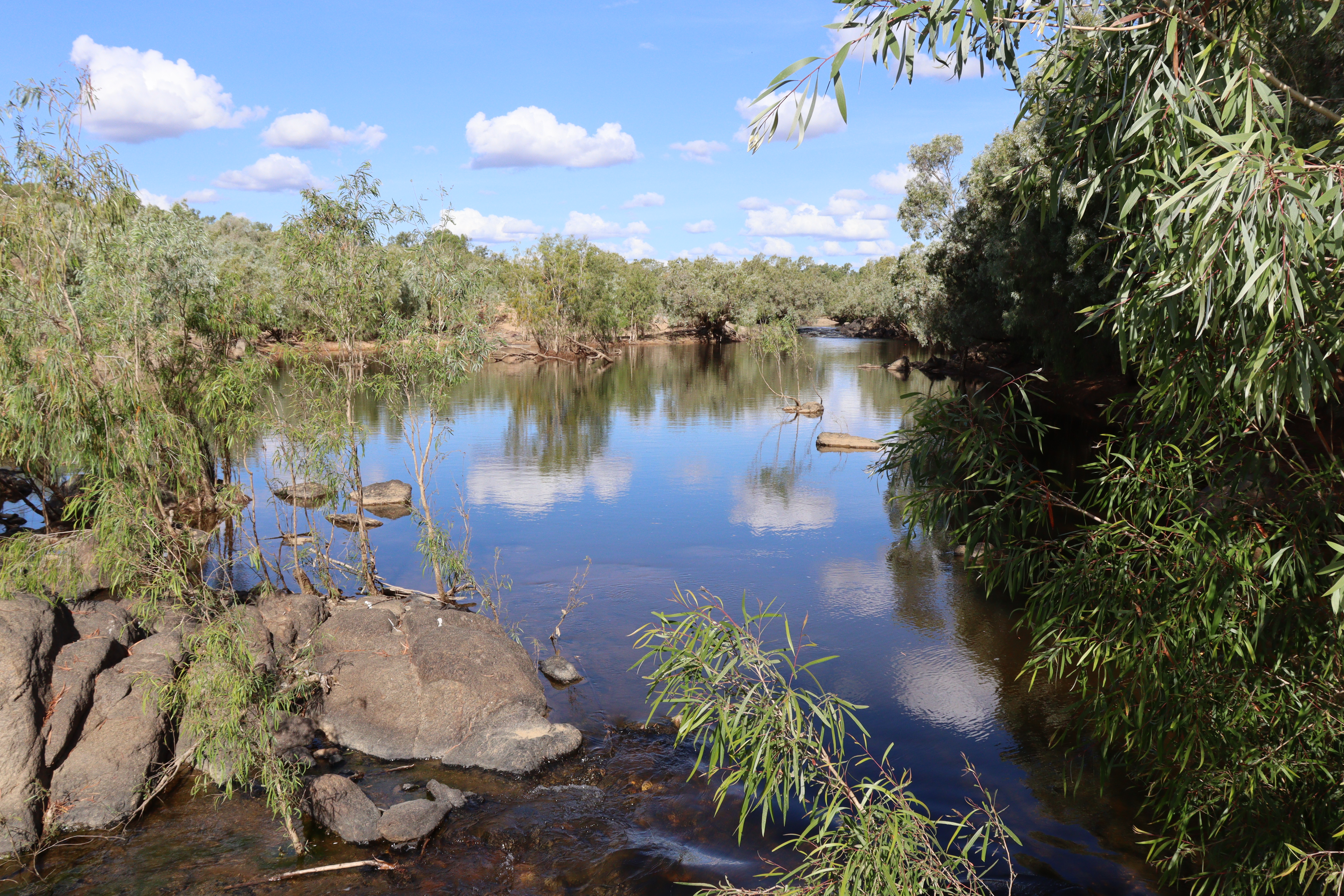
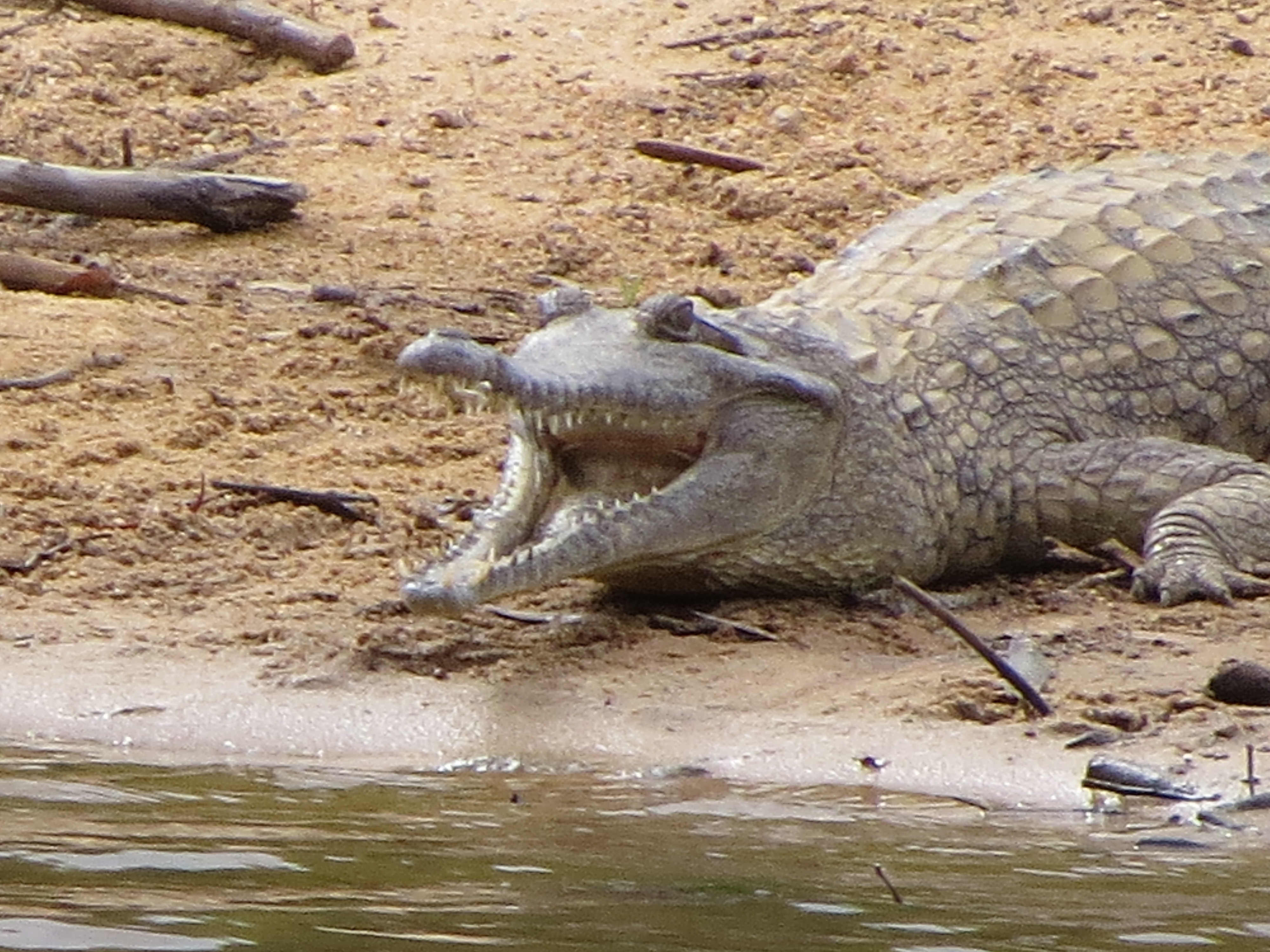
After a refreshing cold shower at the Kalpower Crossing camp area on the Normanby River, we continued to our next campsite at Twelve Mile Lagoon, which according to the signs, was 15 kilometres off the road on a 4WD track but turned out to be not too difficult. Our site at first appeared to be not as pleasant as the night before’s, but we found it to be much more secluded and infinitely quieter being so much further from the road.  Once we set up and dragged our chairs to a point where we were high above the Normanby River, we found that it was a great spot for croc-spotting. And spot plenty of crocs we did! On the opposite bank, we spotted 5 or 6 what we thought were freshies or Johnstone River crocs, but they could have been salties, and we sat watching them for quite some time till later in the afternoon, they were joined by another very large estuarine croc that had to be around 4 metres. He just lay in the water and was obviously not too hungry as several magpie geese walked right by his snout and he made no move to get them. Despite them all being on the opposite bank of this nice wide river, I felt somewhat reassured that the bank on our side was quite high and pretty steep.

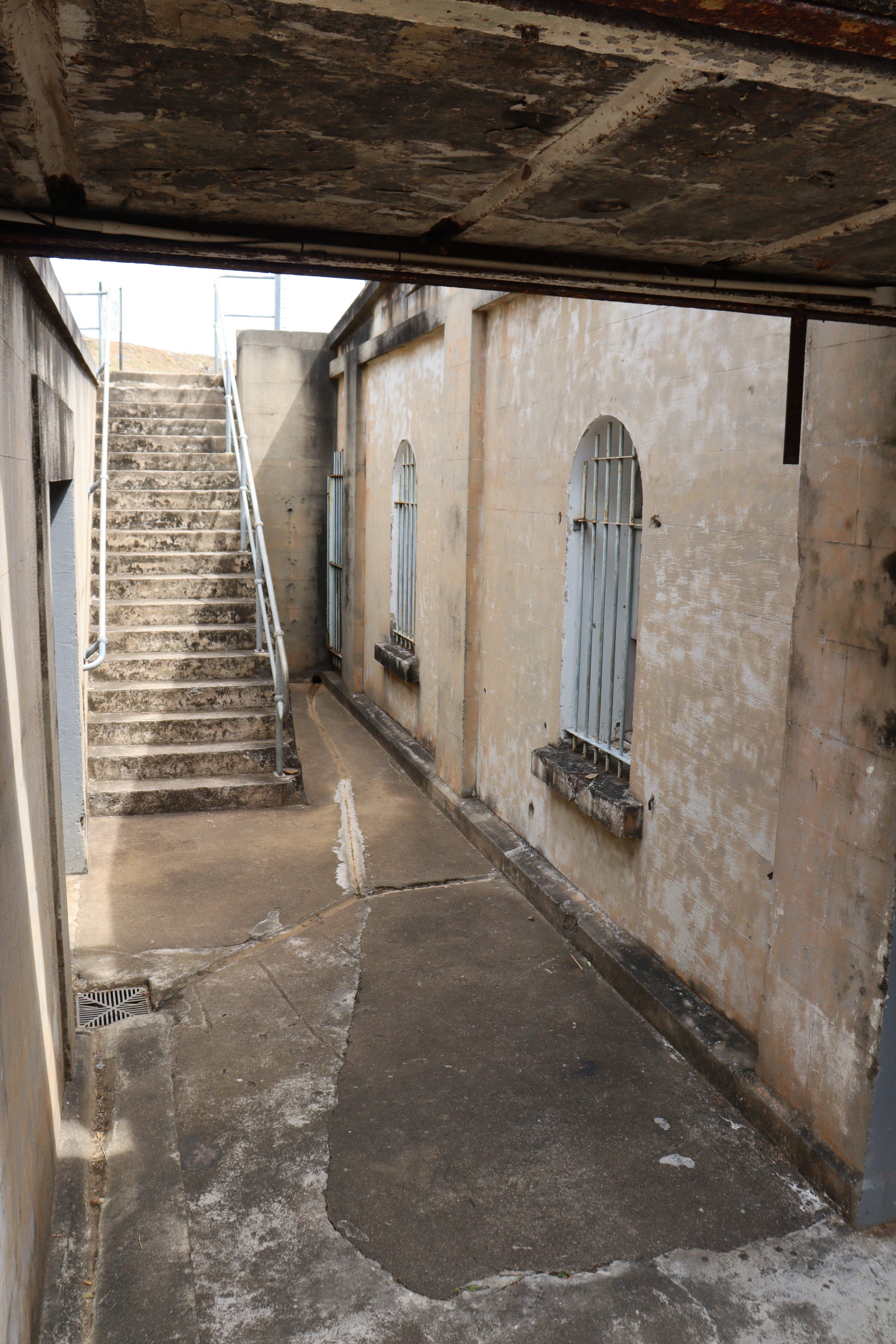
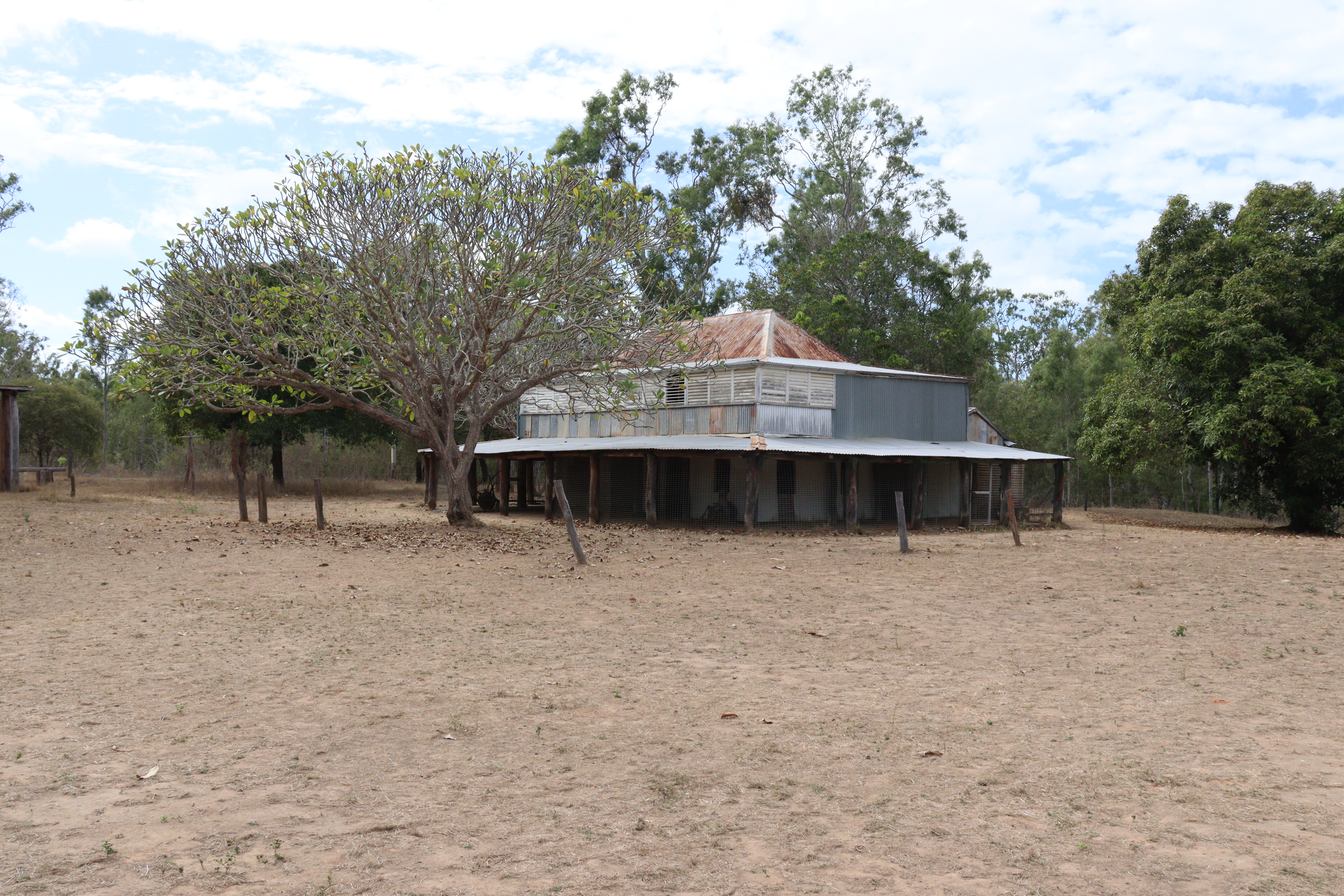
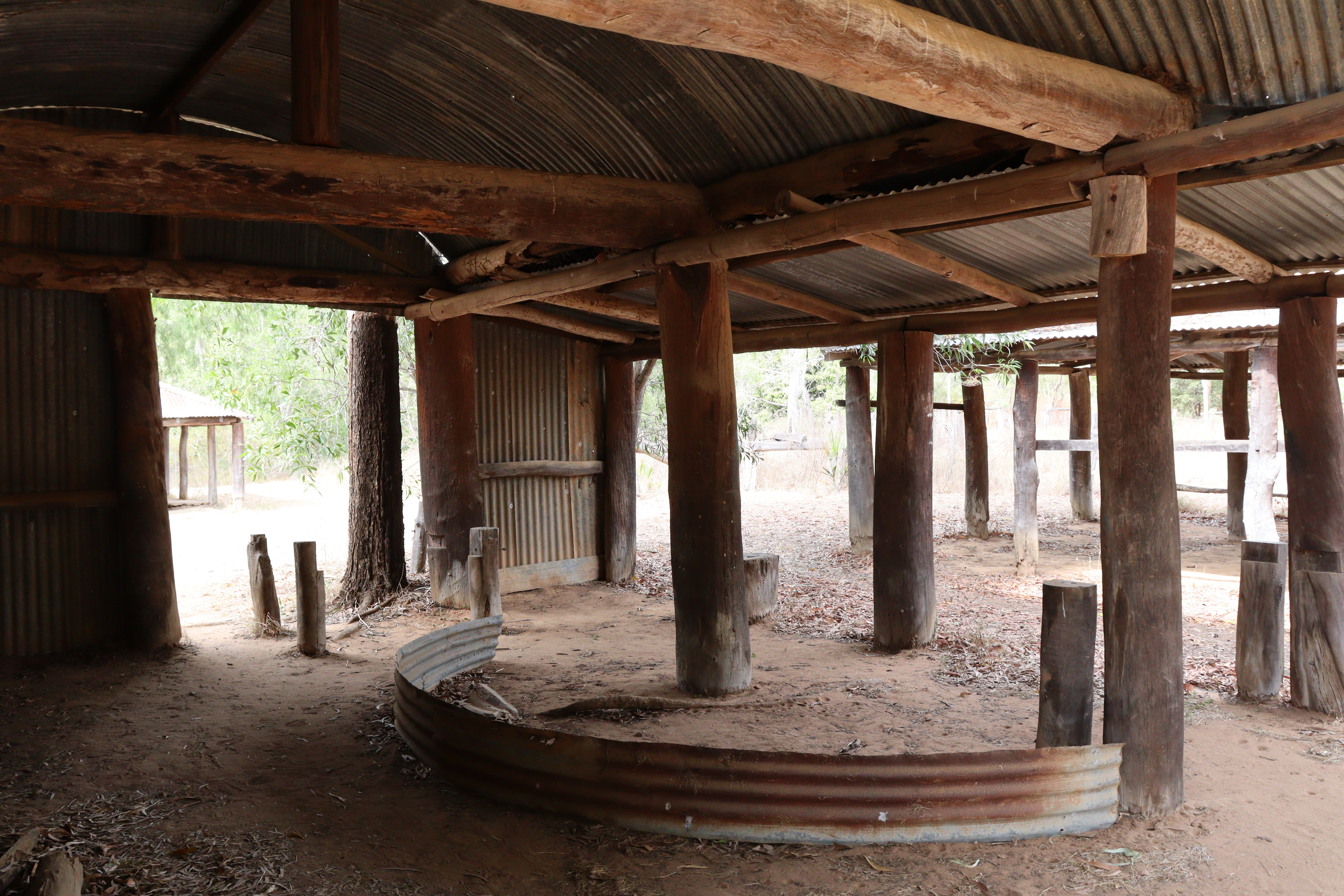
On the way our of Rinyirru, we called in at Old Laura Homestead, a well preserved two storey house complete with shutters and wide verandahs, meathouse, stockmen’s quarters, saddlery and blacksmiths buildings. The Laura cattle station was in continuous operation from the gold rush of 1880 right up till 1966 and despite its isolation and often being cut off by seasonal weather, its community was virtually self-sufficient.

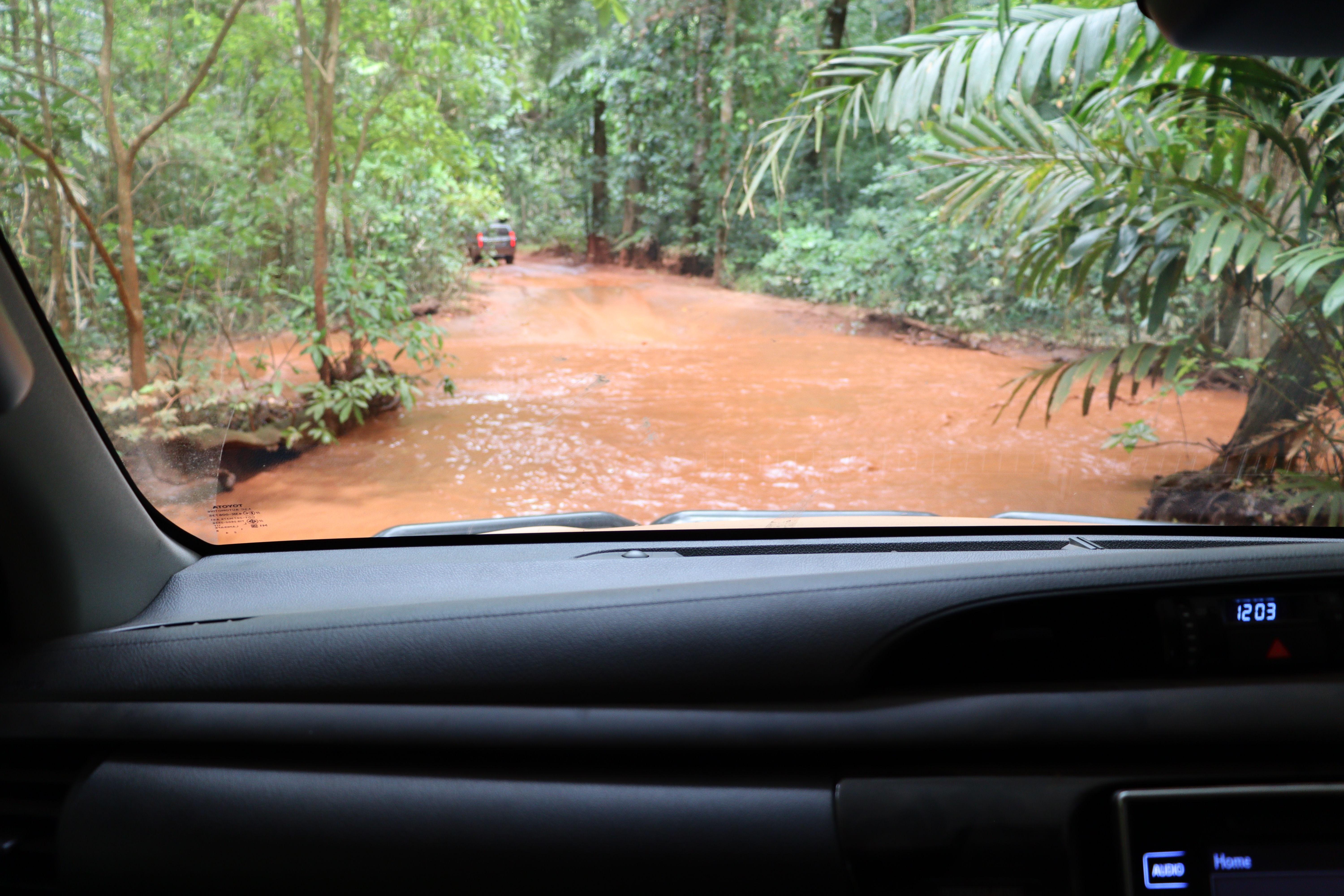
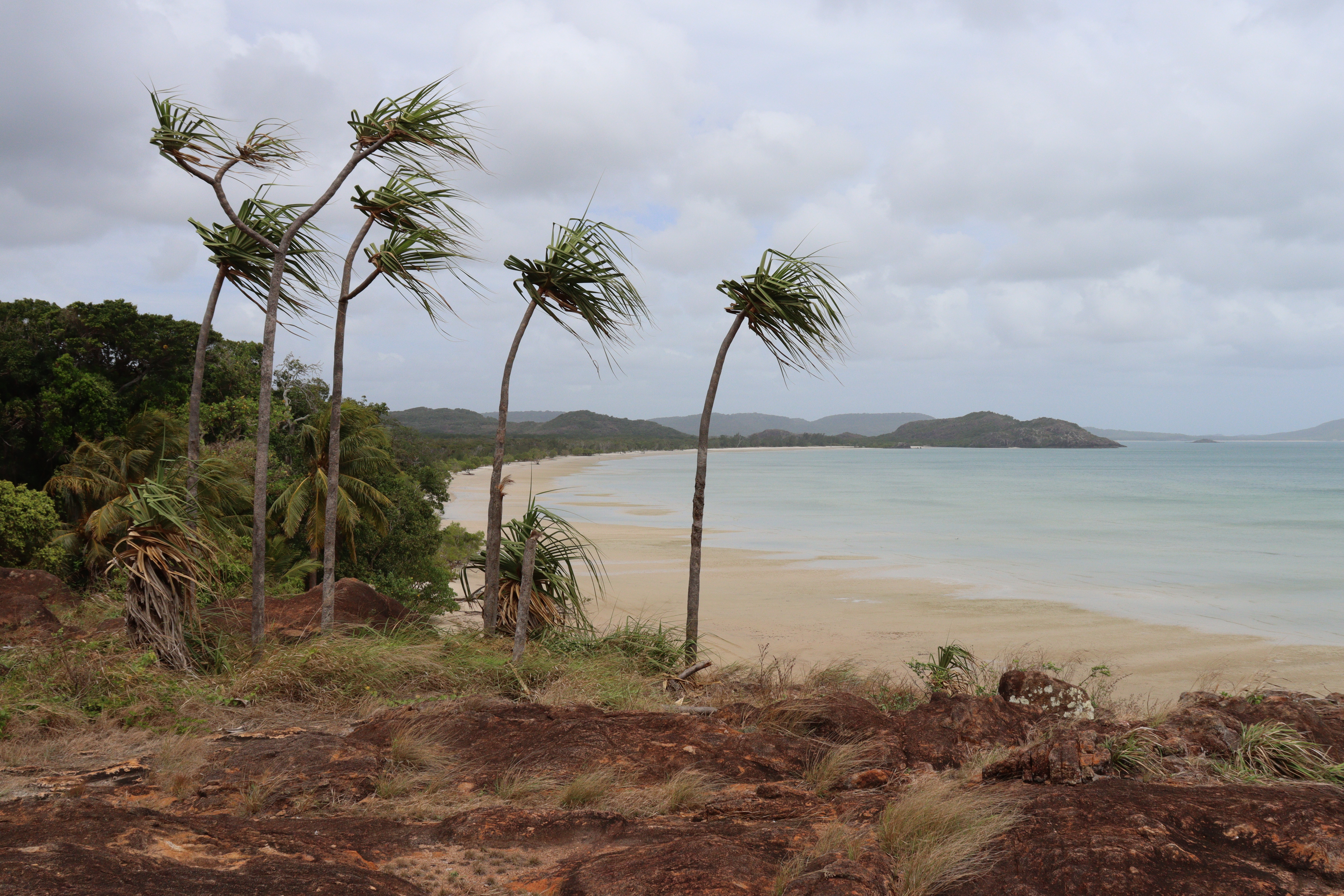
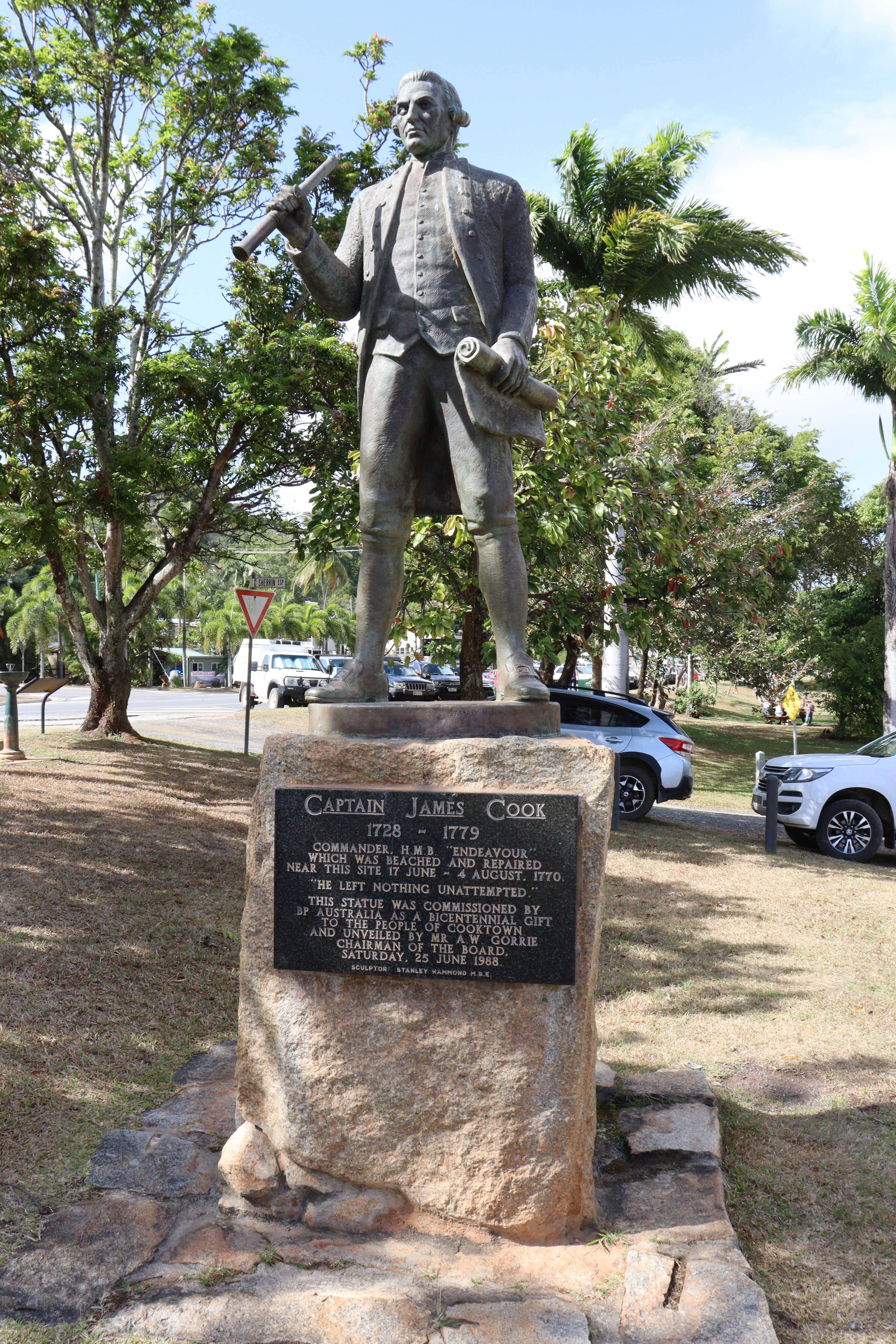
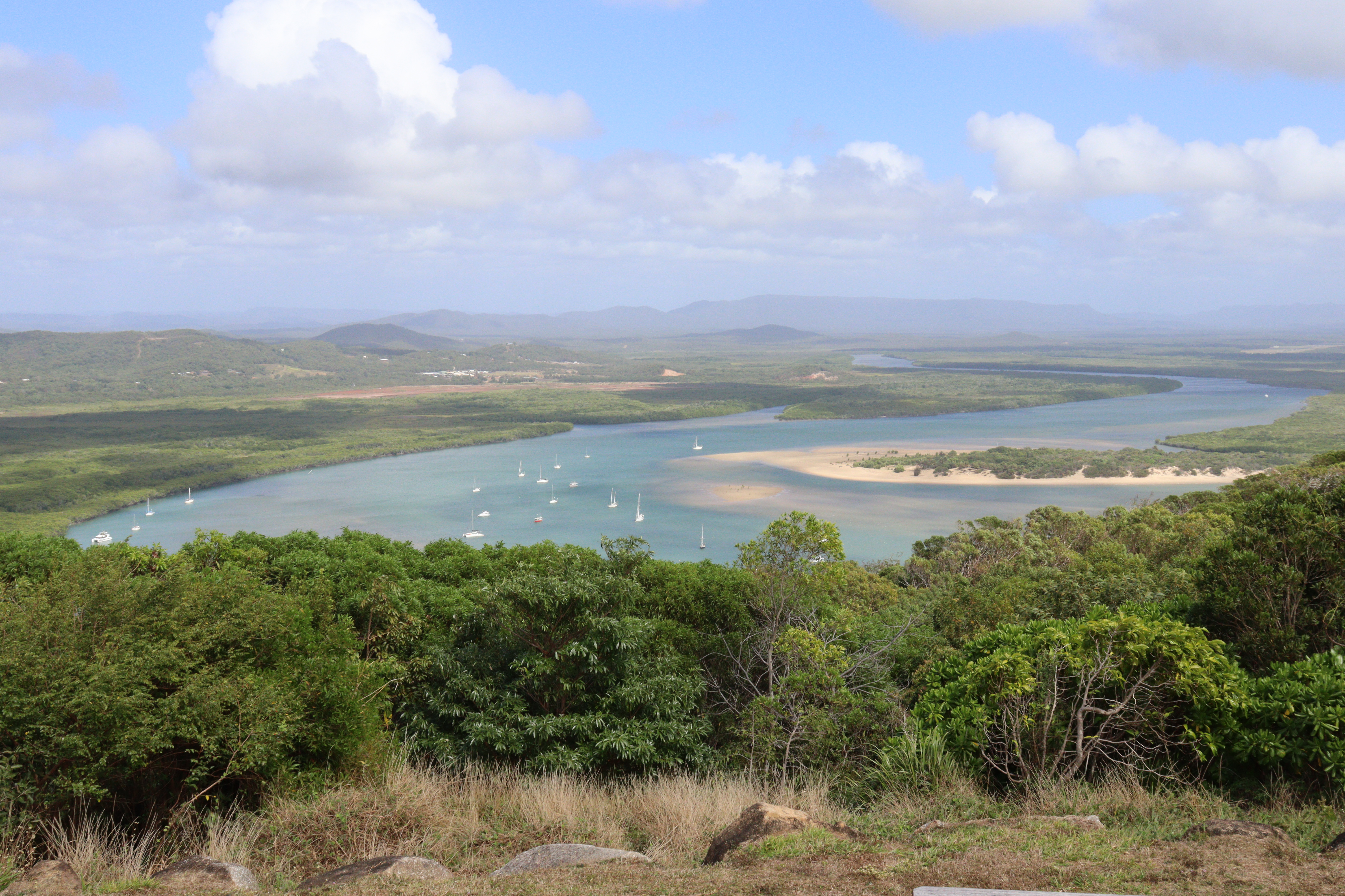
Fording several rivers with wet crossings and causeways, crossing the Great Dividing Range took us down to the coast and to Cooktown, where Captain Cook beached his ship the Endeavour for repairs in 1770. For the next couple of days we explored the sights of Cooktown, including Grassy Hill Lookout and Lighthouse, a very steep slow walk up to the lookout but worth the effort when rewarded with 360° views over the town, the Endeavour River, the Great Divide, and the Coral Sea. From that point we continued a walking trail down through the rainforest, passing two pretty, secluded beaches and into the lovely Botanic Gardens, filled with tropical plants and palm varieties.

A short distance out of Cooktown, heading south, we came across a small pullout and carpark beside the road, where signposts announced we were at Black Mountain NP – Kalkajaka. This mountain actually appears to be no more than a huge pile of rocks, but as the signs explain, it’s a huge, fragmented granite rock that has been eroded away over the last 260 million years, thus forming the pile of rounded boulders we see today.

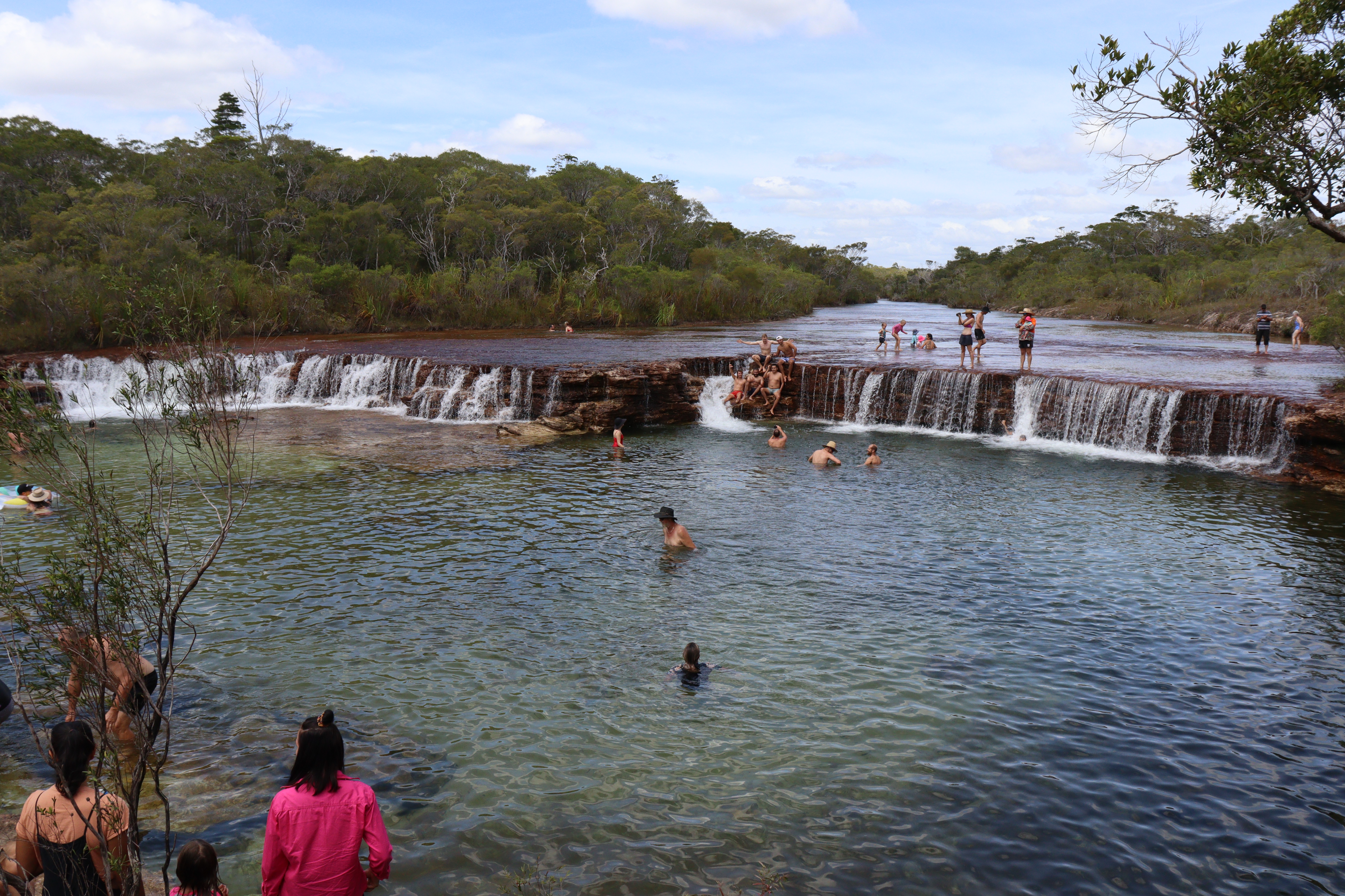
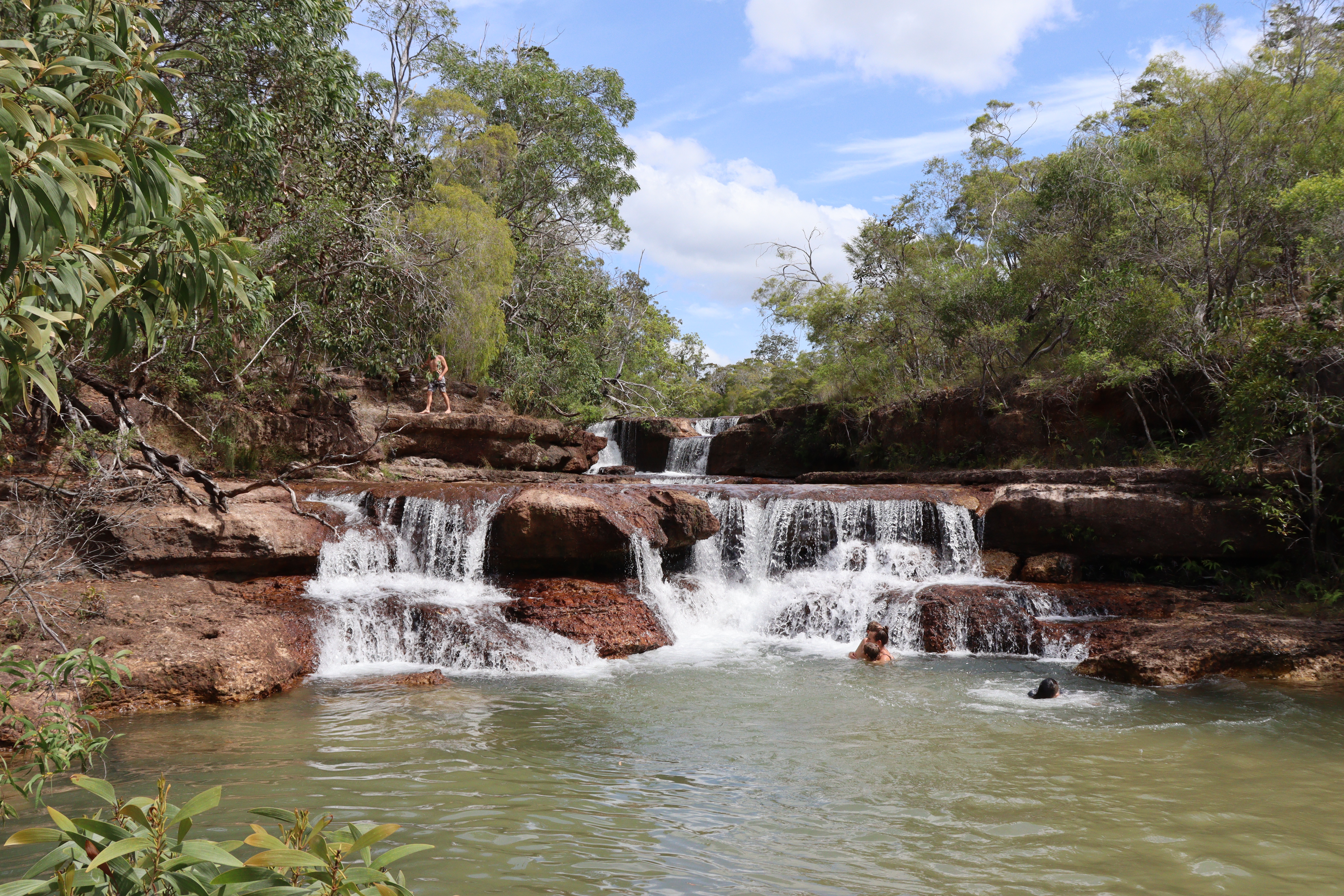
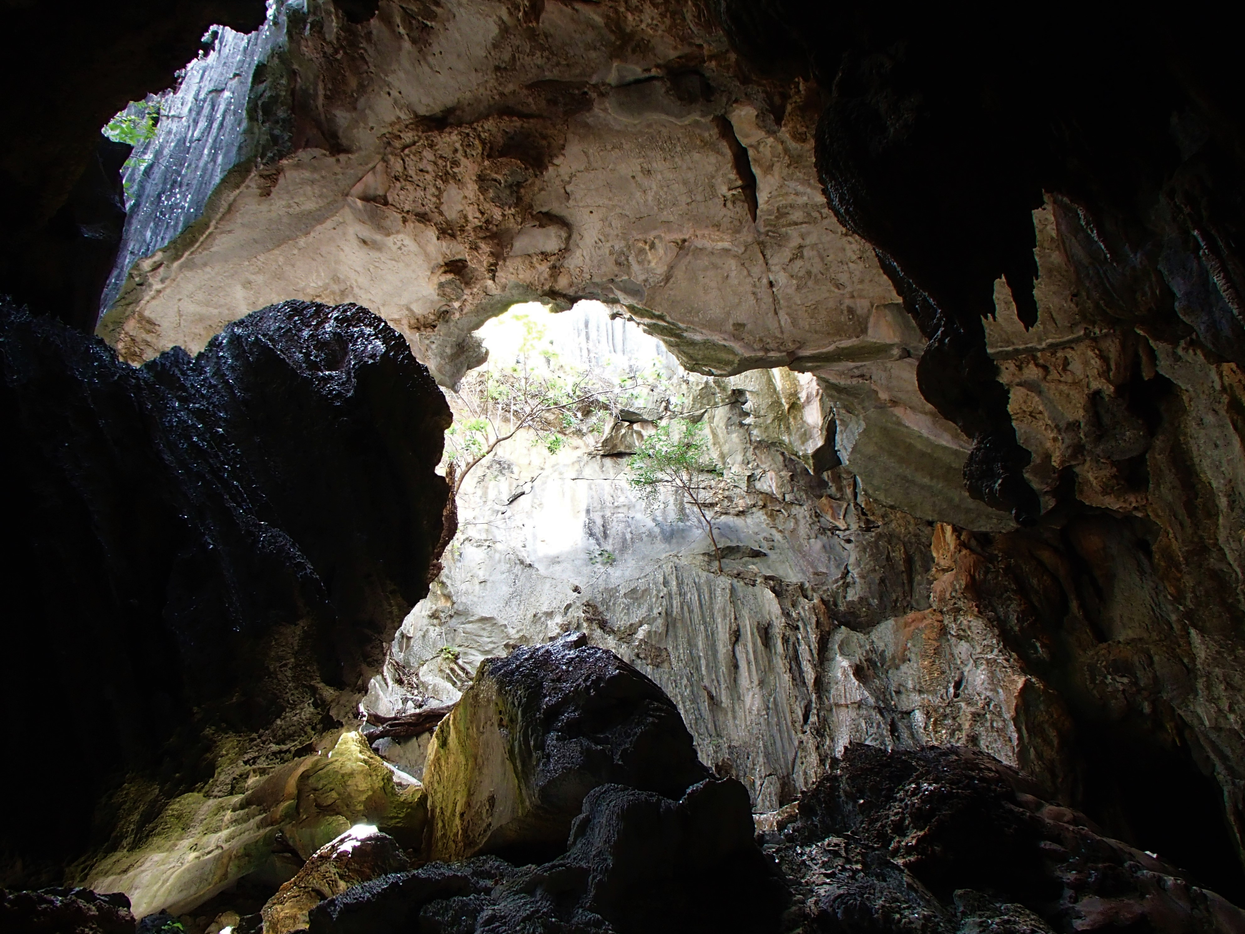
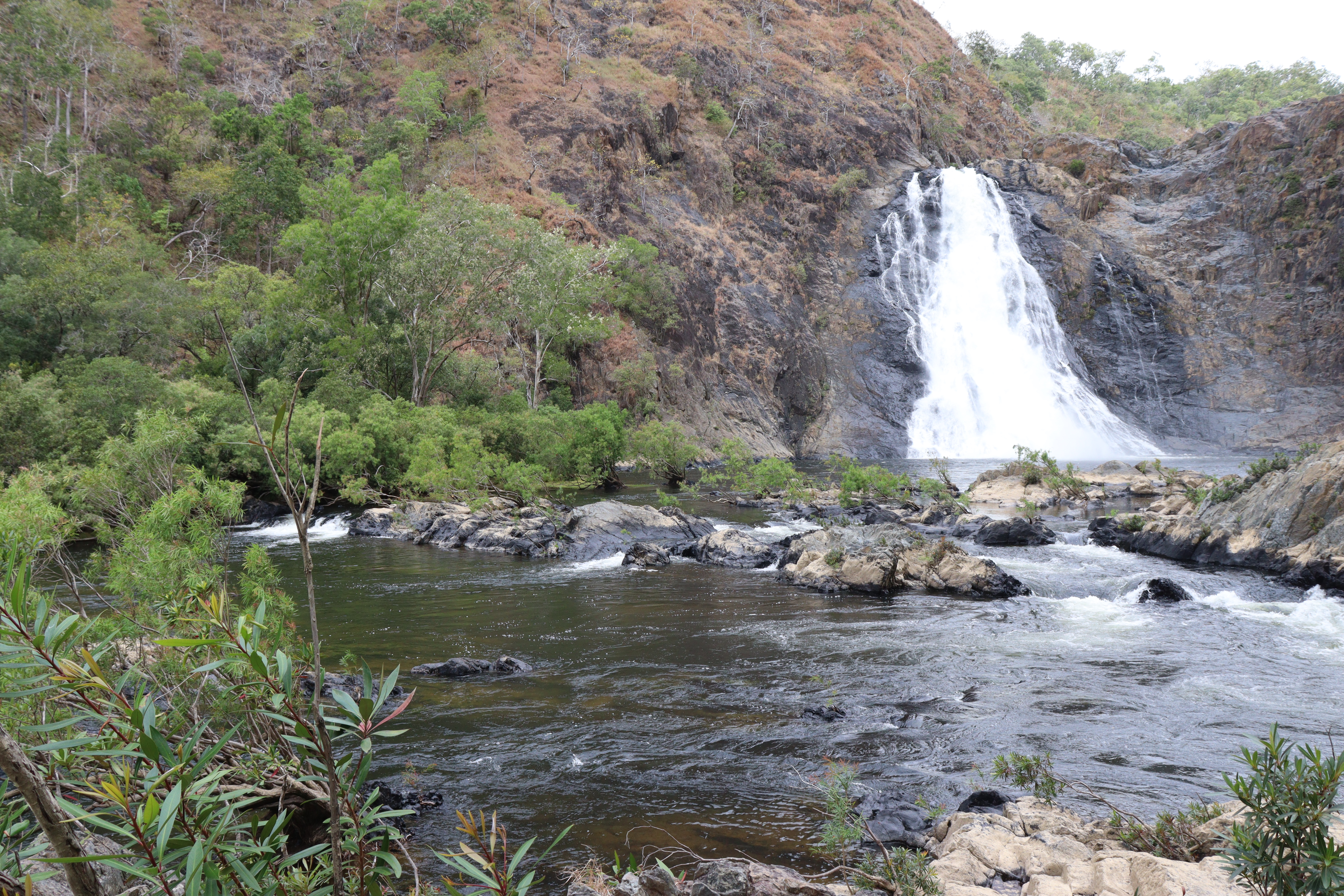
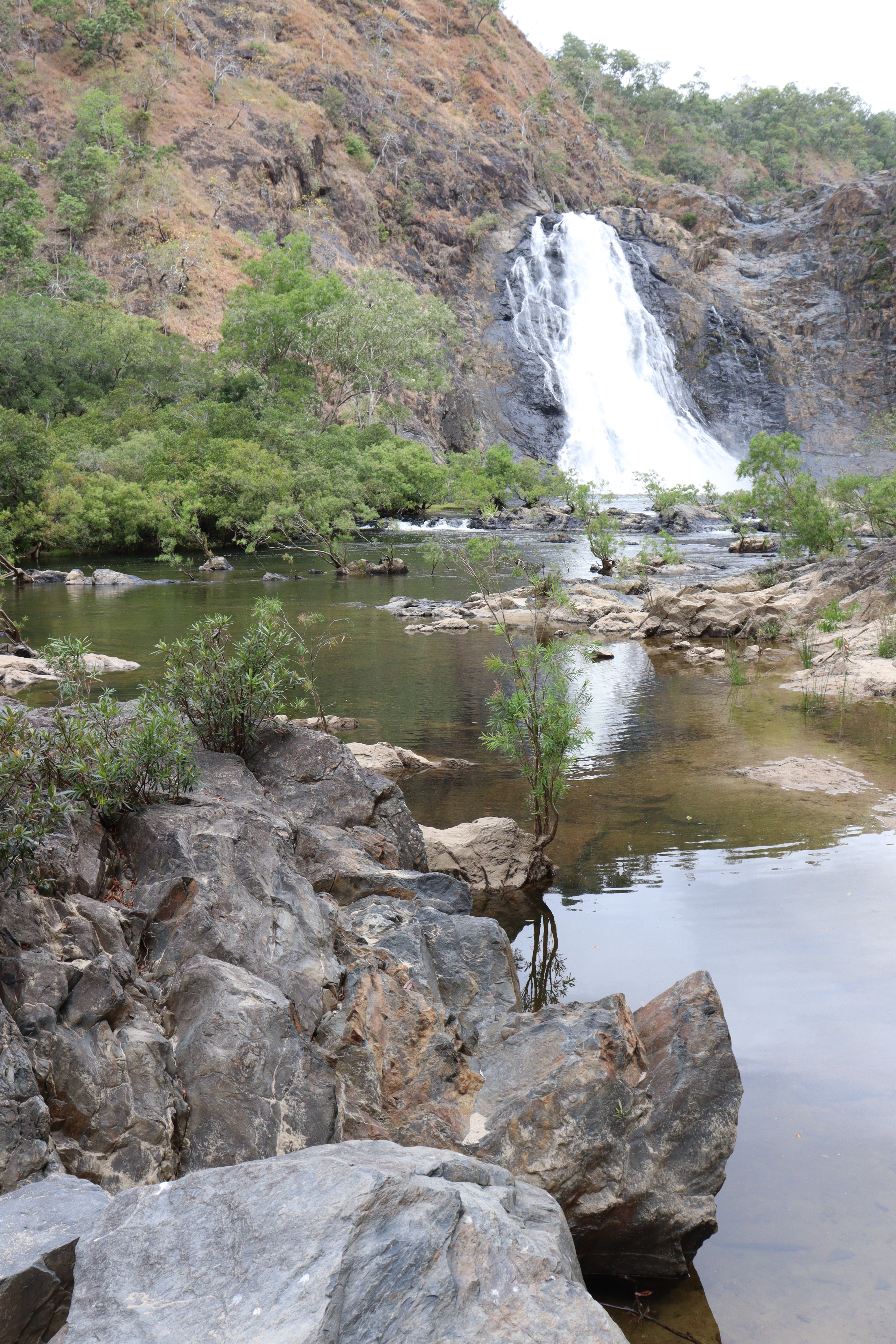
 About 70 kilometres south of Cooktown, within the Daintree NP, are the Bloomfield Falls – Wujal Wujal – where we walked the 1 kilometre track then scrambled over the rock till we came upon these most breathtaking cascades, tumbling about 40 metres over the sheer rock wall with impressive force, probably more so on this day due to the rain we’d had the last few days.

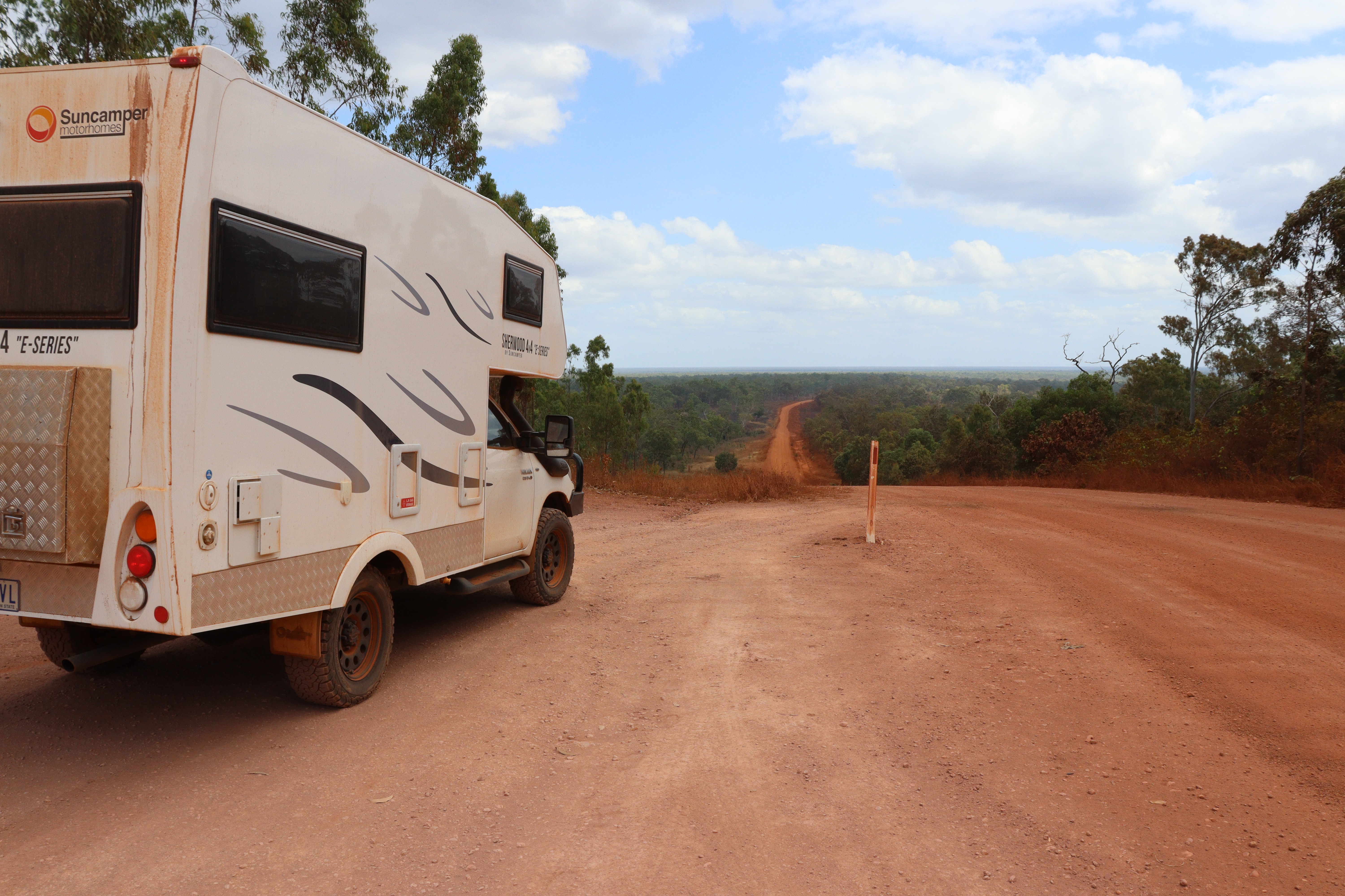
From this point on, we started taking longer days driving. We had covered all the places we wanted to see for this trip, so it was time to start heading home. So after a night at the Three Rivers Hotel (from Townsville to Greenvale they’re building a line…. ), visiting friends at a station on the Burdekin River, and catching up with more friends in Charters Towers, we turned left (south) at Torrens Creek.

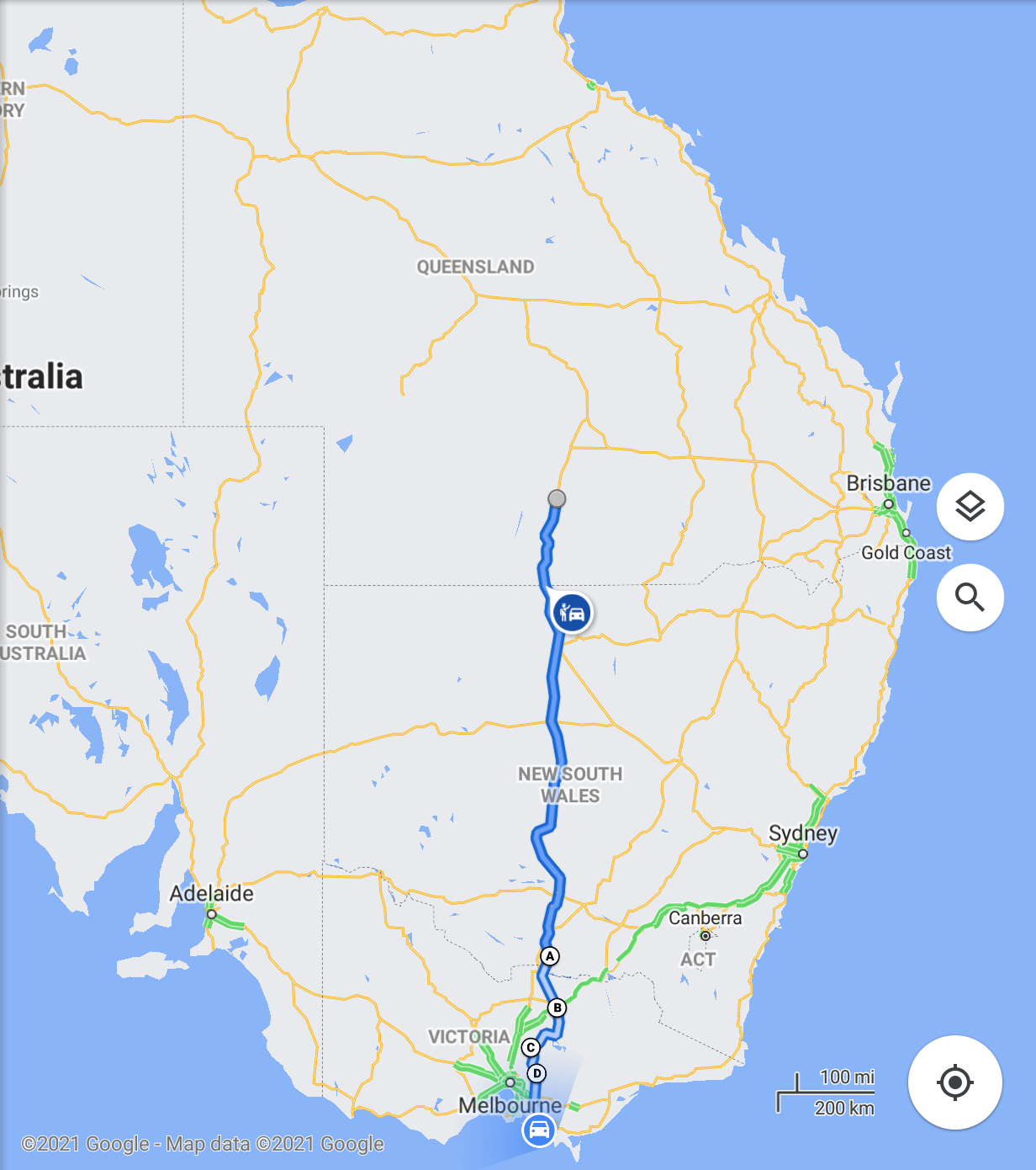
With Covid causing on-again off-again border closures between the states, we had applied for and been granted a 24-hour pass to travel from Queensland through New South Wales and into Victoria. Travelling on this pass, we had to traverse NSW within 24 hours, not have any unnecessary contact with anyone and document any stops for fuel etc.  Many people had been taking detours into Northern Territory and South Australia, but by the time we were about to hit the Qld NSW border, that detour avenue had also closed. So we spent our last night in Queensland about 200km north of the border, started early the next day and drove about 730 kilometres till we got to a roadside stop to spend the night, which left us only about 375 kilometres to get us across the border and back into Victoria the next day.

Best laid plans…..

That all went according to plan. We crossed the border into Victoria in a little over the 24 hours, even with our overnight stop, and had our permit checked by police as we crossed. So all was good. We were now on home territory and could take our time to get the rest of the way home, so we found a bakery and had a late breakfast. When we got back into the car, Gary turned on the radio, which he hardly ever does, just in time to hear the news that within 20 minutes, Victoria was going into lockdown again. WHAT??? This lockdown was a snap announcement with only 2 hours before coming into effect, so after having driven from Queensland and having to get through NSW on our 24-hour permit, we decided to just drive the rest of the way home in the same day. So we ended up driving 1480 km from 8am in Queensland on the Friday till we were home in Victoria by about 4.30pm on the Saturday with a night sleeping at a roadside stop in between! Big days of driving for us…our “big” days are normally a maximum of about 150 – 200 km. Luckily with Roxy we can both drive, because we would never have gotten so far so quickly if had all been up to Gary alone!

And so our Trip to the Tip had come to an end. We had been away for 96 nights (almost 14 weeks) and covered 12100 kilometres in Roxy, visited lots of friends, enjoyed lots of new experiences, had lots of hot weather and seen lots of new sights in this great country of ours.

And now we are home and planning our next adventures.

WTF?? Or Ha Ha!!

  • Weipa Caravan Park Rules – NO working on cars, boat motors etc – BUT just in our little section of the park, there were at least 4 vehicles getting more done than just a tyre change!!
  • We’d been looking forward to a quiet night at a station stay which was on a station owned by friends of friends of ours, but when we got to the gate, there was a huge log blocking the way with signs announcing it was closed. Turned out, as we discovered later, that due to Covid restrictions, it had shut down THAT VERY DAY!!
  • From Torrens Creek, Gary drives about 140 kilometres on good wide double strip bitumen, passing only one car and one motorbike. I take over and within 40 kilometres, it turns to single strip bitumen, and THAT’S when we pass a stock crate, a road train, several cars with caravans AND some more trucks!! WHY is it always when I’m driving???
  • Just outside Barcaldine, we stopped to get fuel at the unmanned fuel depot, where there are three outlets. How does it happen that not one, but ALL THREE of the outlets were out of operation!!
  • Driving on (luckily) a relatively straight stretch of road behind two vehicles towing caravans, when suddenly the front one is swerving onto the wrong side of the road, for no apparent reason: there was nothing on the road he needed to swerve for!! And they wonder how these caravan rollovers and accidents occur!!

Don’t forget, if you want to read about our travels prior to Roxy, head on over to our earlier Blogs at <taberstravels.wordpress.com>

Destination Cape York – part 4

Thursday Island and Pajinka -The Tip

(Click on images to enlarge)

So here we were – we’d made it to the Tip of Cape York, well ALMOST!

Camping at Loyalty Beach, or anywhere this far north, brings different weather conditions than we are used to. Being tropical, our first couple of days were overcast and very, humid with showers, but that didn’t take away from our enjoyment of the place. Being right on the beach, we had lovely views across the turquoise waters of Torres Strait to the closest of the Torres Strait Islands, and along the coast with palm-fringed beaches. Yes, it is somewhat of a paradise!

The locals are so friendly, always ready with a wide grin. Whilst sitting outside enjoying the views, we were greeted by a young man who pulled up in his ute and offered to “clean up” our site for us, and then proceeded to rake up the masses of dead leaves and piles of horse poo that littered our site. (There are a number of horses that roam freely around the whole area, including both caravan parks.) After about 10 minutes, he announced he had to finish up for the day, and would come back tomorrow to finish the job, so off he went. Surprisingly, he was back the next morning, bright and early and raked up about half of what he’d piled up the day before, but from that point on, each time he drove past our site – and there were many! – he would toot and give a big wave and a wide smile like we were his best mates!

We took a walk along the beach from Loyalty Beach to Seisia, to explore what the town had to offer. Being just a small community, there is not much more than the servo, a café/take-away, a Food Store and the caravan park. The store is reasonably well stocked, considering its distance from suppliers, and we learned that most stuff comes in by ship from Weipa. But our main interest was in finding the wharf area, so we’d know where to head in a few days’ time when we were heading over to Thursday Island. The wharf itself is only short, but stands in relatively deep water, and there were a number of locals using handlines to catch some of the hundreds of small fish that hung around the pylons.

Wanting to be closer to the wharf for our Thursday Island trip, we moved from Loyalty Beah and into the Holiday Park at Seisia, where we were also able to leave Roxy on site for half price while we were away. From our site here, we spied a couple of sizeable estuarine crocodiles lazing in the sun on the beach of Red Island, a short distance offshore opposite the wharf. First ones for this trip.

We took a drive about 7 km south of Seisia, down to Bamaga, the larger of the two towns up here, where just out of town is the airport and a couple of WW2 plane crash sites and fuel dumps. The planes, a DC3 and a Beaufort Bomber are both in expectedly poor condition after crashing over 75 years ago, but the real eye-opener for me was the number of rusty 44-gallon drums strewn all over the place in the surrounding bush – literally thousands of them!

Gary had read somewhere that the local fishing club was open on the Friday night for drinks and dinner and to watch the NRL Broncos vs Cowboys on a big screen, so we decided to go down and join them in what turned out to be a rather pleasant evening with quite a surprising number of customers enjoying the tasty fish and chips, the game and the company on a balmy evening, with the added bonus of a beautiful sunset over Red Island.

After those few days exploring this part of the Cape, we packed a green supermarket bag each and took the ferry about 40km across to Thursday Island. With an area of only about 3.5 km2 and a population of about 3000, it is the capital of the Torres Strait Islands and almost as far north as you can go and still be in Australia. For the next five days we explored pretty much every corner of the island; we reckon we walked every single street and pathway there is on that island and for such a small place, it has plenty of hills to keep your fitness up!! After our first night spent in the motel, we moved up to the second highest house on the island, a beautiful B&B which was our home for the next four nights.

On the highest point of the western end of the Island, not far from our B&B, sits Green Hill Fort, built between 1891-1893 and jointly funded by the Colonies (states) at the time, with Britain supplying the armament. Built in response to the “Russian scare” – a confrontation between Britain and Russia – and as a defence point for the whole of the country, there was never a shot fired in conflict and it has served no military purpose since WW2. After serving as a weather station for the BOM between 1954 and 1993, it has since been restored and is now a Heritage Listed Museum. Apart from its museum, which was closed when we were there, it’s a great place to get views over most of Thursday Island and its neighbouring islands, and possibly to the mainland on a clear day, and is also a popular spot for locals and visitors alike to head with some nibbles and drinks to watch the sun setting over the neighbouring islands.

Thursday Island had a lucrative pearling industry founded in the 1880s, which attracted workers from Japan Malaya and India. Although the industry is virtually non-existent since the 1960s, the Heritage Listed Historic cemetery with its incorporated Japanese Cemetery being the final resting place of between 600 and700 Japanese pearl divers and their families, is evidence of how big the industry was.

Access to Thursday Island is by ferry from the mainland after the thousand-kilometre trip up the Cape, or alternatively you can fly from Cairns to Horn Island next door and ferry across from there. Horn Island is larger than Thursday, but with a smaller population, most of which is based at Wasaga Village at the western end of the island and many of whom commute by ferry across to Thursday Island for work or school. Being a larger island, Horn Island is the site of the main water supply dam from which water is piped across to Thursday Island and is also home to the waste management landfill for TI. Horn’s history includes gold mining and pearling industry, and it was home to a major allied airbase, which was attacked several times by Japanese planes during WW2. Taking the ferry across to Horn Island one day, we took a bus tour of the major sights which included historic sites of gun emplacements, WW2 airstrip, WW2 plane crash sites, a restored anti-aircraft gun and slit trenches. The Heritage Museum in town houses an astonishing collection of local history, pearling and war photos and memorabilia, and enough information to last through weeks of reading!

A friend from my teaching days lives on Thursday Island, so we spent an afternoon around at her place meeting her family and catching up, and on a nice calm Torres Strait evening, they took us out in their speedboat for a sunset cruise around the closest islands (Goods, Friday, and past Prince of Wales Islands). The casual Thursday Island lifestyle was clearly evident in this cruise, with Jess and Steve, their four kids ranging from 1 to 7 years old, Gary and me, an esky and two camp chairs all crammed into the back of this boat, having a sip or two of our chosen “poison” and spilling more of it as the boat slapped repeatedly on the choppy waters. Calm? Probably not as calm as I had envisaged!

After 5 nights on the island, we repacked our bags and took the ferry back to Seisia on the mainland and back to Roxy. And then we headed up to our ultimate destination -Pajinka – The Tip of Cape York. It’s about a 40-kilometre drive along corrugated a road – of course! – through tropical forest and jungle with a couple of shallow river crossings, till you get to the carpark. Once you have managed to get a car space amongst the heaps of other vehicles parked there, it’s about 800 metres walking up over a rocky trail and down to The Tip, Australian mainland’s northernmost point, marked by a signpost stating this fact. Considering how far it is to come and how rough the route to get there, it’s surprising to see the hordes of people that flock to this point but gratifying to see the considerate behaviors where everyone waits their turn for THE photos of them beside the signpost, and/or offering to take yours. It’s a rough and wild spot, with waves crashing in from all directions, made more so on our visit by the gusty wind, but the stunning views southwards along the beaches and out to sea and surrounding islands are worth the effort of the trip. And of course, getting THAT pic with the sign is VERY important!!

Heading back to Seisia, we called in at The Croc Tent for souvenirs, then out to Punsand Bay Resort, where many visitors to the area choose to stay, and where we enjoyed a great lunch at the aptly named Corrugation Bar.

So, after almost two weeks at the top, it was time to start heading south again, although the thought of tackling THAT road and all its corrugations again didn’t hold much excitement for either of us.

About a hundred kilometres south of Seisia, we turned off the Northern Bypass Road onto a short section of the OTT and headed into Fruit Bat Falls, about 3 km off the road. Again, the carpark was pretty crowded – we were getting used to this by now, so not too surprised! Once we walked along the short boardwalk and track to the falls, we could understand why – Fruit Bat Falls is an undeniable highlight of the sights to see on a trip up Cape York. The track leads to an expansive freshwater pool at the base of a shallow but wide waterfall, above which the sandstone rock platform has several natural “spa” pools. It’s not just a pretty place, but a welcome spot after the heat and dry of the Cape savannah to enjoy a refreshing swim, safe in the knowledge that there’s no crocs. And yes, heaps of people were there availing themselves of that opportunity! Makes it a bit hard to get a photo of the whole falls without people in it!

Heading another 8 kilometres up the OTT to visit Eliot and Twin Falls meant negotiating a couple of deep, steep but dry crossing points. After watching a couple of 4WD vehicles go through the first one, we decided that Roxy was also capable so through we went without much worry. Once through, the rest of the track out to the falls was pretty easy going.

Wow! Is the only word I can use to describe Twin and Eliot Falls. Again, a boardwalk takes you down to the falls area. Twin Falls is a broad cataract where the waters of Canal Creek cascade over several tiers of the sandstone platforms till they join Eliot Creek. Just upstream from the confluence, the Eliot Creek tumbles over a horseshoe shaped ledge, creating several separate waterfalls that flow into the creek below. So inviting and SO amazing! Again, both swimming spots were pretty crowded, so we back tracked a little and crossed another deep steep dry crossing that took us up to a free camp area further upstream on Canal Creek where we spent the night. After setting up camp, we wandered over to the next creek crossing to watch a couple of vehicles taking this wet and challenging crossing of the creek (we’re still on the OTT here) and decided that it was DEFINITELY not for us!  So then we walked upstream a bit further to enjoy a refreshing dip in the myriad bubbling spa pools that had been gouged out of the rock – a great end to the day!

Heading down the Bamaga Road, it seemed the road was even worse than when we went up two weeks ago if that was at all possible, but then there had probably been a couple of thousand vehicles gone through in that time so I guess it was possible!  In any case, driving the 120 kilometres from the Fruit Bat Falls turnoff to Bramwell Junction Roadhouse took us three hours!

 We turned onto the Batavia Downs Road which took us through to the Peninsula Development Road and only 70 kilometres short of Weipa, so we headed in that direction. Having decided that Weipa would probably be pretty busy by the time we got there and having also seen several signs along the roadside of a cheap $2 camp spot, we thought we would check that out. It turned out to be a large, cleared area beside a dam on York Downs Station. It had a long drop toilet and no one else was there, so it suited us just fine and we spent a restful night beside the dam with only lots of birds for company.

After a night in Weipa and a quick look around – not really too much to see as all the mine tours were booked out for the next few days and the place was packed too – we headed off. Calling in at Archer River on the way through, we hoped to get some forms for the upcoming census, but they only had them for campers staying there. We were pleased however, that we were able to retrieve Gary’s RFDS cap that he had left on a seat when we had dinner there three weeks ago! So we ended up spending the night on the river just above Coen, AND we were visited there by a census collector, so all was good!

WTF?? or Ha Ha!!

  • Having a drink at the beach-front bar at Loyalty, Gary took and posted online a photo of me with the lovely beach, sunset and island background. Response from our 4-year-old grandson – “I see Oma drinking a bourbon!”
  • Thursday Island -first night in a motel, paid almost $250 and they didn’t even have milk for our cup of tea!
  • Heading up to the Tip on the Pajinka Road, we passed three scrawny looking dogs about 10 kilometres beyond The Croc Tent souvenir shop – one appeared to be dead lying on the road. When we got back to the Croc Tent on our way back down, there they were – all three of them. So obviously NOT dead, just resting!
  • At the OTT turnoff to Fruit Bat Falls, here came Old Mate on his pushbike.  He’s taken four weeks from Cairns to pedal up to this point on the OTT, planning to reach the Tip. WHAT WAS HE THINKING??!!!
  • Coming back out of Eliot & Twin Falls, had to wait for 4 vehicles coming through that first steep dry crossing. First one comes through, and Old Mate comes and asks, “Is this the worst crossing?” Gary asked him how far he was going, and he replied, “All the way”. We got the feeling this was his first major 4WD attempt, and if he thought that crossing was hard, then he was in for a very rude shock!!
  • The things you see. Just coming out of Coen and hit the gravel road. There’s a retro looking caravan pulled off the side of the road and standing beside the road is a man wearing a KILT!!

Destination Cape York – Part 3

Karumba to Cape York

(Click on images to enlarge)

By the time we hit Karumba, we had travelled around 6000 kilometres in two months and Karumba was our final familiar place before we started heading up Cape York Peninsula into territory we had previously not visited. Before leaving Karumba, we called in at the caravan park and bought some fresh cooked prawns to take with us for that night’s dinner.

Taking the Burke Development Road (the Alternate Route of the Savannah Way) we expected our next couple of days to be relatively quiet with less traffic, as this road is roughly 600 km unsealed, unserviced and un-touristy terrain, following for the large part, the Mitchell River and travelling through several large cattle stations but no towns or settlements and therefore no fuel stops until you arrive at Chillagoe almost 600 km down the track.  Indeed, the first road sign we came to after turning onto this road indicated “No Fuel for 540km!”  Checking our vehicle’s fuel range indicator, we could have been concerned that it said we only had 431km till empty, but we knew that our long-range tanks were almost full giving us a range of almost 1000 km, so we forged ahead.

Travelling this road, we were also aware that there were no specific camp areas along the whole distance till Chillagoe and we had been told that the first station we passed through had a strictly “No Camping” policy, so we intended to just drive on through and camp somewhere along the road once we had passed through the station boundary. Hadn’t really thought that through had we, as this station stretches for about a hundred kilometres from boundary to boundary along the road, with very little in the way of nice bushy areas you could sneak into for the night. So, once we passed the homestead area, we drove about 80 kilometres and by 5ish and having not passed anything suitable we just pulled off the road and parked, thinking this would do for the night – surely we won’t disturb anyone on this quiet stretch of outback road? How wrong we were!! We certainly hadn’t counted on the amount of traffic that decided to pass by us once we had parked – cars, station utes, campers and quite a number of trucks kicked up dust well into the night. Added to that, Gary’s plan for a nice meal of garlic prawns almost came unstuck too; with no running water (trying to conserve what we had in the tanks) and thousands of little bugs that somehow found their way through the flywire, his task of peeling the prawns became a misery! Got the job done in the end with a bit of help from me and we still managed a delicious dinner on the roadside.

Next morning, we had only driven about 10 kilometres before we came across “Dinnertime Lagoon,” a large and stunning waterhole covered with waterlilies in full flower – would have been a perfect campsite if only we’d known!! For the rest of this day and the next, we continued on the dirt road, encountering a variety of things which made it a memorable drive: cattle on this unfenced road by the hundreds -yeah we’re pretty used to that but always a good sight; a majestic wedge tailed eagle feasting on road kill and not in a hurry to leave it, giving me a chance for some pretty good shots of him through the windscreen; a white bellied sea eagle also soaring past;  signs indicating the 68000 square kilometre shire that has a MASSIVE population of just 2500; 250 kilometres of bulldust holes – and yep I reckon we hit every one of them creating a nice dust cloud in our wake; several waterlily covered waterholes – so pretty and unexpected in this dry savannah country; and several crossings of the Mitchell River where we stopped for a break to admire its sparkling beauty.

After almost 600 kilometres of dirt and dust driving, we hit the bitumen just as we entered Chillagoe, a town that once thrived on mining of gold, silver, copper, and fluorite, but now has just a small zinc mine and marble quarries. However, Chillagoe also boasts a spectacular karst landscape, and the Chillagoe-Mungana Caves National Park is its main tourist drawcard – and rightly so. Of the 600 to 1000 limestone caves in the area, several are open for ranger guided tours while a few offer the self-guided option. The guided tours are well worth doing as they take you deep into the cave systems to learn about their history of formation and discovery, to witness the wonderful formations of stalagmites, stalactites, columns and shawls in a range of colors, as well as a variety of chambers, some small and others huge, and to catch a glimpse of the caves’ wildlife including large hand-sized huntsmen spiders and leaf-nosed- and sheath-tailed- bats. The jewel in the crown is the Royal Arch Cave which boasts two massive chambers, The Cathedral and The Royal Arch – absolutely stunning! -and where Gary got to squeeze through “The Chute,” a tiny claustrophobic tunnel from one chamber to another. As well as the caves there are numerous limestone rock formations surrounding the town including the much-photographed Balancing Rock, and just out of town are the Heritage Listed Chillagoe Smelters, which have their own interesting history.

Thirty kilometres from Chillagoe is the township of Almaden, a thriving metropolis of less than a hundred people. There’s a quaint historic railway station there as it’s on the Mareeba-Chillagoe line and the town also serves as an overnight stopover for passengers on the tourist train, “Savannah Lander,” which runs twice weekly between Cairns and Forsayth. We had joked about the man sitting at the station saying he was waiting for a train, but as it happened, he turned out to be the station master and he actually WAS waiting for the Savannah Lander which was due within half an hour after a four-day trip from Cairns.

Coming to Mareeba, the last big town we would see for the next few weeks, we stopped to stock up on some supplies. Luckily, we hadn’t planned to stay there because the place was packed!! Passing the showgrounds on our way in, there would have been 200 caravans/RVs and then at another reserve, there appeared to be a CMCA gathering of around 300 RVs! No Thanks!! Our stopover at Palmer River Roadhouse 150 kilometres further on proved to be a much better choice, as there was plenty of space and we were able to have a relaxed, quiet evening and enjoyed a great roadhouse dinner – the biggest burgers you’ve ever seen!!

Biggest burgers ever at Palmer River Roadhouse

And so, we reached the PDR – Peninsula Development Road, and for the next 800 kilometres to the Tip of Cape York, the road lived up to its reputation. About 300km or so of the 800km is sealed, sometimes in good long stretches and with more sealing happening each year, but the rest varies between average gravel/dirt road to awful corrugated or rocky, rough or possibly the worst-you’ve-ever-been-on road that “rattles the fillings out of your teeth” according to Gary. Along the way though, there was plenty of interest: scenery changing from dry cattle country to forest to tropical rainforest and waterways ranging from trickles to wide rivers.

Archer River Roadhouse about halfway up the Cape, sits above the Archer River, a lovely clear, wide but shallow waterway that is obviously a popular spot for the locals from Lockhart River Aboriginal Community to come for a crocodile-free swim. Once again, the roadhouse offers camping, accommodation, meals, and a welcome beer or two.

About 50 kilometres north of Archer River the route to the Tip turns onto the Telegraph or Bamaga Road and the awful road conditions continue! A pleasant stop – and a chance to take a break from the corrugations rattling everything – is Moreton Telegraph Station, originally built in 1887 as part of the Overland Electric Telegraph line connecting Australia to the rest of the world. Although it no longer serves as a Telegraph station, its position on the Wenlock River makes it an ideal spot for a break or an overnighter if you so desire. We didn’t stay but called in to the kiosk and the lady there told us about their 3-kilometre walking track along the river to the “barra hole” and down to Cave Creek where the rock has been eroded to form a Natural Bridge and the creek flows under the “bridge” in a small waterfall – well worth the look.

From Bramwell Junction, the road splits; you can continue on the OTT or Old Telegraph Track, a very rough, challenging, strictly 4WD track, which follows the original telegraph line, passing through several deep river crossings, slippery riverbanks and stretches of deep sand. NO thanks – I’ve seen the pictures and videos!!  OR you can follow the Telegraph Road/Northern Bypass Road which gets you there in roughly similar distance but with far less challenging – albeit corrugated – conditions, which suited us just fine! Either route will get you to the Jardine River.

The Jardine River Ferry is operated by the locals and the $100 return fare entitles you to the 30-second crossing each way and to camp in some of the CYPAL (Cape York Peninsula Aboriginal Lands) that are not National Parks or private campgrounds, but we chose to head out to Loyalty Beach campground as we’d heard that the Seisia campground was always packed. Checked in, set up then checked all the cupboards and were pleasantly surprised to find that despite all those corrugations (that rattled our fillings out!), we had not broken so much as an egg or a china cup! Pretty good going!!

So here we were – we’d made it to the Tip of Cape York, well ALMOST!

WTF or Ha Ha!!

  • Chillagoe must have a pre-requisite of guinea-fowl ownership for potential residents. Never before have I seen so many guinea fowl – it seemed like every house had at least a dozen of the noisy critters!!
  • Looking at the Almaden station (dirt) platform, it appeared to have been very neatly raked and I commented that someone had done so. “That would be me -it’s part of the contract” says the man who turned out to be the station master. I guess it’s the outback version of rolling out the red carpet for the visitors.
  • How close is too close? Palmer River campsite, there’s more than 30 metres of clear space between us and the next caravan, but Old Mate backed in SO close to us that when he opened his camper towards us, his bed was about 30 centimetres from our window!!
How close is too close??
  • Parked up for the night in a roadside pull out, two more vehicles together, both towing, pull in, one (A) parking virtually nose to nose with us and second one (B) across the track from us. A little later a third vehicle (C) comes into the pull out and parks near (but not right on top of) vehicle B, so B moves his vehicle up next to his mate (A), almost blocking us in, but still had the cheek to comment that the newest guy was “not very socially acceptable, parking so close!”