Tabers Travels Go West

Click on images to enlarge.

Western Australia.

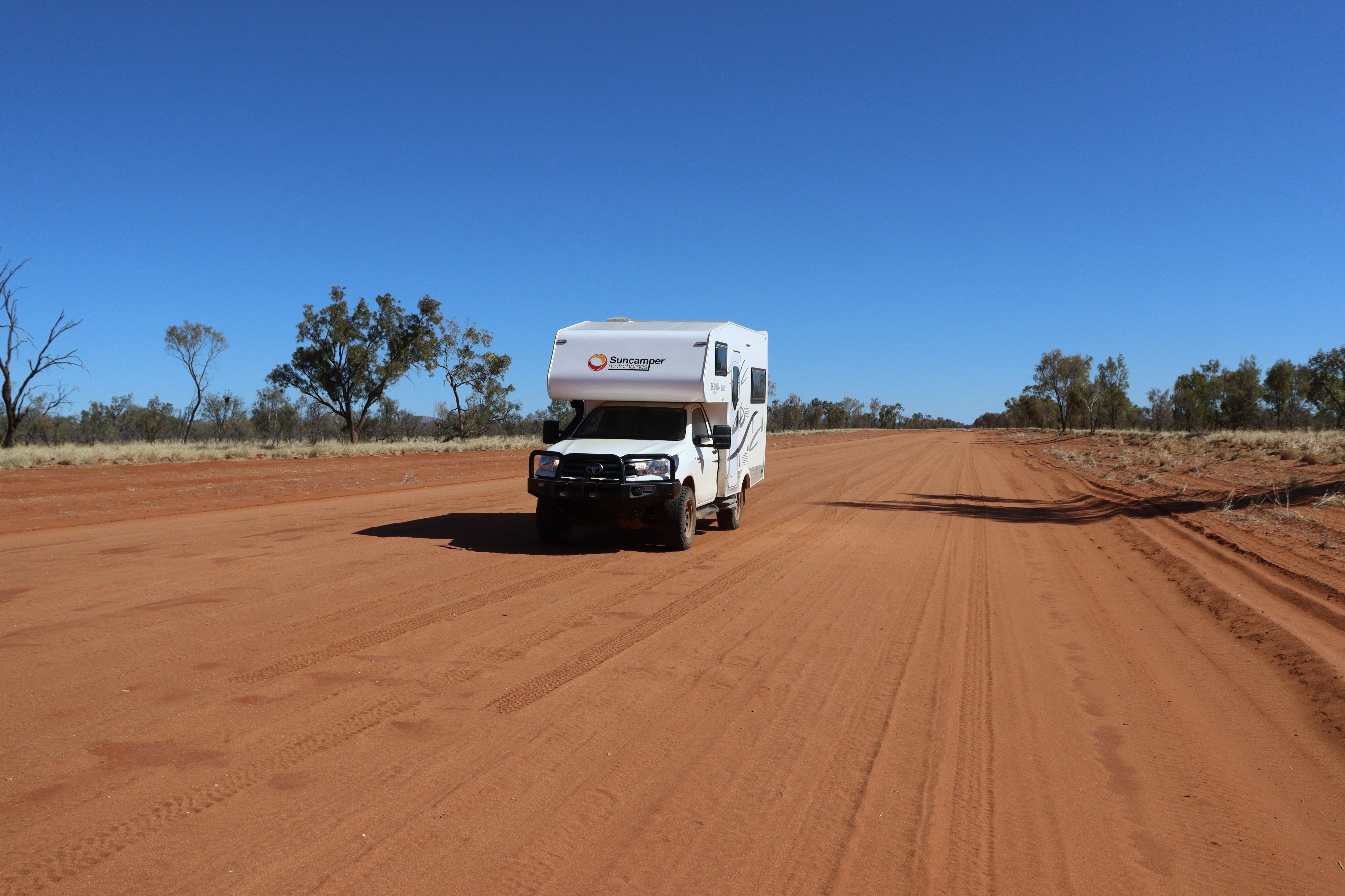
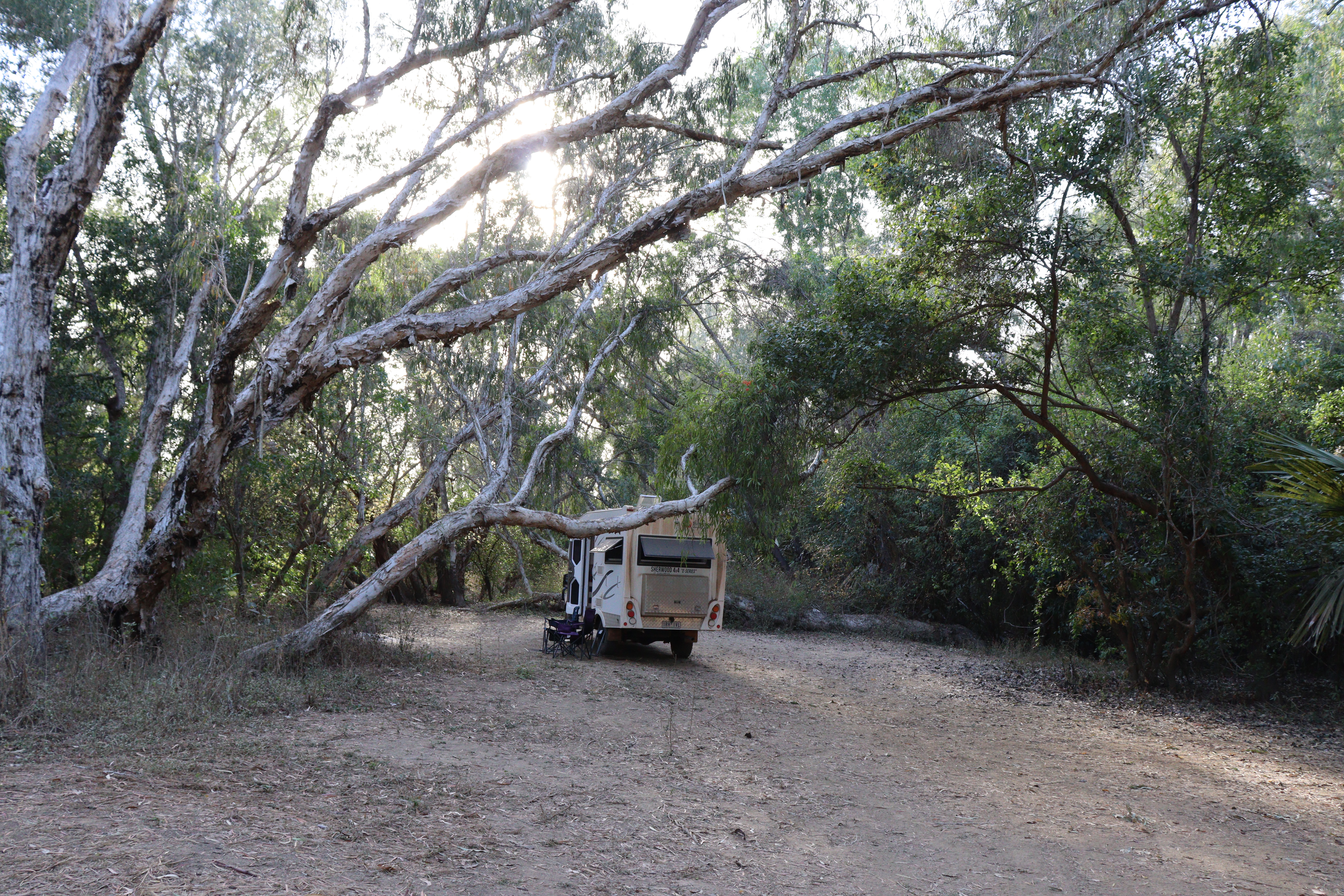
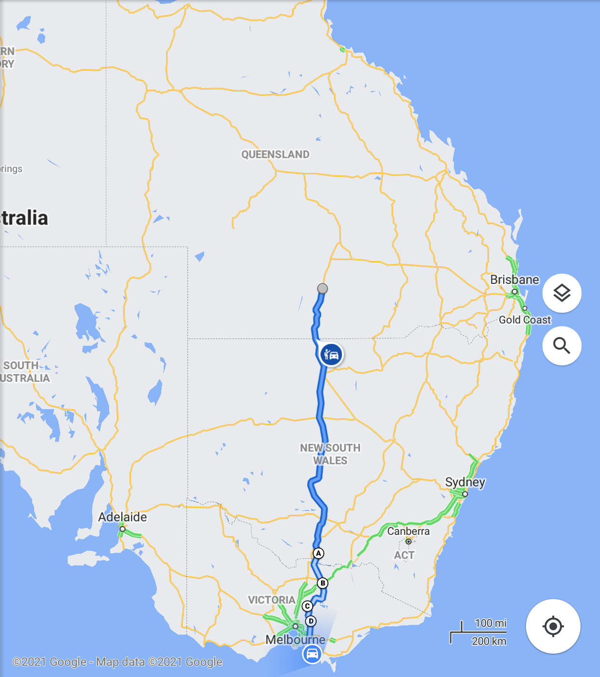
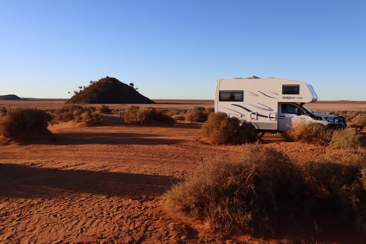
It had been over 36 years since we had travelled over there (except for a brief stop in Perth airport on our way to Broome for a Kimberley Cruise) and we had a few places on the list that we had never been to, so we packed up Roxy (the motorhome) and took off.

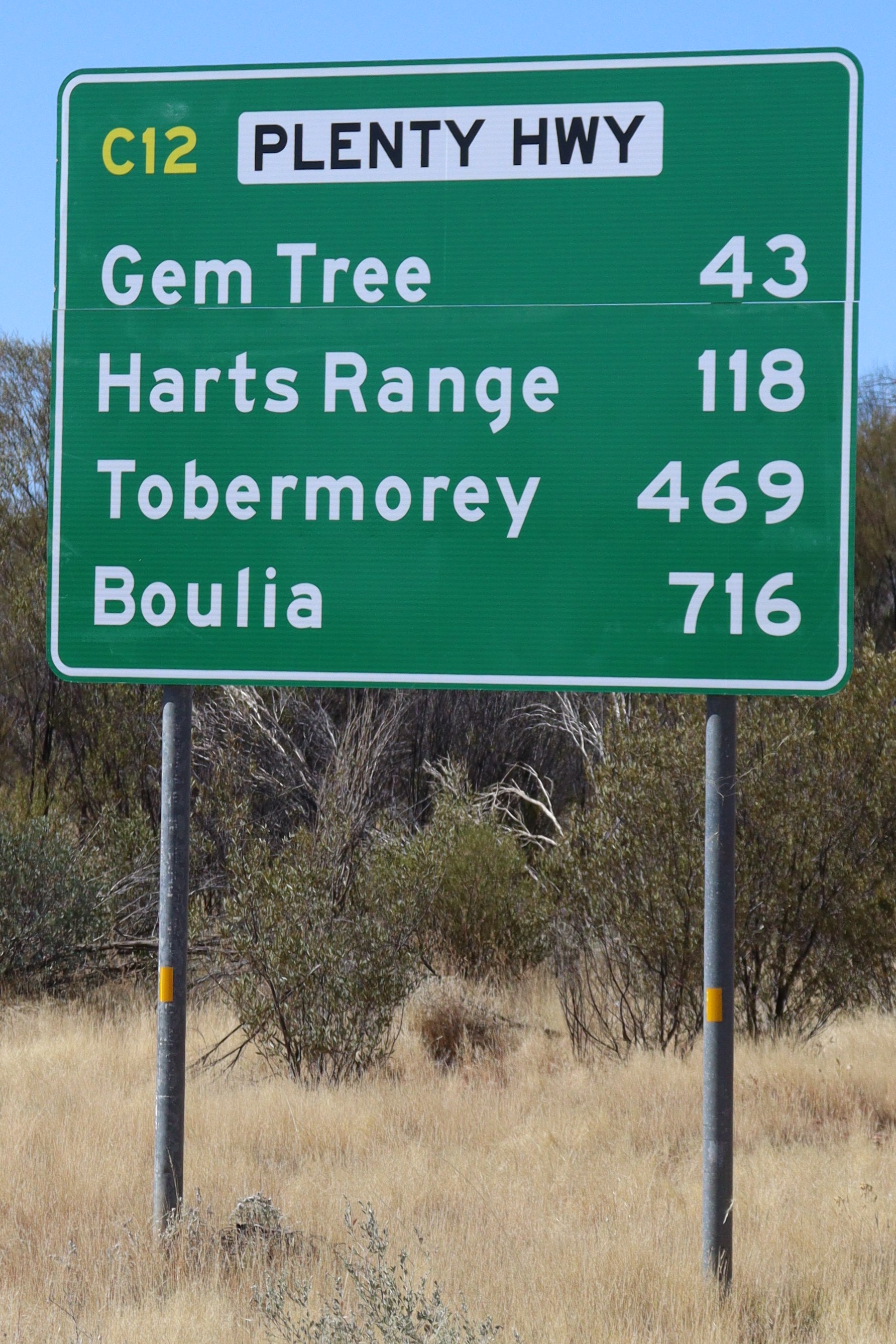
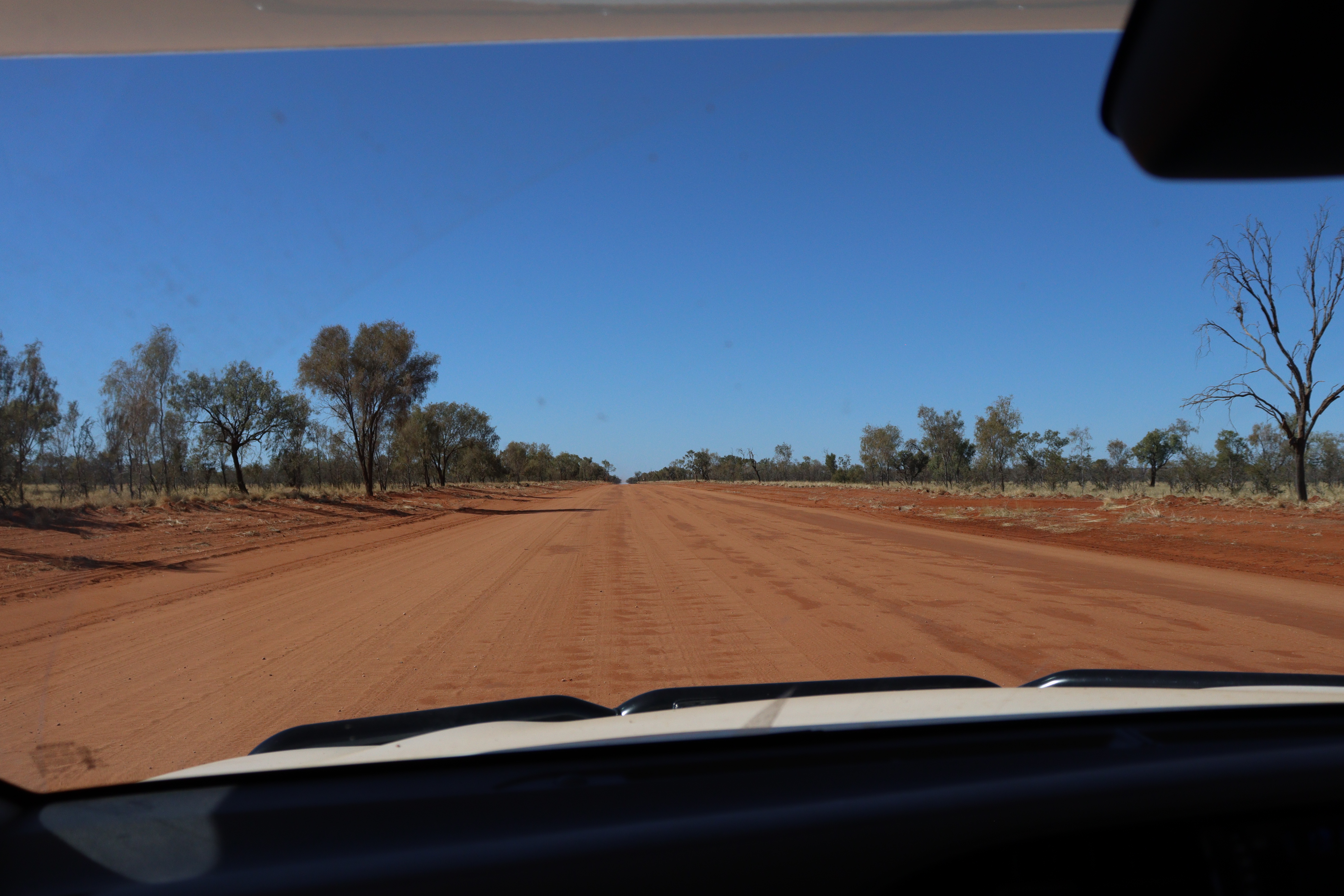
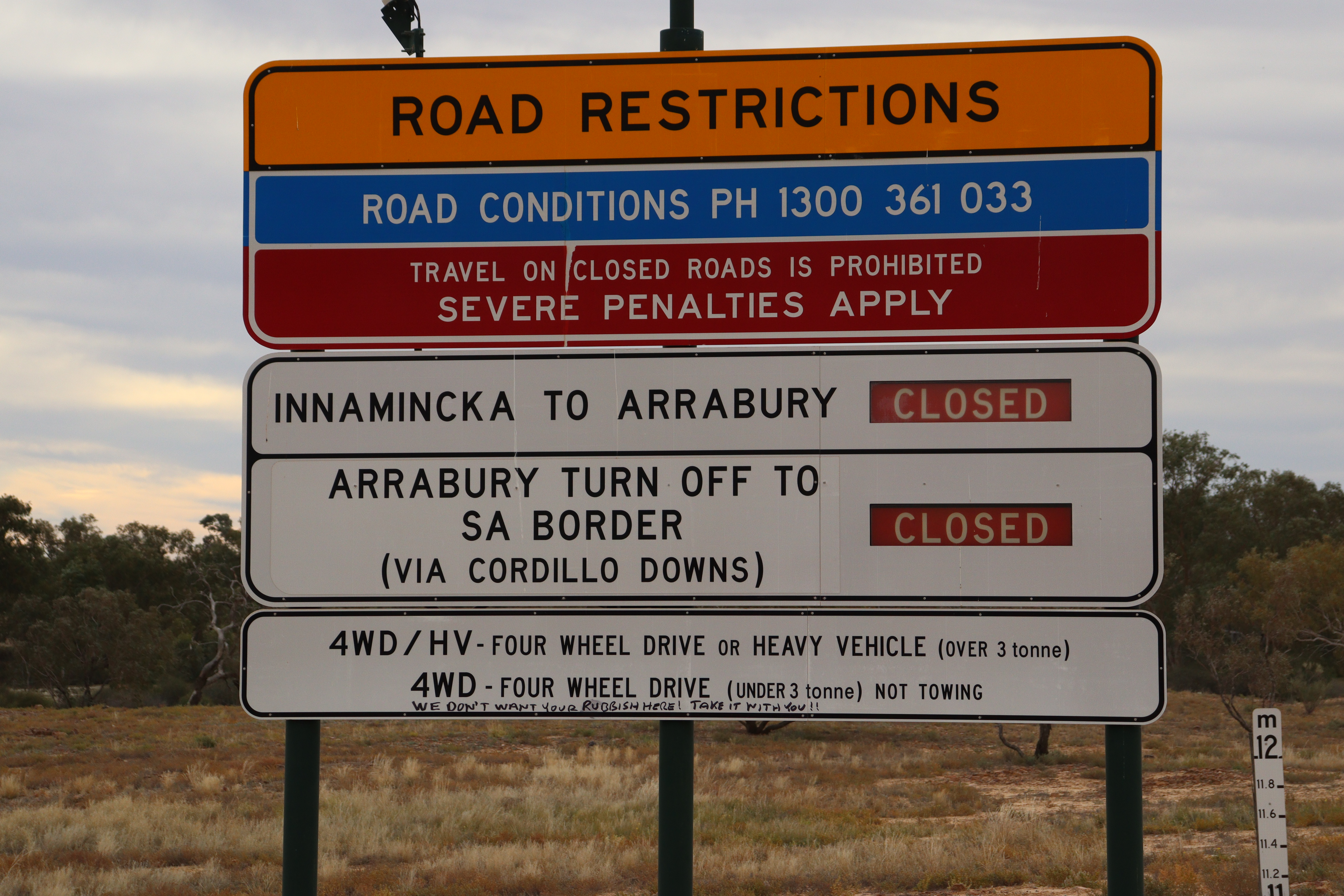
Rain once again had impacted on our initial travel plans: we had intended driving up into the Northern Territory and across to WA on the (dirt/gravel) Great Central Road, but as we began our trip, that road was closed due to  rains, as were several others. We even managed to get stranded for a few nights in a couple of places where the rains came after we travelled in and so we had to wait till roads dried a bit and opened again before we were able to get out again. No drama – all part of travelling the outback during winter.

So instead of heading north, we took the “easy” option and drove across the Nullarbor, which was great as we hadn’t done that for 36 years either.

Along the way, we stopped in at a number of places to vary the route and make it a little more interesting.

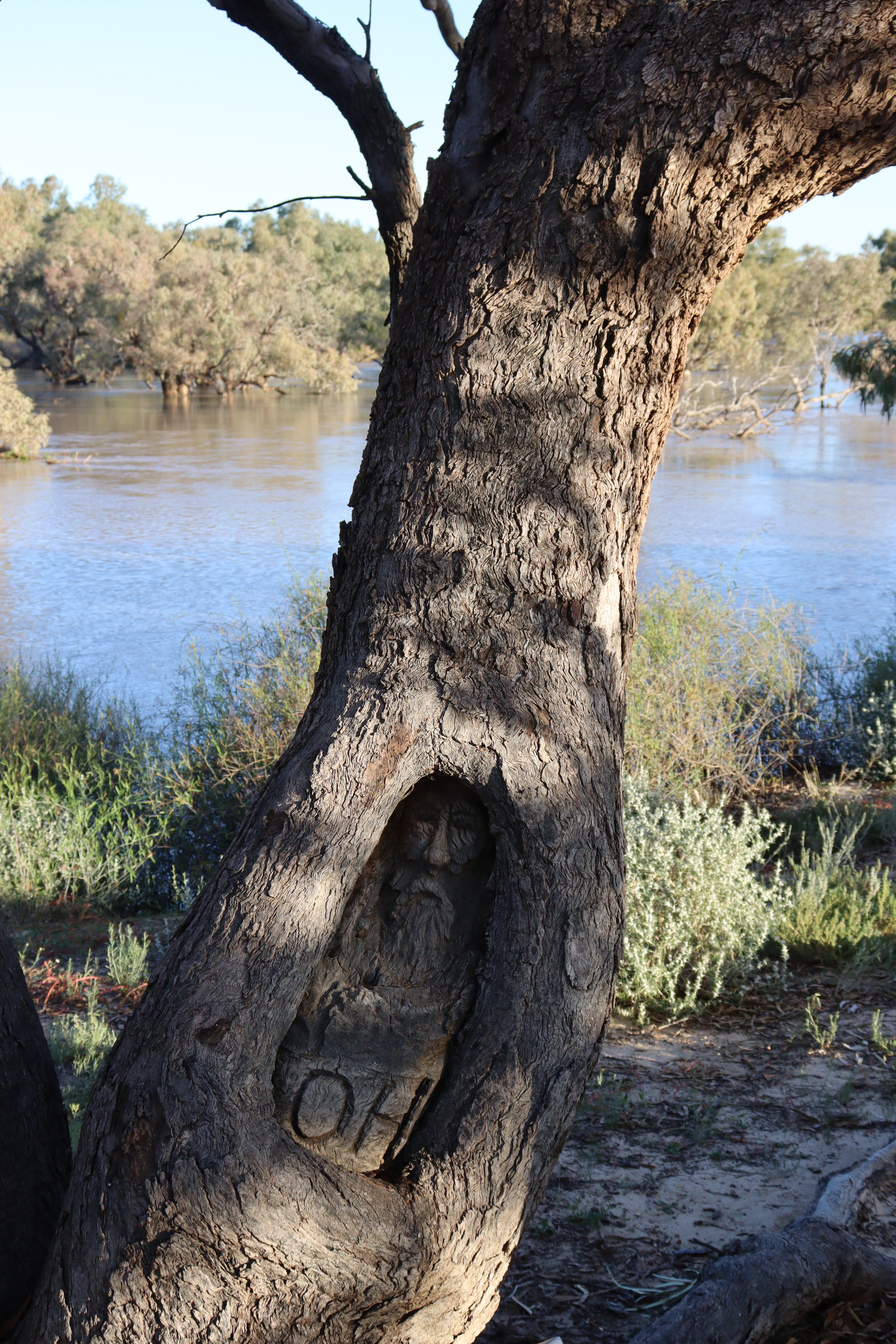
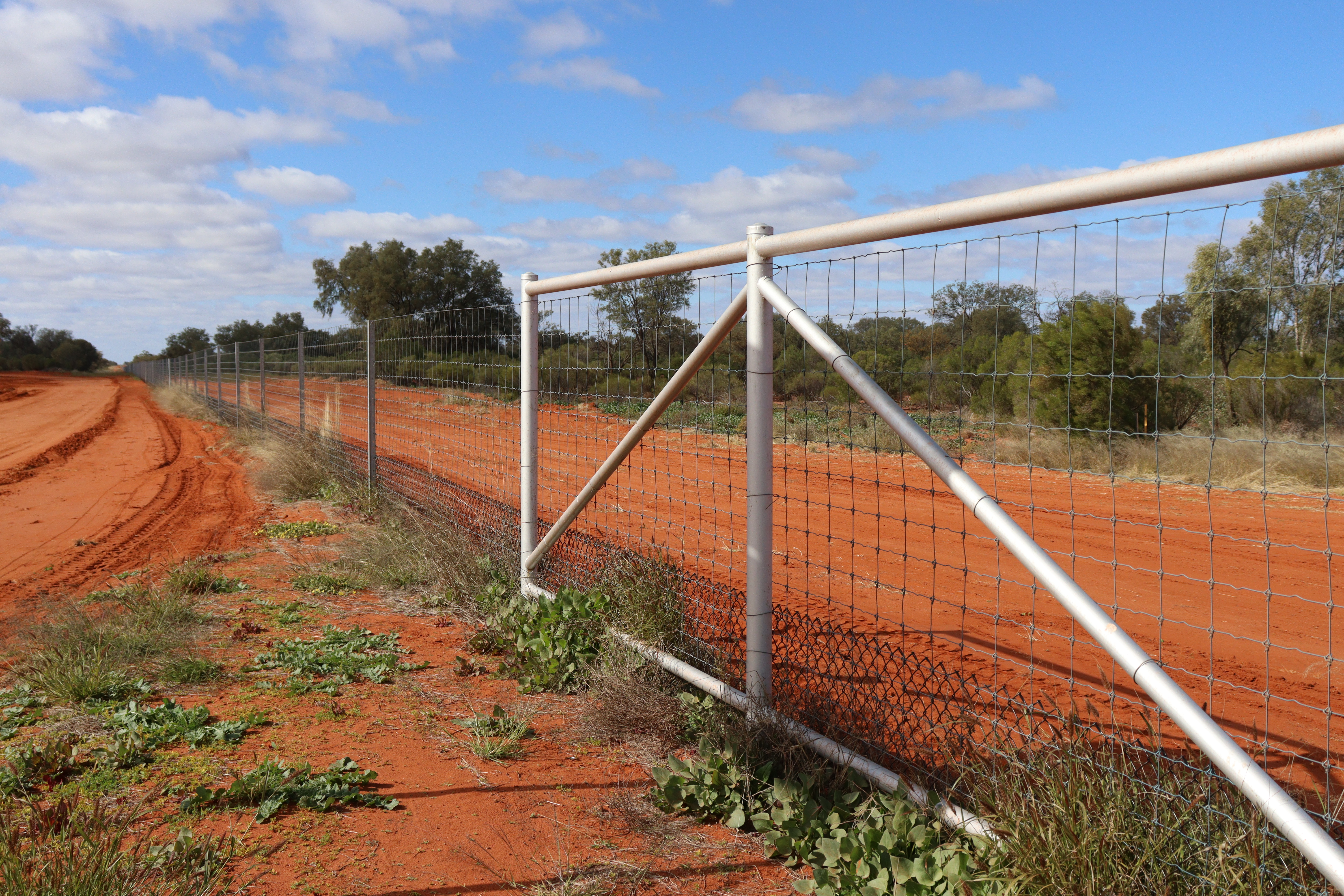
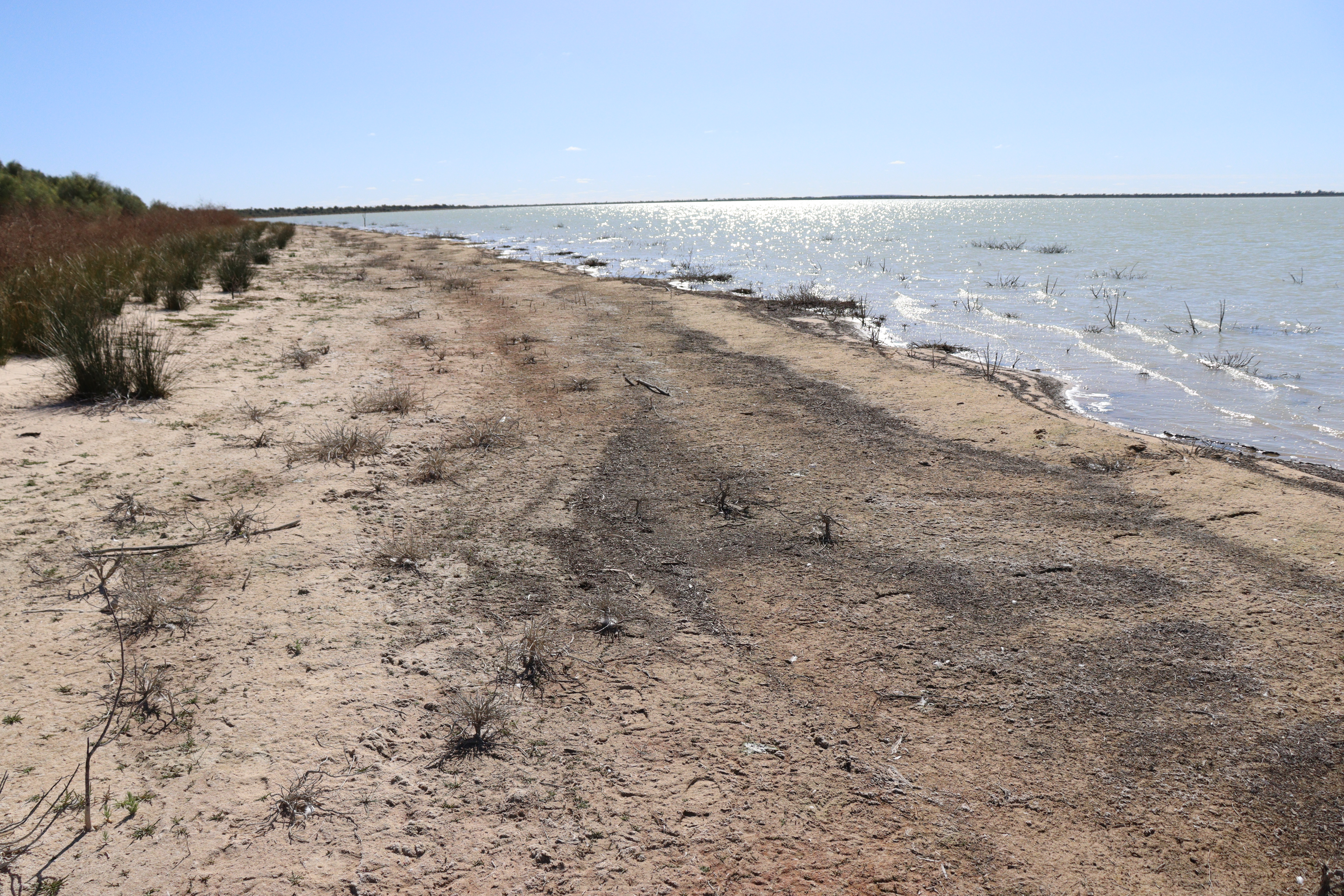
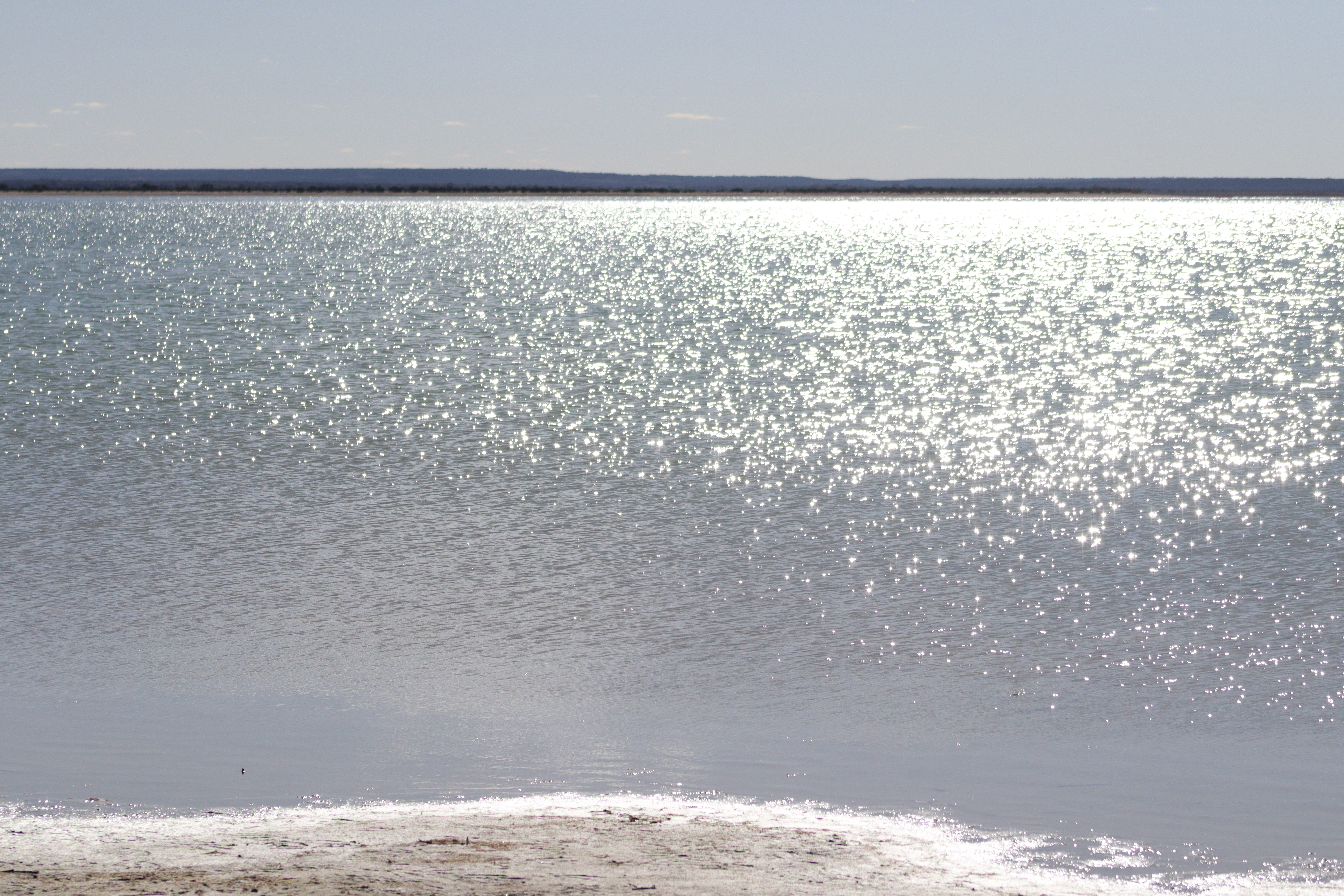
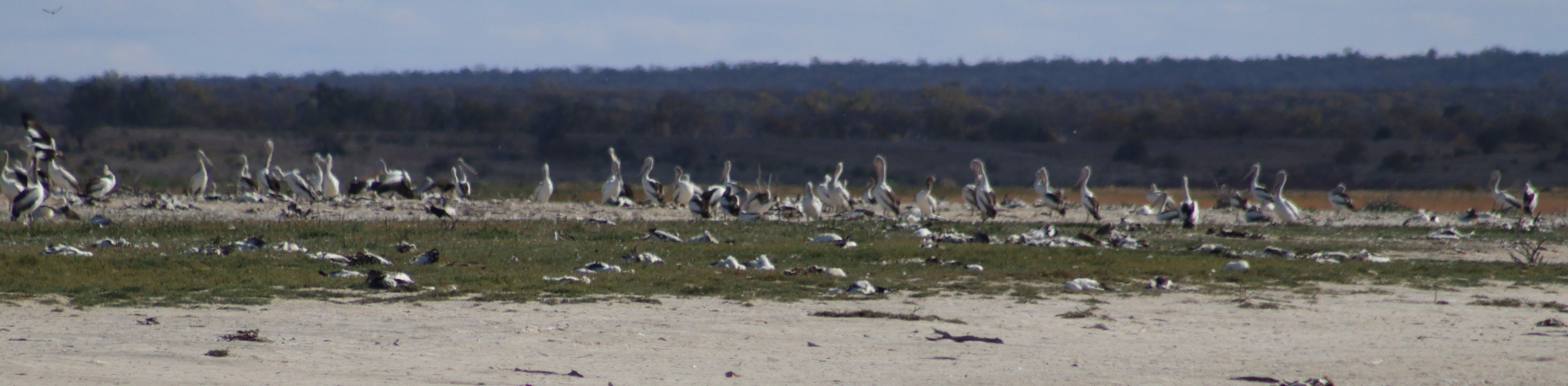
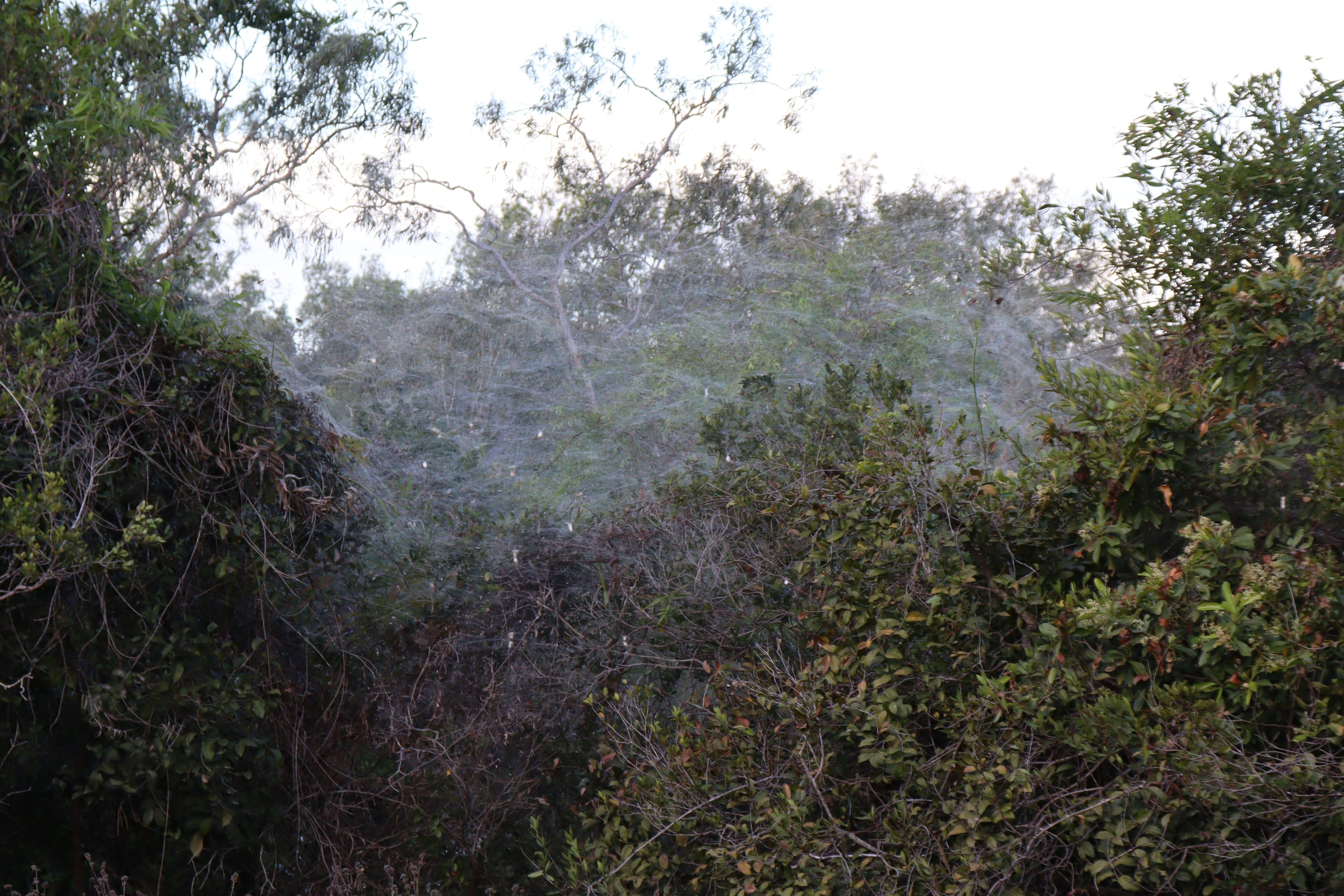
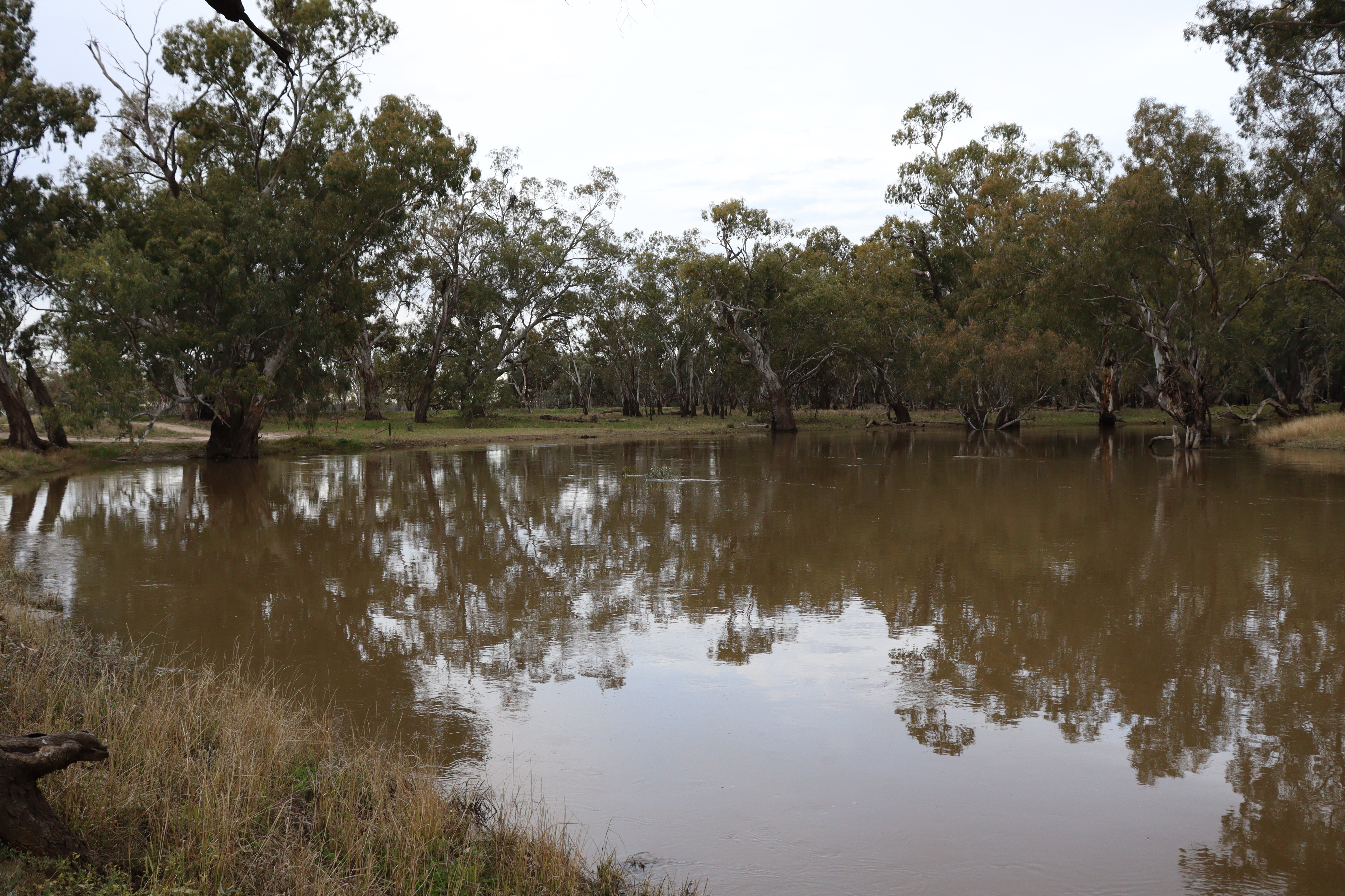
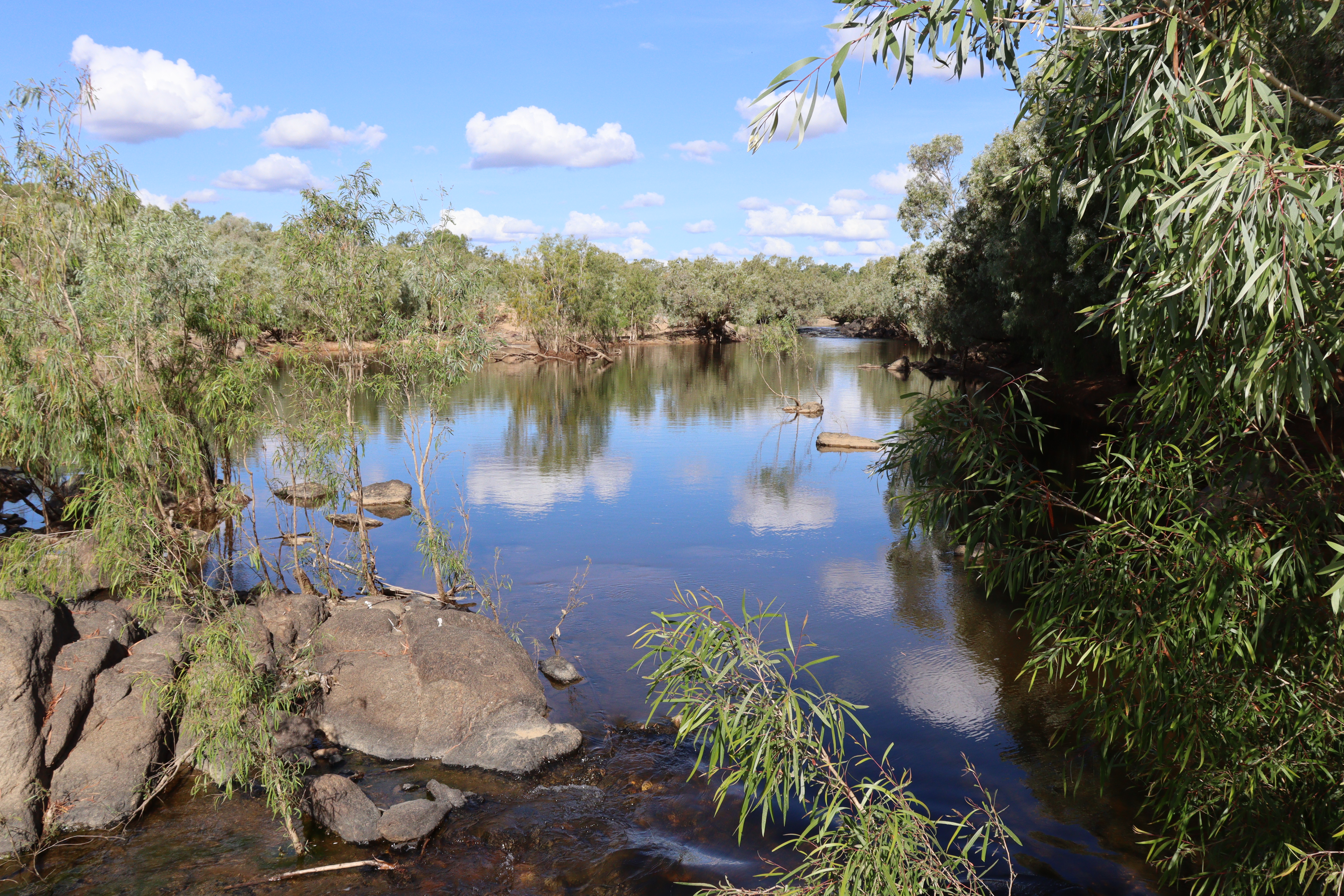
Starting with a couple of nights camping on the Murray just out of Robinvale, we headed up through Mildura to take a back road (dirt of course) across to Renmark, thus avoiding the main highways and traffic. Pulled up for the night at a free camp on the Rufus River Road at Lake Victoria, and true to form, the rain came which kept us there for the next three nights as the road was closed to all traffic. We managed to fill in those days quite easily by exploring the local area, although we couldn’t venture too far as we had to go on foot – even then we found ourselves getting taller with the sticky mud clinging to our shoes. So we checked out Lake Victoria with its resident populations of pelicans and cormorants and other water birds, and its sad history of the Rufus River Massacre of 1841. We also took a longer walk out to the Lock 7, one of the 13 Locks along the Murray River which maintain flow, water levels and navigation of the river. No boats coming through that day, so we turned around and walked the long sticky walk back to our campsite.

After three days we heard the road was open again, so rather than continuing through to Renmark, we thought it was wiser to backtrack the shorter distance to the bitumen and stay on bitumen for a while. In doing this we still had to navigate about 60km of sticky gluey road and we quickly concluded that this road should NOT have been open to traffic yet!! However, we made it back to Wentworth, with Roxy weighing a whole lot more than when we went in, due to the mud that had collected in every wheel well and on the mud guards and bumpers. We even had to stop at one point to clean off the manual step that had dropped down with the weight of the mud it had collected as we drove along.

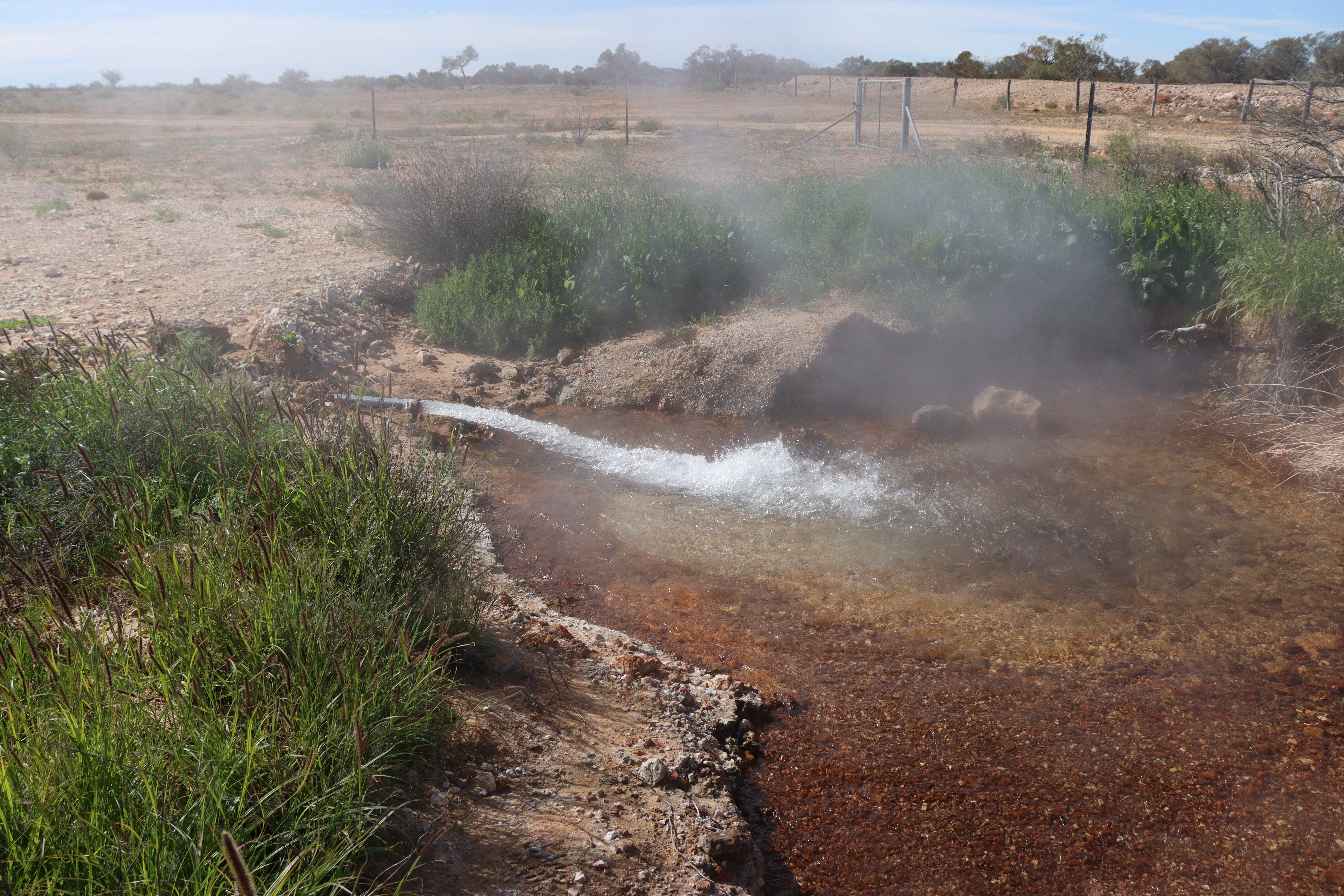
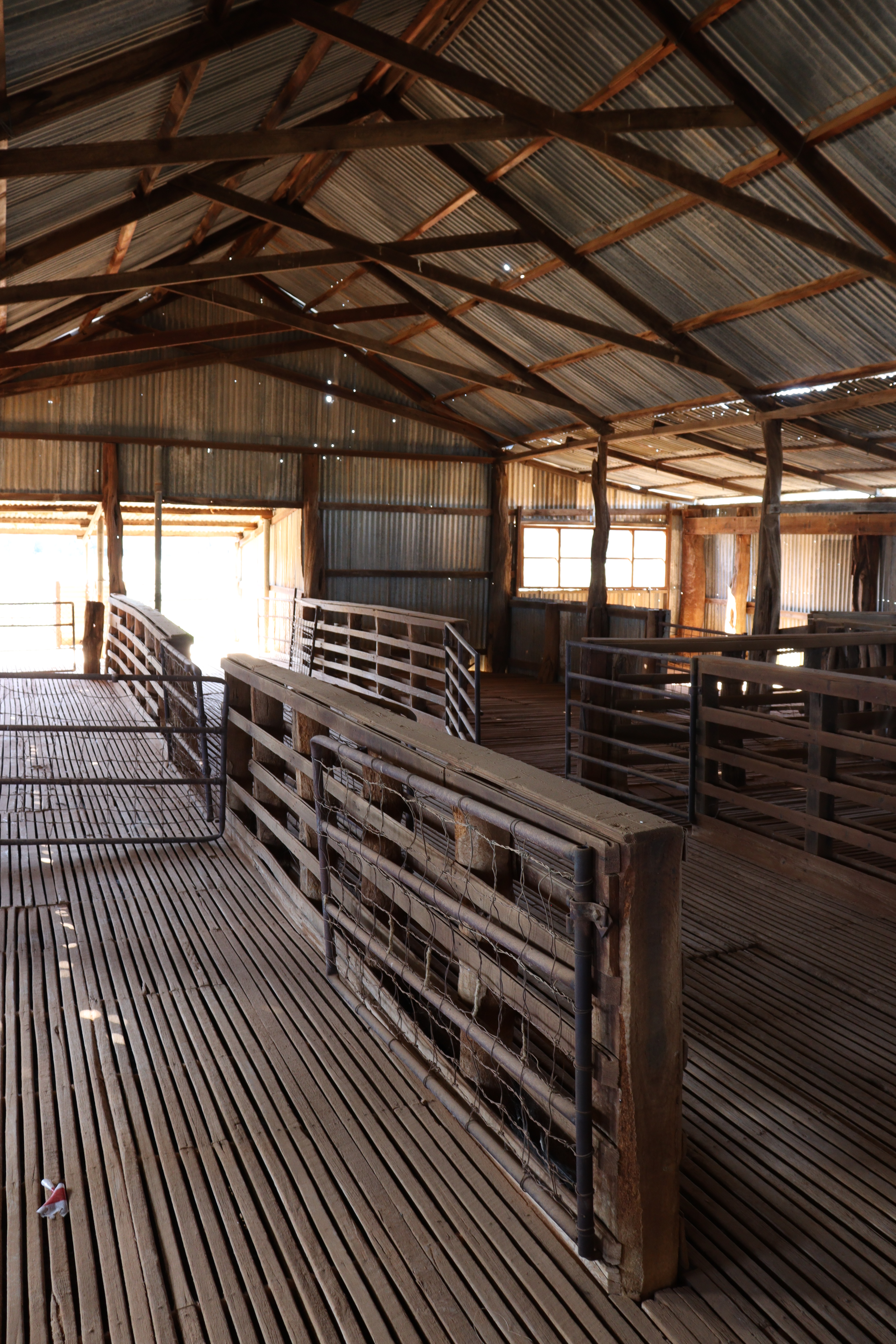
Staying on bitumen till we got through Port Augusta, we turned onto a dirt road to spend a few nights in the Gawler Ranges at Mt Ive Station, a working sheep station that offers camping, accommodation and a bar, along with its unique tourist sites including Lake Gairdner, a huge salt lake where annual Speed Week events occur and Land Speed Records are attempted.  Four-wheel drive tracks around the property take you to other sites of interest, including the Organ Pipes, a large stand of rhyolite pillars, and The Embankment, a dry-stone wall dam built in the late 1800s for water catchment. This dam wall does have a small leak and although he tried (and unlike the little Dutch boy) Gary was unable to stem the flow by plugging it with his finger!

Leaving Mt Ive, we passed through the Gawler Ranges National Park – spotting a Mallee Fowl on the roadside – and down to meet the Eyre highway at Minnipa, to continue on our way out west, with a couple of overnight roadside stops.

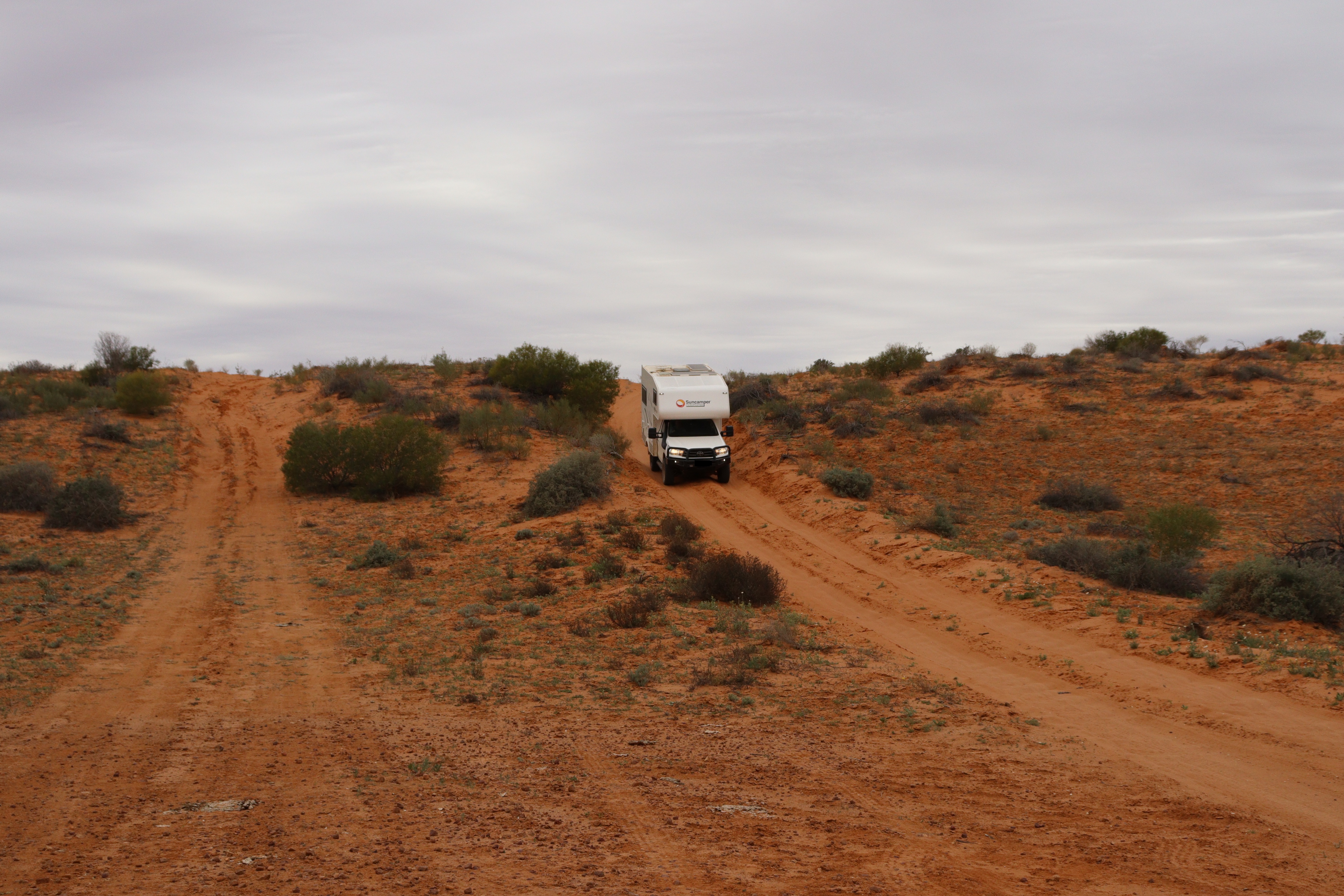
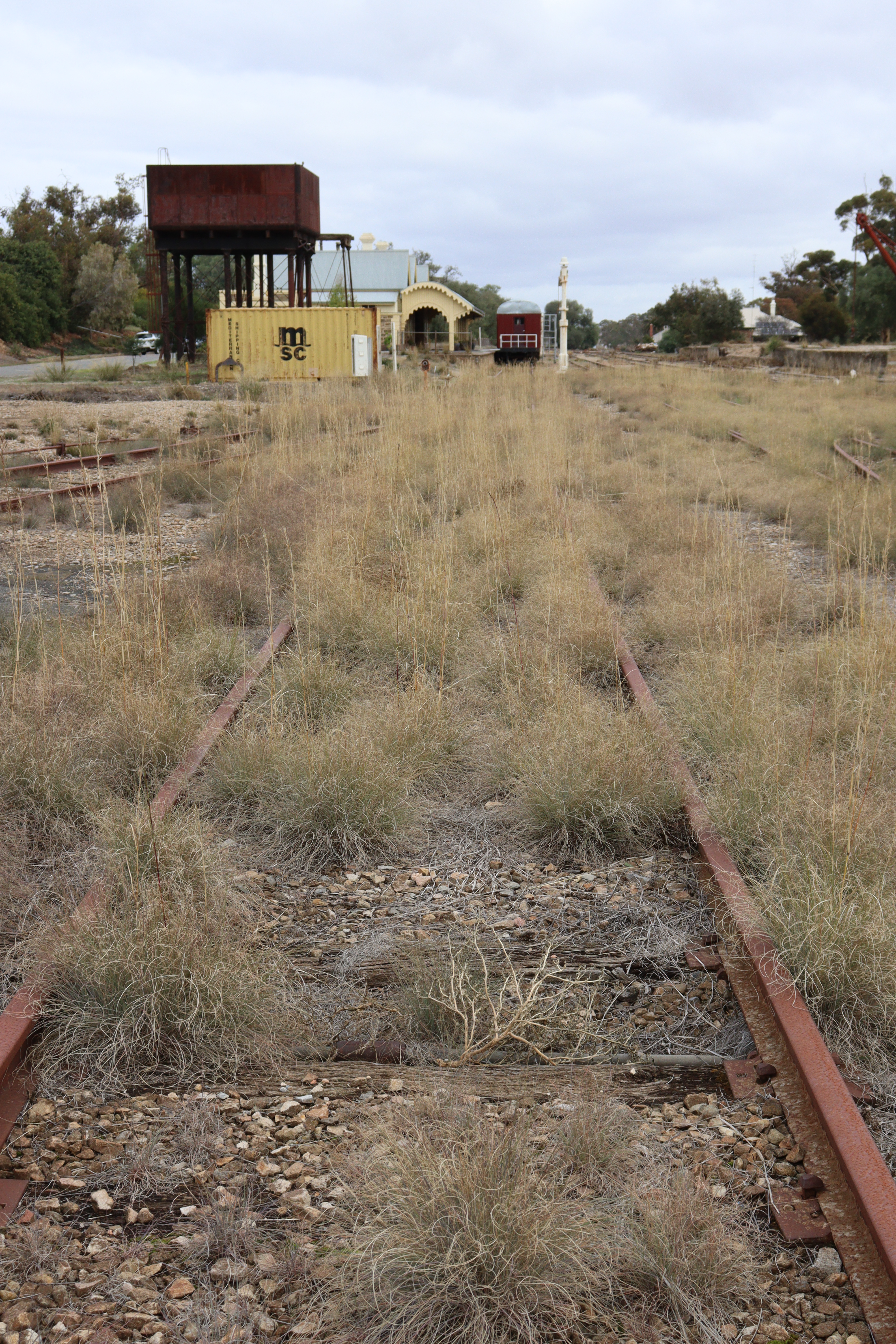
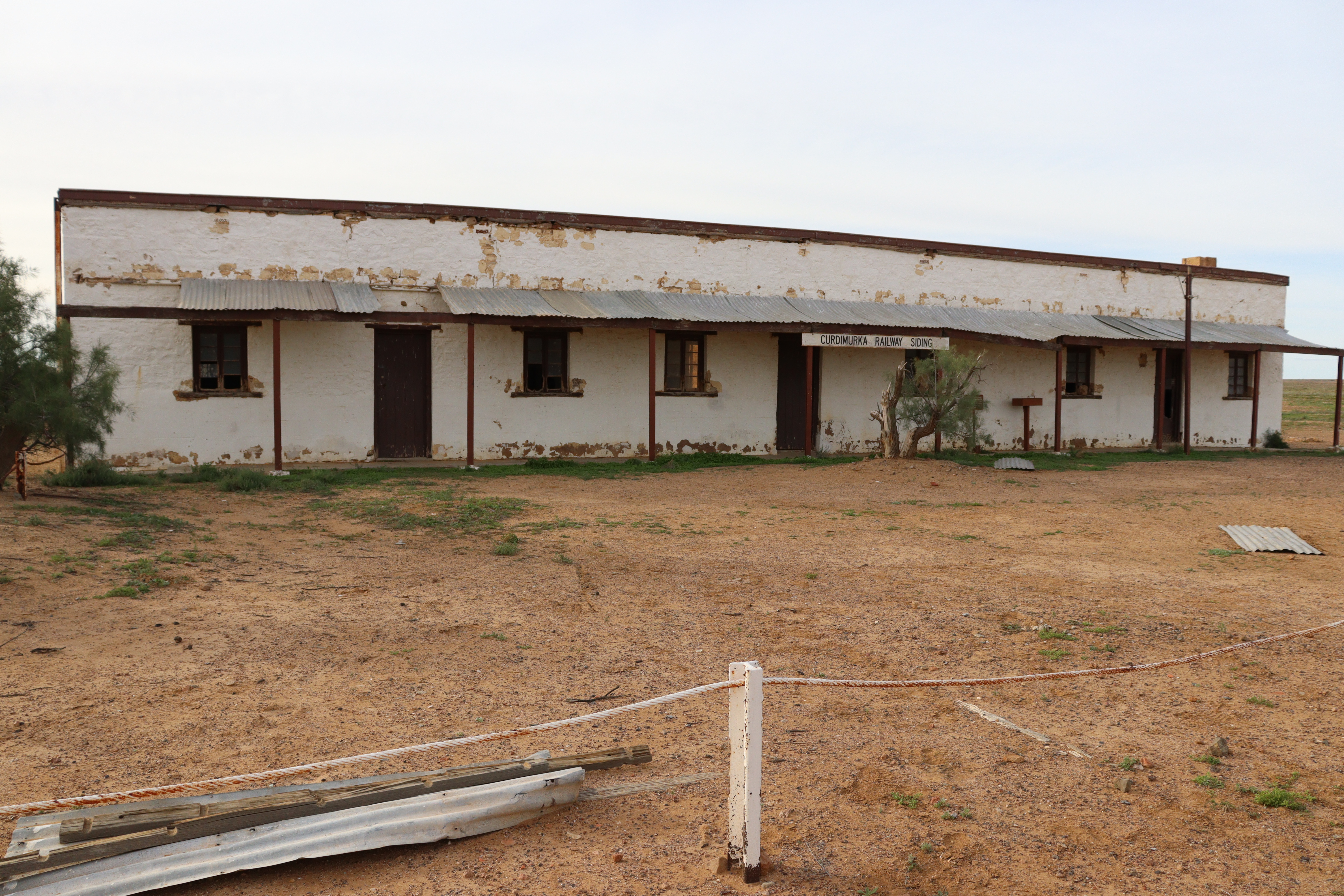
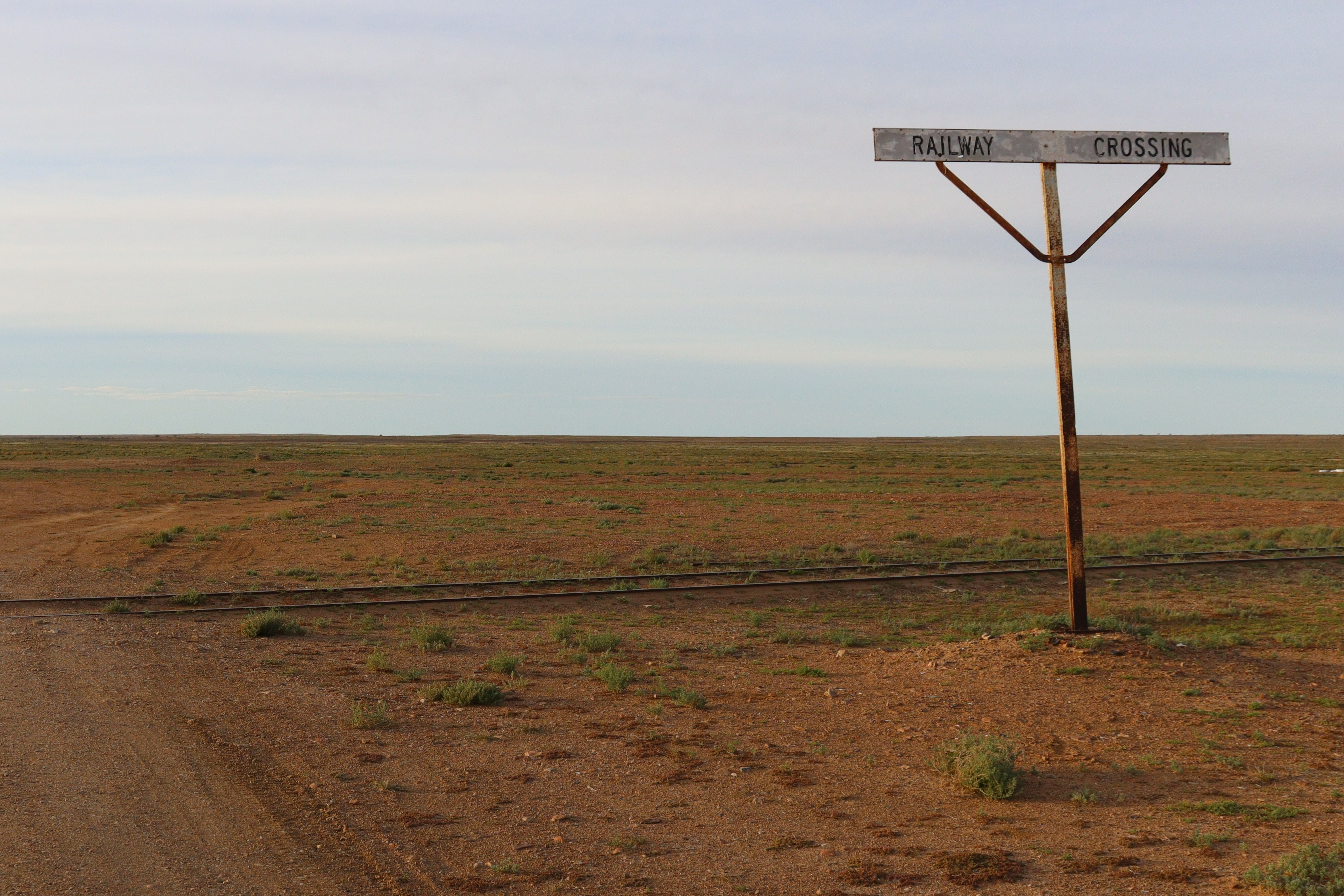
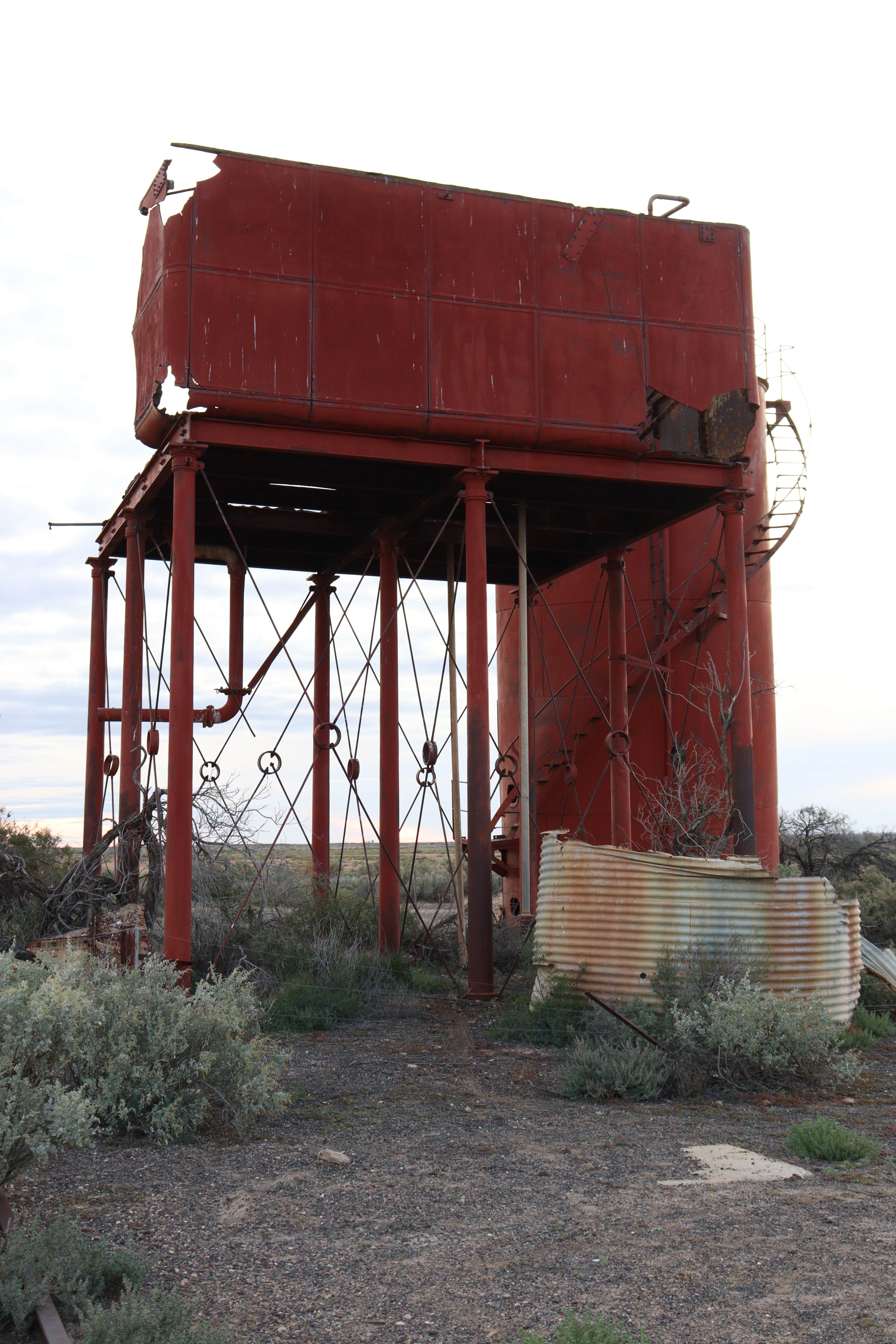
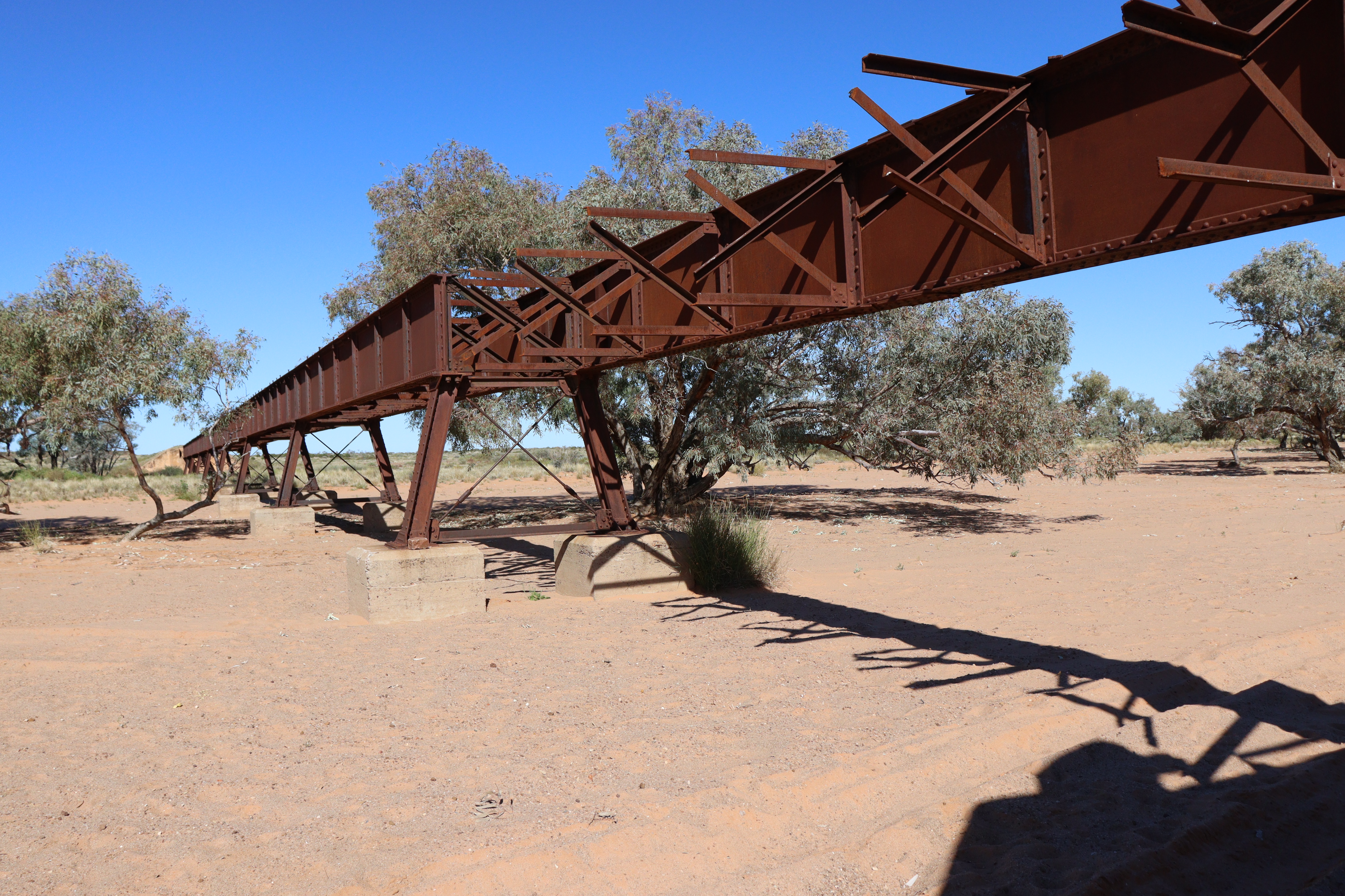
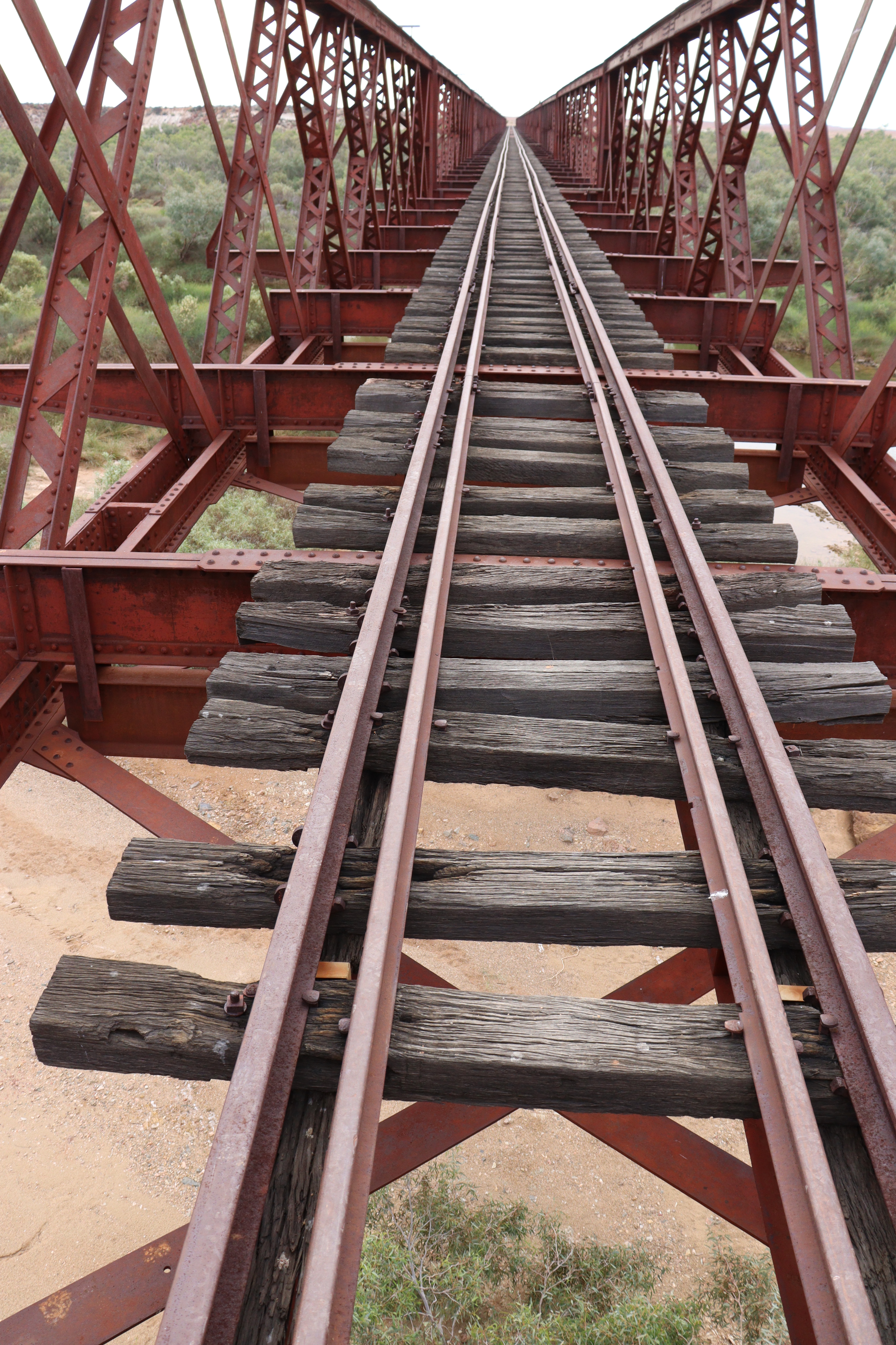
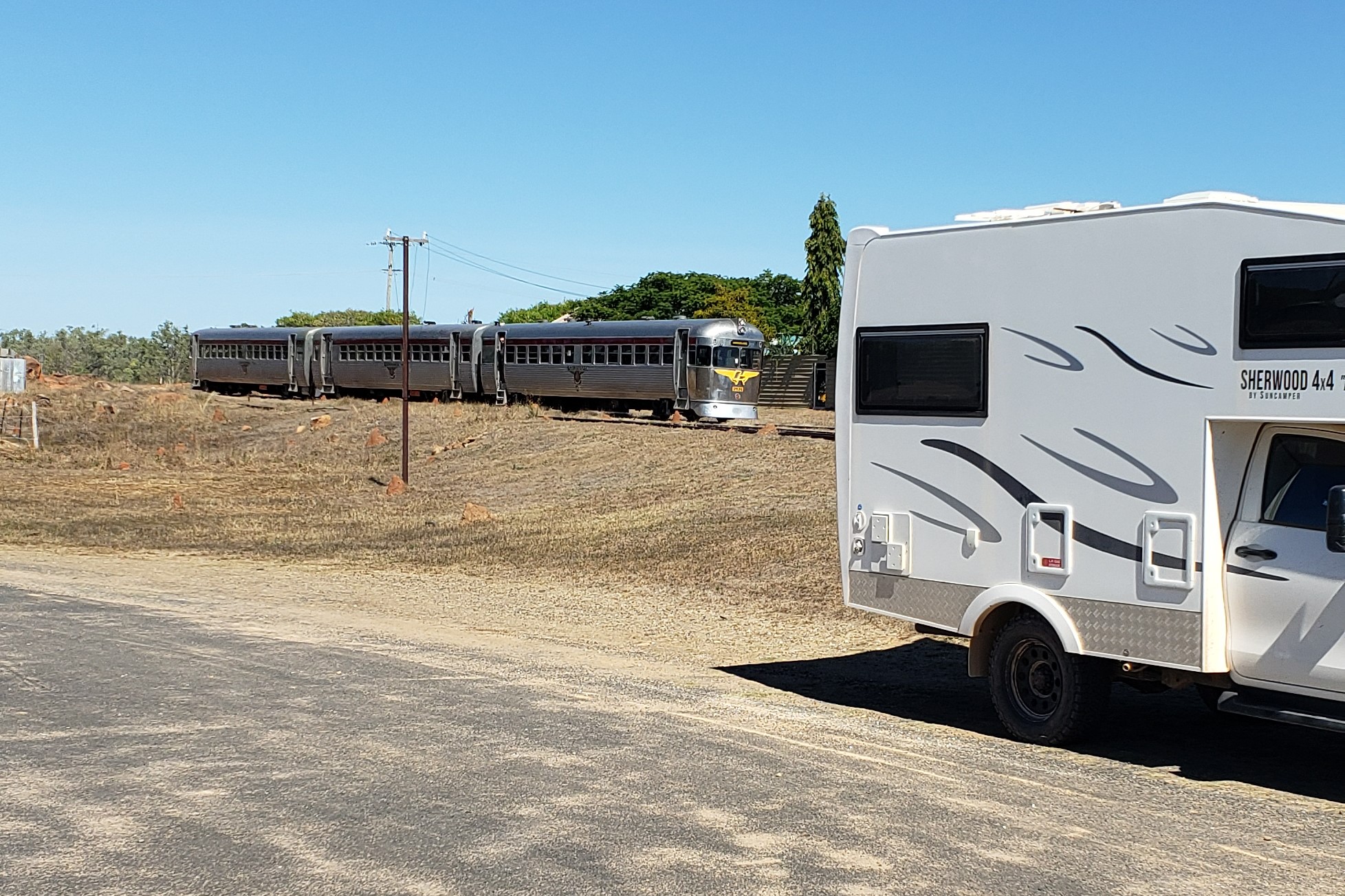
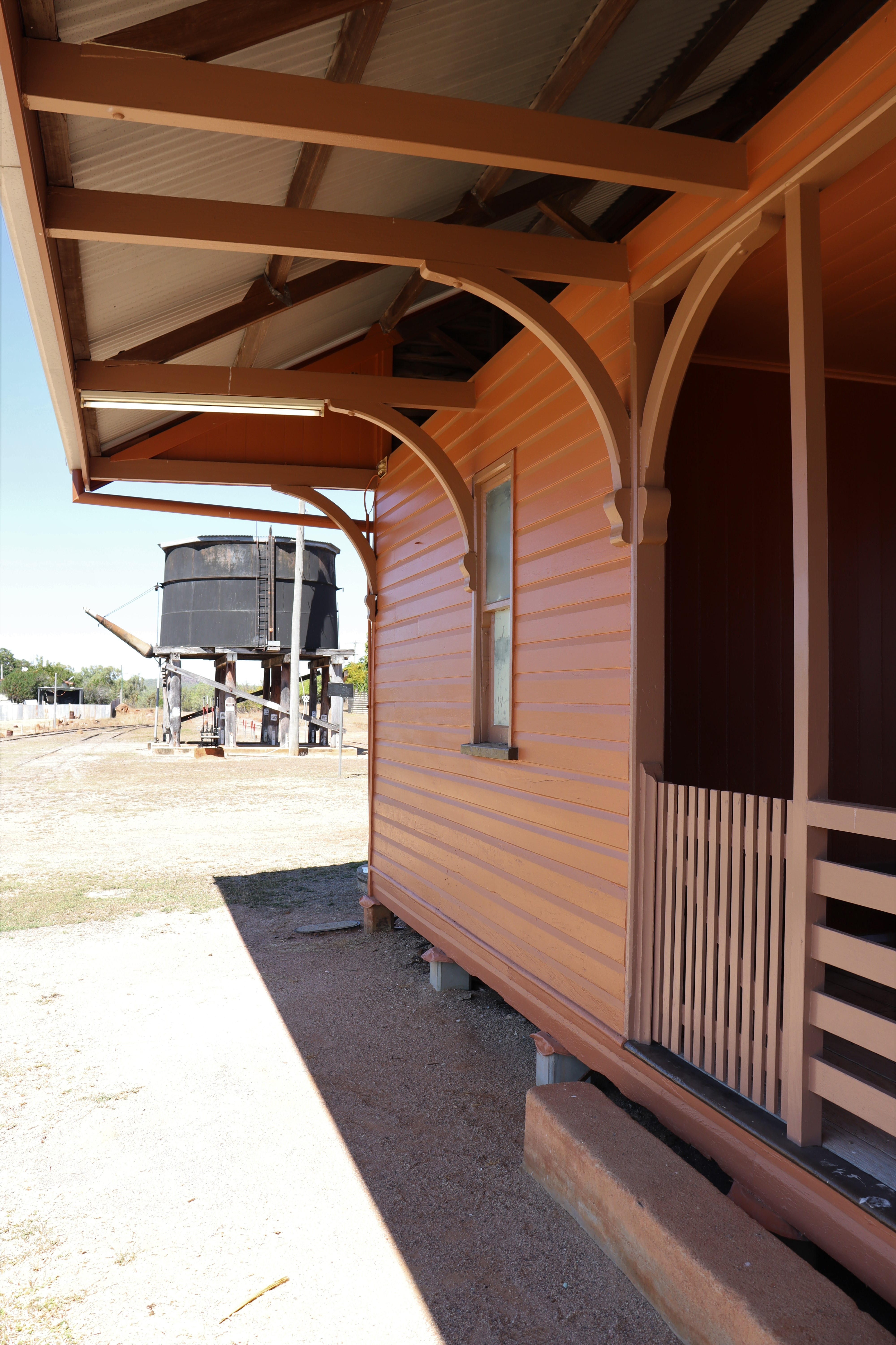
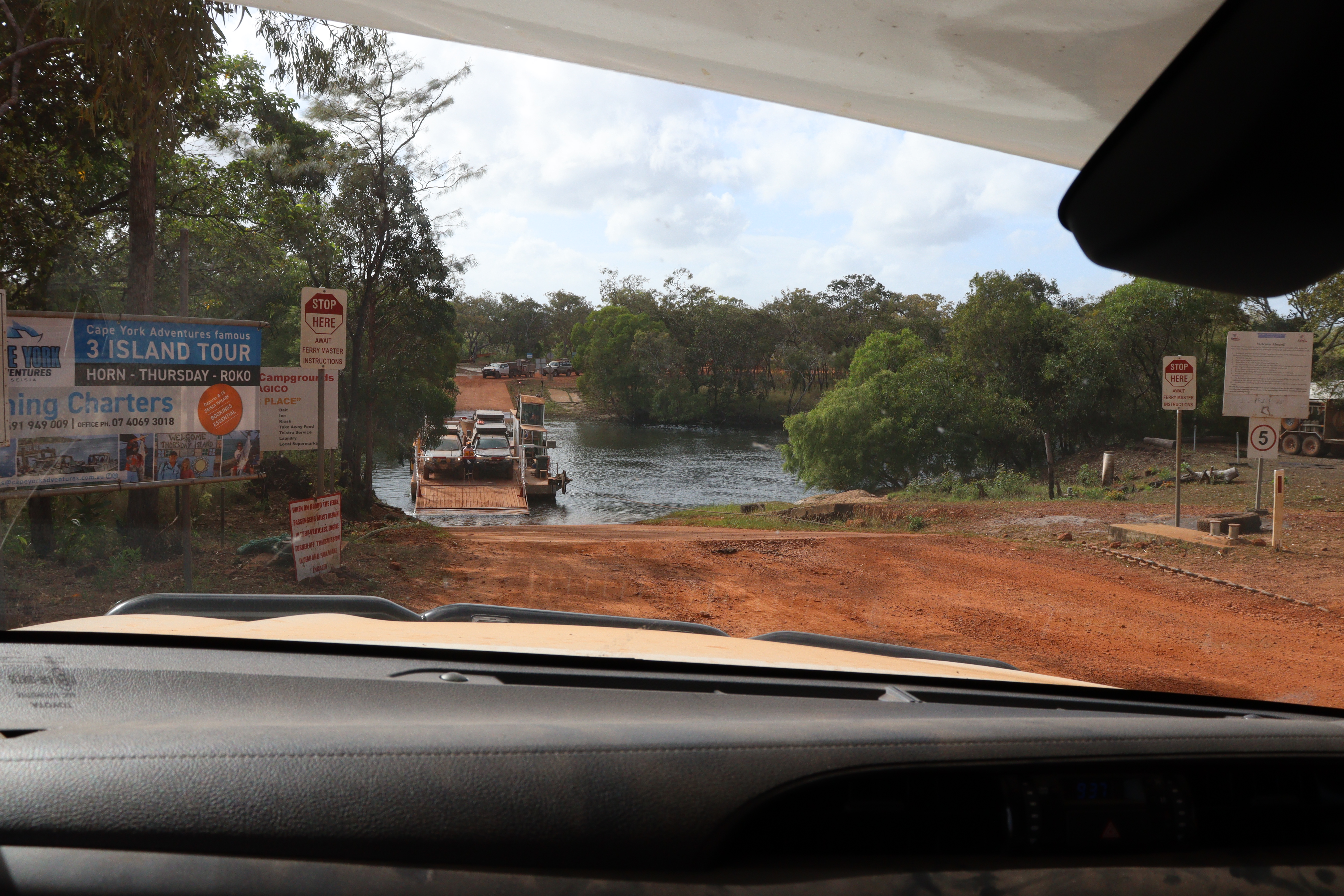
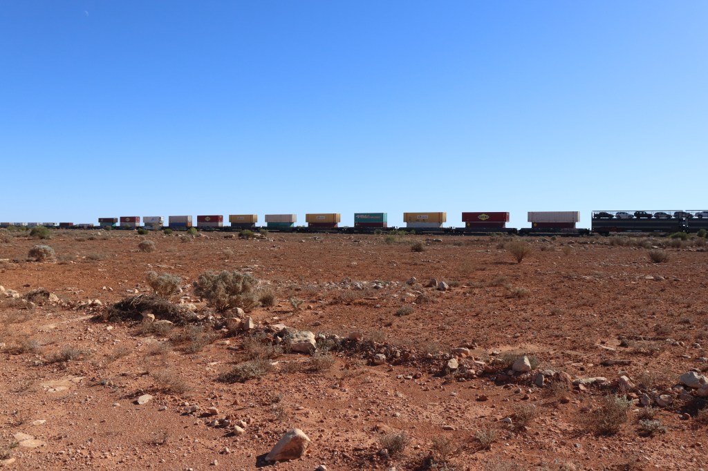
After crossing into WA and driving about 300 km, we detoured off the main highway and crossed the plains northwards on a pretty rough “road” (120 kilometres took us 6 hours!!), through 11 farm gates of varying styles, till we hit the Trans Australian Railway line at Haig, one of the original “towns” along the Line.  From there, we followed the railway line on the Trans Access Road, a very well-maintained dirt road, the rest of the way into Kalgoorlie and the Goldfields.  Stopping in at Rawlinna (population 30) another of the towns along the line, we had lunch and a cuppa on the huge tables at the station, where passengers on the Indian Pacific train trip across the country are treated to an “Outback Experience” of dinner under the stars.

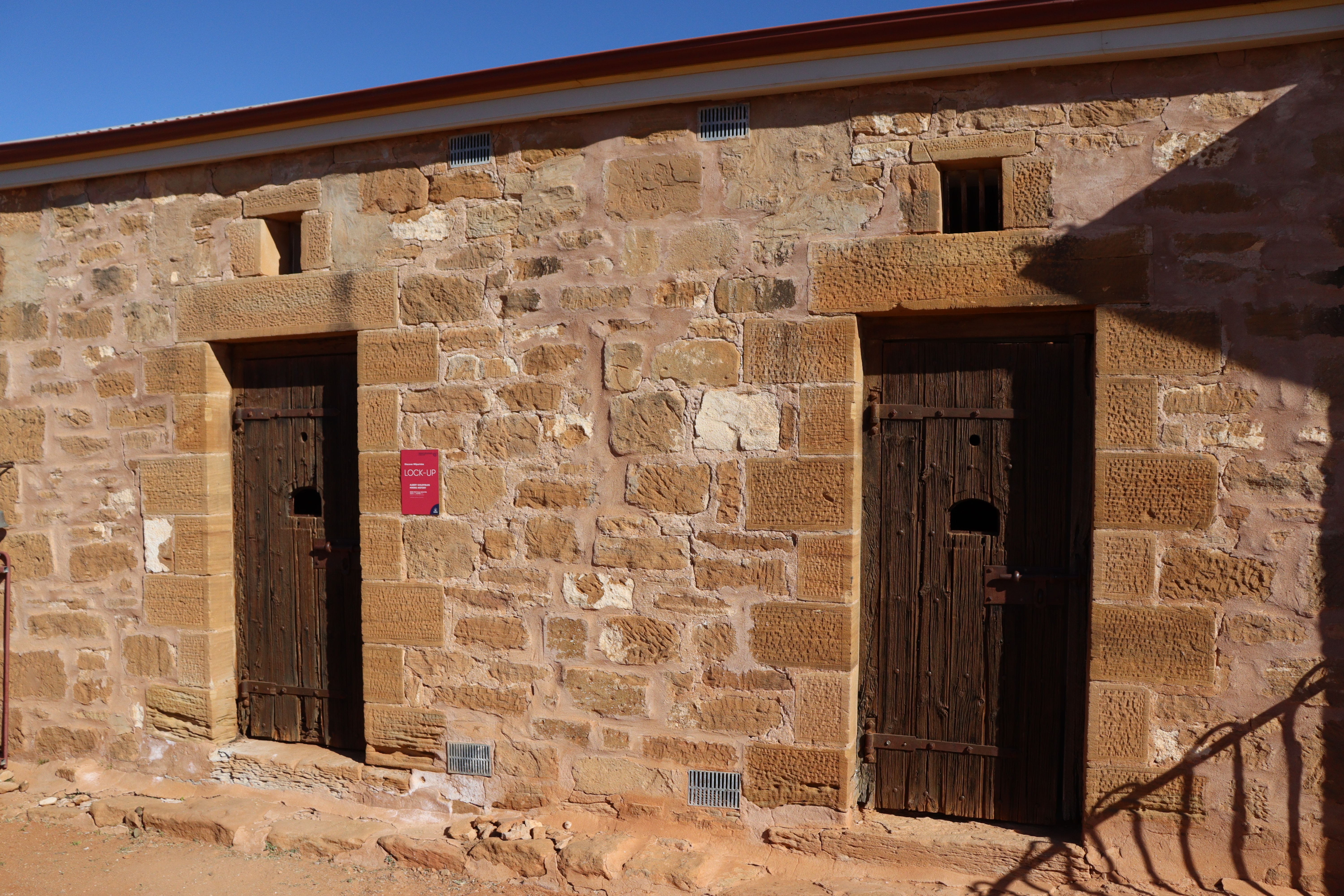
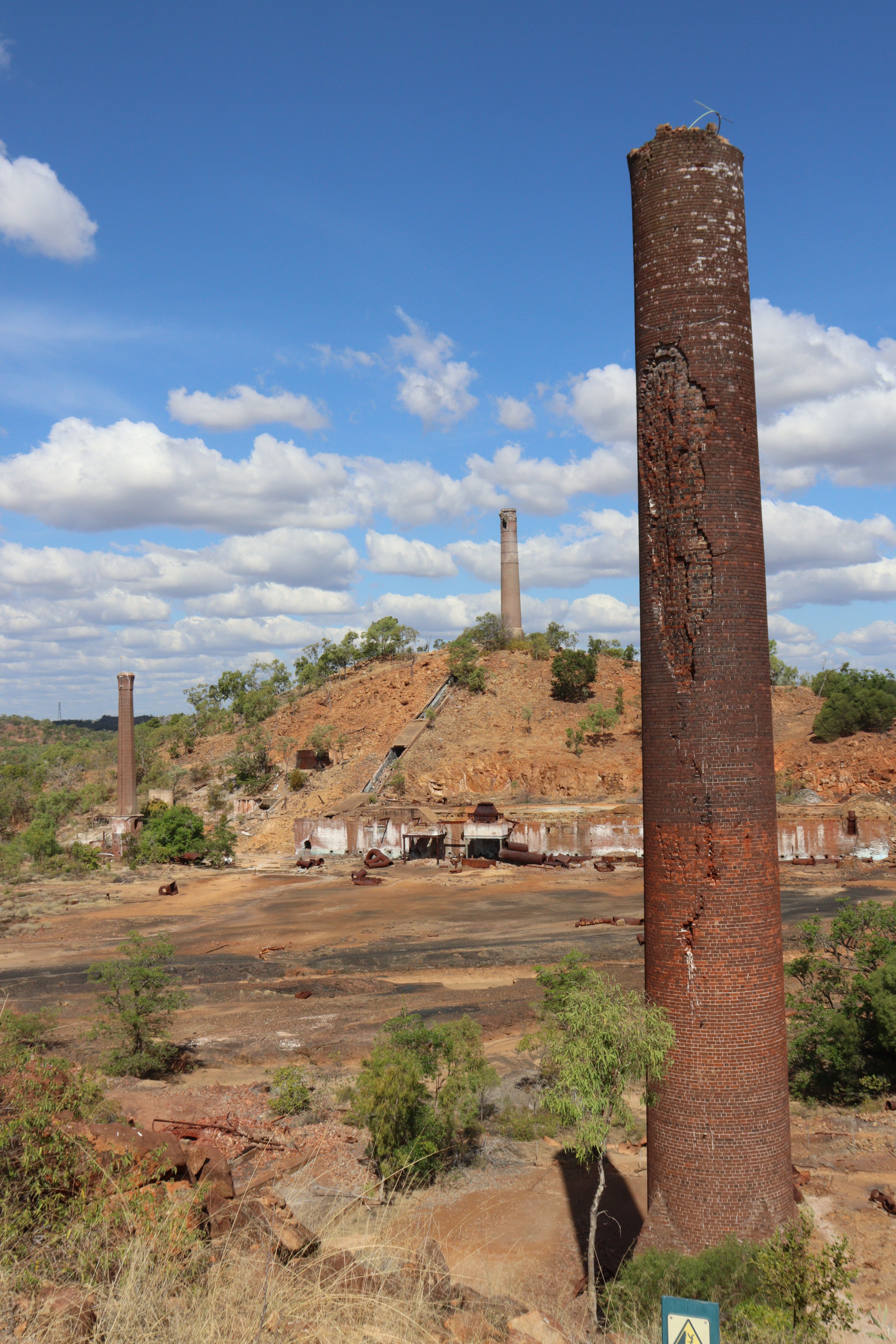
Kalgoorlie has a great FREE (in our price range) Museum of the Goldfields, and lots of grand buildings dating back to the height of the gold rushes there. The town is dominated by the “Superpit”, the huge hole in the earth formed by dredging for gold. If you do nothing else in Kalgoorlie, it is well and truly worth going up to the Lookout which overlooks this massive operation, where, since gold was first discovered in 1893, over 60 million ounces of gold has been produced, making it one of the richest gold producers in the world.

The Super Pit gold mine, Kalgoorlie

North of Kalgoorlie, we called in at the Two Up Shed, one of only two venues in Australia where Two-up, the gambling game popularized by WW1 Australian soldiers, is legally played any time, happening here most weekends and public holidays. Elsewhere playing the game is illegal except on Anzac Day.

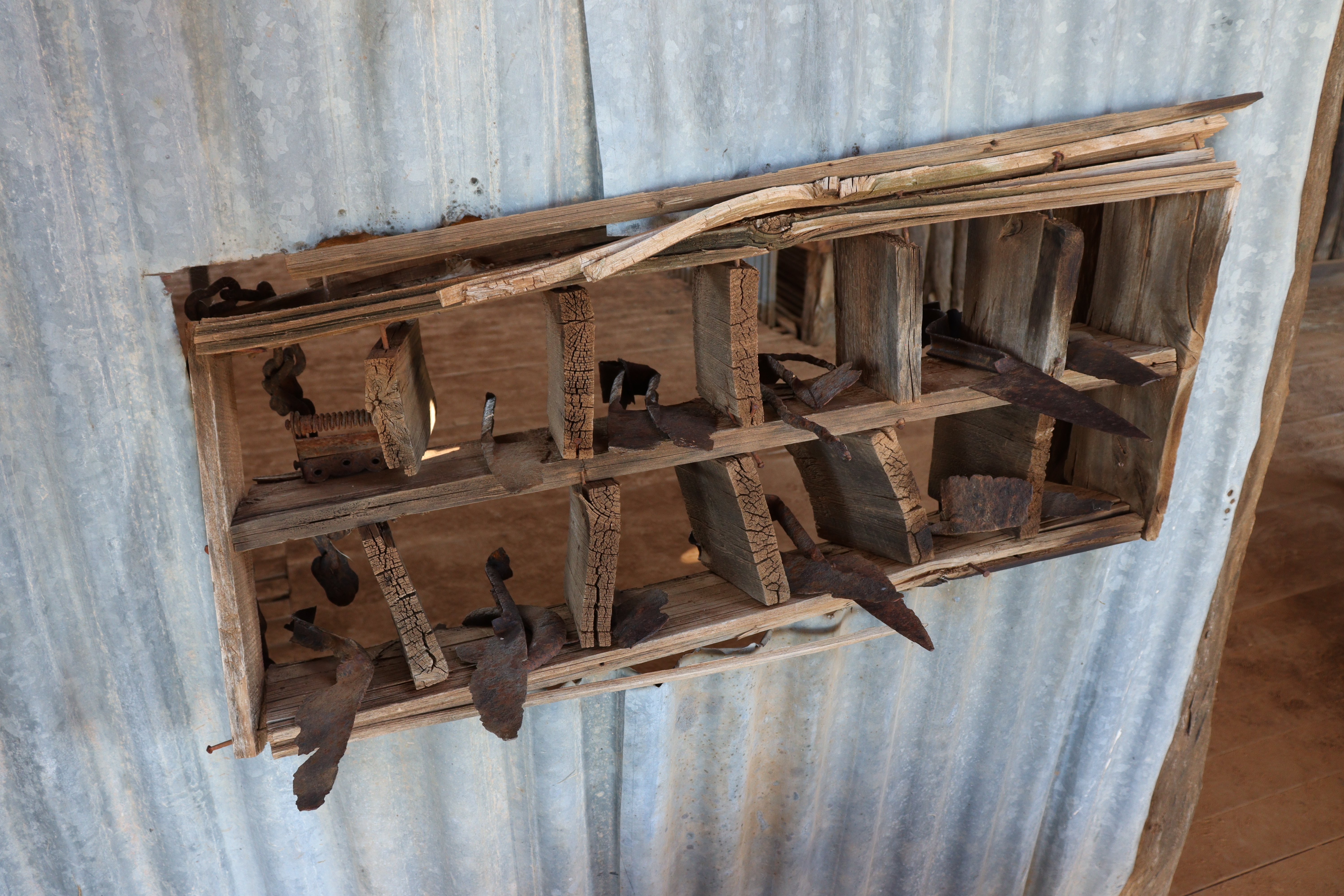
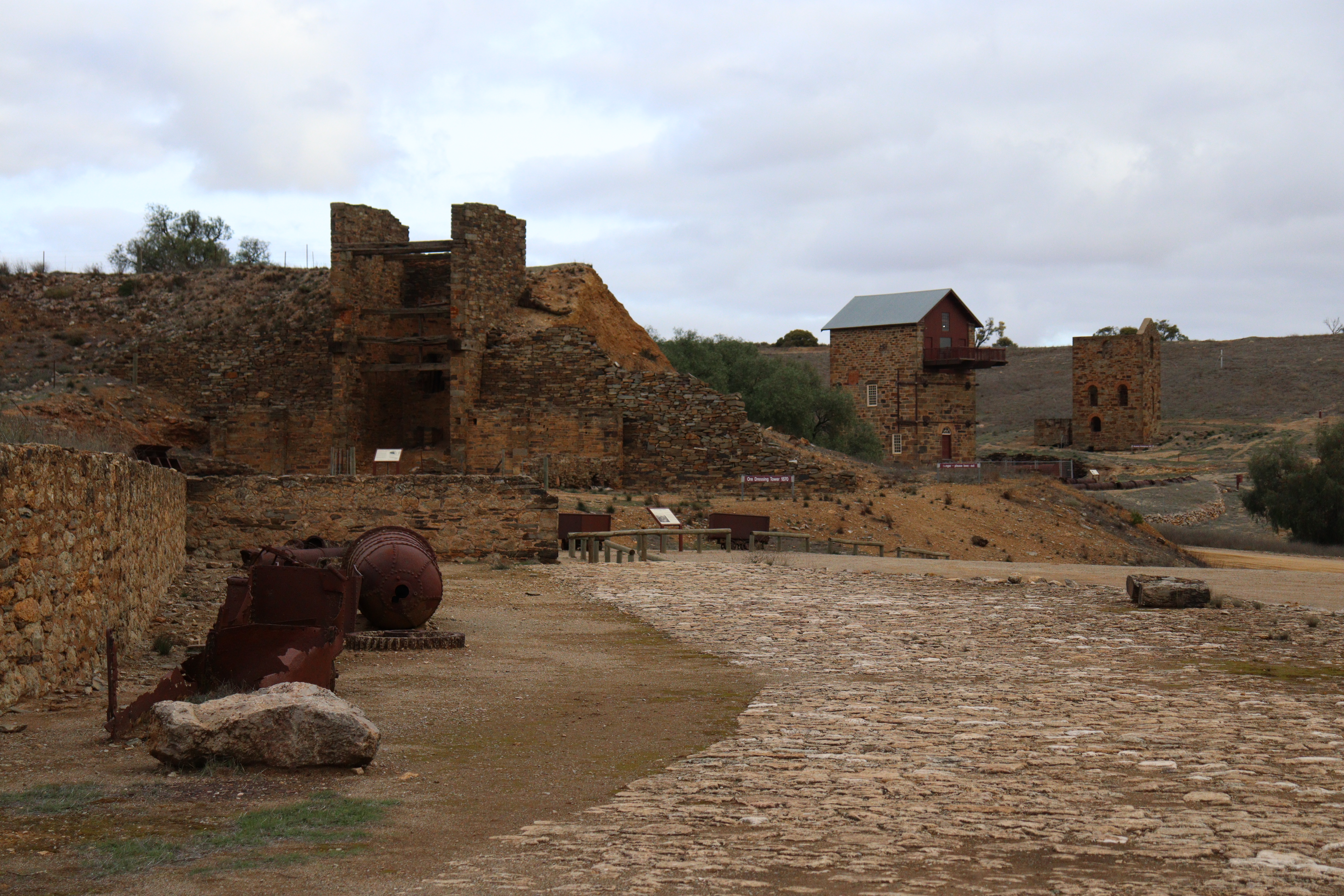
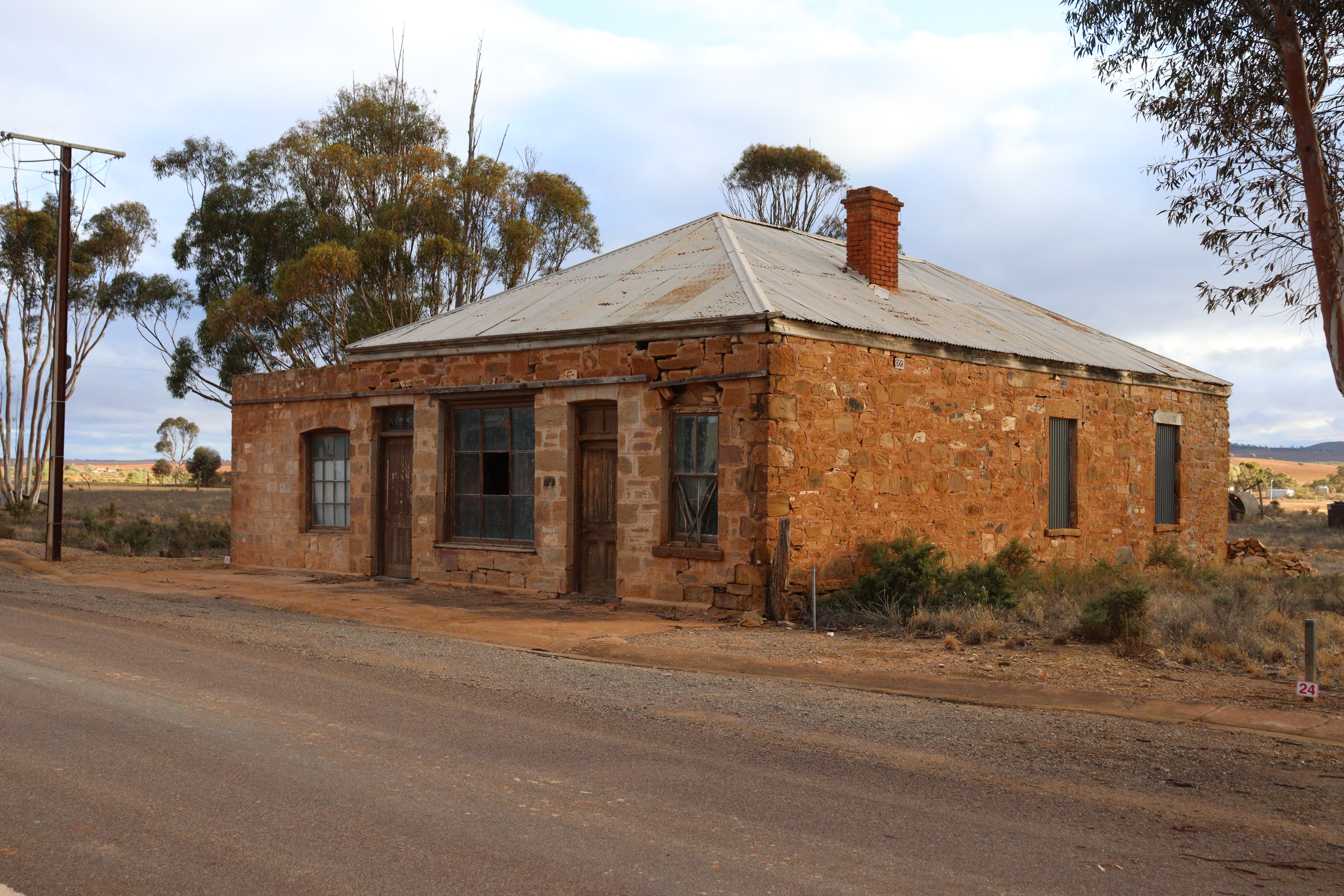
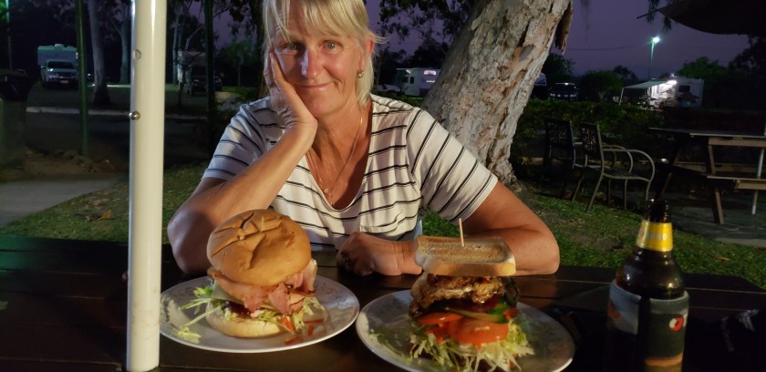
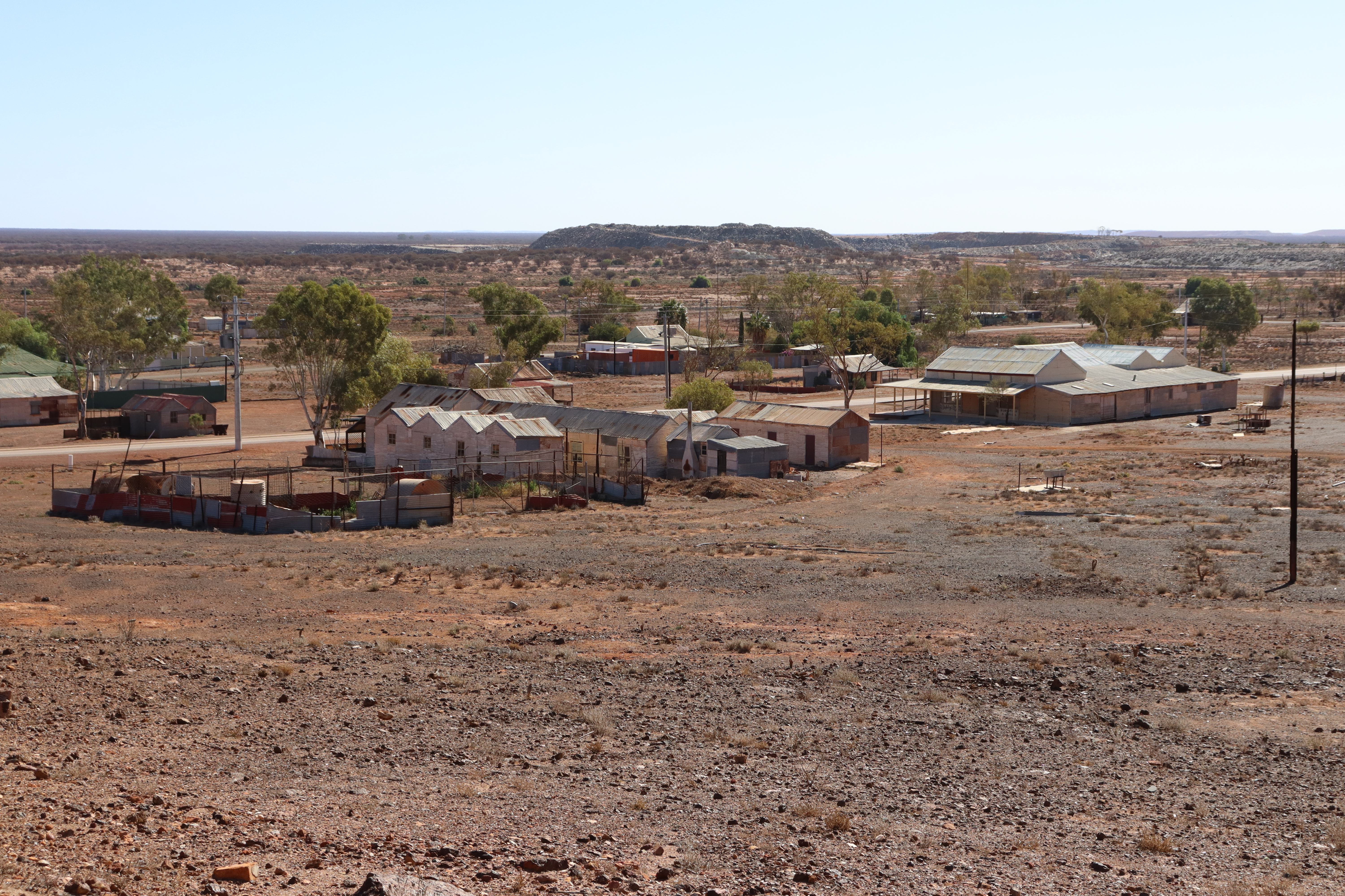
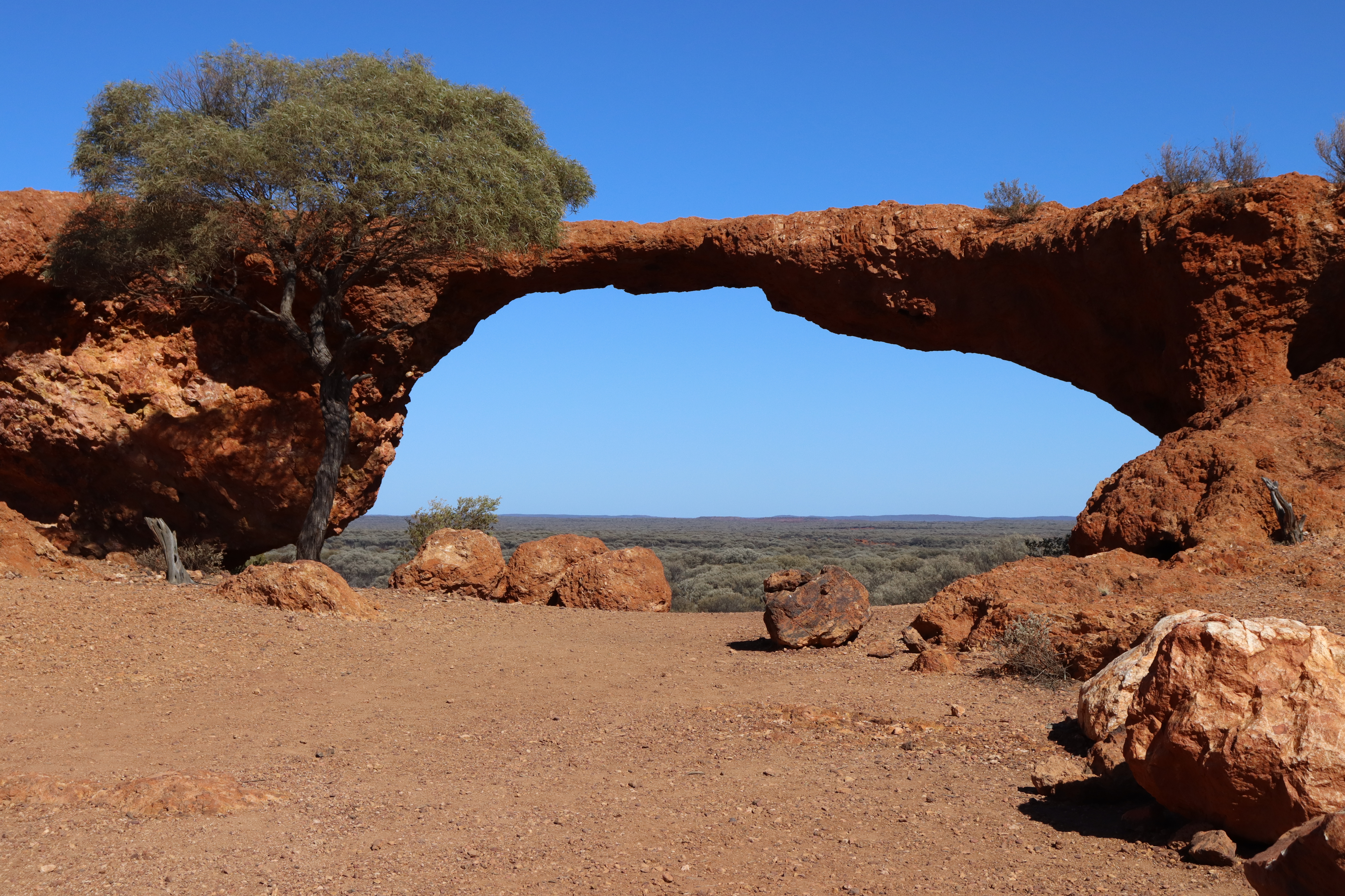
After lunching on the biggest hamburgers I’ve ever seen at Broad Arrow Tavern, we followed the Golden Quest Discovery Trail along  some minor trails and backroads to places steeped in goldfield history, including: Ora Banda, Copperfield, Goongarrie,  Davyhurst and Mount Morgans,  most of which are now just sites of former towns;  and Kookynie, a stop on the rail line that still boasts an open pub – but getting a drink can take a while as feeding the local horse at the front door takes precedence!  And the quaint old town of Gwalia, home of the 1.6 kilometre-deep, 1897-established Sons of Gwalia Mine, once managed by (future US President) Herbert Hoover, and where old miners’ cottages and “camps” (shacks) have been preserved and restored by volunteers. Goldfields towns that still have  decent (and friendly) populations and include Leonora, Menzies, Laverton and Sandstone, are surrounded by some amazing country and natural features, notably The Granites, and Ularring Rocks, both of which are piles of large red boulders and rocks that resemble a mini version of the Devils Marbles of NT; and the impressive London Bridge, a weathered basalt archway believed to be around 350 million years old.

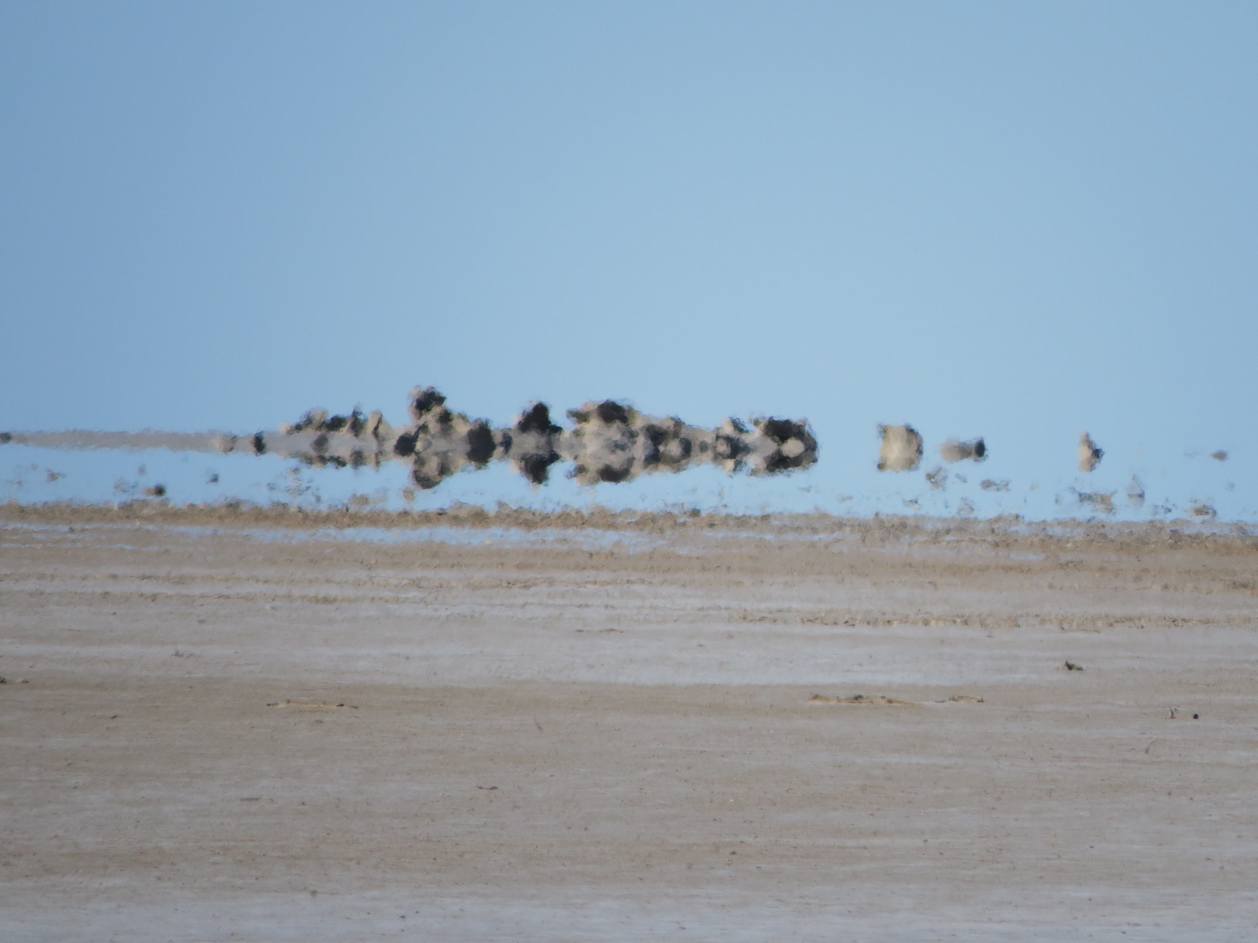
Lake Ballard, a huge (mostly) dry salt lake has an outdoor art gallery featuring 51 life-sized metal statues representing people from the nearby town and spaced out across the surface of the lake, so you need to walk several kilometres to see them all. Gary managed to find about 32 of them but I only got to about 10!

From the goldfields we headed south through Meckering, site of the 1968 earthquake that was felt over a 700 km radius, virtually destroying the township and leaving a 37 km-long fault marking the quake’s vertical lift of 1.98 metres.

After a couple of days in Mandurah to visit Gary’s sister and brother-in-law, and checking out the Mandurah Giants, massive giants sculpted from timber offcuts – well we only managed to get to one – we continued southwards to visit the giant trees of the Southern Forests. These Karri, Red Tingle and Jarrah trees are amongst Australia’s tallest trees growing to heights between 45 and 80 metres and girths up to 20 metres at the base. Famous among these giants are the fire lookout trees, where the fire-spotters used to climb the peg-ladders to the top of the trees to spend their days on the lookout for fires in the forests. In the past you could climb several of these trees as a tourist thing, but (luckily!!) they were closed for climbing when we were there and due to safety concerns have now been closed indefinitely. We got the tall tree experience by walking the Tree Top Walk in the Valley of the Giants, where you walk along suspension platforms 40 metres above the forest floor, which sway as you walk, simulating the movement of the top sections of these giant trees. Pretty impressive.         

Starting to head eastward again, following the south coast of WA took us through some amazing places, mainly National Parks of the south coast.

 The D’Entrecasteaux NP ‘s two sections are vastly different from each other but both well worth visiting. The coastal section near Windy Harbour showcases the wild rugged beauty of the coastline bordering the Southern Ocean here and features several lookout points with the highlight being the amazing “Windows” rock formation. Further inland, the NP’s Mount Chudalup section features (oddly enough!!) Mt Chudalup where we walked the 1.5-kilometre trail and scrambled over some steep sections of rocks to the summit of this great granite outcrop for amazing 360° views across the surrounding country all the way to the coast. This section is a botanical treasure trove hosting 42 native moss species, 28 lichens and 6 liverworts, as well as trees, bushes, grasses and grasstrees.

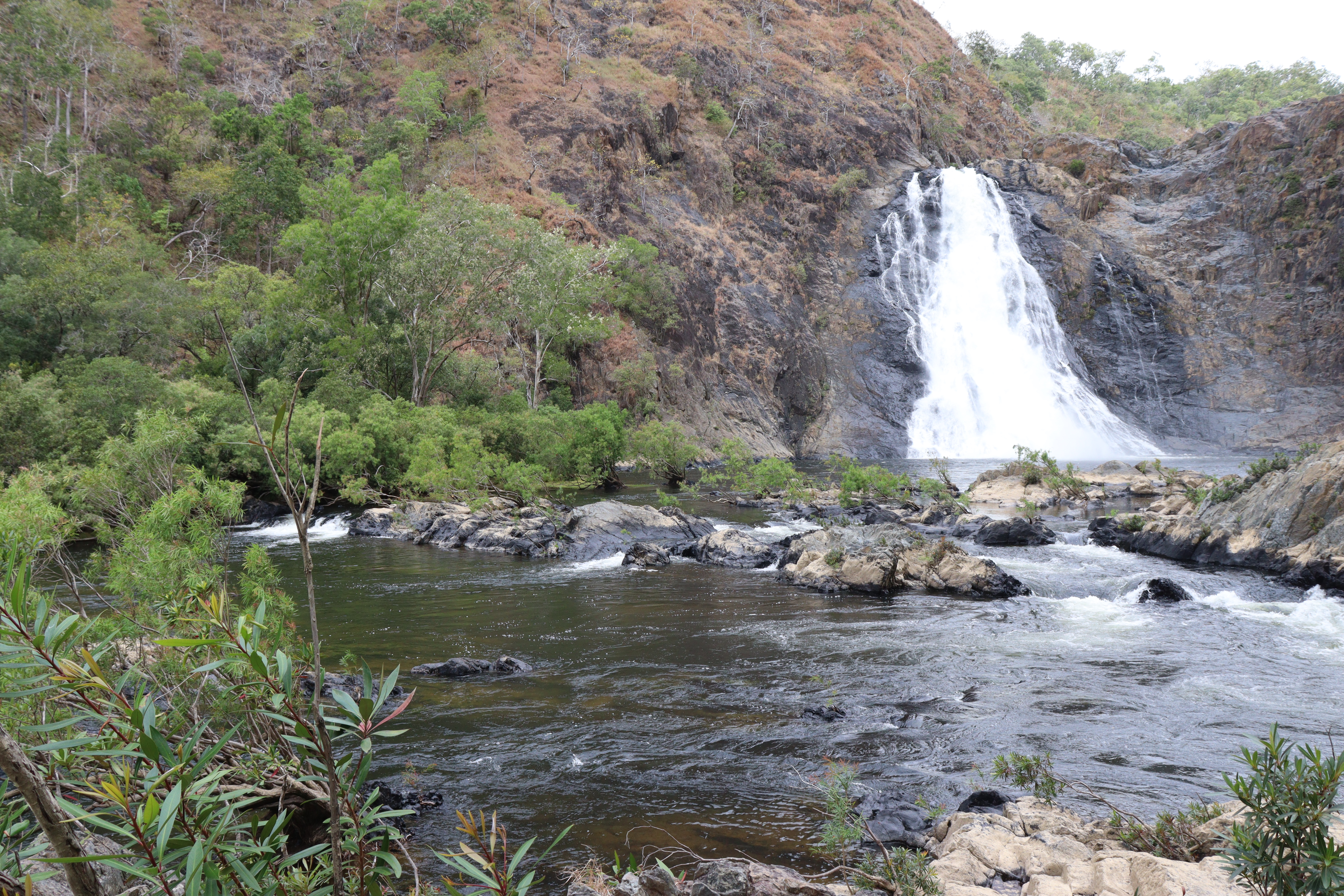
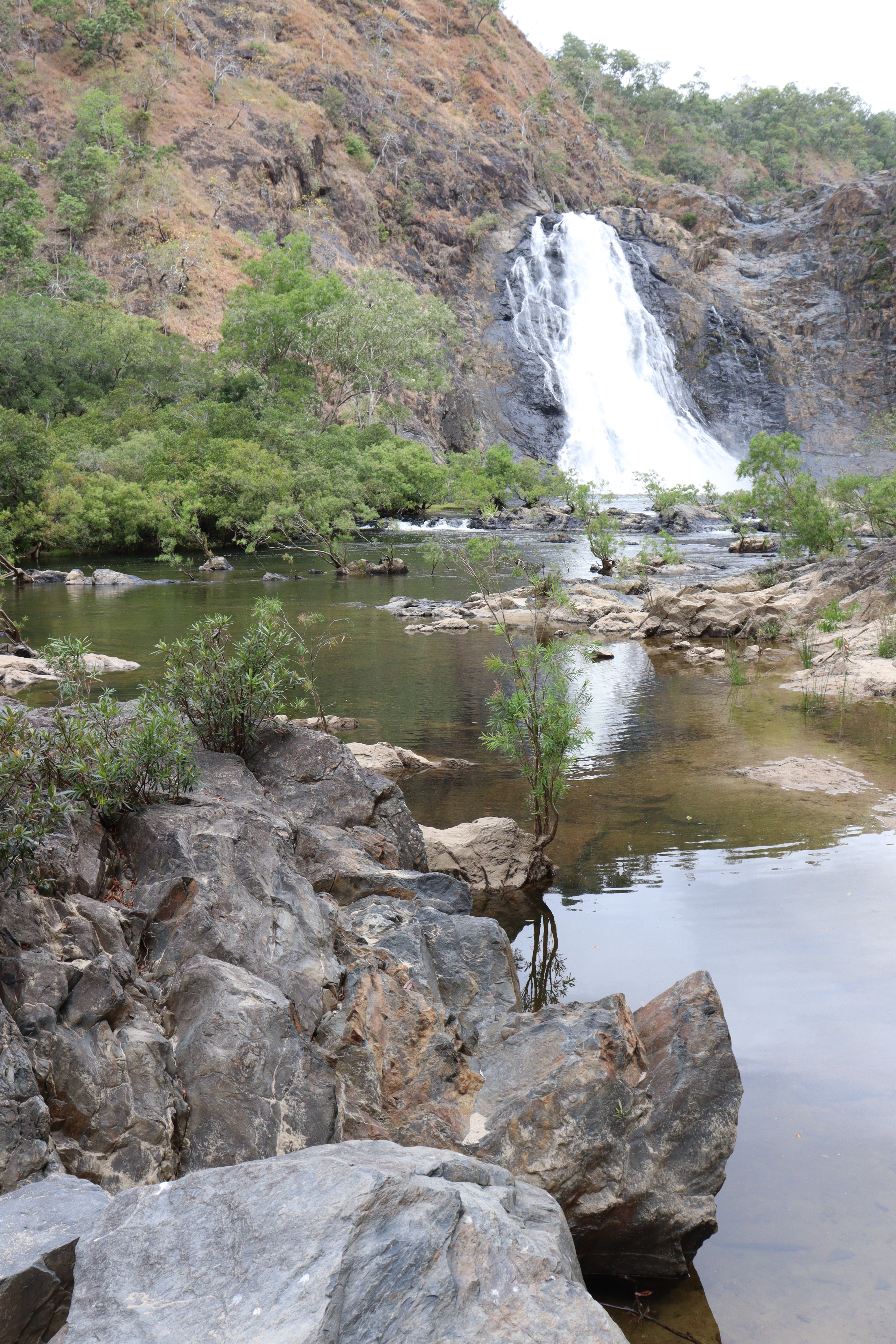
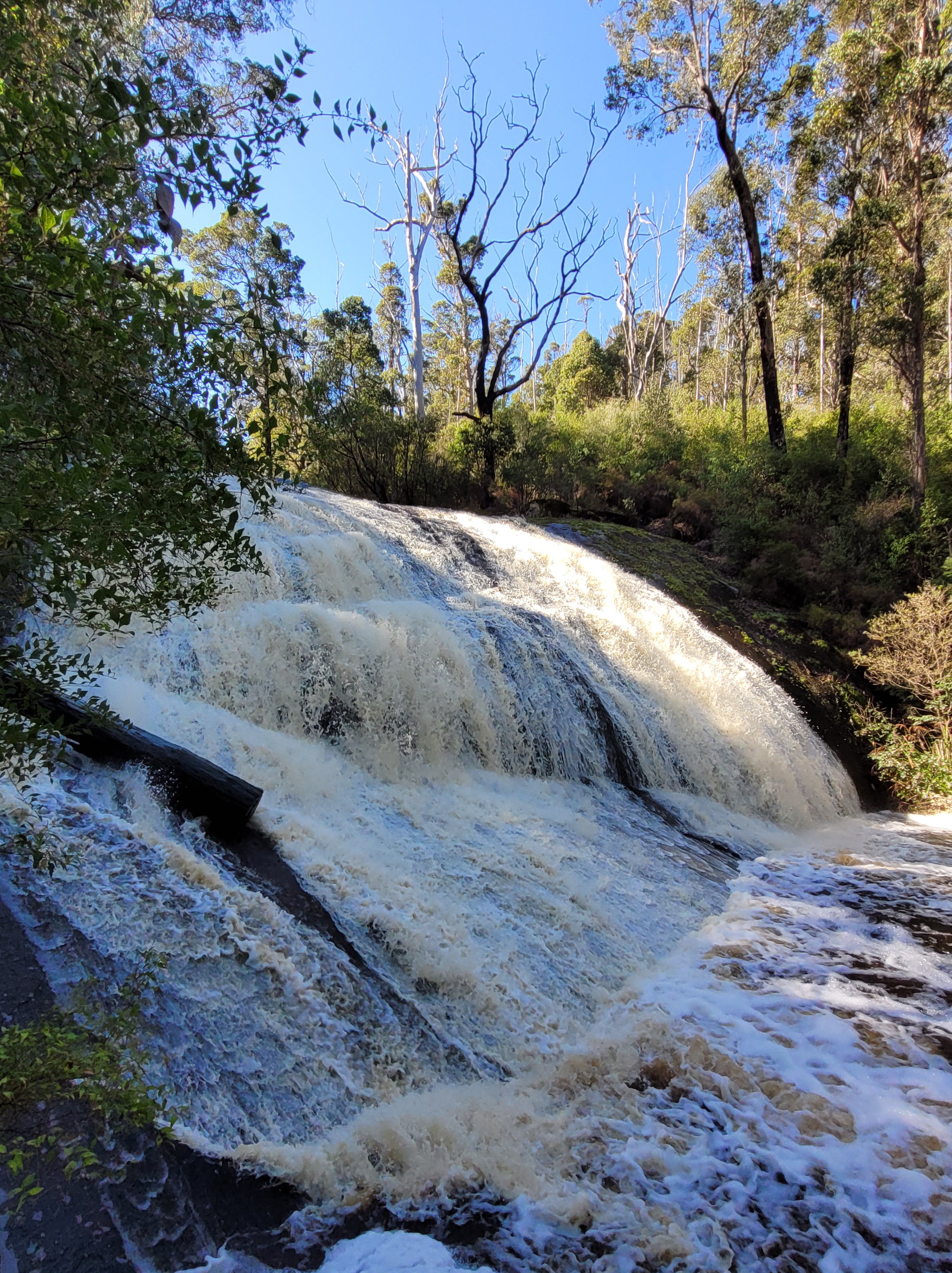
Passing through a number of other National Parks – Boorara Gardner with its spectacular Lane Poole Falls; Shannon NP, site of former timber-workers’ town but now a large camping area; Mount Frankland South NP with the thunderous Fernhook Falls; Mount Frankland NP with its steep trail, over 300 steps and several vertical ladders (and a warning NOT to proceed if “faint of heart or foolhardy” -ha ha!) to reach the summit, where we were nearly blown away by the gale like wind! – we finally came back out to the coast.

Torndirrup NP near Albany, is home to spectacular coastal sites that demonstrate the awesome power of the sea, namely: The Gap, where waves rush into a narrow chasm in the cliff, gradually wearing away the rock over millions of years; The Natural Bridge, where the waves have worn away the rock leaving an arch; and the Blowholes, where a small plaque on the rocks near some small cracks warn you to “Stand Clear – Heavy Swells force air and spray through cracks with great  pressure!” which indeed they do! Standing near the cracks, we were suddenly BLASTED with a huge rush of air which had us in hysterics at the unexpectedness of it!!

Albany is also home to the Historic Whaling Station, and a visit here is well worth it. There are several relics from the days of whale hunting including a whaling boat complete with harpoons, the cutting floor, several skeletons and LOTS of information. You leave this place wondering how the hunters could have continued hunting these beautiful, amazing creatures, and thankful that it has been banned.

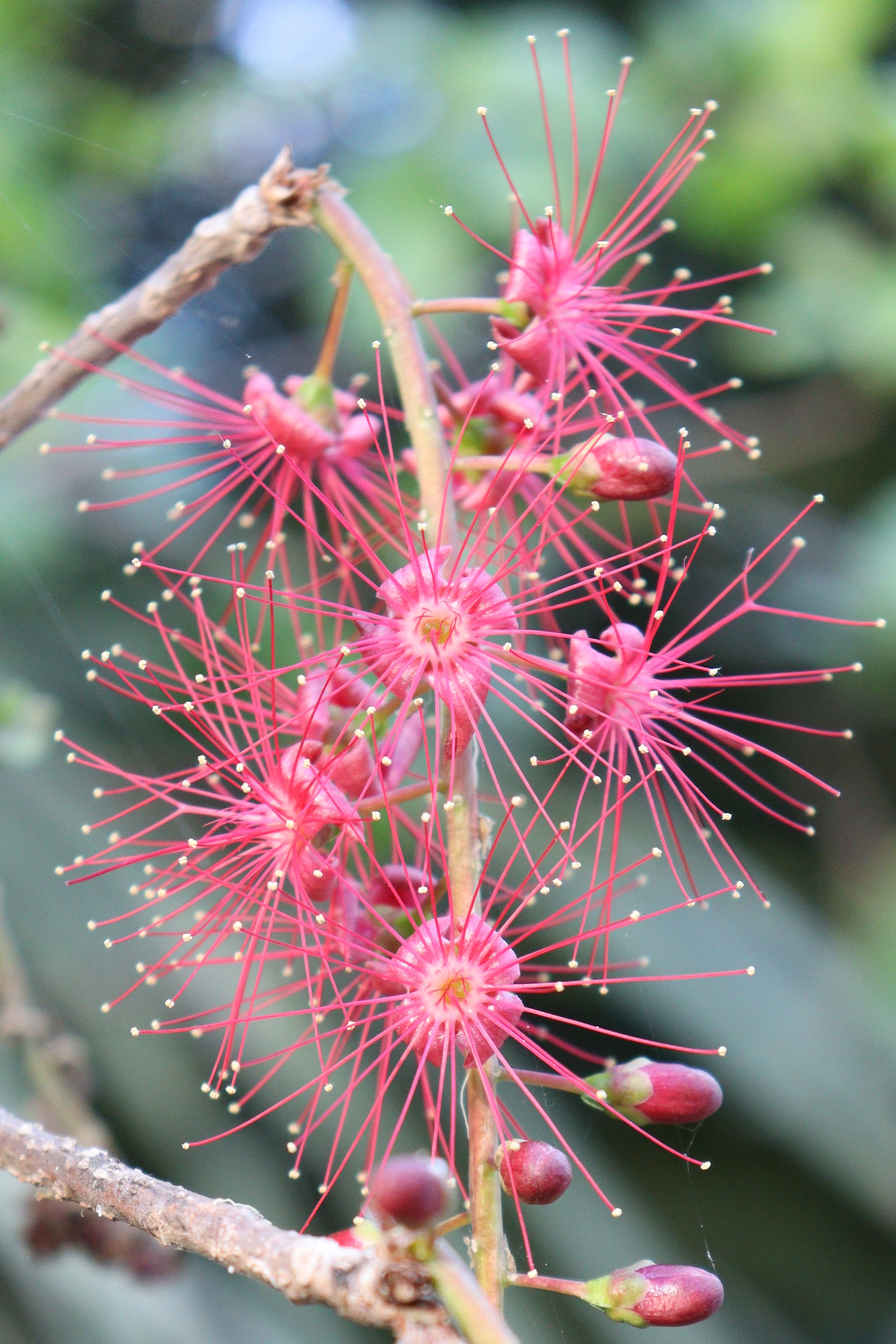
Near Hopetoun on the south coast, Fitzgerald River NP’s skyline is dominated by East Mt Barren rising high above the pristine white sandy beaches and turquoise bays, including Hamersley Inlet and Beach, where the inlet is closed off from the beach by a large sandbar that apparently only opens every ten years or so. Beyond the bar, the beach is filled with hundreds of large, sharp, jagged, shale- or slate-like rock formations sticking up vertically from the sand and the water. AND…. Sooo many coastal wildflowers!

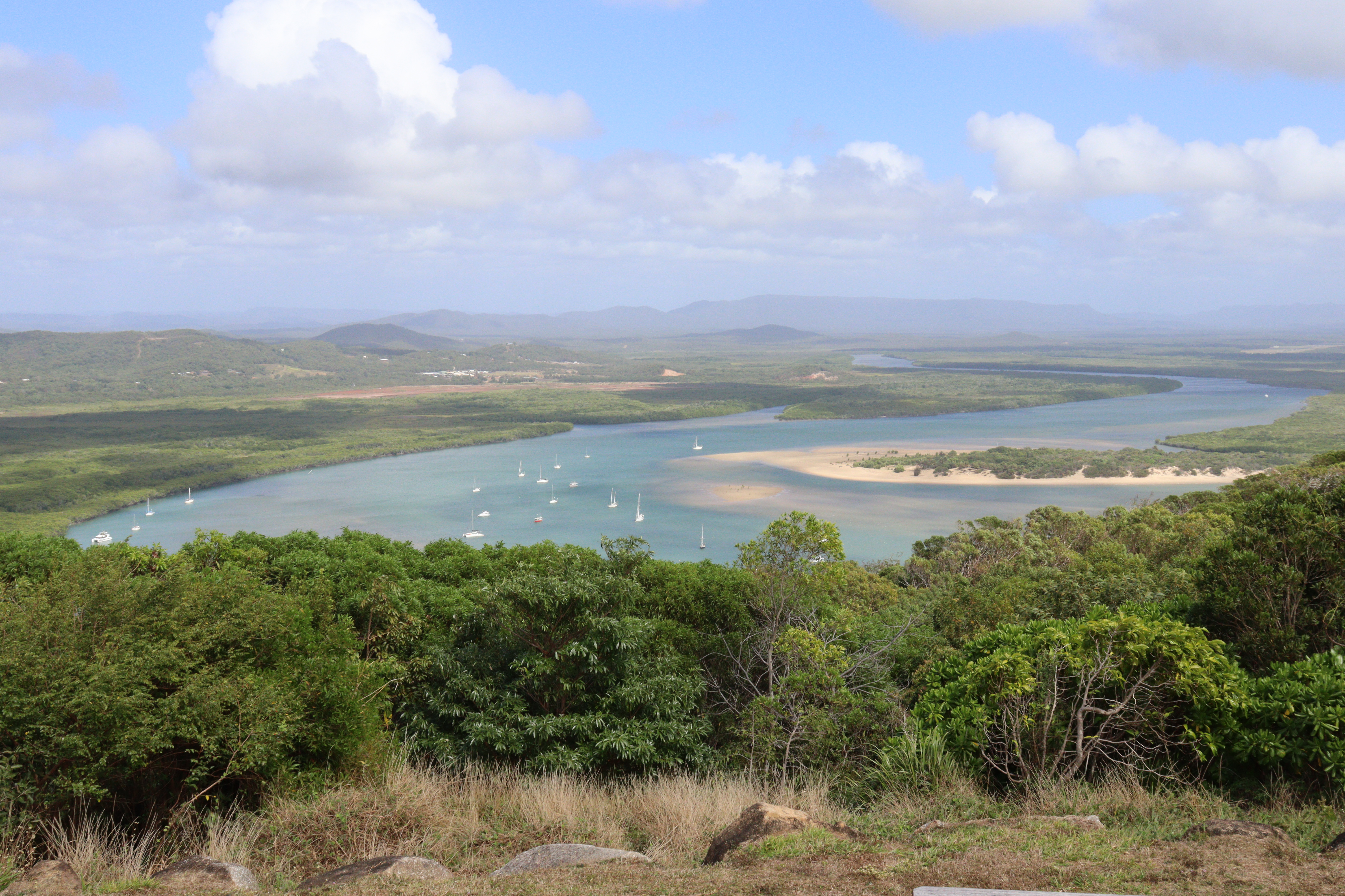
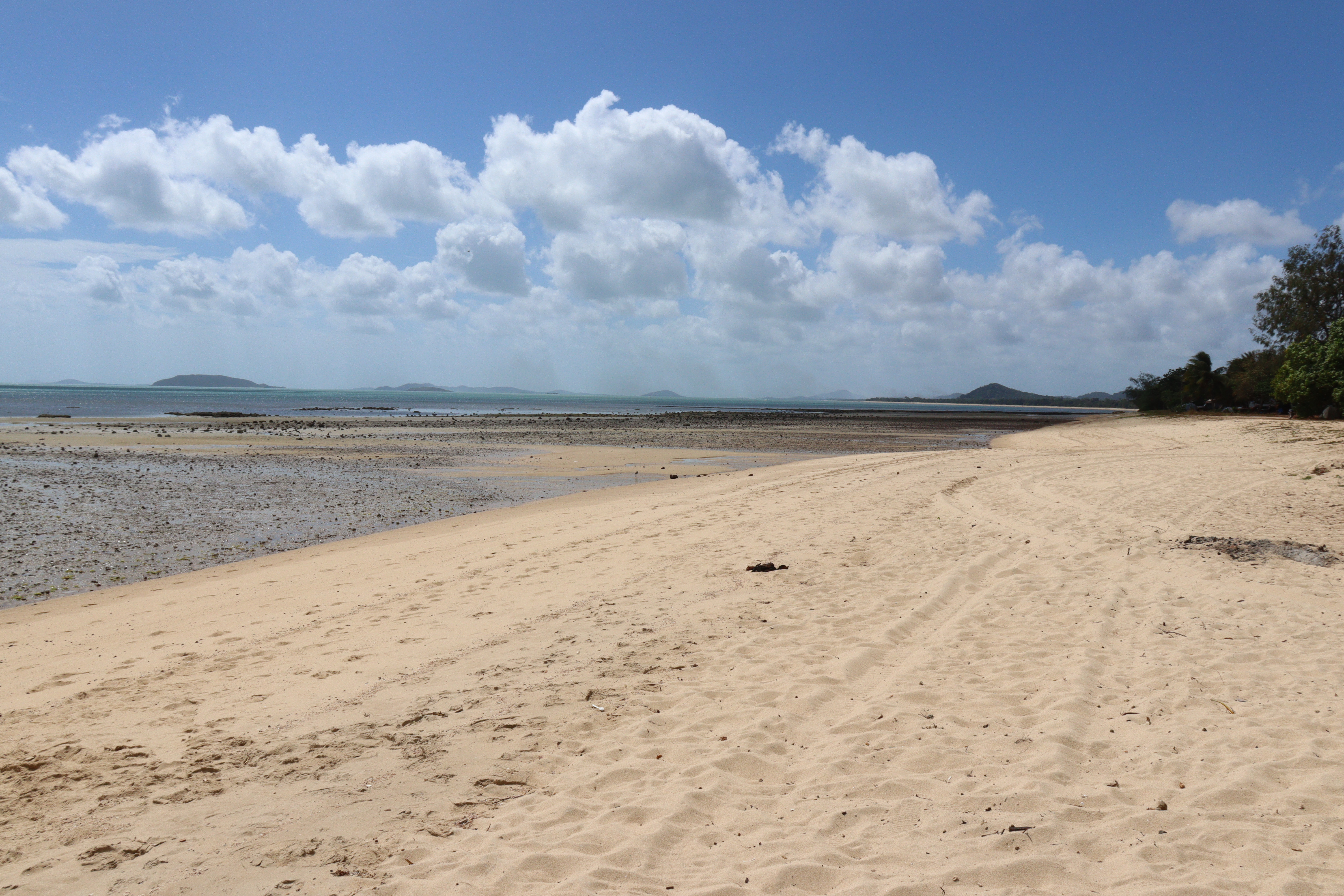
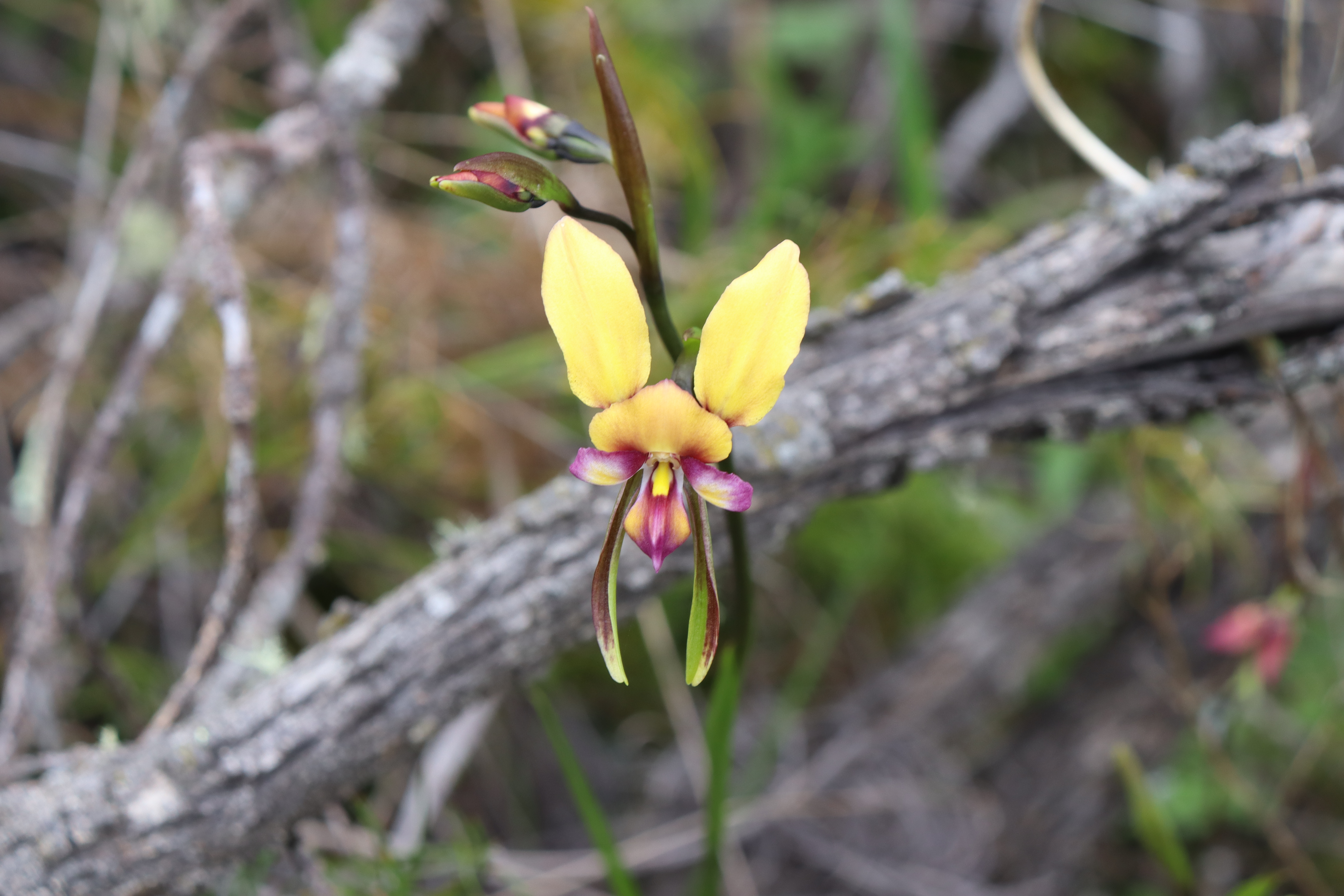
Not far from Esperance is Cape Le Grand NP, where we were treated to the most amazing coastal scenery with rocky ridges, pure white sand and the most perfectly turquoise waters I think I’ve ever seen!  A 3 km walk along the fine white squeaky sands of Lucky Bay – the Jewel in the Crown of this NP – takes you to the far end of the Bay where the turquoise waters break against red granite boulders on which several green copper plaques commemorate Matthew Flinders’ landing here in 1802 in HMS Investigator using the bay as safe anchorage during his circumnavigation of Australia. From the campground, we walked the opposite direction, passing another plaque honoring Flinders, over the headland on the Coastal Walking Trail to Thistle Cove, named in memory of John Thistle, Master of HMS Investigator, and where the huge “Whistling Rock” makes whistling, ocean-like sounds as wind passes through. Further afield more stunning beaches include Hellfire Bay with the same white sand, red granite and turquoise waters, Cape LeGrand Beach where you can drive 22km along the beach to Wylie Bay, and Rossiter Bay where seaweed has washed up and dried creating a carpet about a metre thick! And once again, we were treated to a wondrous display of native wildflowers, including lots of different native orchids in bloom. Magic!

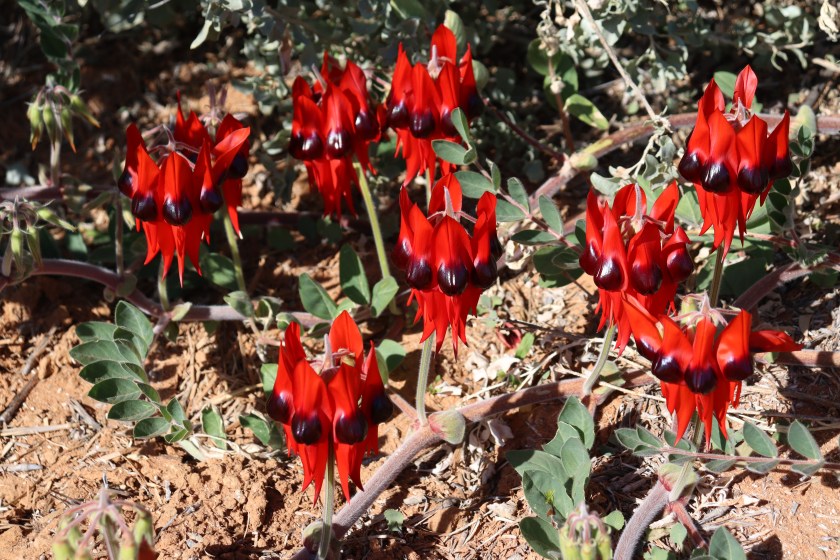
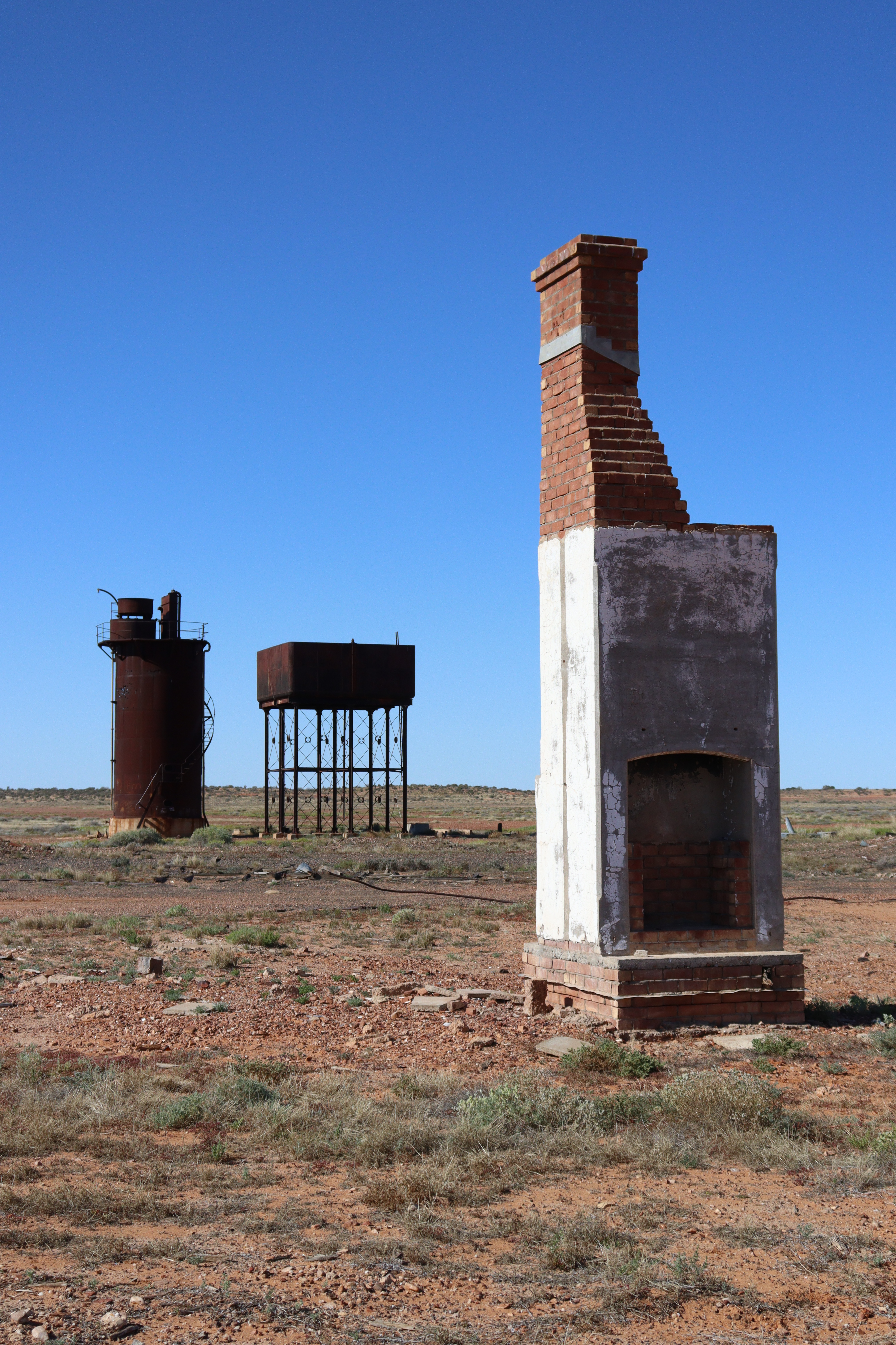
Traversing back across the Nullarbor, we paused to visit the remnants of the Eucla Telegraph Station that are slowly being consumed by the sand dunes, and had to do a U-turn to stop along the highway and take some pics of the only “garden” of the exquisite Sturt’s Desert Pea we saw on our entire trip. Further eastward, we stopped to view the awe-inspiring Bunda Cliffs of the Great Australian Bight, planning to spend the night there like stacks of others. However during the night the wind blew up  to such a force that not only kept us awake, but also had us fearful of Roxy being flipped over, so at 3 in the morning, we got up and drove about ten kilometres further along the highway till we found a little spot that was more sheltered from the wind – and THEN we managed to sleep!

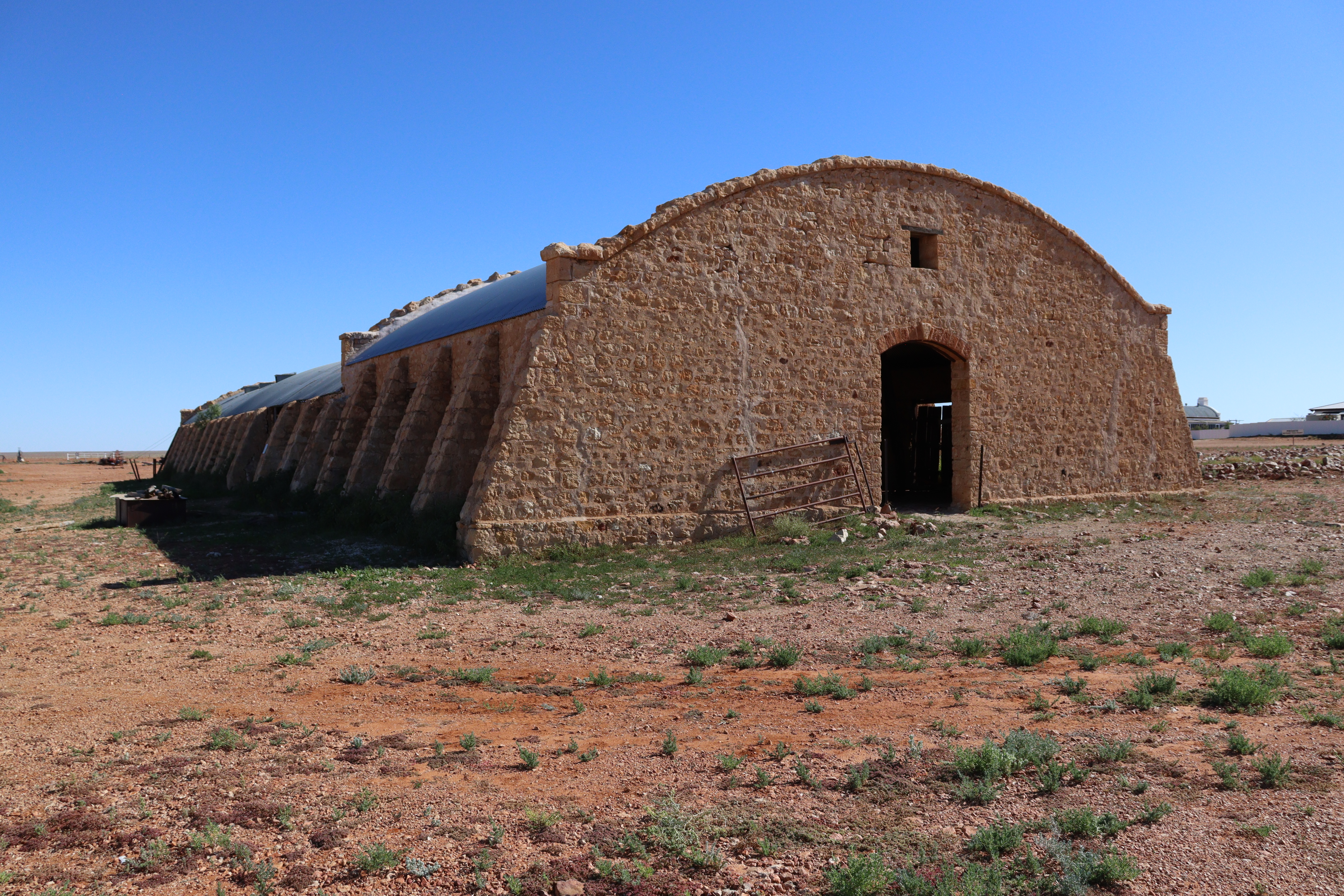
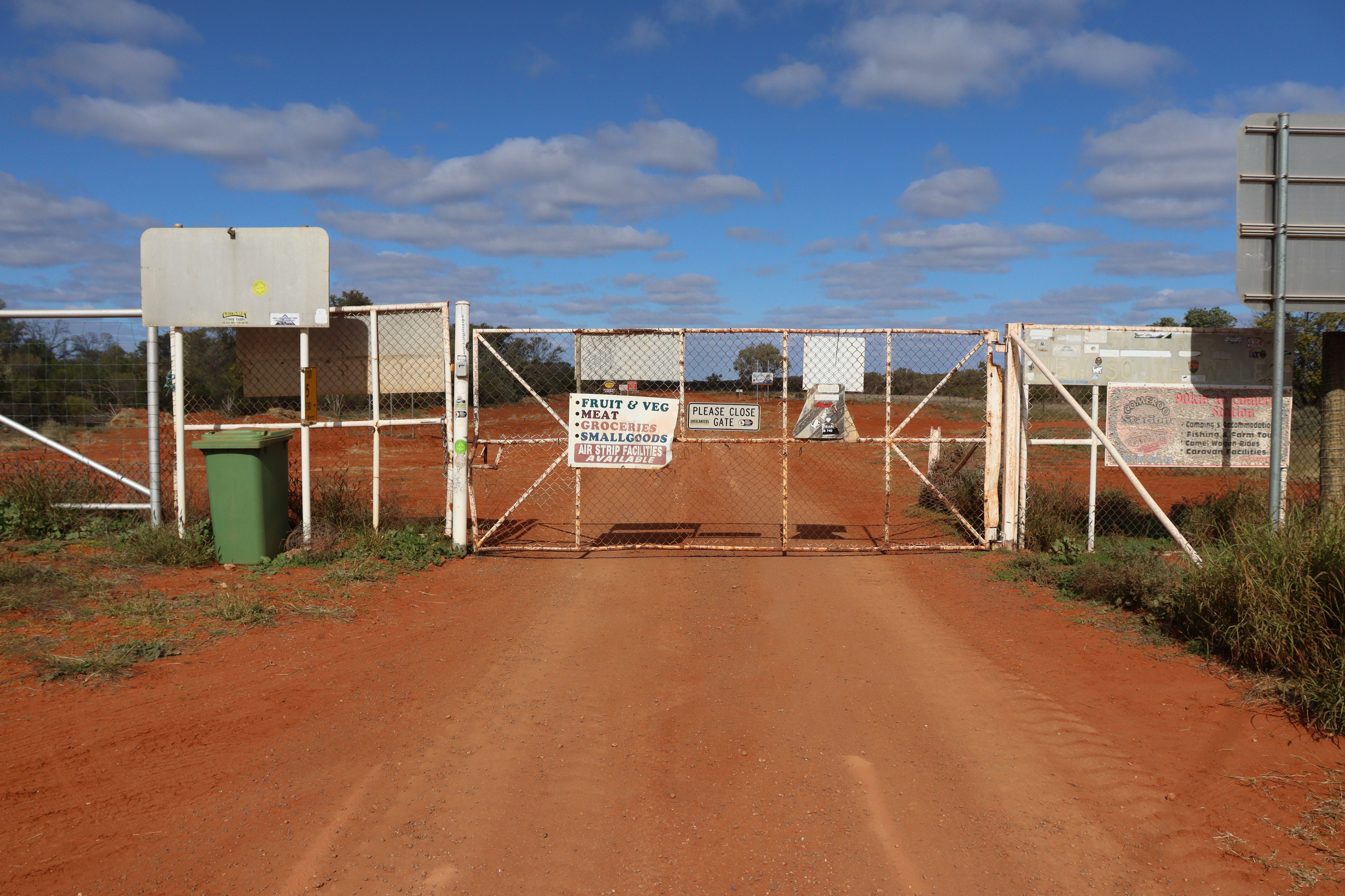
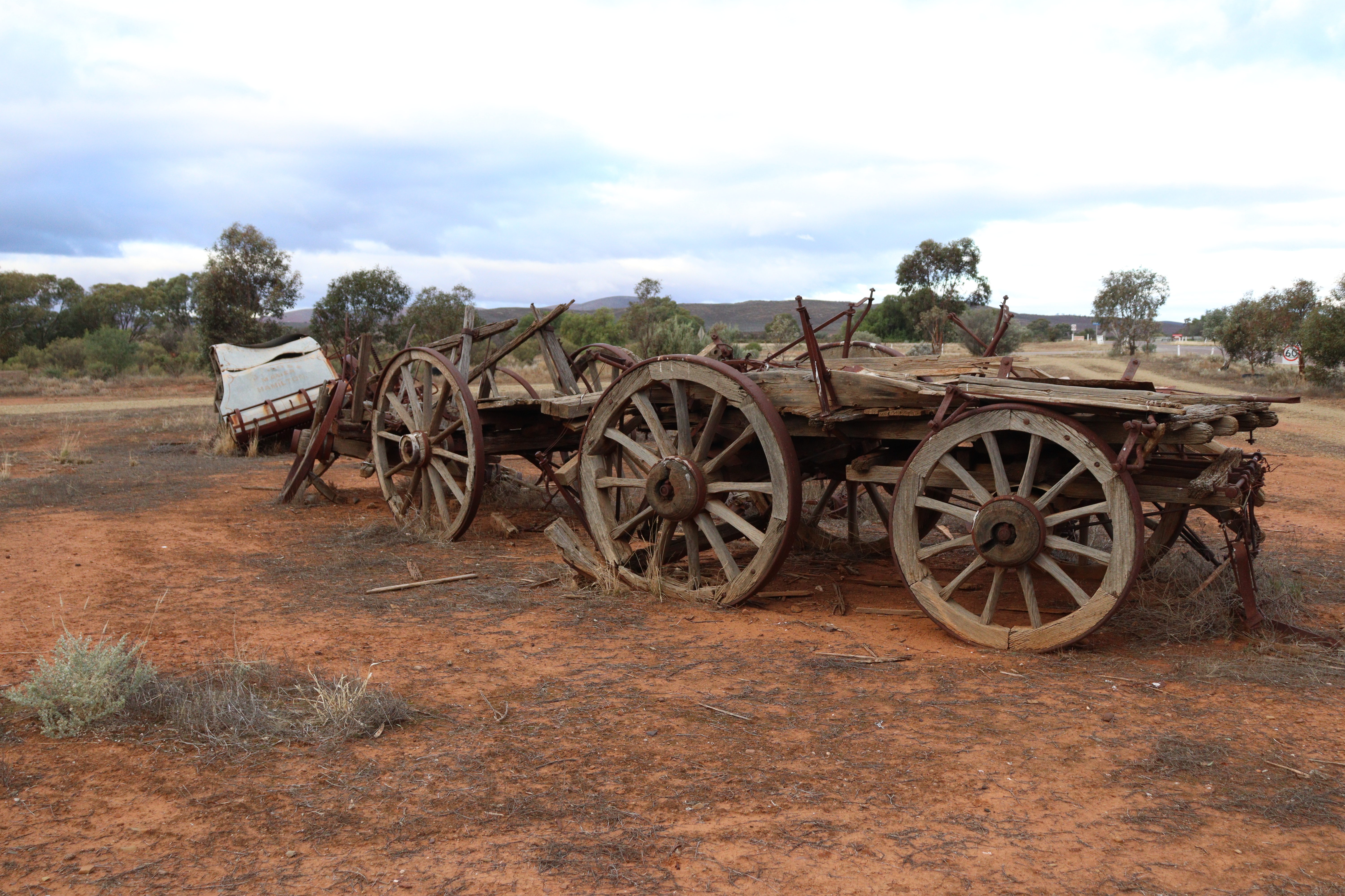
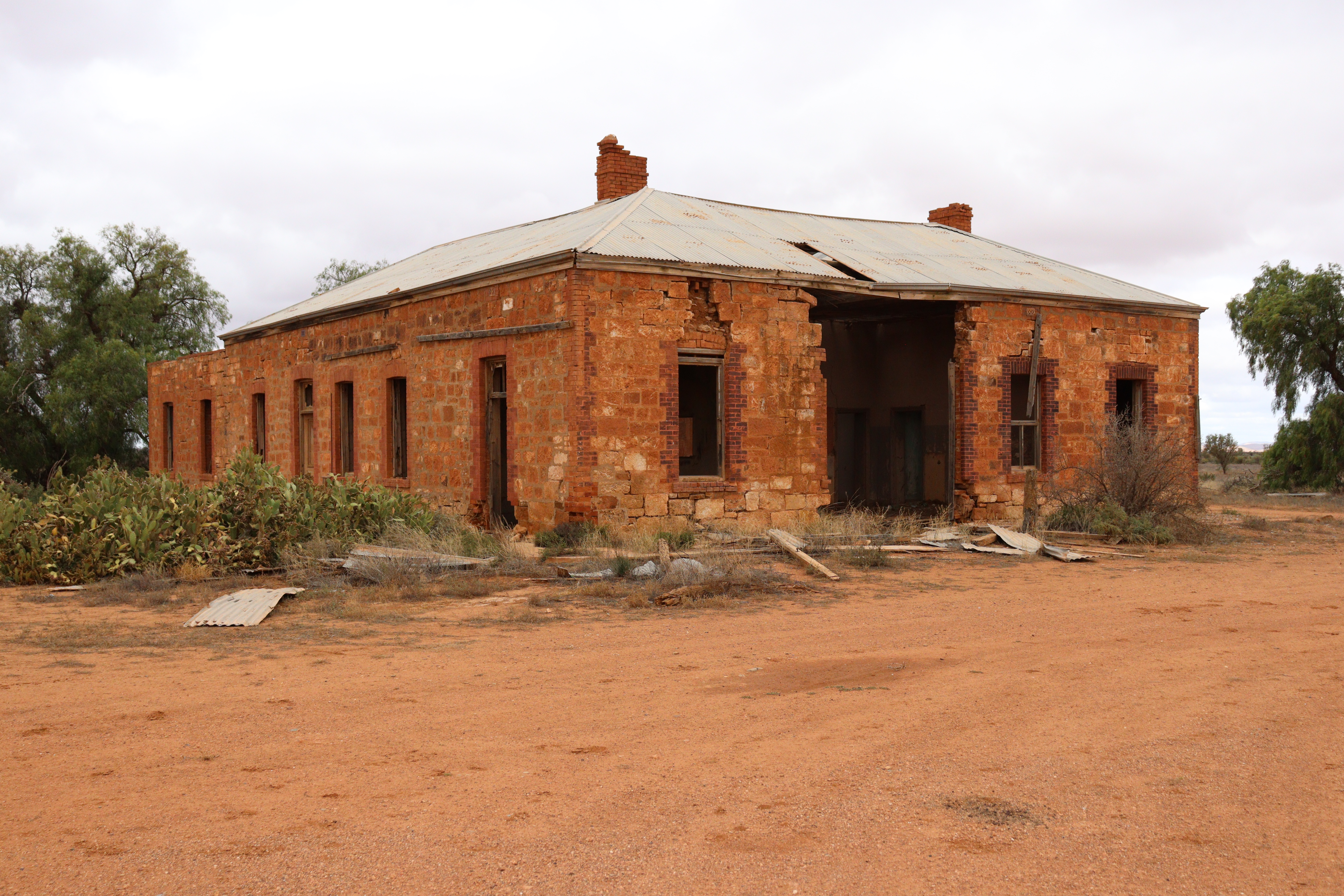
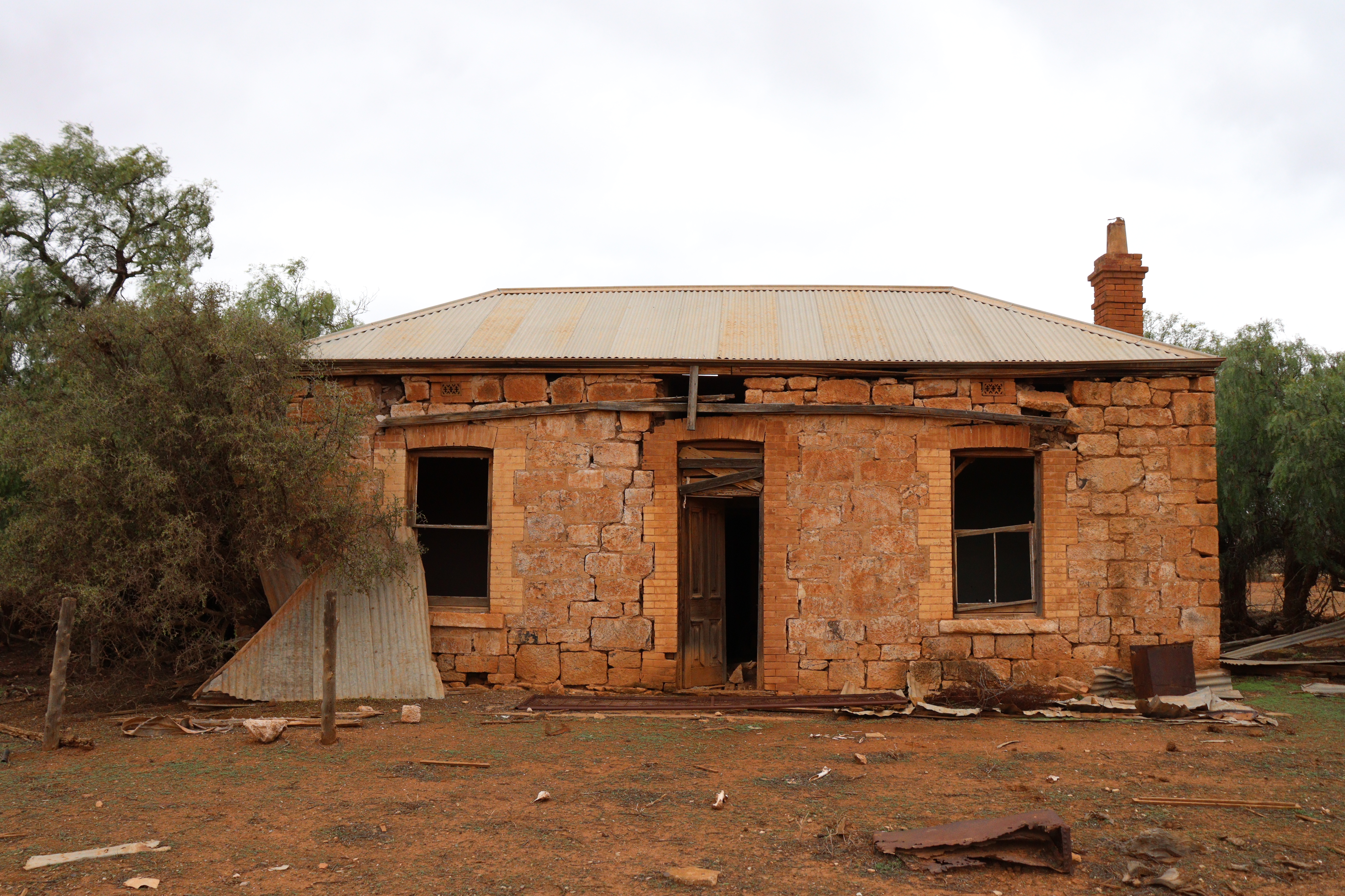
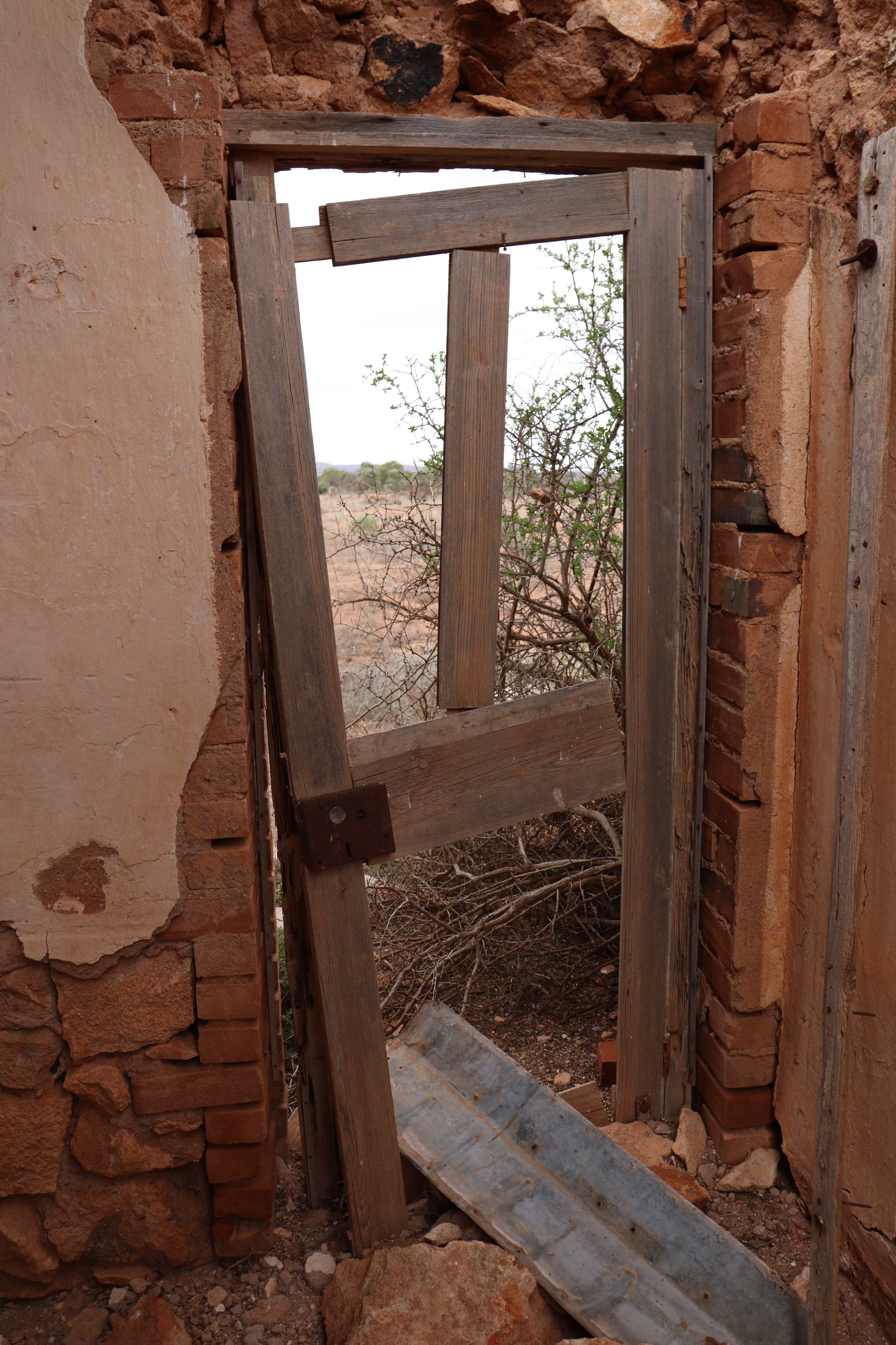
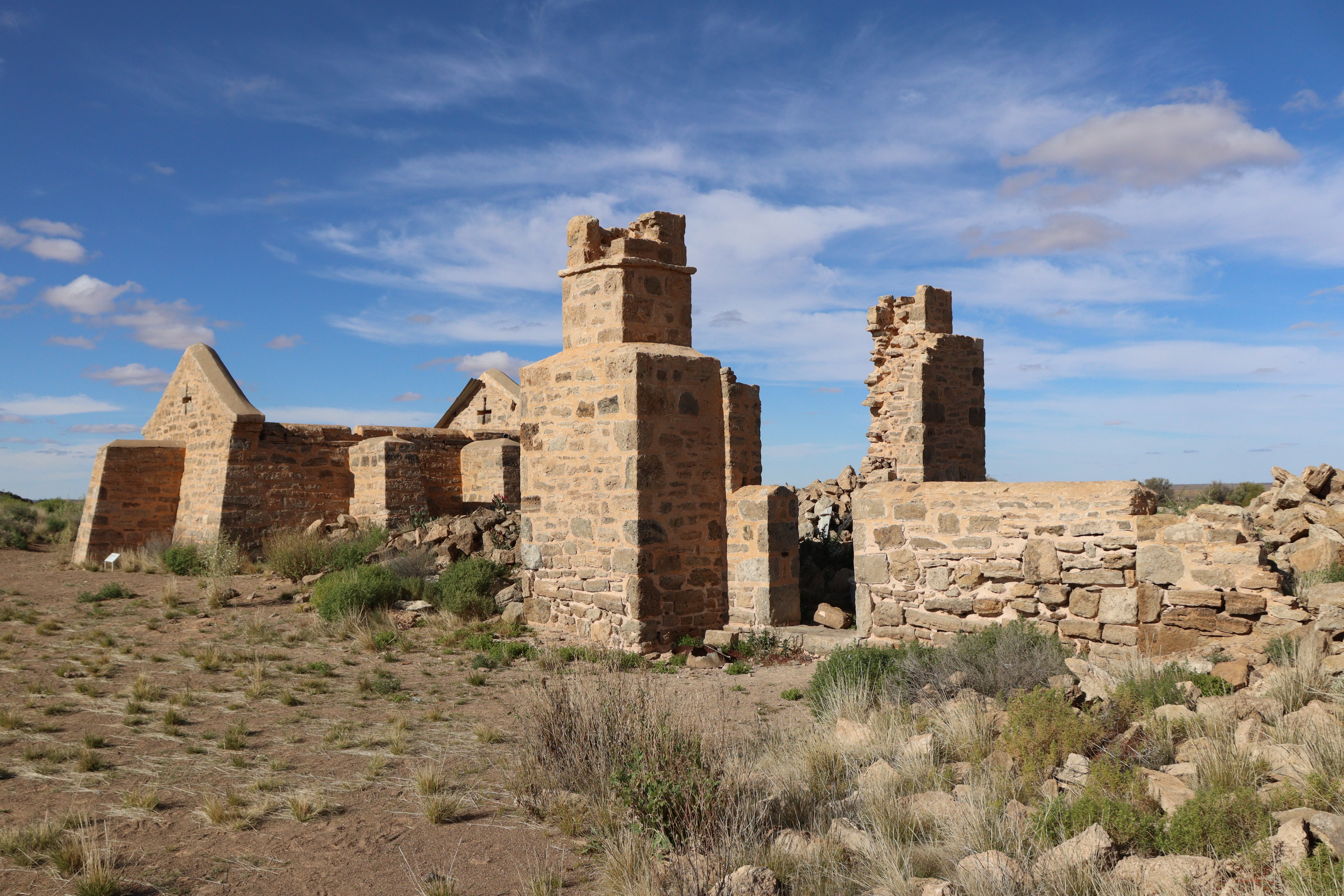
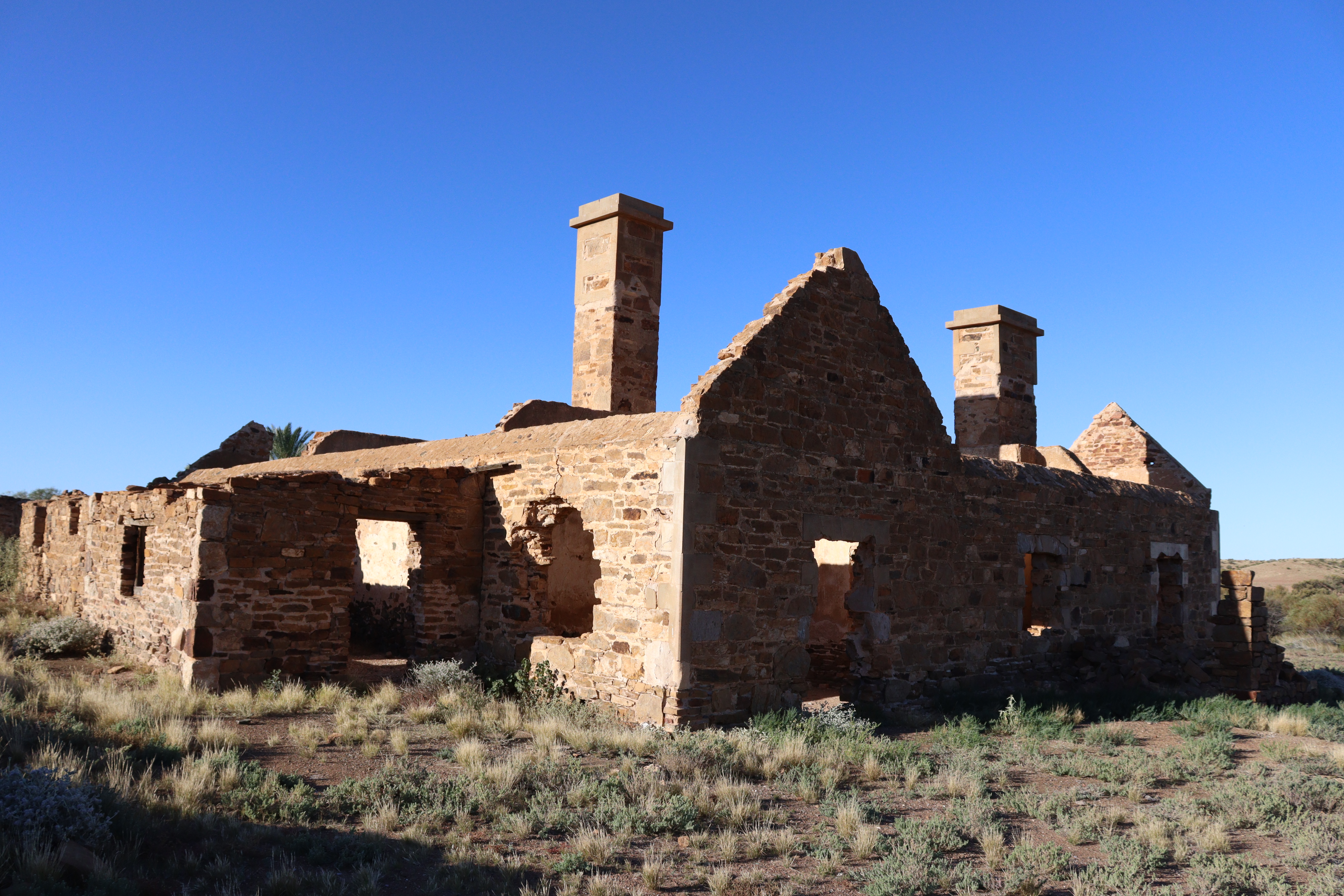
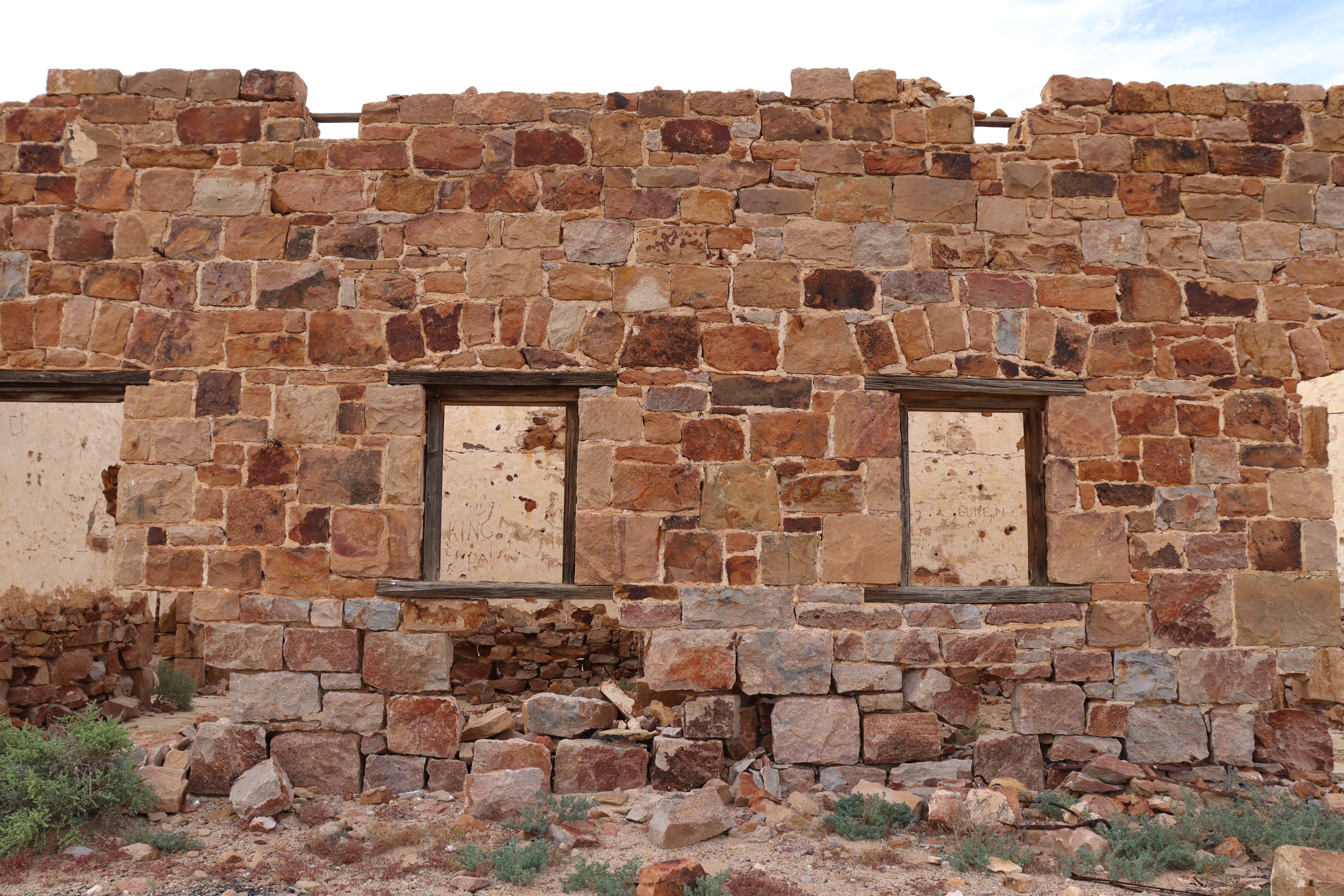
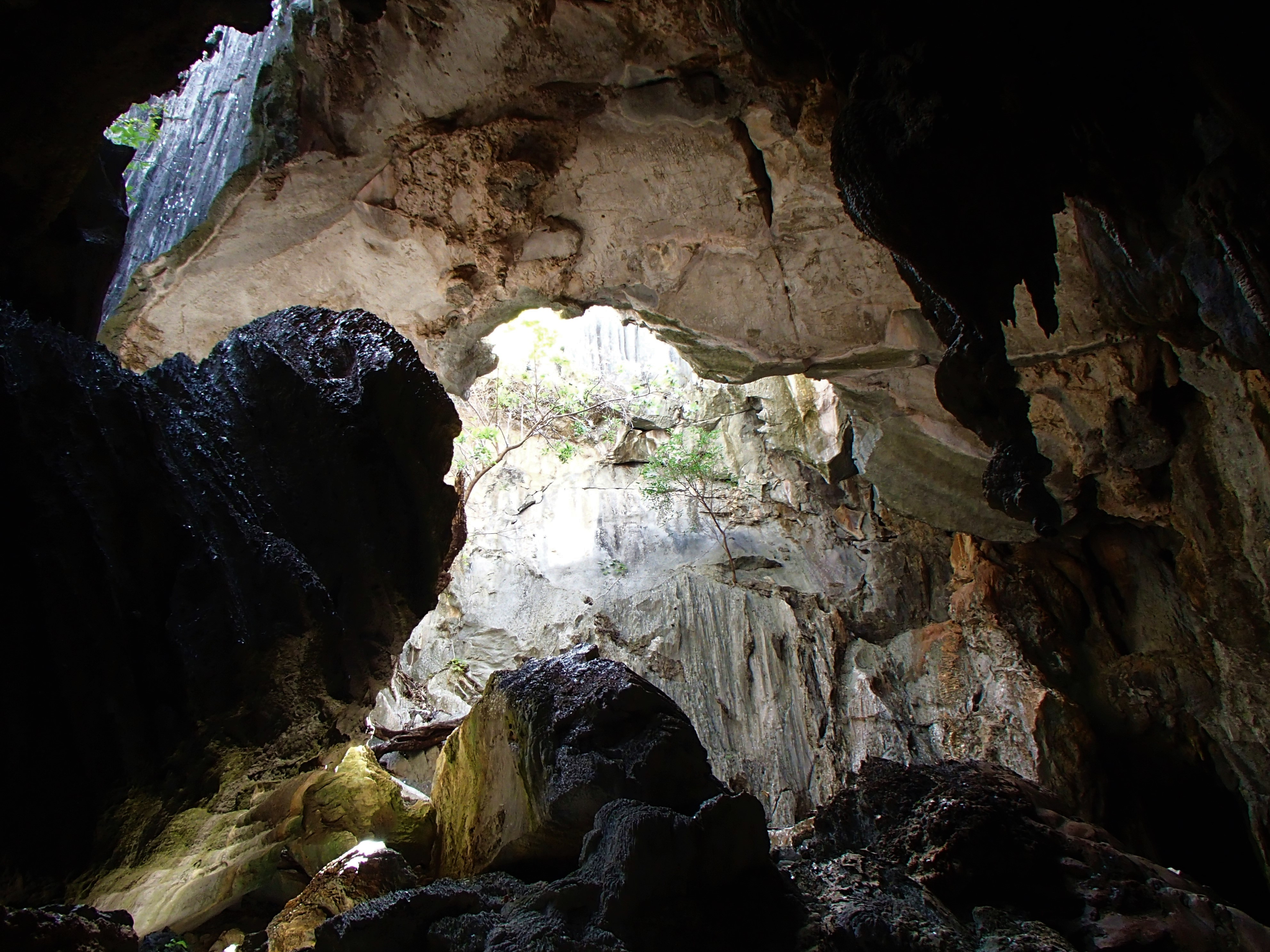
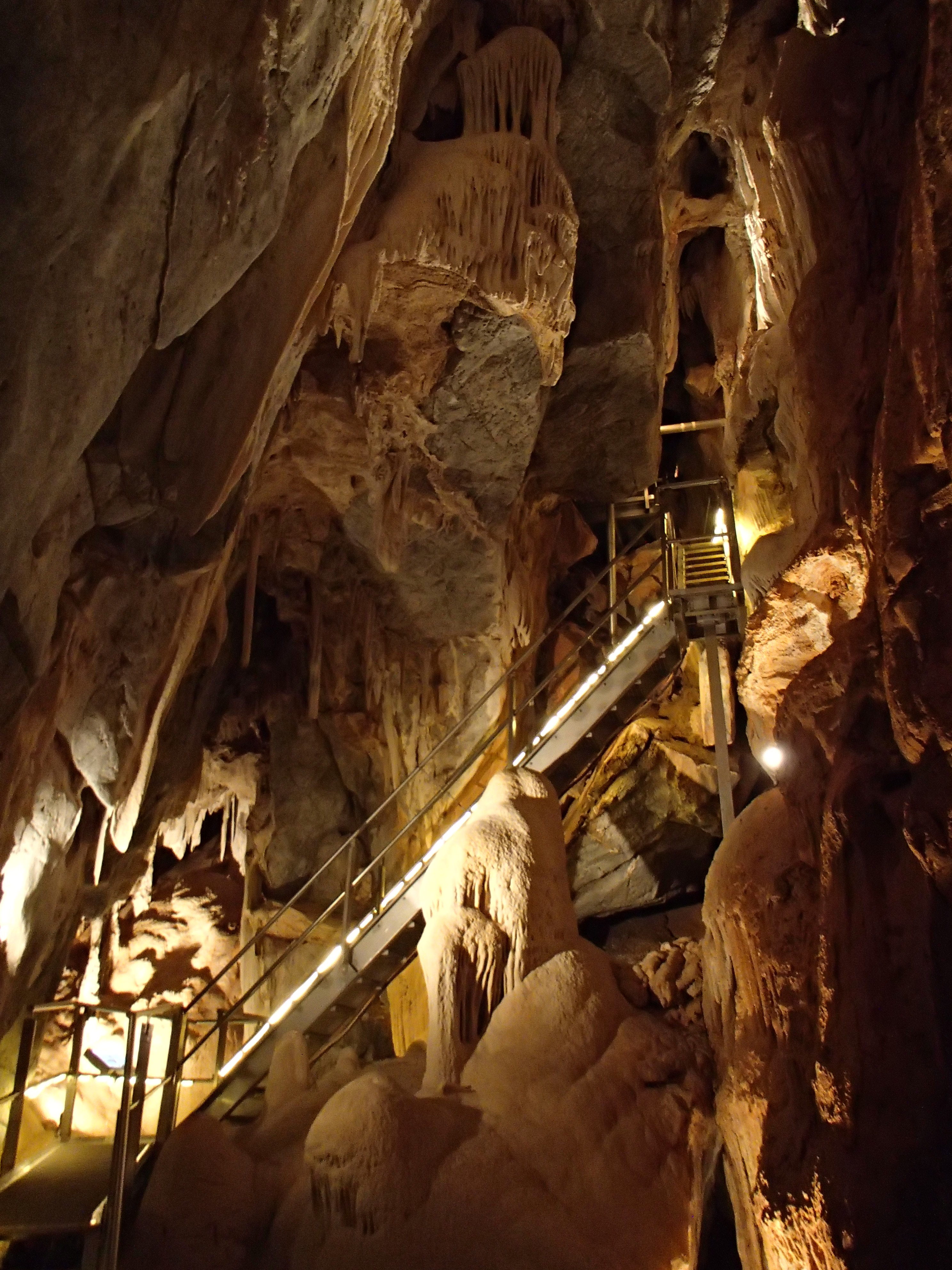
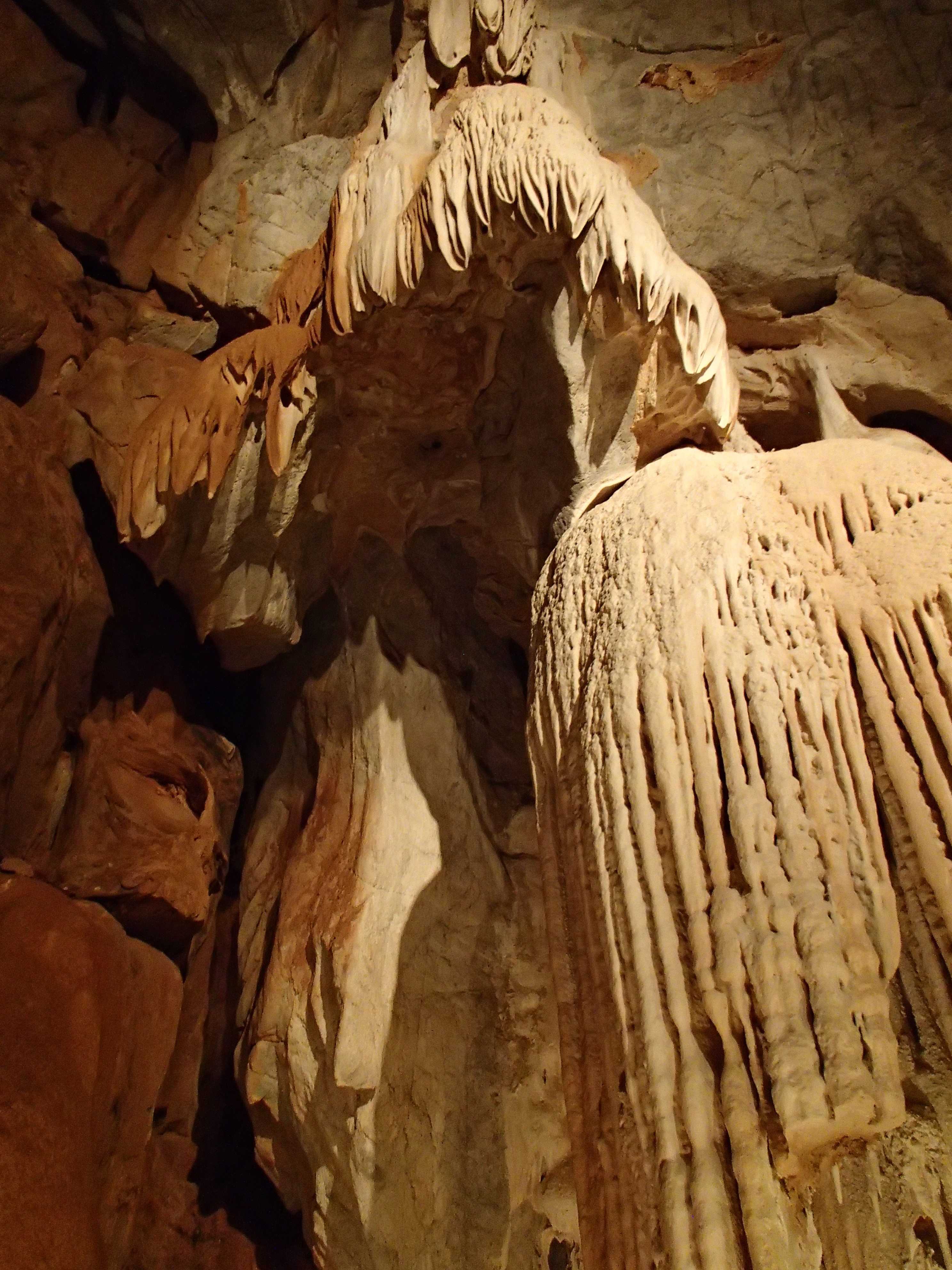
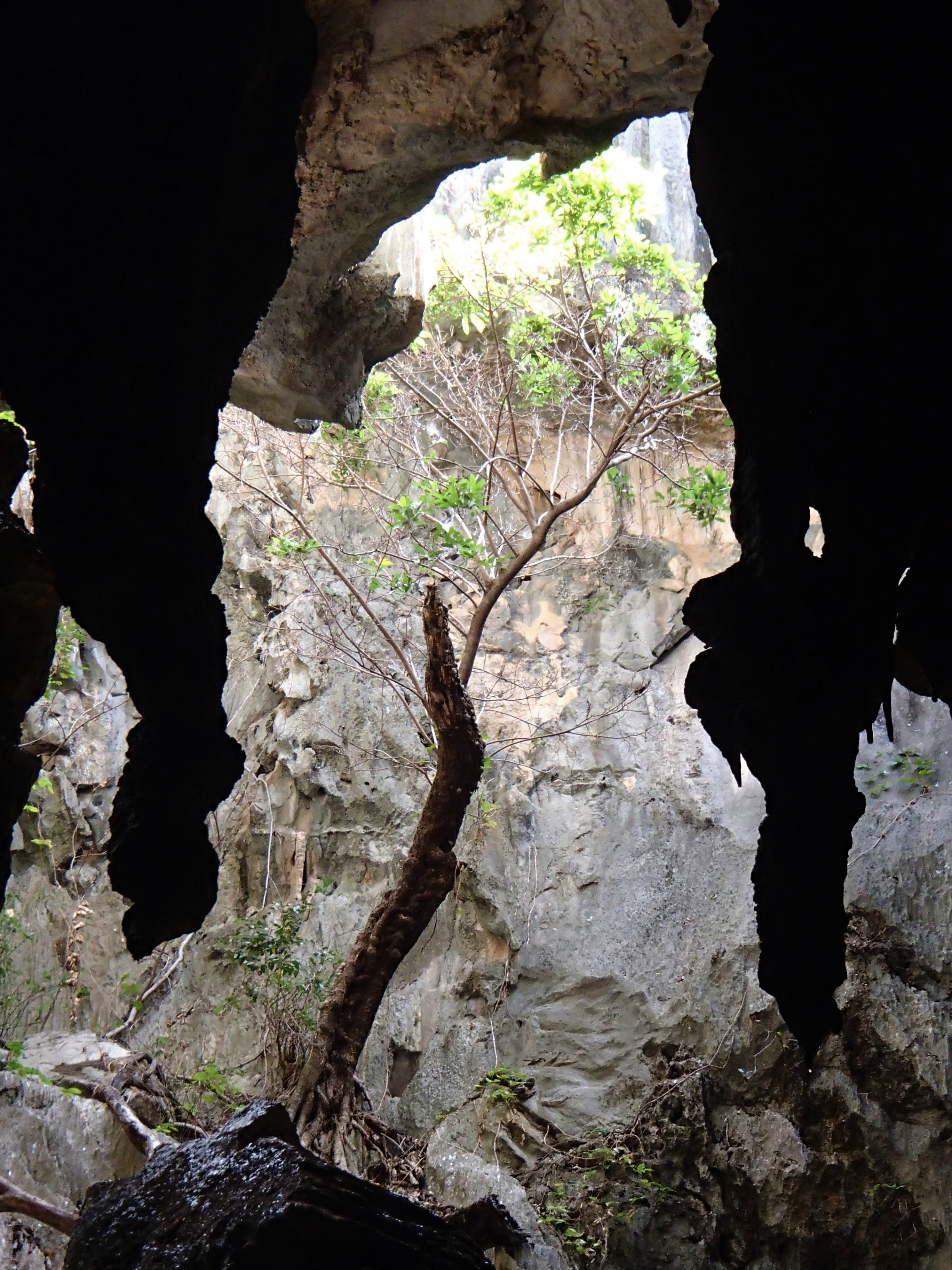
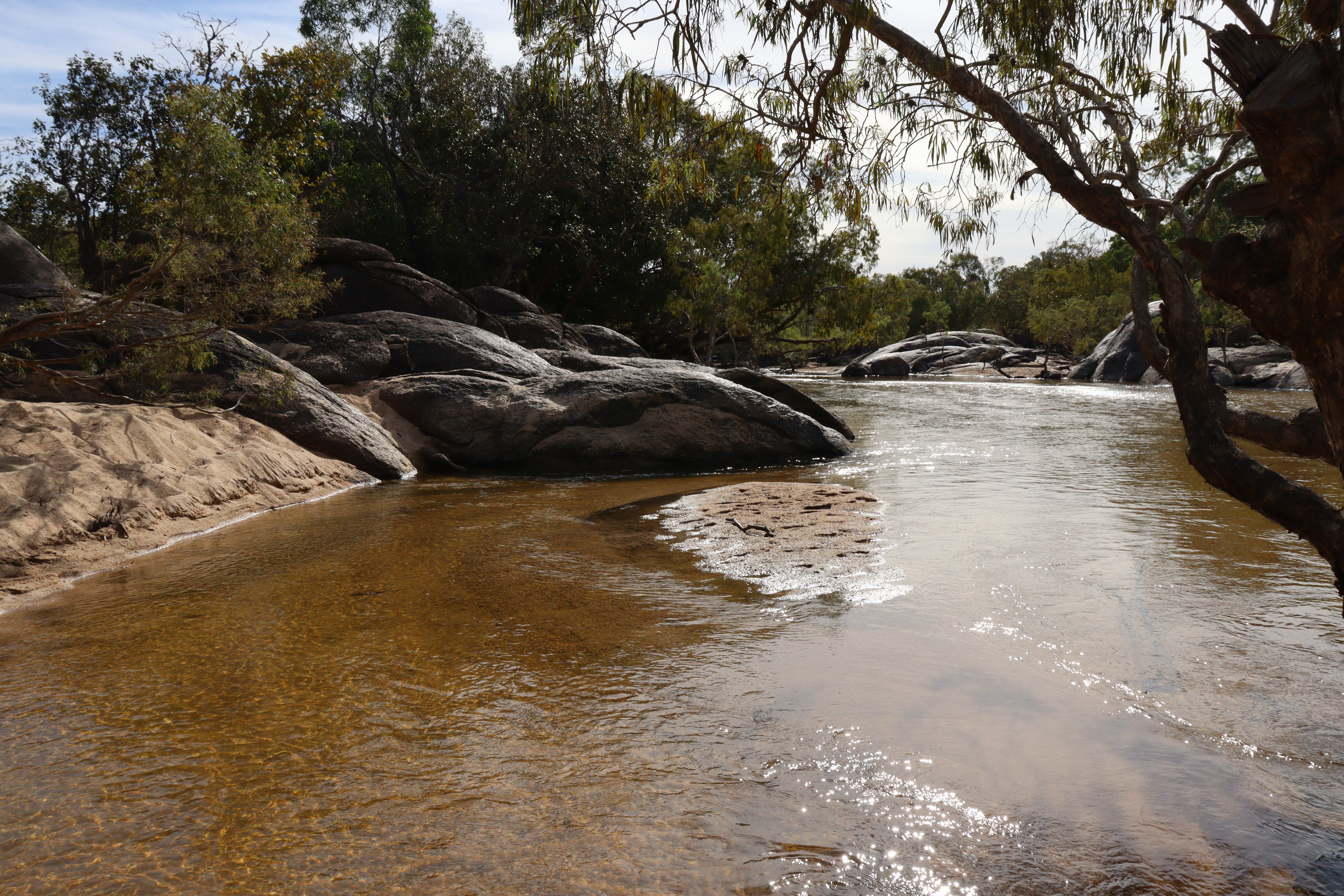
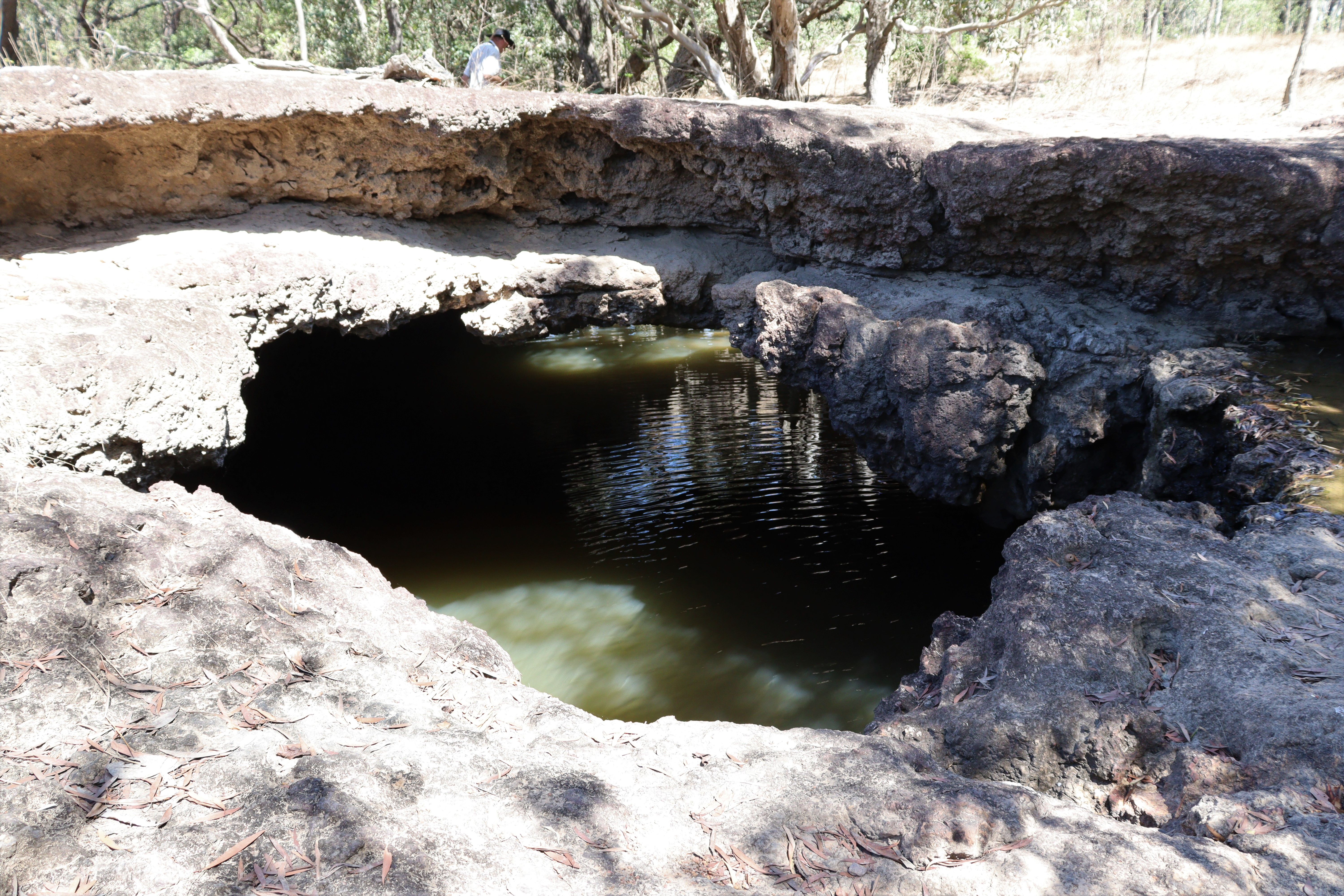
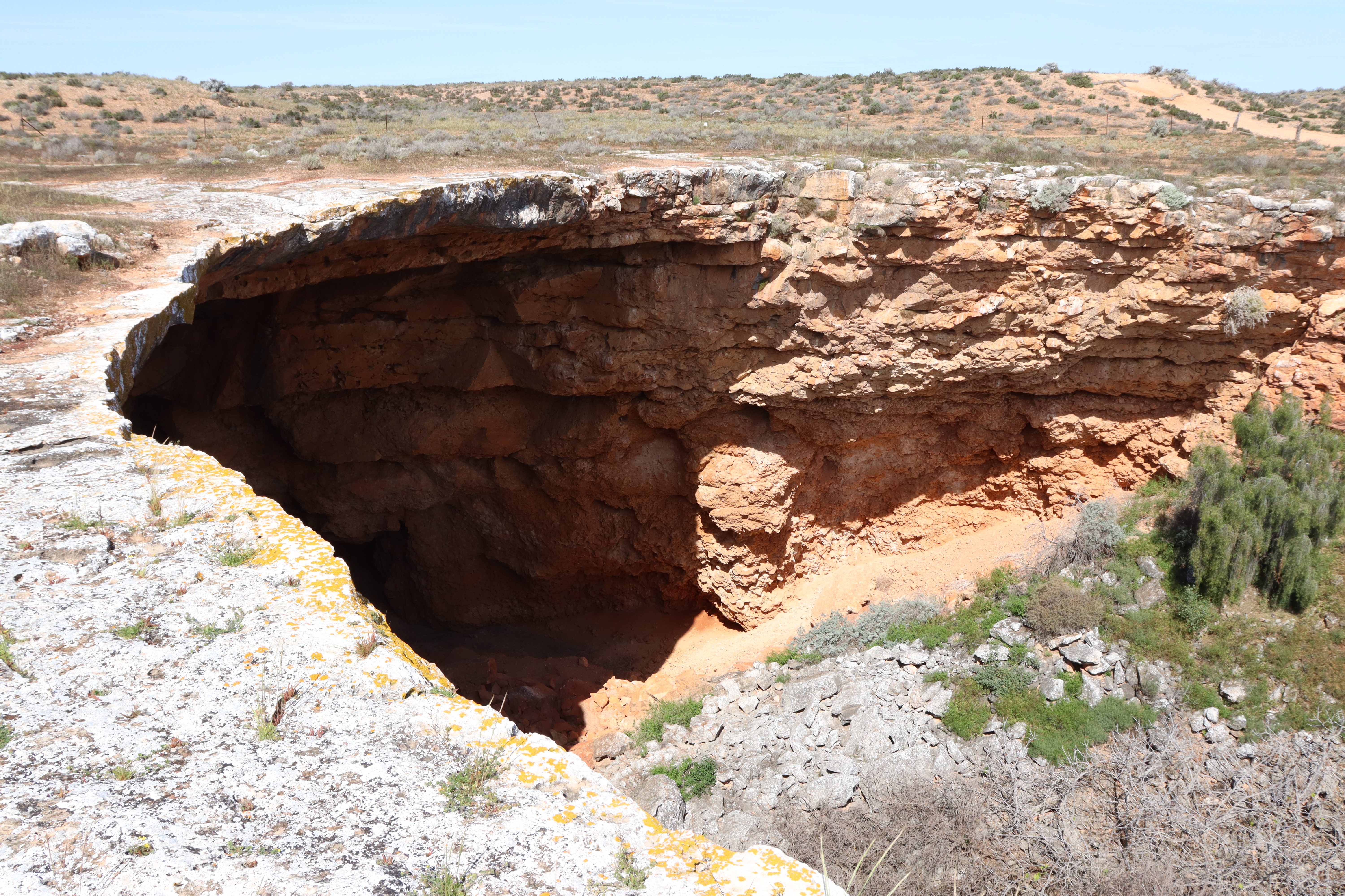
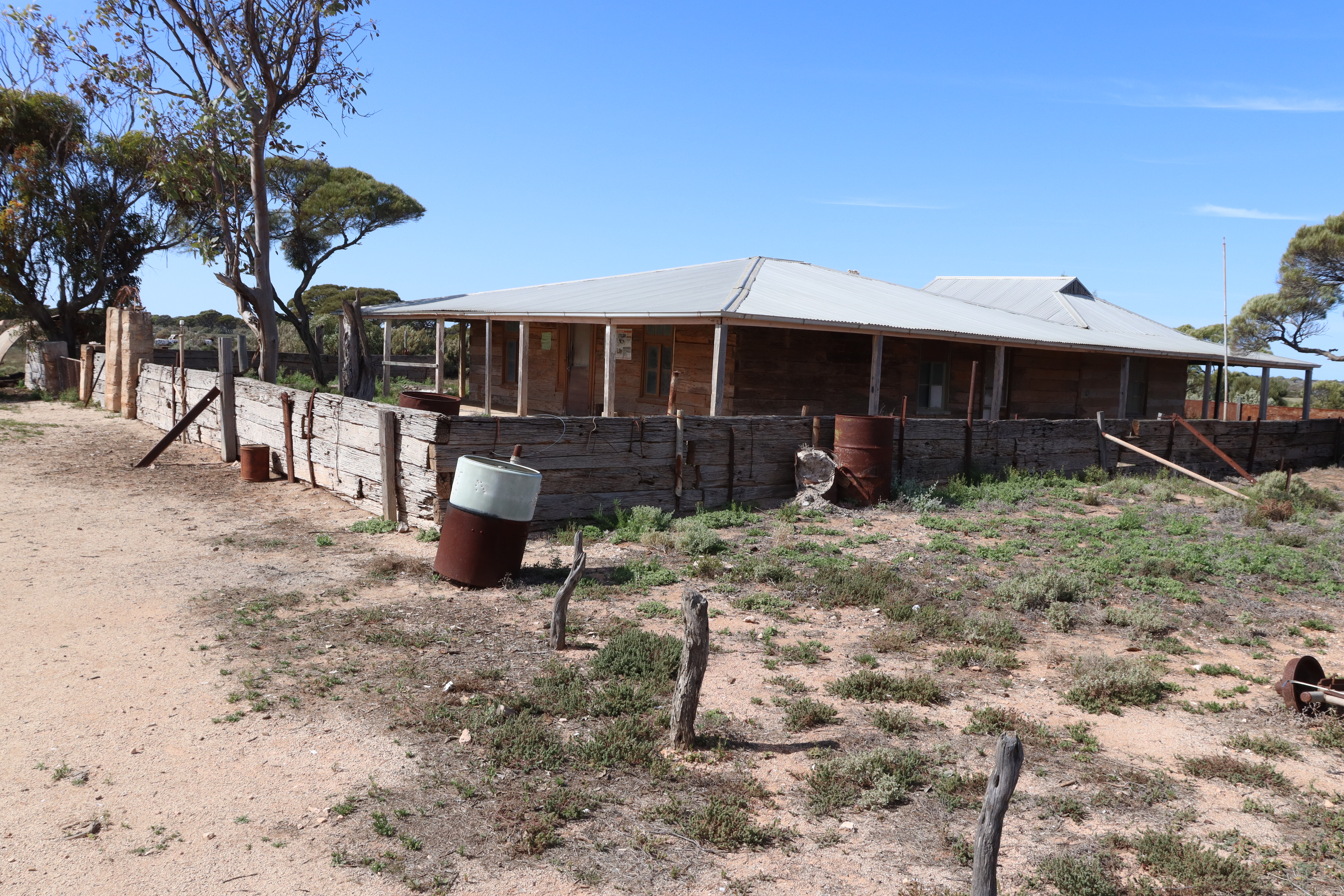
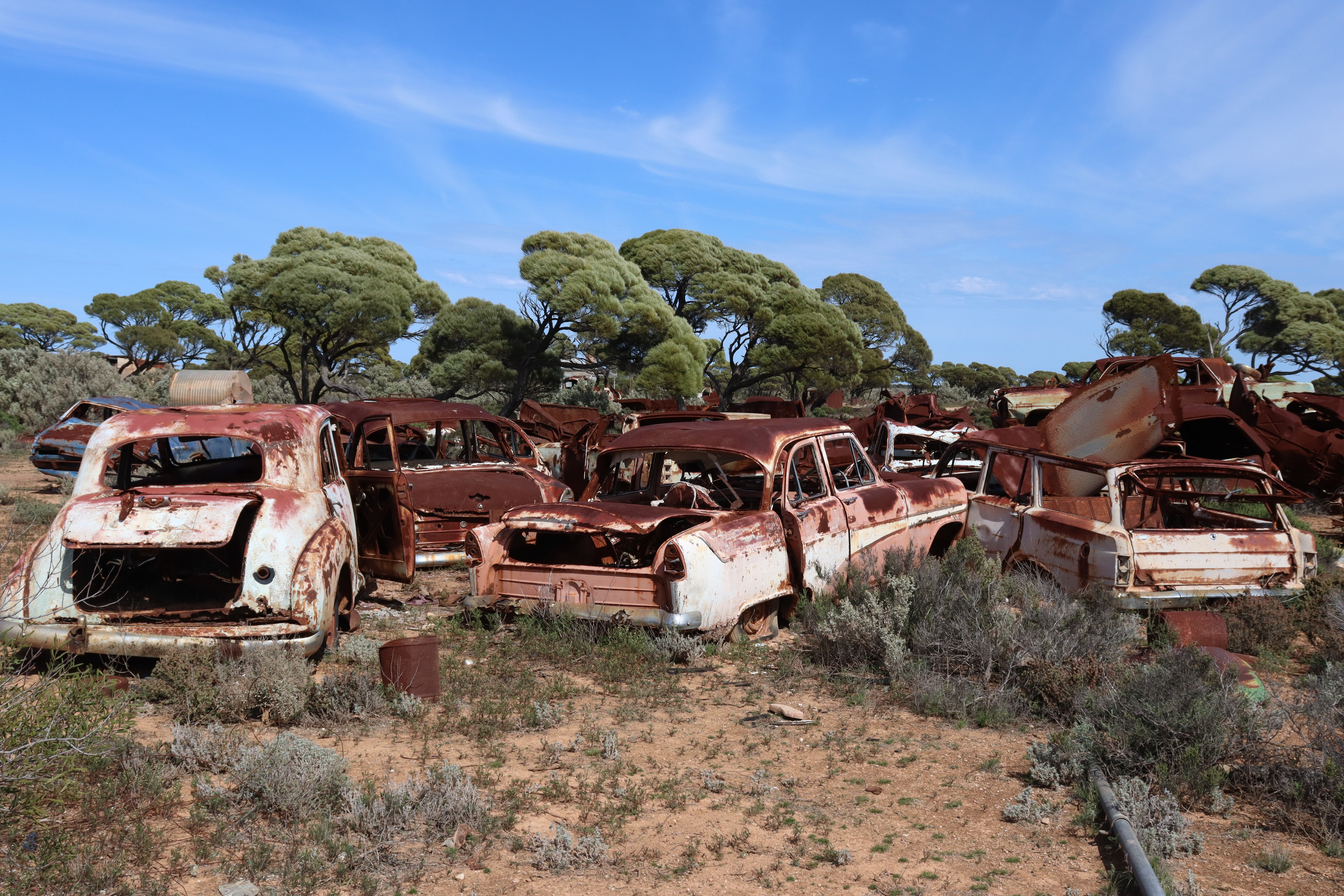
Heading inland, north off the highway, into Nullarbor NP we  checked out the historic Koonalda Homestead, where several of the old buildings, built from old railway sleepers from the  Trans Australia Railway and recycled materials from the old Eucla Telegraph Station,  remain in remarkably good condition, surprisingly with no vandalism or graffiti. What struck us most about this place was the number of “dead” cars – hundreds of them – parked everywhere. Turns out the Homestead was also a roadhouse or service point for travellers along the Old Eyre Highway, and over the years it became a graveyard for the vehicles that broke down! Some 8 kilometres beyond the homestead lies the Koonalda Cave, a huge sinkhole with underground water supplies from which water was pumped to service the homestead and for their stock.

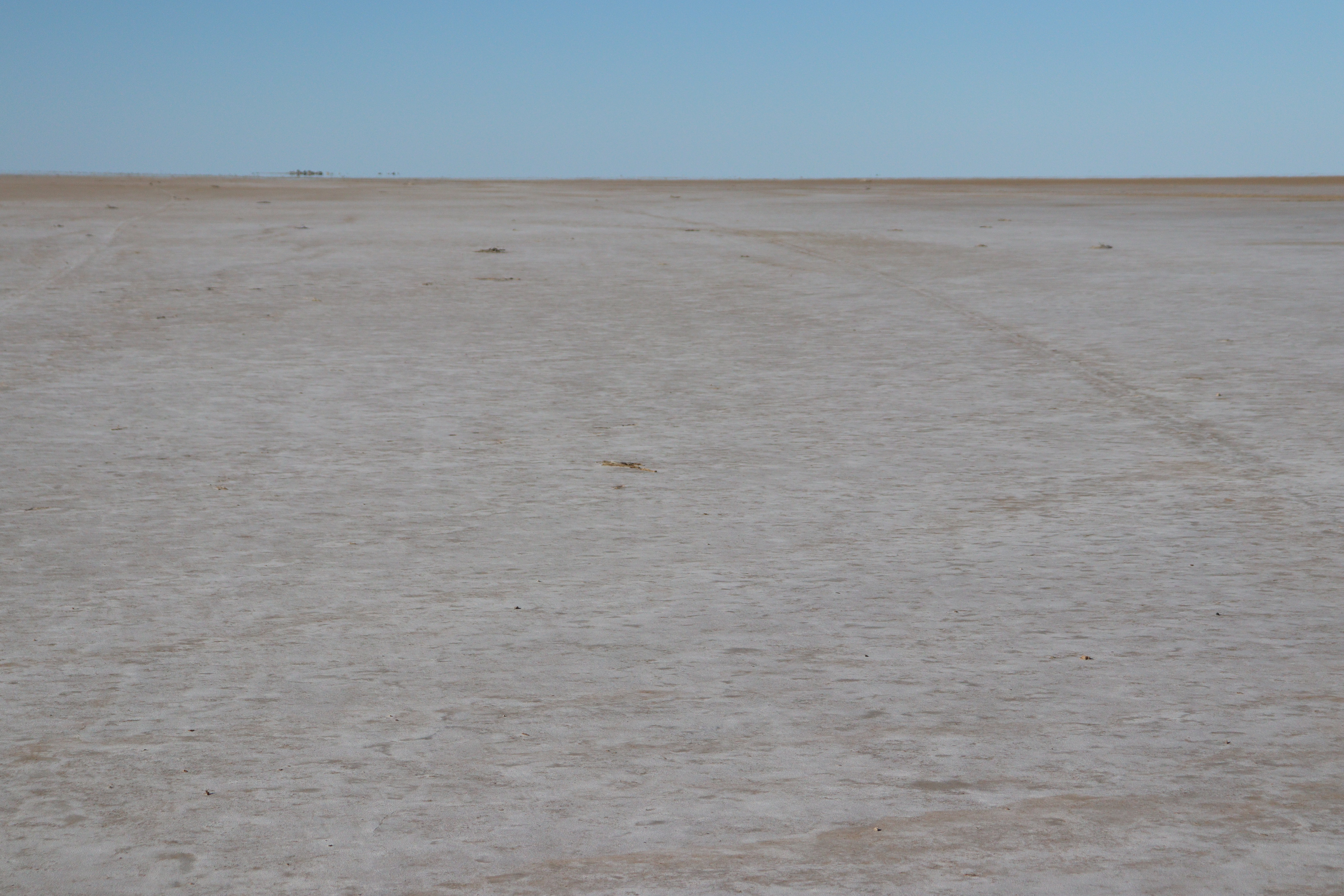
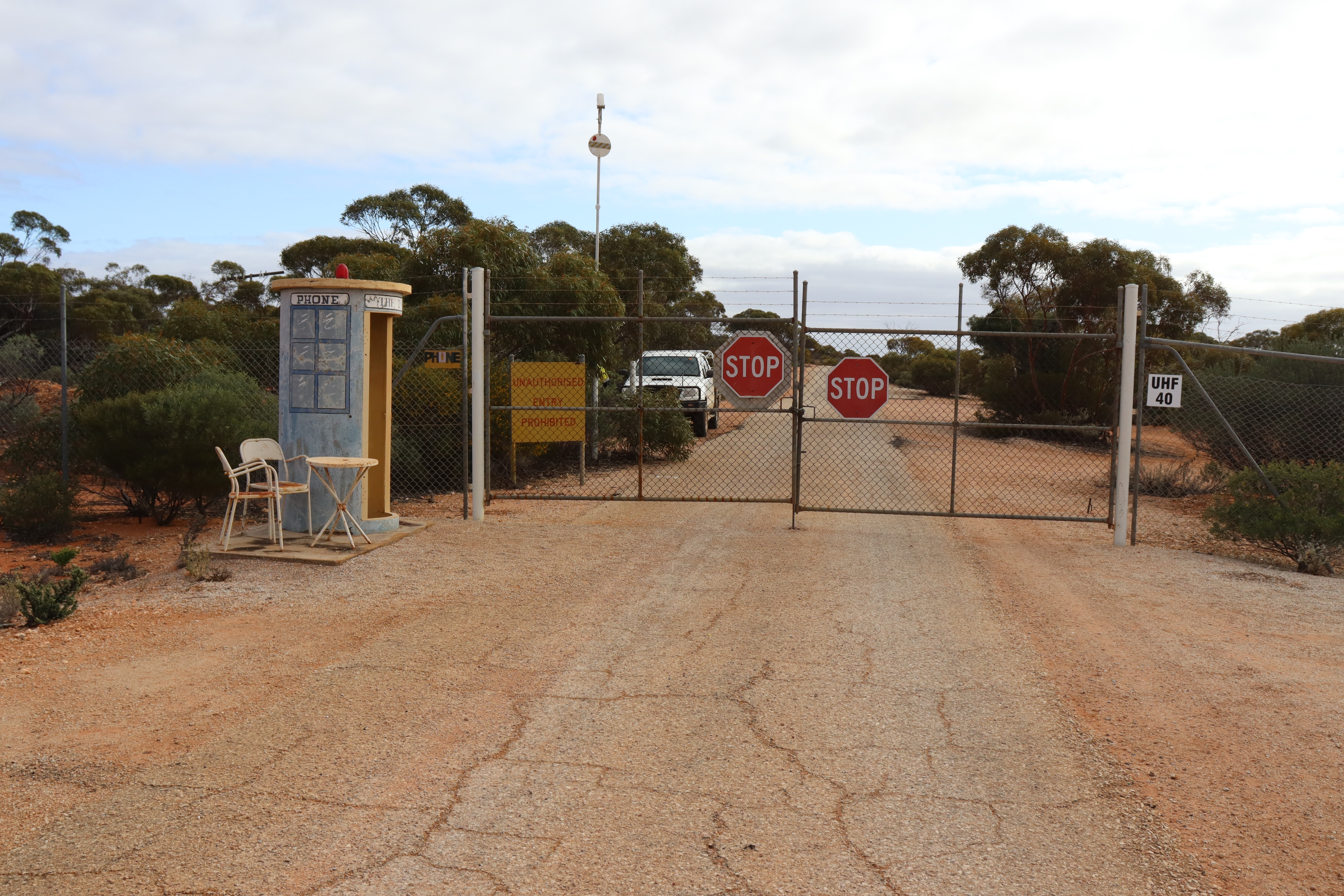
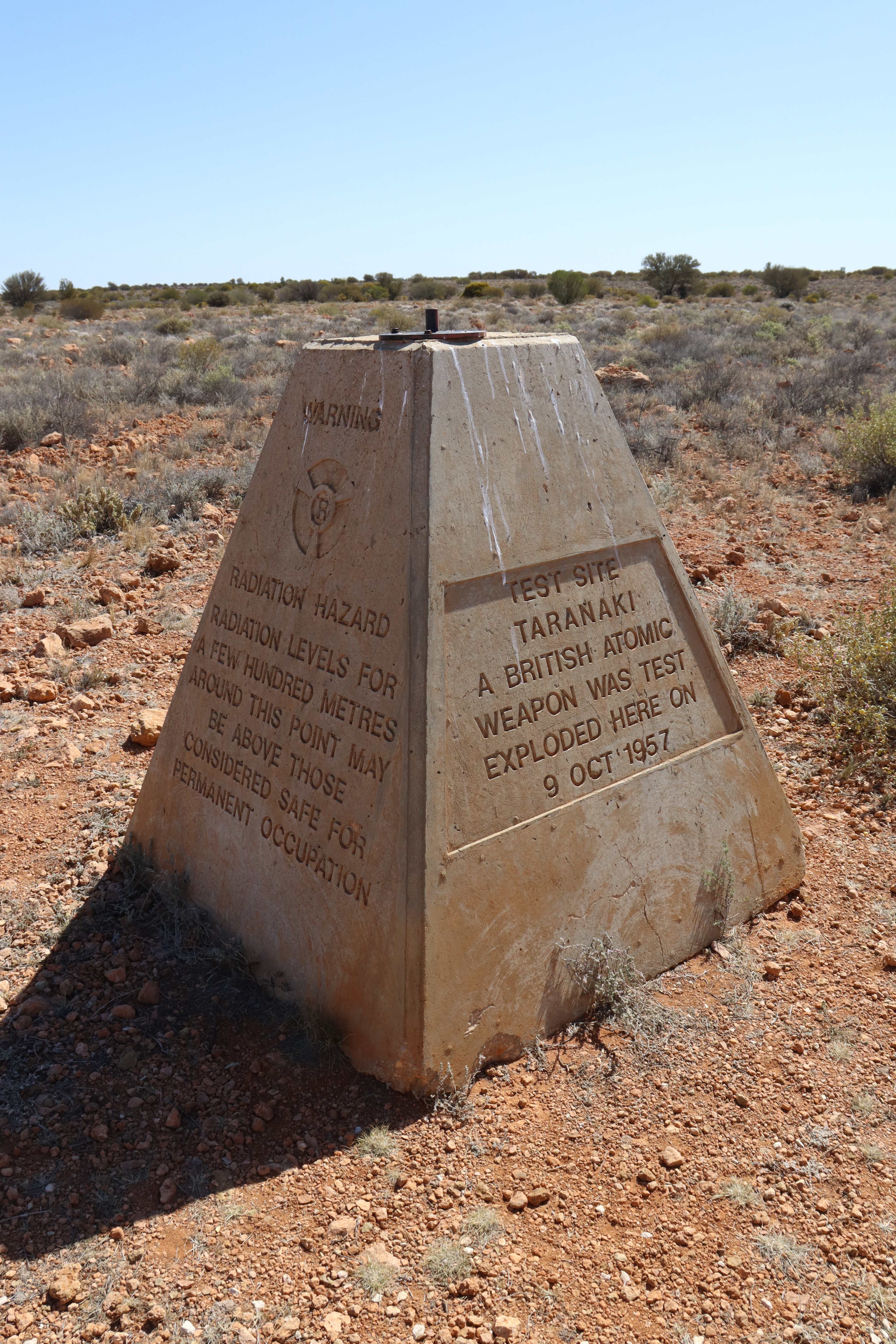
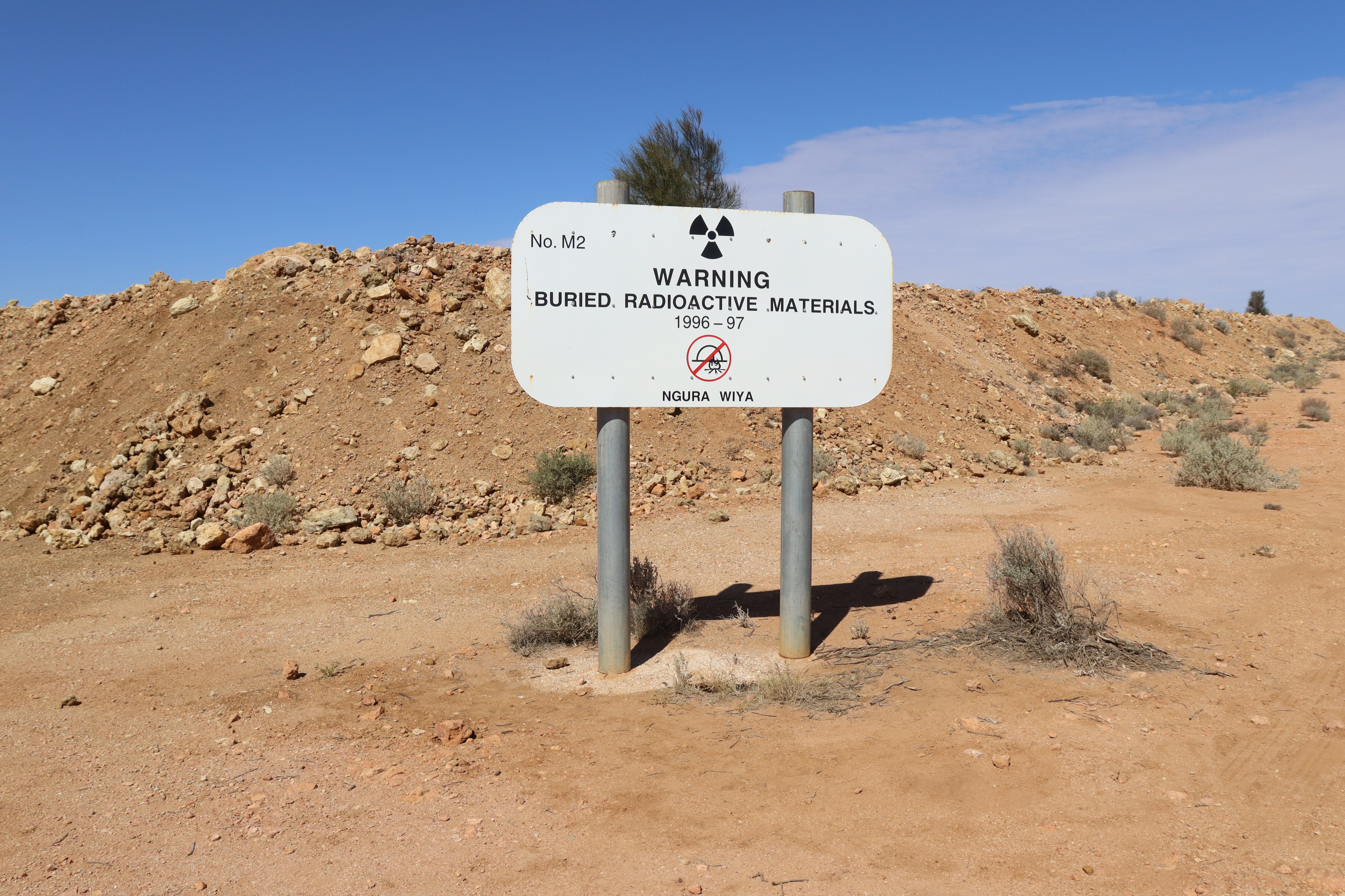
As a conclusion to this trip away, we had decided to spend a few nights and take in a tour of Maralinga, the site of Atomic testing in the 1950s. Camping at the village and then a bus tour out to ground zero of the multiple atomic tests is fascinating but also sobering when you realise the impact these tests had on the local people, their future generations and on the landscape. Our guide was a wealth of information about the building of the town, the test sites and the aftermath and cleanups. There are still lots of radioactive fragments lying around on the ground in the ground zero precinct, although our guide assured us that they were at very minor and safe levels of radioactivity. Hope he’s right!!

In our last few weeks of this trip, we made the decision to sell Roxy, as our plans for the next couple of years included a trip to New Zealand and hopefully an extended time in Europe, which would mean Roxy would sit unused for a couple of years – not good for the vehicle and too much money tied up in her to have her sitting around. So we advertised and due to there being none available and a 2-year-plus wait for a new one, we sold her within a couple of weeks of first advertising, which was great (although a little sad to see her go!). It’s great to know, however, that she is continuing her duties and taking her new owners (who continue to call her Roxy!) to many of the special places this great country has to offer.

WTF or Ha Ha!!

  • Camp at a free camp, go across to the pub for dinner and couple of drinks – AND end up winning the meat raffle!!
  • Roadside camp, not free but gets a few in. We tuck up the back to not be in anyone’s way. Then 2 cars with vans come in and virtually block us in. The wife seems a little embarrassed, but HE says, “If he (obviously referring to Gary) can’t get out of there, he’s a shit driver!”
  • We’re about 100 kilometres short of Kalgoorlie, still on the Trans Access Road (following the Trans Australia rail line) and there on the side of the road is a chest freezer!
  • At Kookynie Pub, Charlie the horse gets hand-fed in the front doorway, then proceeds to “wash” the windows with his tongue!
  • Laverton Lookout has a big tower with water tank on top – and underneath the framework, a picnic table held in place with a big chain!
  • Road signs near Gwalia – “Road Subject to Closure for Blasting”!
  • Caravanning etiquette – apparently, it’s ok to park your coaster camper right across the front of someone’s car, essentially blocking them in, just so you can get better satellite TV reception!
  • Big tourist site at the Valley of the Giants Tree Top Walk in Walpole Nornalup NP – and there’s NO café!!!
  • WHY are 4WD vehicles allowed to drive all along the pristine beach at Lucky Bay in Cape LeGrand NP??
  • WHY do so many National Parks only take camping bookings online ……BUT rarely, if ever, have phone service or Wi-Fi capability to do so??????
  • Old Mate with his dog in a little white van with a surfboard on top in an off-the-highway free camp area, drives around and around EVERY SINGLE track for at least 20 minutes, before he finally settles on a spot. FFS – it’s a FREE camp for ONE night!!
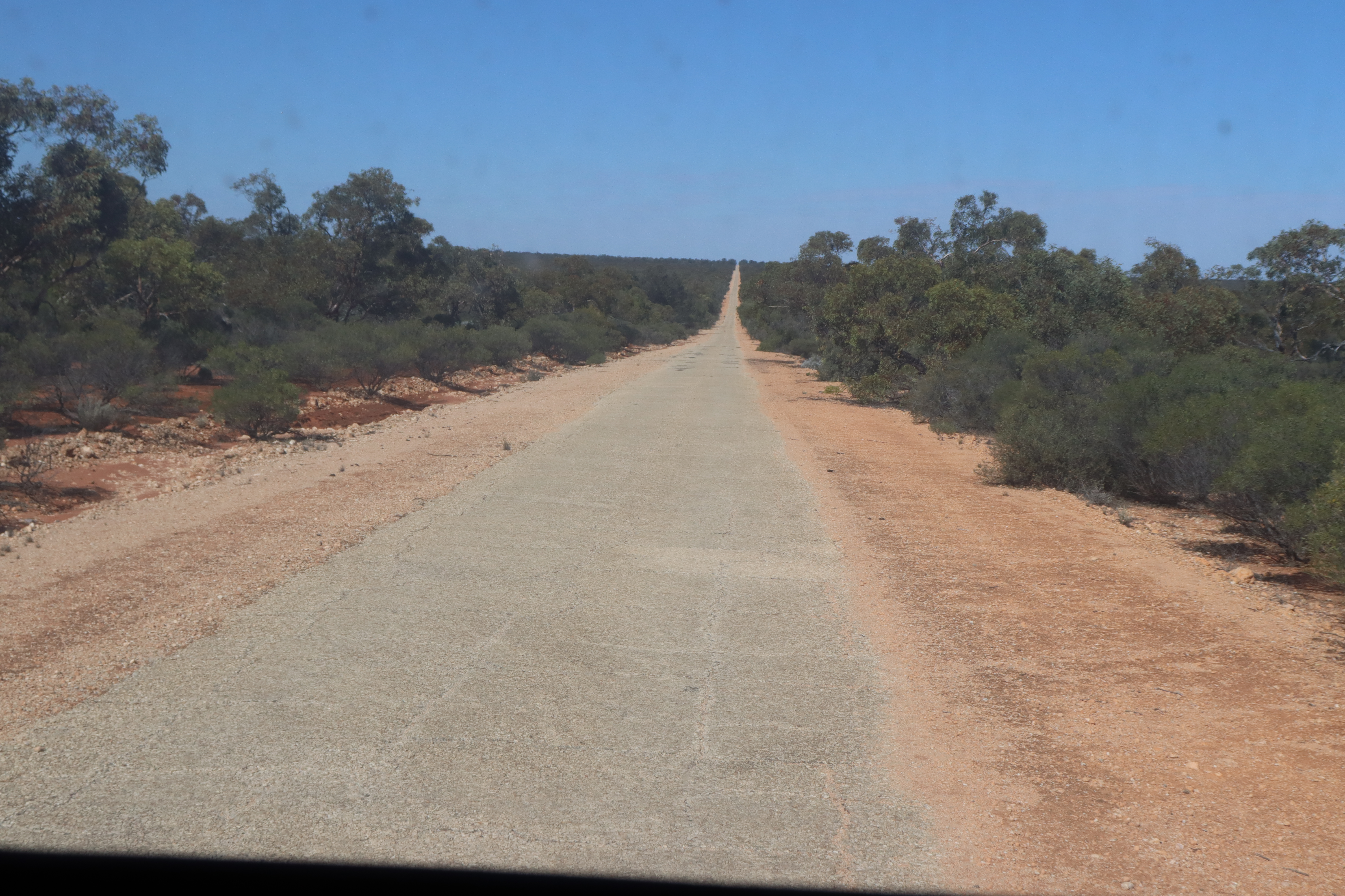
  •  Maralinga town, test sites, and airstrip – which is the world’s ONLY other designated landing site for the space shuttle – was all built within 16 months by 2000 service personnel.  AND the 270 km of sealed and 2500 km unsealed roads were made to last, having never been upgraded or resealed. Maybe those roadbuilders need to come and work for VicRoads!!!
  • What is wrong with people crossing State borders?? Coming through Ceduna (Fruit and Vegie) Quarantine Station, we had nothing to get rid of or declare and the officer was most appreciative of our being “so well organized,” telling us that they had already seized over 80 kilograms of restricted product THAT DAY!!

Outback 2022 – Part 2

Continuing our 2022 journey into the red dust of the outback, we leave Oodnadatta and cross into Queensland on the Plenty Highway.

From Alice to Currawinya and home.

(Click on photos to enlarge.)

Leaving the Oodnadatta and heading back towards the Stuart Highway, the Painted Desert is a fine example of art in nature. With its hills and mesas of different colored sands against a wide desert and gibber plain backdrop, it’s almost impossible to take a bad photo here!

Painted Desert mesas

North of Alice Springs, we turned off onto the Plenty Highway for the 700-plus kilometre drive back into Queensland. As with many of our outback roads, this is a “highway” in name only, as only the first 75 or so kilometres are sealed, with the rest of the road being dirt, red sand or gravel and ranging from smooth to quite corrugated. But again, it is a trip worth doing, and for us more appealing as it is a “road less travelled.” Three cattle stations along the way offer camping with amenities -including a bar at two of them! – so, it’s not as remote as it might seem.

Once into Queensland, we headed through the three Bs – Boulia, Bedourie and Birdsville, passing through fairly quickly aiming to avoid the ten thousand or so music fans heading to Birdsville for the Big Red Bash music festival – too many people for us!! Stopped in at Carcory Ruins and Carcory Bore for a look – love this spot where water from the Great Artesian Basin deep below ground comes to the surface in a constant steaming hot stream flowing into several pretty pools. Tempting for a hot bath but I think the water is still too hot at 85°C, although several hundred metres downstream it’s supposed to be cooler.

After quick stops at the iconic Betoota Hotel and Deon’s Lookout, we turned down the Arrabury Road heading for Innamincka, and took a side trip to visit Haddon Corner, where Queensland and South Australian borders meet. Taking this side track is a 30-kilometre round trip on a relatively formed track over several red sand dunes, but in the end its quite a long drive to go and see a POST!

From the Arrabury road we took another detour and drove up to Cordillo Downs Shearing Shed with its unusual sandstone buttress walls and curved roof. Dating back to 1883, this shed once boasted 88 stands (up to 120 stands in 1890) with a record number of 82000 sheep shorn in the 1888 season – all with hand shears!!

Innamincka is Burke and Wills country so of course we visited the famous Dig Tree, made famous through the ill-fated Burke and Wills expedition of 1861-2, then down into Innamincka “township”, where the Cooper and Strzelecki Creeks had well and truly broken their banks and had cut all roads except for the main one in and out of town. After all the rain that had  been around it wasn’t surprising, but it was certainly a sight to see the Cooper Creek covering the causeway for several hundred metres, and the resulting greenery and wildflowers that had sprung up everywhere.

Taking the Strzelecki Track out of Innamincka, we were somewhat surprised at the extent and number of bitumen sections, but even more surprised when we came to a “Stop & Go” man with his sign to hold up the traffic for roadworks!

Cameron Corner marks the meeting point of Queensland, New South Wales and South Australia and also the northern entry to Sturt NP, which is home to the Wild Deserts program. This is a partnership between the NSW Government, UNSW, NSW National Parks & Wildlife Service and Ecological Horizons aiming to understand, promote and manage desert ecosystems through experiments, fieldwork, monitoring and  management of feral species,  and reintroduction of endangered species within their specialised feral-proof enclosures.

Sturt NP also encompasses several former pastoral stations and therefore several homesteads, shearing sheds, shearers’ quarters and water bores remain to be explored. Some have been restored whilst others have been left to slowly deteriorate and succumb to the elements, but even with that thought in mind, I couldn’t help but think that the original pastoralists at Olive Downs didn’t value their shearers too highly – the shearers’ quarters were made of metal sheeting with no windows except for wire grills and would have been as hot as hell out there!

The Corner Country townships of Tibooburra and Milparinka date back to the gold era and as such boast some historic buildings, with the original stone ones in Milparinka being systematically restored by the “Friends of Milparinka”. These feature lots of information on the town’s history and include the courthouse, police station – with two holding cells out back – and the old pub, a very friendly and welcoming place to stop for a drink and a meal.

Took us 6 weeks of travelling before we finally saw these beauties!

Narriearra Caryapundy Swamp National Park is one of the newest NPs in NSW and not too far from Sturt NP, so we headed there not quite knowing what to expect. Well, as it’s so new, there’s not a whole lot! A brand new camp area is situated on an embankment above the surrounding floodplains, with clearly defined sites and brand-spanking new long drop toilets – I think we were the first to use them!! It’s 20 kilometres from the turnoff to the Park gate and then another 30 or so kilometres till you reach the campground, with NOTHING in between except a turnoff to the original homestead! But …. the 360° views from the campsites overlooking the floodplains and the very distant horizons are a sight to behold! AND…. I think we had the official welcoming committee to greet us on our way in …. a group of 40 or more emus strolling along the road not particularly perturbed by us driving through.

Welcoming Committee, Narriearra Caryapundy Swamp NP

Crossing back into Queensland at Hungerford, we headed into Currawinya NP. Once again, this Park resulted from the acquisition of several pastoral stations dating back to the 1860s and features a variety of infrastructures associated with the shearing and wool industry of the past. So once again we visited several woolsheds, shearers’ quarters and so on – it seems that this trip has mainly focused on woolsheds and the like. But it’s amazing how different from each other they all are – different “board” setup, different building design, different outbuildings and state of repair or deterioration – but all of them so interesting!

Currawinya, despite its semi-arid landscape, is home to a diversity of waterways and wetlands, and in 1992, it was designated a Ramsar Wetlands Site of international importance. While the Paroo River runs through it, the park also features several mound springs that bring water to the surface from far below, and two huge lakes: Freshwater Lake Numalla which is periodically flushed and refilled by Paroo River floodwaters, and saltwater Lake Wyara which dries to a vast salt-pan in times of drought. During years of good rains and floodwaters when water is abundant, as it was last year, the salt waters of Lake Wyara attract hundreds of thousands of waterbirds, which come to feed and breed, and we were fortunate enough to witness the spectacle of thousands of pelicans that jostled for space around the lake’s edge. Unfortunately though, this huge influx of birds has its downside, and the waters can’t sustain all the new hatchlings through to adulthood and many thousands are left to die there as well. Not a pretty sight, but that’s nature….

So, that was it. We had filled in the gaps of places we missed in the previous trip and added some extras, and after 53 nights, 8200-odd kilometres, 4 States, 1 Territory, and 7 National Parks, it was time to start heading home….. to start thinking and planning for the next trip.

WTF?? Or HaHa!!

  • In Alice Springs – Victorian registered car: that’s normal, but his registration plates are Club Car plates…. thought you were only allowed to drive certain amounts or distances under Club Car rego?
  • Why is it that campers next door packing up at 7 am can only put one thing into the car at a time and then slam the door shut after Every Single Thing?! Wouldn’t it be easier – and less aggravating for the neighbours – to leave all the doors open, get everything packed into the car and then shut the door JUST ONCE?
  • Why is it that groups of more than one vehicle travelling together on outback (dirt) roads have to travel right up each other’s bums? It’s not like they can’t see them – well, actually they can’t! But they can follow the dust trail without having to eat it, surely??!!
  • We are the only ones camped in a camp area that stretches for about a kilometre amongst the dunes, and Old Mate with his caravan pulls in about 20 metres away from us!
  • About 50 km north of Birdsville, came across one of the BEST sights we’ve seen – a concrete garden setting sitting out in the middle of the gibber plains!
Intimate dining, Outback style!

Outback 2022 – Part 1

Home to Oodnadatta.

Most years when we head off in Roxy, we head “north for the winter,” generally up into Queensland to absorb some warmer weather, but last year we had a different idea, namely, to travel a loop incorporating some of the National Parks we had missed the year before. However, the weather impacted on our travel plans, and our route of travel changed several times, due to closed roads or closed National Parks, but in the end, we did manage to get into a couple of parks from our list and even a couple of new ones.

For the first few weeks, we stuck to the bitumen and headed across to South Australia, visiting a few of the older and smaller towns along the way.

Burra is a quaint little town that we have passed through on several previous occasions, but never really stopped to have a good look at what it has to offer – aside from its yummy Cornish pasties – so we chose to spend a couple of nights there. After checking in to the campground, we set off walking around the town. Following the disused rail line we found the old Railway Station, which has been restored and maintained in a lovely condition.  From there we made our way up the hill to the town lookout and found that we were just near the old open-cut Burra Burra copper mine, so we spent the next few hours in the mining precinct exploring the heritage listed buildings and remnants of the mine’s former glorious past. This mine was one of the first in Australia to employ the revolutionary open cut method, and between 1845 and 1877 produced 50 000 tonnes of copper metal from 700 000 tonnes of ore and was deemed unprofitable, but when it reopened and operated from 1971 to 1981, it produced 24 000 tonnes of copper metal from two million tonnes of ore. Personally, I can’t see how the figures from the first operation deemed it unprofitable when looking at those from the second?? Anyway, we filled in our afternoon checking it all out, so I guess it was kind of profitable for us!

Leaving Burra we stopped just out of town for the must-do photo of the Burra Homestead or Cobb and Co Coach House Hotel (ruins), the humble little stone house on its own in a paddock, which became famous after it featured on the cover of Midnight Oil’s Diesel and Dust album. It’s probably now one of the most photographed little houses of its type and although it’s on private property, there’s a gravel carpark just off the road so you can stop to take your own version of this classic photo.

Carrieton, a tiny, charming town in the southern Flinders Ranges, is well worth a visit, if only to check out the old buildings. Surveyed and proclaimed a town in the 1870s, its population had grown to over 200 by the 1890s and, with the railway coming through, the town prospered and added some 40 or so buildings, some of which are still there today. The school which opened in 1882 and at one stage grew to over a hundred students – with just one teacher!! – finally closed in 1997, and it, along with the community store and memorial hall and clubrooms, were taken over by the Progress Association, which also leases the local swimming pool from the council. The Association converted the school into the town’s caravan park, where we were greeted with a friendly welcome and some tourist advice as well. Although the town’s population is now only about 23, I think every one of them, along with many from elsewhere, crowded into the historic pub, The Carrieton Hotel, on the Friday night when we went in for dinner, and the atmosphere was again most hospitable and pleasant.

Taking the tourist advice offered in Carrieton, we drove the 80-kilometre Johnburgh loop, which took us out of town, through the Oladdie Range and down into Johnburgh historic township, where we spent several hours exploring the remnants of the town’s buildings. Built of local stone, like most of South Australia’s old towns, many of the buildings are in reasonable condition, and offer plenty of photo opportunities.

Ikara-Flinders Ranges National Park is always worth a visit. With its stunning and ancient mountain backdrops, its pioneering history and the amazing Wilpena Pound, we were quite happy to re-visit this Park, and as per usual, we discovered something we hadn’t seen there before. Taking a walk along part of the Heysen Trail following Wilpena Creek, we found the Old Wilpena Station complex, comprising the original homestead dating back to 1860, and outbuildings such as the Store, Blacksmithy, Stables, and several houses, all built from local stone and all nestled in the valley amongst the huge river redgums.

The Oodnadatta Track is an iconic road route that follows the route of the original Old Ghan Railway that linked Adelaide and Alice Springs. Having travelled the Track in the past we knew what to expect, but this time we slowed down and really explored the many sites it offers along the way. Many of these sites, such as Curdimurka, Beresford, and Edward Creek, are the old railway sidings that incorporate fettlers cottages, huge water tanks and Kennicott water softeners and remnants of the old railway tracks. Historic railway bridges occur as frequent reminders of how quickly waterways can fill after a downpour, with some of these bridges being over 300 metres long.

…and so it begins!

Wabma Kadarbu Mound Springs Conservation Park with its active mound springs bringing water from the Great Artesian Basin to the surface, is worth the short drive off the main track. The Bubbler lives up to its name with water continuously bubbling up from the depths creating lovely patterns in the colored sands, while the Blanche Cup sits atop a fairly high mound with its hot water pool surrounded by a thick growth of reeds.

Strangways Springs and The Peake were historic pastoral leases and Overland Telegraph Repeater Stations dating back to the 1870s. While Strangways is a short two kilometres off the Track, The Peake ruins are found at the end of a slow 20-kilometre 4WD track, but both are well and truly worth the effort of getting there. Both of these State Heritage Listed locations feature a number of buildings in varying stages of disrepair and include some very interesting and photo-worthy structures.

Just out of William Creek “township” is the turnoff to Kati Thanda – Lake Eyre National Park, and the 60-odd kilometre road, which passes through varying landscapes, ranging from dry cattle grazing to gibber plains to a most unexpected “moonscape” of dark rock and mesas, and finally takes you out to Halligan Bay Campground, at the edge of Lake Eyre.  Not sure what to expect out there as there had been varying reports of water in the lake after all the rain up north, but on arrival we found the lake to be much as it usually is – a dry crusted salt pan, and walking out onto it for a couple of hundred metres convinced us that we would not get to see any water there except by turning our feet back and forth in the salt and sand to bring some to the surface. This did not however take away from our experience of Lake Eyre, as it simply must be seen to be appreciated. It is just MASSIVE! At no point could we see the other side, and maybe, just maybe, we were able to see reflections of rocks on distant water – or it may have been reflected on the endless white of the salt.

Overnight campsites along the Oodnadatta generally consist of pulling up at the old railway sidings, but the best spot in my view, was the Algebuckina Waterhole, across the track from the historic 527-metre-long railway bridge – the longest on the Track and at one time the longest in SA.  The waterhole is well off the main track, and we spent a lovely night there watching a variety of birds coming and going, including lots of yellow green “swarms” of budgies – just amazing to see!

WTF?? Or HaHa!!

  • Getting back to our site in Mildura after several hours out, we found our outside doormats, which, being very wet, we had left on site to keep our spot, were no longer there. But, new neighbours right next to us had, funnily enough, exactly same ones, even placed in same positions as we had left them. So I knocked on their door and politely said, “You don’t mind if I take our mats back now, do you?” to which he sheepishly replied, “Well, it was very wet when we got in here!”  -no attempt to deny he’d taken them…and from then on, no eye contact or greetings offered!
  • Burra Burra mine site is part of a Tourist Passport where you need a key to access some of the sites. As it turns out, the mine site is one that needs a key. Being on foot wasn’t an issue for us, but a carload of visitors who had driven into the site after finding the gate open, found themselves locked in after their drive around the site. Last we saw of them, they were parked inside the locked gate, trying to ring for help to get them out!
  • Halligan Bay-Lake Eyre – just on sunset a car drives into the campground, round the loop without even stopping and back out again. Why?? It’s a 61-kilometre 4WD-recommended road to get out there and they didn’t even stop!!
  • Algebuckina Bridge -527 metres long, iconic photo-op. so why does this idiot park right under the bridge meaning no one can get a good shot of the bridge without getting his rig in it too?
  • Pink Roadhouse in Oodnadatta – iconic, great hamburgers you can’t jump over, but diesel at $2.999 per litre did hurt a bit!
Oodnadatta’s iconic Pink Roadhouse

Destination Cape York – Final

Rinyirru-Lakefield NP – Cooktown – Home

(Click on images to enlarge)

Coming back down the Cape, we took a detour. Turning eastward from Musgrave Roadhouse onto Lilyvale Road, we headed towards Rinyirru-Lakefield National Park, another of the CYPAL (Cape York Peninsula Aboriginal Land) National Parks.

Not far from the turnoff, we pulled into a side track to check out the waterhole at Lotusbird Lodge – the place certainly lives up to its name as the waterhole was covered in lotus lilies and numerous birds including magpie geese and ducks. Further on, we entered Rinyirru Lakefield NP, and we drove through Nifold Plain, where we were suddenly struck by the sight of these weird tall triangular shaped trees in the distance. They turned out to be a variety of Corypha utan palm which originate in India through Malaysia, Philippines Indonesia and into Cape York  and can grow to 20 metres tall, flowering in a massive cluster of up to a million flowers, only once at the end of its life. (thanks Mr Google/Wikipedia.)

This Park has many campsites at different waterholes and along several different rivers, all of which are tidal and therefore have the “Achtung” croc warnings.  Staying the first night at Hann Crossing on the North Kennedy River, our campsite was a lovely, secluded spot, very quiet on a ledge well above the water.  Walking back to the crossing, it seemed that only a couple of the campsites were occupied. At one point, I saw what appeared to be a smoky haze amongst the bushes, but on closer inspection, it turned out to be a huge mass of spider webs slung thickly between the trees, with hundreds of spiders of different shapes and sizes hanging in them. I’ve never seen anything like it! At the actual Crossing, the river reduces to a narrow chute before cascading into a wide pool that expands to a large waterhole. That night, sitting outside in the dark, we heard a large splash and shining a torch on the water, we spied several pairs of red eyes – CROCS! Luckily our ledge, although close to the water’s edge, was high enough to not be a concern.

Continuing through the Rinyirru Lakefield NP, we stopped in at Breeza Homestead  historic site where the relics of the original corrugated iron homestead remain nestled under a pair of  huge mango trees a short distance from a large lagoon covered in waterlilies. Further along the road, Red Lily Lagoon boasts a year-round water retention which is ideal for the survival of the many plants, particularly the lotus lilies, that grow there.

After a refreshing cold shower at the Kalpower Crossing camp area on the Normanby River, we continued to our next campsite at Twelve Mile Lagoon, which according to the signs, was 15 kilometres off the road on a 4WD track but turned out to be not too difficult. Our site at first appeared to be not as pleasant as the night before’s, but we found it to be much more secluded and infinitely quieter being so much further from the road.  Once we set up and dragged our chairs to a point where we were high above the Normanby River, we found that it was a great spot for croc-spotting. And spot plenty of crocs we did! On the opposite bank, we spotted 5 or 6 what we thought were freshies or Johnstone River crocs, but they could have been salties, and we sat watching them for quite some time till later in the afternoon, they were joined by another very large estuarine croc that had to be around 4 metres. He just lay in the water and was obviously not too hungry as several magpie geese walked right by his snout and he made no move to get them. Despite them all being on the opposite bank of this nice wide river, I felt somewhat reassured that the bank on our side was quite high and pretty steep.

On the way our of Rinyirru, we called in at Old Laura Homestead, a well preserved two storey house complete with shutters and wide verandahs, meathouse, stockmen’s quarters, saddlery and blacksmiths buildings. The Laura cattle station was in continuous operation from the gold rush of 1880 right up till 1966 and despite its isolation and often being cut off by seasonal weather, its community was virtually self-sufficient.

Fording several rivers with wet crossings and causeways, crossing the Great Dividing Range took us down to the coast and to Cooktown, where Captain Cook beached his ship the Endeavour for repairs in 1770. For the next couple of days we explored the sights of Cooktown, including Grassy Hill Lookout and Lighthouse, a very steep slow walk up to the lookout but worth the effort when rewarded with 360° views over the town, the Endeavour River, the Great Divide, and the Coral Sea. From that point we continued a walking trail down through the rainforest, passing two pretty, secluded beaches and into the lovely Botanic Gardens, filled with tropical plants and palm varieties.

A short distance out of Cooktown, heading south, we came across a small pullout and carpark beside the road, where signposts announced we were at Black Mountain NP – Kalkajaka. This mountain actually appears to be no more than a huge pile of rocks, but as the signs explain, it’s a huge, fragmented granite rock that has been eroded away over the last 260 million years, thus forming the pile of rounded boulders we see today.

 About 70 kilometres south of Cooktown, within the Daintree NP, are the Bloomfield Falls – Wujal Wujal – where we walked the 1 kilometre track then scrambled over the rock till we came upon these most breathtaking cascades, tumbling about 40 metres over the sheer rock wall with impressive force, probably more so on this day due to the rain we’d had the last few days.

From this point on, we started taking longer days driving. We had covered all the places we wanted to see for this trip, so it was time to start heading home. So after a night at the Three Rivers Hotel (from Townsville to Greenvale they’re building a line…. ), visiting friends at a station on the Burdekin River, and catching up with more friends in Charters Towers, we turned left (south) at Torrens Creek.

With Covid causing on-again off-again border closures between the states, we had applied for and been granted a 24-hour pass to travel from Queensland through New South Wales and into Victoria. Travelling on this pass, we had to traverse NSW within 24 hours, not have any unnecessary contact with anyone and document any stops for fuel etc.  Many people had been taking detours into Northern Territory and South Australia, but by the time we were about to hit the Qld NSW border, that detour avenue had also closed. So we spent our last night in Queensland about 200km north of the border, started early the next day and drove about 730 kilometres till we got to a roadside stop to spend the night, which left us only about 375 kilometres to get us across the border and back into Victoria the next day.

Best laid plans…..

That all went according to plan. We crossed the border into Victoria in a little over the 24 hours, even with our overnight stop, and had our permit checked by police as we crossed. So all was good. We were now on home territory and could take our time to get the rest of the way home, so we found a bakery and had a late breakfast. When we got back into the car, Gary turned on the radio, which he hardly ever does, just in time to hear the news that within 20 minutes, Victoria was going into lockdown again. WHAT??? This lockdown was a snap announcement with only 2 hours before coming into effect, so after having driven from Queensland and having to get through NSW on our 24-hour permit, we decided to just drive the rest of the way home in the same day. So we ended up driving 1480 km from 8am in Queensland on the Friday till we were home in Victoria by about 4.30pm on the Saturday with a night sleeping at a roadside stop in between! Big days of driving for us…our “big” days are normally a maximum of about 150 – 200 km. Luckily with Roxy we can both drive, because we would never have gotten so far so quickly if had all been up to Gary alone!

And so our Trip to the Tip had come to an end. We had been away for 96 nights (almost 14 weeks) and covered 12100 kilometres in Roxy, visited lots of friends, enjoyed lots of new experiences, had lots of hot weather and seen lots of new sights in this great country of ours.

And now we are home and planning our next adventures.

WTF?? Or Ha Ha!!

  • Weipa Caravan Park Rules – NO working on cars, boat motors etc – BUT just in our little section of the park, there were at least 4 vehicles getting more done than just a tyre change!!
  • We’d been looking forward to a quiet night at a station stay which was on a station owned by friends of friends of ours, but when we got to the gate, there was a huge log blocking the way with signs announcing it was closed. Turned out, as we discovered later, that due to Covid restrictions, it had shut down THAT VERY DAY!!
  • From Torrens Creek, Gary drives about 140 kilometres on good wide double strip bitumen, passing only one car and one motorbike. I take over and within 40 kilometres, it turns to single strip bitumen, and THAT’S when we pass a stock crate, a road train, several cars with caravans AND some more trucks!! WHY is it always when I’m driving???
  • Just outside Barcaldine, we stopped to get fuel at the unmanned fuel depot, where there are three outlets. How does it happen that not one, but ALL THREE of the outlets were out of operation!!
  • Driving on (luckily) a relatively straight stretch of road behind two vehicles towing caravans, when suddenly the front one is swerving onto the wrong side of the road, for no apparent reason: there was nothing on the road he needed to swerve for!! And they wonder how these caravan rollovers and accidents occur!!

Don’t forget, if you want to read about our travels prior to Roxy, head on over to our earlier Blogs at <taberstravels.wordpress.com>

Destination Cape York – Part 3

Karumba to Cape York

(Click on images to enlarge)

By the time we hit Karumba, we had travelled around 6000 kilometres in two months and Karumba was our final familiar place before we started heading up Cape York Peninsula into territory we had previously not visited. Before leaving Karumba, we called in at the caravan park and bought some fresh cooked prawns to take with us for that night’s dinner.

Taking the Burke Development Road (the Alternate Route of the Savannah Way) we expected our next couple of days to be relatively quiet with less traffic, as this road is roughly 600 km unsealed, unserviced and un-touristy terrain, following for the large part, the Mitchell River and travelling through several large cattle stations but no towns or settlements and therefore no fuel stops until you arrive at Chillagoe almost 600 km down the track.  Indeed, the first road sign we came to after turning onto this road indicated “No Fuel for 540km!”  Checking our vehicle’s fuel range indicator, we could have been concerned that it said we only had 431km till empty, but we knew that our long-range tanks were almost full giving us a range of almost 1000 km, so we forged ahead.

Travelling this road, we were also aware that there were no specific camp areas along the whole distance till Chillagoe and we had been told that the first station we passed through had a strictly “No Camping” policy, so we intended to just drive on through and camp somewhere along the road once we had passed through the station boundary. Hadn’t really thought that through had we, as this station stretches for about a hundred kilometres from boundary to boundary along the road, with very little in the way of nice bushy areas you could sneak into for the night. So, once we passed the homestead area, we drove about 80 kilometres and by 5ish and having not passed anything suitable we just pulled off the road and parked, thinking this would do for the night – surely we won’t disturb anyone on this quiet stretch of outback road? How wrong we were!! We certainly hadn’t counted on the amount of traffic that decided to pass by us once we had parked – cars, station utes, campers and quite a number of trucks kicked up dust well into the night. Added to that, Gary’s plan for a nice meal of garlic prawns almost came unstuck too; with no running water (trying to conserve what we had in the tanks) and thousands of little bugs that somehow found their way through the flywire, his task of peeling the prawns became a misery! Got the job done in the end with a bit of help from me and we still managed a delicious dinner on the roadside.

Next morning, we had only driven about 10 kilometres before we came across “Dinnertime Lagoon,” a large and stunning waterhole covered with waterlilies in full flower – would have been a perfect campsite if only we’d known!! For the rest of this day and the next, we continued on the dirt road, encountering a variety of things which made it a memorable drive: cattle on this unfenced road by the hundreds -yeah we’re pretty used to that but always a good sight; a majestic wedge tailed eagle feasting on road kill and not in a hurry to leave it, giving me a chance for some pretty good shots of him through the windscreen; a white bellied sea eagle also soaring past;  signs indicating the 68000 square kilometre shire that has a MASSIVE population of just 2500; 250 kilometres of bulldust holes – and yep I reckon we hit every one of them creating a nice dust cloud in our wake; several waterlily covered waterholes – so pretty and unexpected in this dry savannah country; and several crossings of the Mitchell River where we stopped for a break to admire its sparkling beauty.

After almost 600 kilometres of dirt and dust driving, we hit the bitumen just as we entered Chillagoe, a town that once thrived on mining of gold, silver, copper, and fluorite, but now has just a small zinc mine and marble quarries. However, Chillagoe also boasts a spectacular karst landscape, and the Chillagoe-Mungana Caves National Park is its main tourist drawcard – and rightly so. Of the 600 to 1000 limestone caves in the area, several are open for ranger guided tours while a few offer the self-guided option. The guided tours are well worth doing as they take you deep into the cave systems to learn about their history of formation and discovery, to witness the wonderful formations of stalagmites, stalactites, columns and shawls in a range of colors, as well as a variety of chambers, some small and others huge, and to catch a glimpse of the caves’ wildlife including large hand-sized huntsmen spiders and leaf-nosed- and sheath-tailed- bats. The jewel in the crown is the Royal Arch Cave which boasts two massive chambers, The Cathedral and The Royal Arch – absolutely stunning! -and where Gary got to squeeze through “The Chute,” a tiny claustrophobic tunnel from one chamber to another. As well as the caves there are numerous limestone rock formations surrounding the town including the much-photographed Balancing Rock, and just out of town are the Heritage Listed Chillagoe Smelters, which have their own interesting history.

Thirty kilometres from Chillagoe is the township of Almaden, a thriving metropolis of less than a hundred people. There’s a quaint historic railway station there as it’s on the Mareeba-Chillagoe line and the town also serves as an overnight stopover for passengers on the tourist train, “Savannah Lander,” which runs twice weekly between Cairns and Forsayth. We had joked about the man sitting at the station saying he was waiting for a train, but as it happened, he turned out to be the station master and he actually WAS waiting for the Savannah Lander which was due within half an hour after a four-day trip from Cairns.

Coming to Mareeba, the last big town we would see for the next few weeks, we stopped to stock up on some supplies. Luckily, we hadn’t planned to stay there because the place was packed!! Passing the showgrounds on our way in, there would have been 200 caravans/RVs and then at another reserve, there appeared to be a CMCA gathering of around 300 RVs! No Thanks!! Our stopover at Palmer River Roadhouse 150 kilometres further on proved to be a much better choice, as there was plenty of space and we were able to have a relaxed, quiet evening and enjoyed a great roadhouse dinner – the biggest burgers you’ve ever seen!!

Biggest burgers ever at Palmer River Roadhouse

And so, we reached the PDR – Peninsula Development Road, and for the next 800 kilometres to the Tip of Cape York, the road lived up to its reputation. About 300km or so of the 800km is sealed, sometimes in good long stretches and with more sealing happening each year, but the rest varies between average gravel/dirt road to awful corrugated or rocky, rough or possibly the worst-you’ve-ever-been-on road that “rattles the fillings out of your teeth” according to Gary. Along the way though, there was plenty of interest: scenery changing from dry cattle country to forest to tropical rainforest and waterways ranging from trickles to wide rivers.

Archer River Roadhouse about halfway up the Cape, sits above the Archer River, a lovely clear, wide but shallow waterway that is obviously a popular spot for the locals from Lockhart River Aboriginal Community to come for a crocodile-free swim. Once again, the roadhouse offers camping, accommodation, meals, and a welcome beer or two.

About 50 kilometres north of Archer River the route to the Tip turns onto the Telegraph or Bamaga Road and the awful road conditions continue! A pleasant stop – and a chance to take a break from the corrugations rattling everything – is Moreton Telegraph Station, originally built in 1887 as part of the Overland Electric Telegraph line connecting Australia to the rest of the world. Although it no longer serves as a Telegraph station, its position on the Wenlock River makes it an ideal spot for a break or an overnighter if you so desire. We didn’t stay but called in to the kiosk and the lady there told us about their 3-kilometre walking track along the river to the “barra hole” and down to Cave Creek where the rock has been eroded to form a Natural Bridge and the creek flows under the “bridge” in a small waterfall – well worth the look.

From Bramwell Junction, the road splits; you can continue on the OTT or Old Telegraph Track, a very rough, challenging, strictly 4WD track, which follows the original telegraph line, passing through several deep river crossings, slippery riverbanks and stretches of deep sand. NO thanks – I’ve seen the pictures and videos!!  OR you can follow the Telegraph Road/Northern Bypass Road which gets you there in roughly similar distance but with far less challenging – albeit corrugated – conditions, which suited us just fine! Either route will get you to the Jardine River.

The Jardine River Ferry is operated by the locals and the $100 return fare entitles you to the 30-second crossing each way and to camp in some of the CYPAL (Cape York Peninsula Aboriginal Lands) that are not National Parks or private campgrounds, but we chose to head out to Loyalty Beach campground as we’d heard that the Seisia campground was always packed. Checked in, set up then checked all the cupboards and were pleasantly surprised to find that despite all those corrugations (that rattled our fillings out!), we had not broken so much as an egg or a china cup! Pretty good going!!

So here we were – we’d made it to the Tip of Cape York, well ALMOST!

WTF or Ha Ha!!

  • Chillagoe must have a pre-requisite of guinea-fowl ownership for potential residents. Never before have I seen so many guinea fowl – it seemed like every house had at least a dozen of the noisy critters!!
  • Looking at the Almaden station (dirt) platform, it appeared to have been very neatly raked and I commented that someone had done so. “That would be me -it’s part of the contract” says the man who turned out to be the station master. I guess it’s the outback version of rolling out the red carpet for the visitors.
  • How close is too close? Palmer River campsite, there’s more than 30 metres of clear space between us and the next caravan, but Old Mate backed in SO close to us that when he opened his camper towards us, his bed was about 30 centimetres from our window!!
How close is too close??
  • Parked up for the night in a roadside pull out, two more vehicles together, both towing, pull in, one (A) parking virtually nose to nose with us and second one (B) across the track from us. A little later a third vehicle (C) comes into the pull out and parks near (but not right on top of) vehicle B, so B moves his vehicle up next to his mate (A), almost blocking us in, but still had the cheek to comment that the newest guy was “not very socially acceptable, parking so close!”